
Beginner Off-Road Trails
Near Calipatria, California
Explore All Beginner Trails Near Calipatria, California
Beginner Off-Road Trails Near Calipatria, California
Discover the best beginner-friendly off-road trails near you. These easier, lower-rated trails are a great place to start — browse trail maps, check difficulty ratings, and find your next adventure.
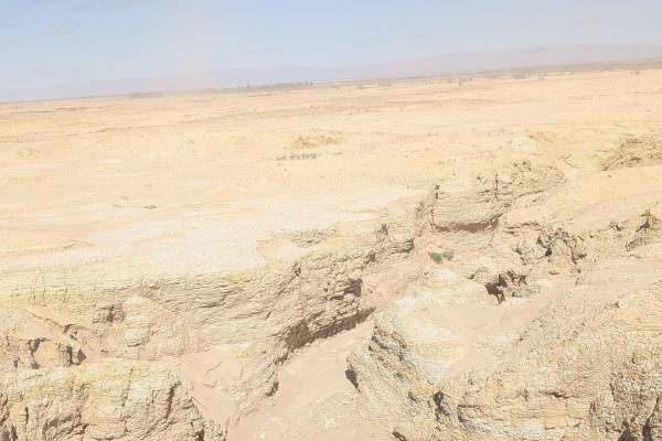
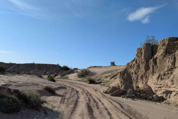
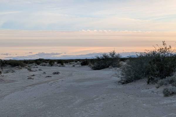
BLM 412
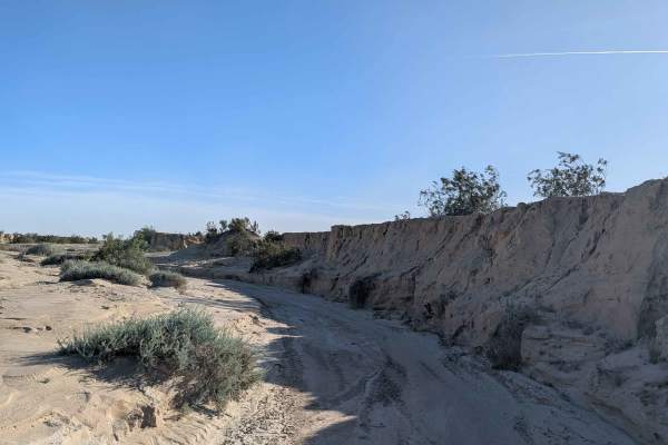
This trail is a hard-packed sand route that connects BLM 326 to farmland roads to the east, serving as an important connector between recreation areas and agricultural lands. There is very little vegetation, with just a few large and small bushes scattered throughout the sparse landscape. The land t...
Learn more about BLM 412
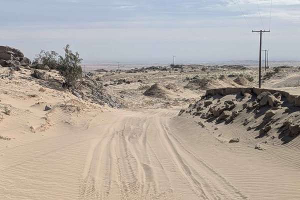
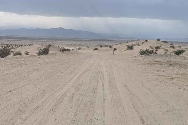
BLM 414
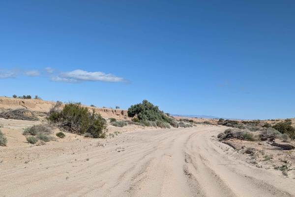
This trail is off BLM 326 and features a very sandy surface that has been reset by recent storms, making it hard to find the beginning of the trail, so follow the map carefully for navigation. The landscape is very barren with very little vegetation in the beginning, eventually gaining some small to...
Learn more about BLM 414
BLM 194 SE
This trail is a fairly wide wash with a surface that's hard-pack sand mixed with deep sand, creating varying traction conditions. The wash has sand and mud walls with parts of it lined with lots of vegetation, adding greenery to the corridor. You'll encounter some washboards scattered throughout, cr...
Learn more about BLM 194 SE
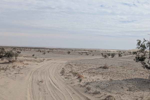
BLM 326 SE
This trail is fairly smooth compared to others in the area, making it a more comfortable route through the region. The surface is soft sand throughout, requiring momentum management. The trail continues down the power line leading toward the water aqueduct, but ends just past Edgar Road, providing c...
Learn more about BLM 326 SE
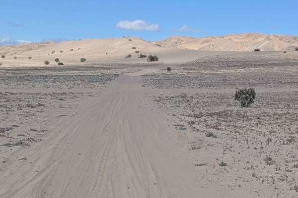
BLM 331
This 8-mile out-and-back trail runs in a small wash with 10 to 15-foot-tall sand walls creating a dramatic enclosed canyon environment. The route is lined with large desert bushes and trees, with some that are overgrown and may hit your vehicle as you drive by, so be prepared for brush contact. The ...
Learn more about BLM 331
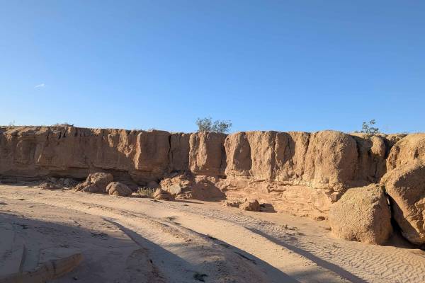
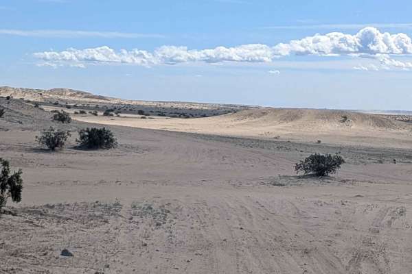
BLM 329
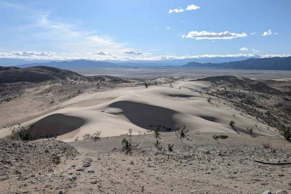
This trail is a large wash that winds through various sand hills and walls, with some reaching up to 30 feet tall creating a dramatic and enclosed canyon environment. The sand is very fluffy and can be deep at times, requiring constant momentum management through these soft conditions. There is lots...
Learn more about BLM 329
BLM 327
This 4-mile out-and-back trail starts at BLM 326 NW and heads west. The surface is dirt and sand, surrounded by desert bushes throughout. Views of Superstition Mountain serve as your backdrop, with Fish Creek Mountain also visible, providing scenic mountain views. The trail follows a plateau just to...
Learn more about BLM 327
BLM 326 NW
This trail starts just off Highway 86, with the beginning surface being gravel that quickly turns to dirt as you progress. The route follows underneath the power lines, providing easy reference for navigation. You'll encounter some whoops and ruts scattered throughout. The trail goes in and out of c...
Learn more about BLM 326 NW
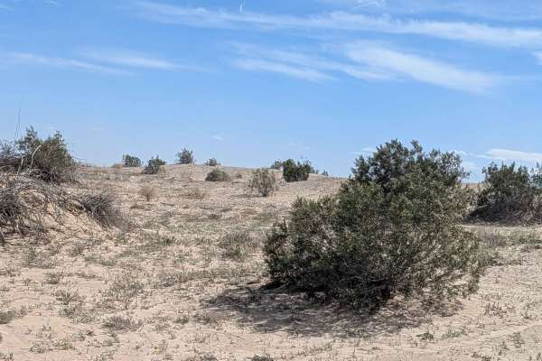
BLM 324
This medium-sized wash features a very sandy surface with some sections of very deep sand and some ruts over 18 inches, creating serious obstacles. The wash winds through the desert, lined with desert bushes and seasonal blooming wildflowers, adding color to the landscape. There are many sand walls ...
Learn more about BLM 324
Lady Towers
This trail follows a power line for easy reference as it climbs toward the summit of Superstition Mountain, where there are communication towers and a viewpoint. The surface is a mix of deep sand and deteriorated old asphalt and gravel, creating varied traction conditions throughout. At the top is a...
Learn more about Lady Towers
Superstition Mountain South
This out-and-back trail starts at Lucky Lady Towers and follows the power line through sandy terrain with whoops, washboards, and off-camber sections, creating a varied and challenging ride. There are some small but very deep sand dunes that you have to go over along the way, and these can change ni...
Learn more about Superstition Mountain South
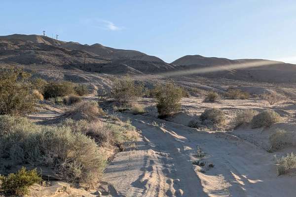
Imler Road
This trail starts off at Superstition Mountain South and begins at mile 9.5 of the El Centro BLM Backcountry Trail. The surface is fine sand and is two vehicles wide, lined with creosote bushes throughout. This trail connects the north side of Superstition Mountain to the south side without having t...
Learn more about Imler Road
BLM 325
This trail features mostly packed sand with some soft sand as well, creating varied traction conditions. The route is a small wash lined with sand walls about 3 feet high, creating an enclosed corridor. The trail is lined with some brush, but is mostly barren throughout. The canyon gets very narrow ...
Learn more about BLM 325
Superstition Mountain - BLM 341
This out-and-back trail serves as a main artery going from Wheeler Road to the southeast side of Superstition Mountain. The surface is fine sand and is 2 to 3 vehicles wide, providing excellent room for navigation and passing. The route is lined with lots of creosote bushes throughout. You'll encoun...
Learn more about Superstition Mountain - BLM 341
BLM 197
This trail runs parallel to the south base of Superstition Mountain with a hard pack sand and loose sand mix creating varying traction conditions. There is very little vegetation, with just a few desert bushes here and there scattered throughout the barren landscape. The trail climbs in and out of h...
Learn more about BLM 197
BLM 206
This trail features a fine sand surface that cuts through some creosote bushes as it navigates the terrain. The route runs along the base of the south side of Superstition Mountain, offering some of the best views of the mountain itself as you travel parallel to its imposing face. The sand is super ...
Learn more about BLM 206
BLM 335
This out-and-back trail features a mix of deep sand and deteriorating old paved sections, creating unpredictable traction conditions as the surface alternates between the two extremes. There is one section with a big off-camber section that demands careful attention and skilled line choice. The rout...
Learn more about BLM 335
BLM 332
This trail starts off at Superstition Trail on the north side of the mountain and quickly drops into a sandy area, creating an immediate descent from the start. The route is a very sandy trail lined with various desert brush and grasses creating a vegetated corridor through the terrain. The wash has...
Learn more about BLM 332
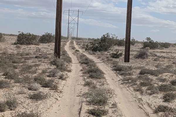
Wheeler Road
This is another main east-to-west trail in the Superstition Mountain OHV Open Riding Area. The surface is a mix of soft sand and hard-pack sand, creating varying traction conditions. The trail follows a power line for easy reference and navigation. The route features a lot of washboards and some who...
Learn more about Wheeler Road
Parachute Landing
Parachute Landing is an unmaintained paved road and beach trail leading to a decommissioned Naval Auxiliary Air Station. A non-technical but eroding road with sand drifts turns into a dirt path, eventually terminating at the beach containing ruins of a small decommissioned World War II Era US Navy b...
Learn more about Parachute Landing
Beginner ATV trails near Calipatria, California
Explore ATV-friendly trails near you. These trails are accessible for vehicles up to 50 inches wide, perfect for ATVs and smaller off-road machines.
BLM 412
This trail is a hard-packed sand route that connects BLM 326 to farmland roads to the east, serving as an important connector between recreation areas and agricultural lands. There is very little vegetation, with just a few large and small bushes scattered throughout the sparse landscape. The land t...
Learn more about BLM 412
BLM 414
This trail is off BLM 326 and features a very sandy surface that has been reset by recent storms, making it hard to find the beginning of the trail, so follow the map carefully for navigation. The landscape is very barren with very little vegetation in the beginning, eventually gaining some small to...
Learn more about BLM 414
BLM 194 SE
This trail is a fairly wide wash with a surface that's hard-pack sand mixed with deep sand, creating varying traction conditions. The wash has sand and mud walls with parts of it lined with lots of vegetation, adding greenery to the corridor. You'll encounter some washboards scattered throughout, cr...
Learn more about BLM 194 SE
BLM 326 SE
This trail is fairly smooth compared to others in the area, making it a more comfortable route through the region. The surface is soft sand throughout, requiring momentum management. The trail continues down the power line leading toward the water aqueduct, but ends just past Edgar Road, providing c...
Learn more about BLM 326 SE
Beginner UTV/side-by-side trails near Calipatria, California
Find UTV and side-by-side trails near you. These trails accommodate vehicles up to 60 inches wide, ideal for UTVs, side-by-sides, and wider off-road rigs.
BLM 412
This trail is a hard-packed sand route that connects BLM 326 to farmland roads to the east, serving as an important connector between recreation areas and agricultural lands. There is very little vegetation, with just a few large and small bushes scattered throughout the sparse landscape. The land t...
Learn more about BLM 412
BLM 414
This trail is off BLM 326 and features a very sandy surface that has been reset by recent storms, making it hard to find the beginning of the trail, so follow the map carefully for navigation. The landscape is very barren with very little vegetation in the beginning, eventually gaining some small to...
Learn more about BLM 414
BLM 194 SE
This trail is a fairly wide wash with a surface that's hard-pack sand mixed with deep sand, creating varying traction conditions. The wash has sand and mud walls with parts of it lined with lots of vegetation, adding greenery to the corridor. You'll encounter some washboards scattered throughout, cr...
Learn more about BLM 194 SE
BLM 326 SE
This trail is fairly smooth compared to others in the area, making it a more comfortable route through the region. The surface is soft sand throughout, requiring momentum management. The trail continues down the power line leading toward the water aqueduct, but ends just past Edgar Road, providing c...
Learn more about BLM 326 SE
The onX Offroad Difference
onX Offroad combines trail photos, descriptions, difficulty ratings, width restrictions, seasonality, and more in a user-friendly interface. Available on all devices, with offline access and full compatibility with CarPlay and Android Auto. Discover what you're missing today!
Open Trail Map