
Beginner Off-Road Trails
Near Bonanza, Colorado
Explore All Beginner Trails Near Bonanza, Colorado
Beginner Off-Road Trails Near Bonanza, Colorado
Discover the best beginner-friendly off-road trails near you. These easier, lower-rated trails are a great place to start — browse trail maps, check difficulty ratings, and find your next adventure.
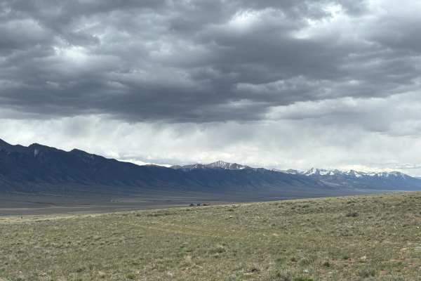
Hi-Wire Road
This is a unique trail that follows a series of high voltage lines across the open plains at the foot of the southern end of the Sawatch Range. While there are no major obstacles, this trail can become extremely muddy during rain or snow, so use caution if the weather is expected. At the terminus of...
Learn more about Hi-Wire Road
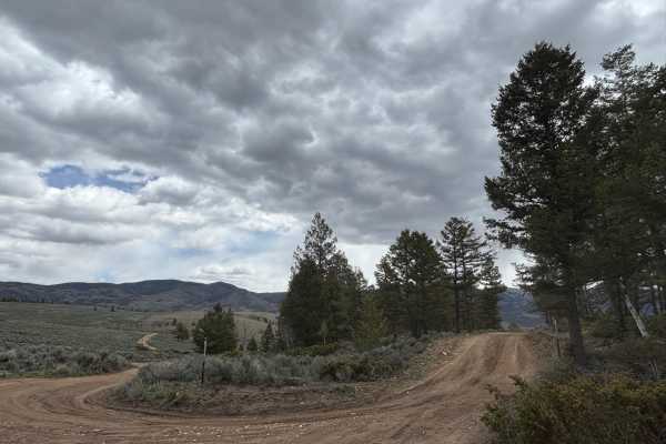
Raghorn Road
This road deviates from Poncha Loop and connects with Velvet Buck Road to provide access to several dispersed campsites. While this road used to head further into the foothills of the southern Sawatch Range, that portion of the road has been closed off at this time. Still, it's worth traveling to ad...
Learn more about Raghorn Road
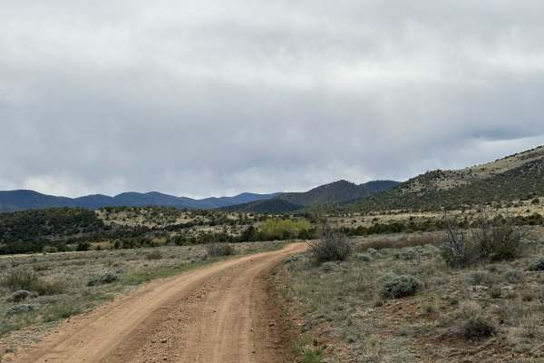
Kelly Creek Cutoff
This trail connects North Turquoise Road with Kelly Creek Road, providing access to the Kelly Creek Trailhead from the northern portion of the plains below the Sawatch Range. The road includes stunning views of the surrounding peaks to the east and the flowing foothills to the west, as well as two e...
Learn more about Kelly Creek Cutoff
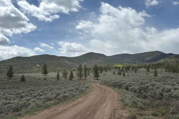
Clover Creek Road
This road provides an alternate way in or out of the main Poncha Loop Road. Along the way, you'll see beautiful views of the surrounding peaks from the southern end of the Sawatch Range and the northern end of the Sangre de Cristo Range. There are several exposed dispersed campsites that are worth c...
Learn more about Clover Creek Road
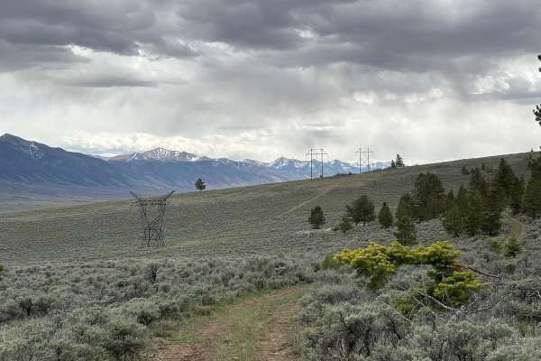
Old Railroad Road
This road heads west of Highway 285, near the Bonanza Highlights trail. It ends near a series of overgrown (but still accessible) trails that head further into the foothills or connect back with the Bonzana Highlights trail. Along the way, you'll see incredible views of the surrounding peaks and her...
Learn more about Old Railroad Road
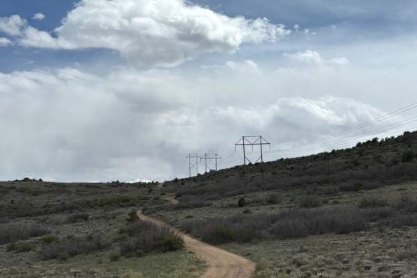
North Turquoise Road
This trail works its way through the open plains between the Sawatch and Sangre de Cristo mountain ranges and falls entirely within BLM, although it passes by a small ranch towards the end. At times, the trail can be hard to see from scrubby overgrowth, but it is generally flat and easy to traverse....
Learn more about North Turquoise Road
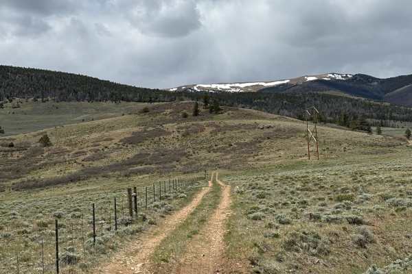
Turquoise Road
This road heads west of Highway 285, across the plains at the foot of the southern Sawatch Range. The road itself is a simple dirt trail that can appear overgrown with scrub at times, making it difficult to see. Along this route, you'll see sweeping views of the surrounding mountain and may encounte...
Learn more about Turquoise Road
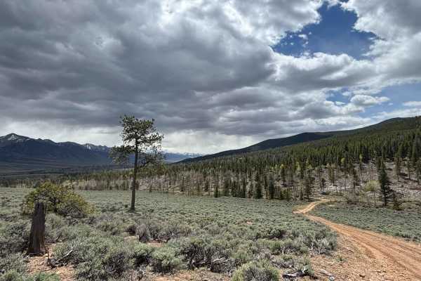
Velvet Buck Road
This road branches off of Poncha Loop and heads further into the foothills of the southern end of the Sawatch Range. It provides several excellent dispersed camping opportunities and views of the surrounding peaks. The road itself is mild and often accessed by budding dirt bikers or families looking...
Learn more about Velvet Buck Road
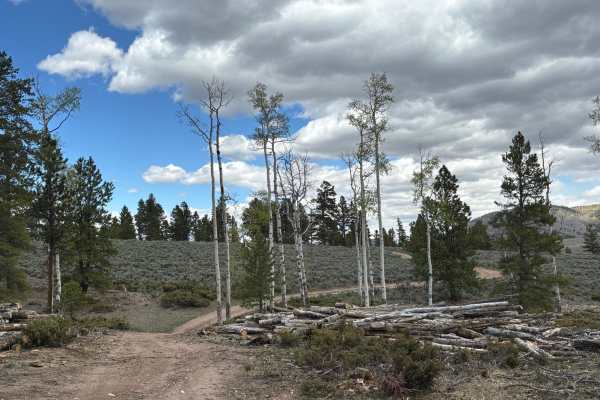
Lasso Road
This road branches off from Poncha Loop and provides access to several high-quality campsites with excellent tree cover and views of the surrounding peaks, mainly the southern end of the Sawatch Range. The road itself passes through groves of both aspens and evergreens, and is commonly used by dirt ...
Learn more about Lasso Road
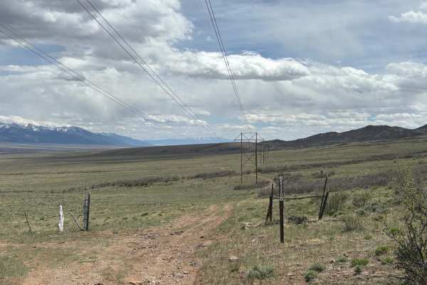
Wild Bill Gulch Road
This route works its way through the base of the foothills of the Sawatch Range, right above (and eventually down to) the open plains below. As you make your way through this rugged terrain, you'll see sweeping views of the surrounding peaks in both the Sawatch and Sangre de Cristo mountain ranges. ...
Learn more about Wild Bill Gulch Road
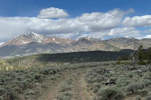
Haircut Road
The road is accessible from Poncha Loop Road and provides access to several lesser-known campsites with incredible views of both the southern portion of the Sawatch Range, as well as the northern end of the Sangre de Cristo Range. It sits directly under some high-voltage lines, but somehow that only...
Learn more about Haircut Road
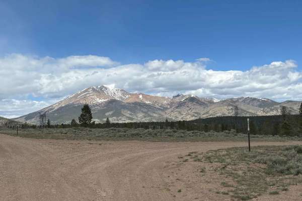
Shirley Road
This road branches off of Poncha Loop and provides excellent opportunities to get closer to the southern portion of the Sawatch Range to enjoy dispersed camping in the aspen groves. You can usually take this road further, but it has been restricted due to logging operations in the area. This is stil...
Learn more about Shirley Road
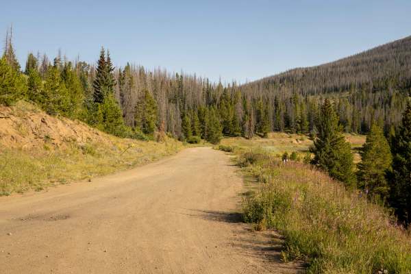
Marshall Pass (East)
The Marshall Pass (East) route is a well-traveled, easy-to-navigate trail in central Colorado, suitable for most high-clearance vehicles. The trail is free of obstacles, making it accessible for drivers of varying skill levels. Several dispersed campsites are located along the route, providing oppor...
Learn more about Marshall Pass (East)
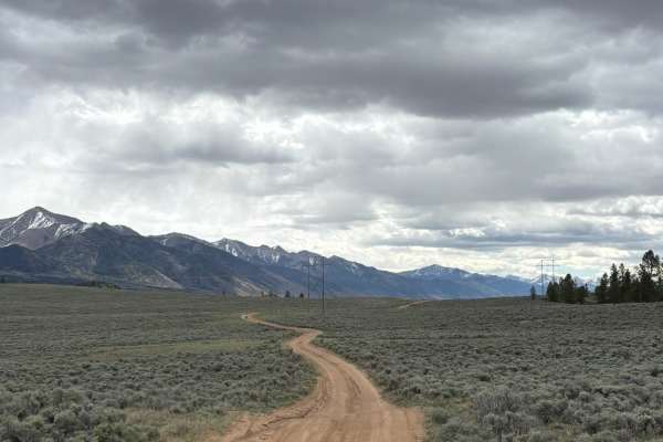
Poncha Loop Road
This loop sits between the southern portion of the Sawatch Range and the Sangre de Cristo Range. It features incredible views of both and a wealth of easy-to-access campsites, perfect for trailers and rigs and dirtbikes alike. This area includes some interesting visual opportunities, like power line...
Learn more about Poncha Loop Road
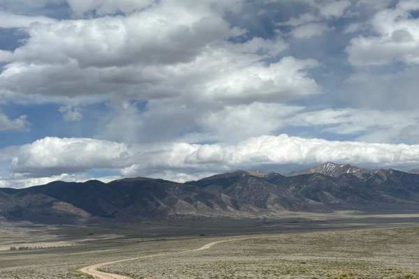
Kelly Creek Road
This road travels across the plains at the foot of the Sawatch Range, west of the Sangre de Cristo Range. It travels through BLM, but borders on some remote residential areas. You may see ATVs from the surrounding houses enjoying this area after work. As you traverse this trail, you'll see stunning ...
Learn more about Kelly Creek Road
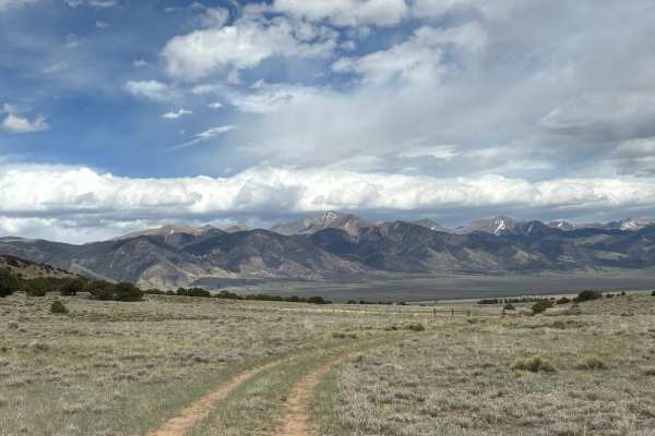
Clayton Road
This road travels west from Highway 285 to a junction of various trails that are popular with local residents. This area includes sweeping views of the surrounding Sawatch and Sangre de Cristo mountain ranges, as well as plenty of the wild antelope that are common to this area. Additionally, there a...
Learn more about Clayton Road
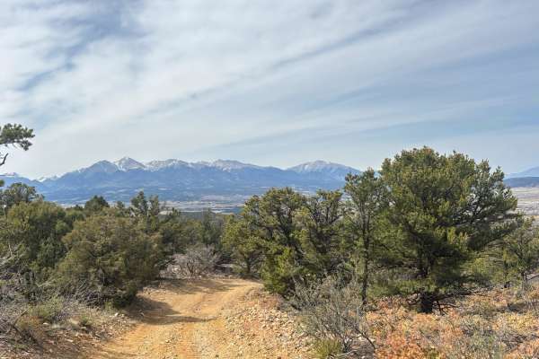
Methodist Mountain Road
This route winds up a logging road from Salida to an overlook with stunning views of the Collegiate Peaks. The road itself is rocky and moves through an old evergreen forest with a recent burn scar. It can be narrow at times, so full-sized trucks may want to avoid this one or risk taking a few battl...
Learn more about Methodist Mountain Road
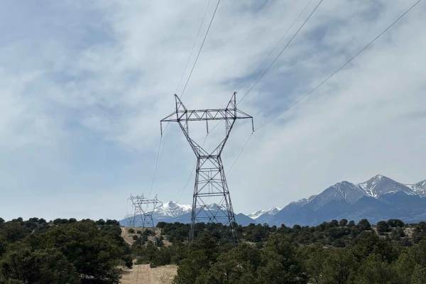
BLM 5669
The route runs along a length of high voltage power lines, with fantastic views of the Collegiate Peaks in the distance. At the terminus are several trailheads for hiking trails around Salida. The road winds through scrub brush typical of this area and does not include any major obstacles.
Learn more about BLM 5669
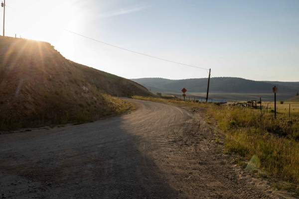
Marshall Pass via Poncha Creek
The Marshall Pass via Poncha Creek trail is a wide, easy-to-navigate route through central Colorado’s San Isabel National Forest. The trail is free of obstacles, though drivers should be aware of blind curves and occasional speed bumps, especially along logging sections. Wildlife is abundant along t...
Learn more about Marshall Pass via Poncha Creek

Mt. Shavano
Mt. Shavano is a scenic 6.3-mile point-to-point trail near Poncha Springs, Colorado, that is ideal for beginners, high-clearance four-wheel-drive vehicles, and SxSs looking for scenic access to high-altitude trailheads. Climbing from an elevation of 7,976 feet to 9,749 feet, this route starts on Cou...
Learn more about Mt. Shavano
Beginner ATV trails near Bonanza, Colorado
Explore ATV-friendly trails near you. These trails are accessible for vehicles up to 50 inches wide, perfect for ATVs and smaller off-road machines.
Hi-Wire Road
This is a unique trail that follows a series of high voltage lines across the open plains at the foot of the southern end of the Sawatch Range. While there are no major obstacles, this trail can become extremely muddy during rain or snow, so use caution if the weather is expected. At the terminus of...
Learn more about Hi-Wire Road
Raghorn Road
This road deviates from Poncha Loop and connects with Velvet Buck Road to provide access to several dispersed campsites. While this road used to head further into the foothills of the southern Sawatch Range, that portion of the road has been closed off at this time. Still, it's worth traveling to ad...
Learn more about Raghorn Road
Kelly Creek Cutoff
This trail connects North Turquoise Road with Kelly Creek Road, providing access to the Kelly Creek Trailhead from the northern portion of the plains below the Sawatch Range. The road includes stunning views of the surrounding peaks to the east and the flowing foothills to the west, as well as two e...
Learn more about Kelly Creek Cutoff
Clover Creek Road
This road provides an alternate way in or out of the main Poncha Loop Road. Along the way, you'll see beautiful views of the surrounding peaks from the southern end of the Sawatch Range and the northern end of the Sangre de Cristo Range. There are several exposed dispersed campsites that are worth c...
Learn more about Clover Creek Road
Beginner UTV/side-by-side trails near Bonanza, Colorado
Find UTV and side-by-side trails near you. These trails accommodate vehicles up to 60 inches wide, ideal for UTVs, side-by-sides, and wider off-road rigs.
Hi-Wire Road
This is a unique trail that follows a series of high voltage lines across the open plains at the foot of the southern end of the Sawatch Range. While there are no major obstacles, this trail can become extremely muddy during rain or snow, so use caution if the weather is expected. At the terminus of...
Learn more about Hi-Wire Road
Raghorn Road
This road deviates from Poncha Loop and connects with Velvet Buck Road to provide access to several dispersed campsites. While this road used to head further into the foothills of the southern Sawatch Range, that portion of the road has been closed off at this time. Still, it's worth traveling to ad...
Learn more about Raghorn Road
Kelly Creek Cutoff
This trail connects North Turquoise Road with Kelly Creek Road, providing access to the Kelly Creek Trailhead from the northern portion of the plains below the Sawatch Range. The road includes stunning views of the surrounding peaks to the east and the flowing foothills to the west, as well as two e...
Learn more about Kelly Creek Cutoff
Clover Creek Road
This road provides an alternate way in or out of the main Poncha Loop Road. Along the way, you'll see beautiful views of the surrounding peaks from the southern end of the Sawatch Range and the northern end of the Sangre de Cristo Range. There are several exposed dispersed campsites that are worth c...
Learn more about Clover Creek Road
The onX Offroad Difference
onX Offroad combines trail photos, descriptions, difficulty ratings, width restrictions, seasonality, and more in a user-friendly interface. Available on all devices, with offline access and full compatibility with CarPlay and Android Auto. Discover what you're missing today!
Open Trail Map