
Beginner Off-Road Trails
Near Atwater, California
Explore All Beginner Trails Near Atwater, California
Beginner Off-Road Trails Near Atwater, California
Discover the best beginner-friendly off-road trails near you. These easier, lower-rated trails are a great place to start — browse trail maps, check difficulty ratings, and find your next adventure.
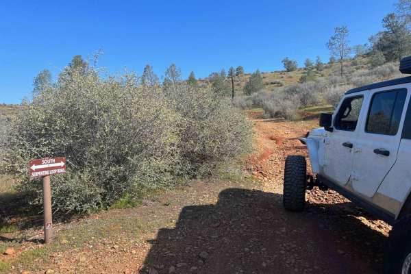
Red Hills Road/Serpentine loop
Red Hills Recreation (BLM) area is a scenic day use only location. There are tons of hiking trails in the area, as well as the Serpentine Loop Trail which is a mild to moderate trail with tons of seasonal water crossings and picnic areas near the water. Accessible to most 4x4 and AWD vehicles, small...
Learn more about Red Hills Road/Serpentine loop
High Times
Discover an exciting off-road trail tailored to 4x4 vehicles, combining moderate terrain with thrilling elements. While mostly easy to navigate, you'll encounter occasional gentle inclines and 12-inch deep ruts, adding a dash of excitement without overwhelming the adventure. Perfect for those seekin...
Learn more about High Times
Low Times
This short but intense spur descends nearly 1,500 feet in just over a mile. The trail is narrow, rocky, and exposed, featuring loose shale and shelf sections that demand careful driving. While suitable for high-clearance 4x4 vehicles, drivers should anticipate tight lines, steep grades, and minimal ...
Learn more about Low Times
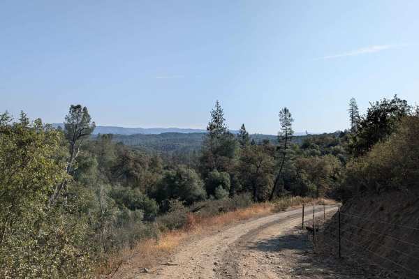
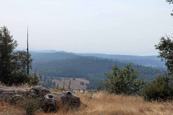
Bull Creek Road South
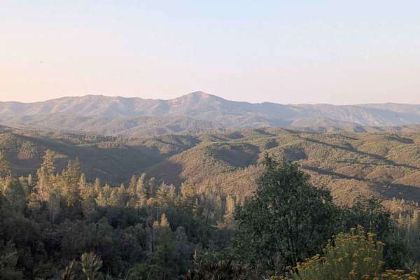
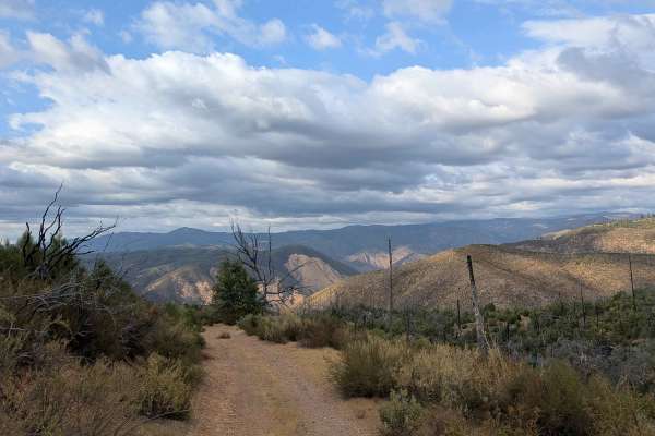
Bull Creek Road South climbs 622 feet and drops just over 300 feet in 4.4 miles. The surface is packed dirt and sand, starting off about one and a half vehicles wide before narrowing in sections. This is a shelf road that climbs steadily after Burma Grade, providing expansive views of the valleys be...
Learn more about Bull Creek Road South
Wagner Ridge Road - FS 2S08
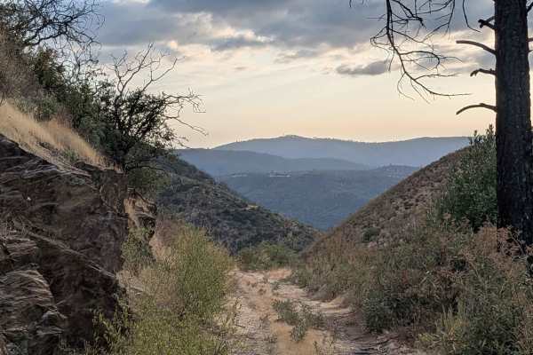
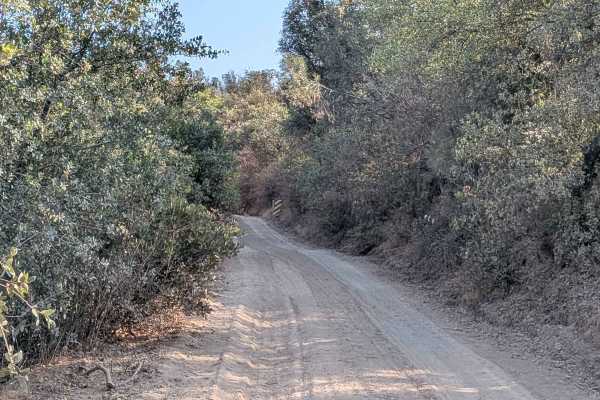
This trail climbs over 600 feet and drops almost 1,200 feet across just over 5 miles of diverse terrain that spans BLM land and Stanislaus National Forest, though it begins on private land requiring respectful passage. Starting at Smith Station Road and ending on Wild Rose Road, the route begins as ...
Learn more about Wagner Ridge Road - FS 2S08
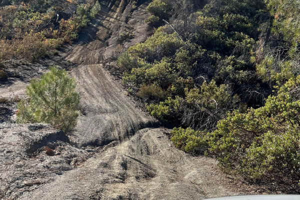
The Rut
This is a lightly traveled trail with a dirt floor. Uneven, rutted dirt trail with erosion. Potential water crossings up to a foot deep, in the winter, and in some spots the rut is 3ft deep steep grades. Roads are typically one vehicle wide with places to pass. The wet season sky rockets the rating ...
Learn more about The Rut
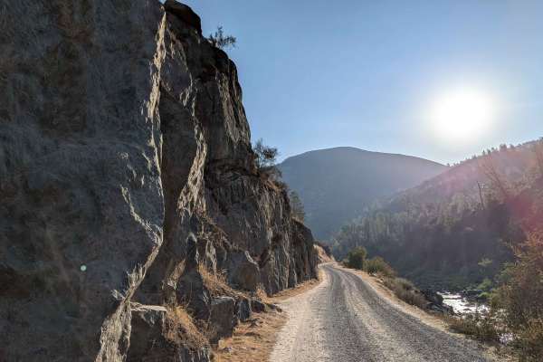
Briceburg Road - Merced River
This gravel road starts behind the Briceburg Visitor Center, across the bridge, and follows the Merced River for its entire length, providing continuous water views and sounds throughout the journey. The track maintains a width of one and a half to two vehicles on a well-maintained gravel surface, t...
Learn more about Briceburg Road - Merced River
Burma Grade Road
Burma Grade climbs almost 1,400 feet in 3 miles. The trail starts at Bull Creek Road and ends at Bull Creek Road South. To access it, take Briceburg Road behind the Briceburg Visitor Center and cross the bridge. The trail is managed by the BLM. The road is hard-packed dirt, about 1.5 vehicles wide, ...
Learn more about Burma Grade Road
Ponderosa Way Cutoff
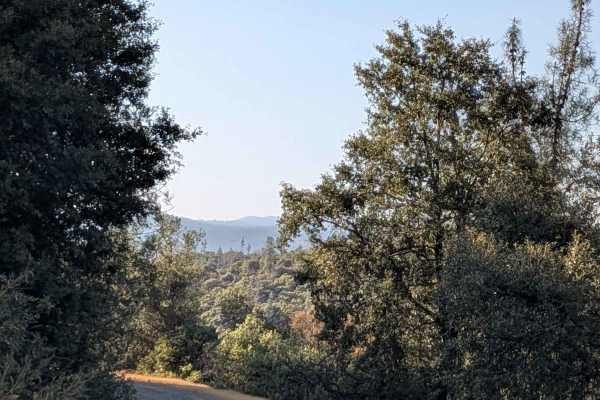
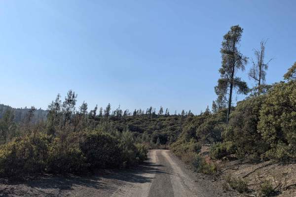
Ponderosa Way Cutoff serves as a convenient shortcut connecting Ponderosa Way and Bull Creek Road, following a relatively flat route that still incorporates ups and downs over various hills throughout its length. The trail offers excellent views of the surrounding forest and valleys, providing sceni...
Learn more about Ponderosa Way Cutoff
Buffalo Gulch Road
Starting from Highway 140, this rugged track drops nearly 1,500 feet and climbs less than 300 feet in under 4 miles before connecting with Ponderosa Way at the top. The trail averages 1 to 1.5 vehicles wide and is made up of uneven gravel and sand, giving it a rough, bumpy feel throughout. At about ...
Learn more about Buffalo Gulch Road

FS 2S37
This trail is a 3.5-mile out-and-back trail that drops almost 700 feet and climbs over 100 feet in just under 2 miles. The trail sometimes runs along shelf roads lined with trees and brush, providing natural corridors and periodic exposure as it descends toward the valley floor. Pleasant views of fa...
Learn more about FS 2S37
FS 3S15
This 5-mile out-and-back trail starts at Forest Service Road 3S02 and drops over 600 feet while gaining over 300 feet in less than 3 miles, creating varied elevation changes throughout the journey. The route follows a shelf road configuration for its entire length, providing elevated perspectives o...
Learn more about FS 3S15
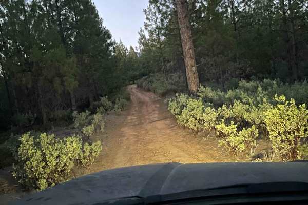
Boneyard Road - FS 1S07
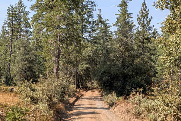
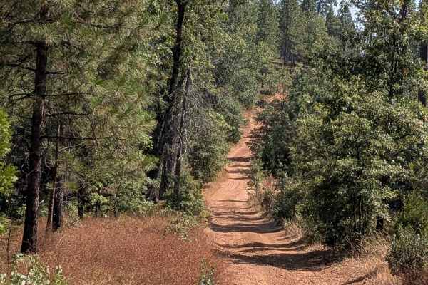
This trail starts just off Highway 120, located 2.7 miles east of the Groveland District Ranger Office, and begins as a 1.5-vehicle-wide gravel trail with some sand sections. Lined with Ponderosa pine trees and bushes, the route provides a pleasant forest driving experience within the Stanislaus Nat...
Learn more about Boneyard Road - FS 1S07

Jordan Creek Road - FS 2S17
This trail drops over 800 feet in just over 4.5 miles, starting on Smith Station Road (FS J132). The route begins in a neighborhood area requiring respectful behavior, initially following a crushed granite gravel road surface. After the first mile, private land ends and the trail continues through t...
Learn more about Jordan Creek Road - FS 2S17
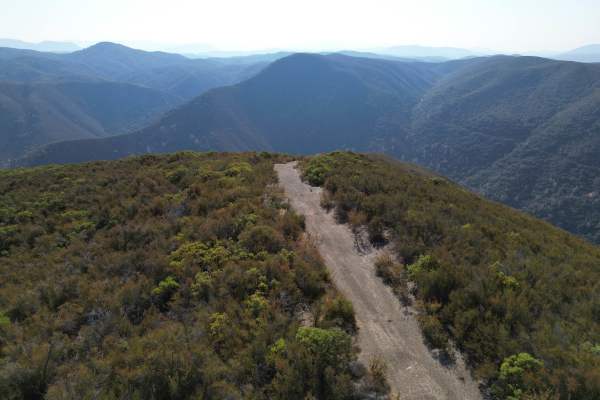
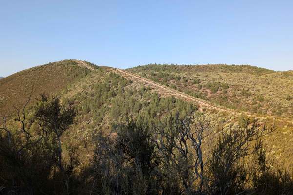
Ponderosa Way
Branching off from Buffalo Gulch Trail, this 3-mile out-and-back route offers big views and a fun ridge-line drive. The sandy track drops more than 700 feet and gains just 90 feet over 2 miles, making it a steady descent out and climb back. The trail averages about 1.5 vehicles wide as it runs along...
Learn more about Ponderosa Way
Briceburg Road - FS 2S05
This trail climbs over 200 feet in just over a mile, connecting Bull Creek Road South to Bull Creek Road North through scenic terrain within the Stanislaus National Forest. The route is lined with grasses, scattered brushes, and some larger trees, creating a pleasant natural corridor that follows al...
Learn more about Briceburg Road - FS 2S05

Bull Creek Road North
This trail starts just off Briceburg Road (FS 2S05) and ends at Old Yosemite Coulterville Road. The road then becomes paved. The route climbs almost 300 feet and drops almost 500 feet over 3.5 miles of varied landscape. As a county-maintained road, only street-legal vehicles are permitted on this ro...
Learn more about Bull Creek Road North

Old Yosemite Coulterville Road
The original road leading into Yosemite Valley, this trail first opened in 1874. Enjoy panoramic views as you climb a well-maintained Forest Service road to Pilot Peak and follow a ridgeline towards Trumbull Peak. The surroundings become lush as you make a fun, short, and twisty descent to Little Ne...
Learn more about Old Yosemite Coulterville Road
FS 3S10
This trail starts right off Bull Creek Road and maintains a width of 1 to 1.5 vehicles throughout its length. The very sandy and dusty surface runs parallel to a creek, providing pleasant water sounds and views during the journey. Lined with bushes and various types of trees, the route creates natur...
Learn more about FS 3S10
Smith Ridge - FS 1S28
This trail climbs over 400 feet and drops almost 400 feet across almost 3 miles of forested terrain, starting near the junction of Forest Service Roads 2S28 and 1S15 and ending at FS1S29. The sandy surface creates very dusty conditions throughout the journey, with numerous trees surrounding the trai...
Learn more about Smith Ridge - FS 1S28
Beginner ATV trails near Atwater, California
Explore ATV-friendly trails near you. These trails are accessible for vehicles up to 50 inches wide, perfect for ATVs and smaller off-road machines.
High Times
Discover an exciting off-road trail tailored to 4x4 vehicles, combining moderate terrain with thrilling elements. While mostly easy to navigate, you'll encounter occasional gentle inclines and 12-inch deep ruts, adding a dash of excitement without overwhelming the adventure. Perfect for those seekin...
Learn more about High Times
The Rut
This is a lightly traveled trail with a dirt floor. Uneven, rutted dirt trail with erosion. Potential water crossings up to a foot deep, in the winter, and in some spots the rut is 3ft deep steep grades. Roads are typically one vehicle wide with places to pass. The wet season sky rockets the rating ...
Learn more about The Rut
Burma Grade Road
Burma Grade climbs almost 1,400 feet in 3 miles. The trail starts at Bull Creek Road and ends at Bull Creek Road South. To access it, take Briceburg Road behind the Briceburg Visitor Center and cross the bridge. The trail is managed by the BLM. The road is hard-packed dirt, about 1.5 vehicles wide, ...
Learn more about Burma Grade Road
Ponderosa Way Cutoff
Ponderosa Way Cutoff serves as a convenient shortcut connecting Ponderosa Way and Bull Creek Road, following a relatively flat route that still incorporates ups and downs over various hills throughout its length. The trail offers excellent views of the surrounding forest and valleys, providing sceni...
Learn more about Ponderosa Way Cutoff
Beginner UTV/side-by-side trails near Atwater, California
Find UTV and side-by-side trails near you. These trails accommodate vehicles up to 60 inches wide, ideal for UTVs, side-by-sides, and wider off-road rigs.
High Times
Discover an exciting off-road trail tailored to 4x4 vehicles, combining moderate terrain with thrilling elements. While mostly easy to navigate, you'll encounter occasional gentle inclines and 12-inch deep ruts, adding a dash of excitement without overwhelming the adventure. Perfect for those seekin...
Learn more about High Times
The Rut
This is a lightly traveled trail with a dirt floor. Uneven, rutted dirt trail with erosion. Potential water crossings up to a foot deep, in the winter, and in some spots the rut is 3ft deep steep grades. Roads are typically one vehicle wide with places to pass. The wet season sky rockets the rating ...
Learn more about The Rut
Burma Grade Road
Burma Grade climbs almost 1,400 feet in 3 miles. The trail starts at Bull Creek Road and ends at Bull Creek Road South. To access it, take Briceburg Road behind the Briceburg Visitor Center and cross the bridge. The trail is managed by the BLM. The road is hard-packed dirt, about 1.5 vehicles wide, ...
Learn more about Burma Grade Road
Ponderosa Way Cutoff
Ponderosa Way Cutoff serves as a convenient shortcut connecting Ponderosa Way and Bull Creek Road, following a relatively flat route that still incorporates ups and downs over various hills throughout its length. The trail offers excellent views of the surrounding forest and valleys, providing sceni...
Learn more about Ponderosa Way Cutoff
The onX Offroad Difference
onX Offroad combines trail photos, descriptions, difficulty ratings, width restrictions, seasonality, and more in a user-friendly interface. Available on all devices, with offline access and full compatibility with CarPlay and Android Auto. Discover what you're missing today!
Open Trail Map