
Beginner Off-Road Trails
Near Ashland, New Hampshire
Explore All Beginner Trails Near Ashland, New Hampshire
Beginner Off-Road Trails Near Ashland, New Hampshire
Discover the best beginner-friendly off-road trails near you. These easier, lower-rated trails are a great place to start — browse trail maps, check difficulty ratings, and find your next adventure.
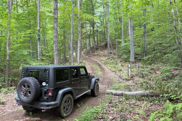
Cass Road
Cass Road is a Class 6 road in Bridgewater, NH. This route can be driven in either direction. From East to West, it runs uphill for nearly the entire route with approximately 600 feet of elevation gain. This route is a good access road into the main part of the Class 6 road system in Bridgewater, as...
Learn more about Cass Road
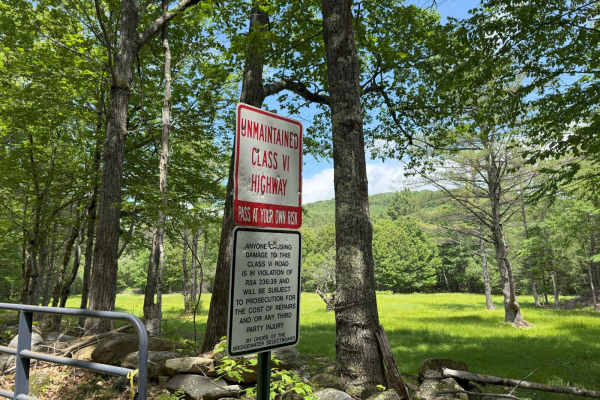
Berry Hill to Old Country Road Loop
This great loop trail runs on Berry Hill and Old Country Class 6 roads in Bridgewater, NH. The trail starts and ends at the historic Bridgewater Town House (1806). Enter the access gate behind the Town House and begin an ascent up Berry Hill Road. The trail is fairly wet and covered with loose rocks...
Learn more about Berry Hill to Old Country Road Loop
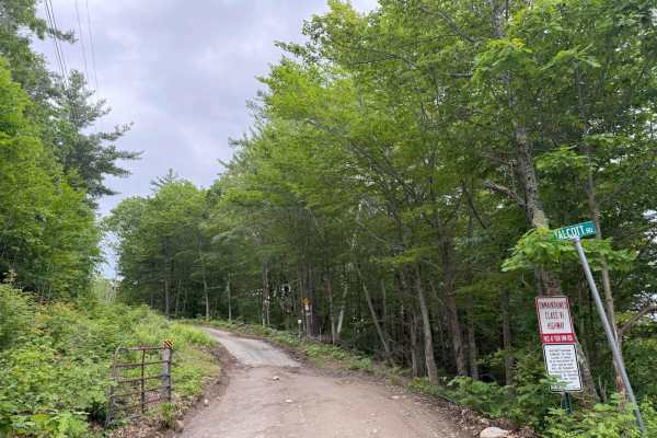
Talcott Road to Old Stage Road
This route starts out on Talcott Road and follows down to Old Stage Road in Bridgewater, NH. Both roads are Class 6 unmaintained roads. The entire route is a gradual descent, with some steep hills along the way. The route starts off with the million-dollar view from the trail's high point, overlooki...
Learn more about Talcott Road to Old Stage Road
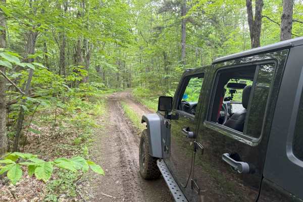
Wade Hill Road
Wade Hill Road is a Class 6 road in Hebron, NH. You can run it in both directions. Entering from the east side, you begin to ascend. You will reach the top in the middle of the trail. The trail travels through thick woods. It is muddy, has small ruts, and some loose, smaller rocks Weather will have...
Learn more about Wade Hill Road
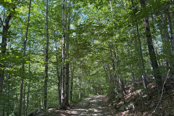
Thompson Road
Thompson Road is a "Class VI" public road in Sandwich, New Hampshire. The route is fairly easy and can be done in a stock 4WD vehicle. This route is an out-and-back, and is supposed to be longer, but was blocked by a gate at about 1.5 miles into the trail. This trail will take you up and down severa...
Learn more about Thompson Road
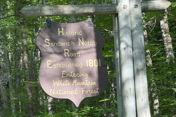
Sandwich Notch Road
Sandwich Notch Road is a well-maintained dirt forest road that runs between Thornton and Sandwich, New Hampshire, in the White Mountain National Forest. This iconic NH scenic byway was first established in 1801. This easy route has a lot of bang for your buck, as the scenery and views are breathtaki...
Learn more about Sandwich Notch Road
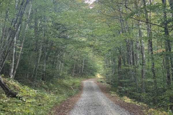
Hubbard Brook Road
Hubbard Brook Road is a well-maintained U.S. Forest Service road located in the southwestern section of New Hampshire’s White Mountain National Forest. Conveniently accessed from Interstate 93, this route offers a quiet, scenic drive that sees far less traffic than many of the forest’s main corridor...
Learn more about Hubbard Brook Road
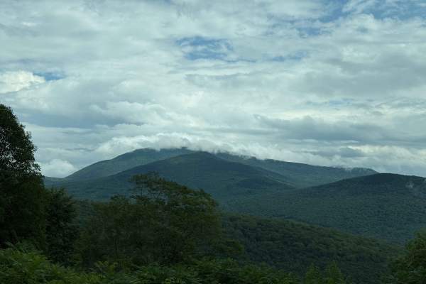
Tripoli Road
Tripoli Road is a well-maintained forest road that connects the Town of Waterville Valley to Thornton via a pass between Mt. Tecumseh and Mt. Osceola. This road is easily passable by any vehicle and is a popular road for access to hiking trails on Mt. Tecumseh and Mt. Osceola, as well as numerous ca...
Learn more about Tripoli Road
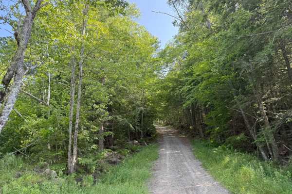
Caverly Road to Devil's Den Road
This route travels across two portions of two Class 6 roads that travel around Caverly Mountain, then between Devil's Den Mountain and Mount Molly. The route is stock four-wheel drive friendly and can be run in either direction. This route starts on Caverly Road and heads West for approximately 1 mi...
Learn more about Caverly Road to Devil's Den Road
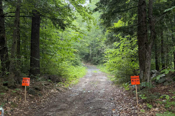
Bound Tree Road
New Hampshire Class VI road. This in-and-out route ends at a small pond, with enough room to turn around. The trail is overgrown and may cause light pinstriping as it passes between property lines and old New England stone walls, with distinct forest types on either side. Posted signage from a lando...
Learn more about Bound Tree Road
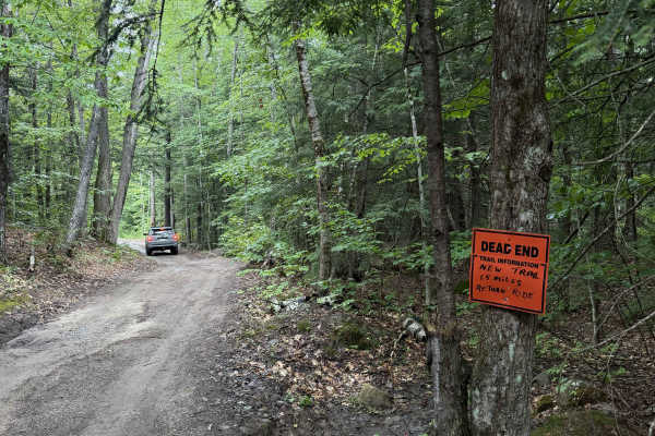
Dummer Road
New Hampshire Class VI road / multi-use trail. This dirt road includes several low areas that show signs of flooding after heavy rain. Use caution near wooden planks covering rusted culverts, as exposed metal may puncture tires. The route is shortened for off-highway vehicles, and signage at the end...
Learn more about Dummer Road
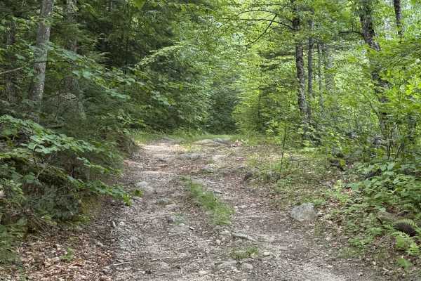
Page Trace Road
New Hampshire Class VI road. Page trace intersects Cunningham Road and is a great continuation through the woods. The route contains a few small rock gardens and some relatively steep climbs. It is hard-packed gravel and dirt for the most part. Some sections are rutted and will certainly become mud ...
Learn more about Page Trace Road
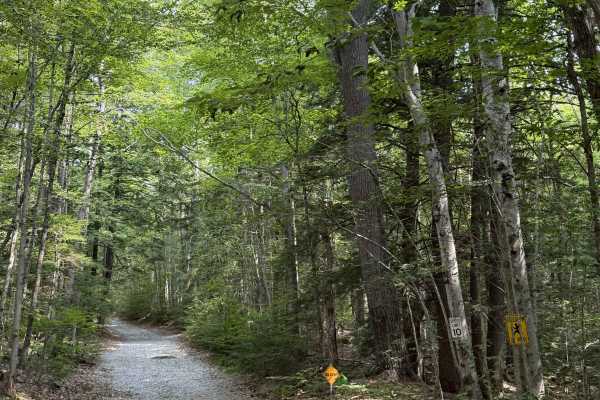
Mink Hill Road
Mink Hill is a smooth gravel road that is still maintained. There are several homes on this route, so be respectful of the land. Fresh gravel has been laid down and is still loose. You'll pass some wetlands on your left before a short climb. There is a post at the end of the trail indicating that OH...
Learn more about Mink Hill Road
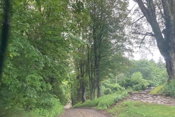
Natty's Route
This public and maintained dirt/gravel route starts in Farmington, New Hampshire, and ends in Strafford. Please be considerate of the residents and stick to the public throughways. Full-width tracks branching off the main throughway are more than likely private property and should never be traversed...
Learn more about Natty's Route
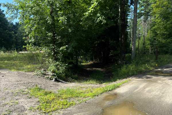
Porter Road
A class 6 road bordering stone walls, old stone structures and barbed wire fences with good forest scenery. This road has some wet spots, some overgrowth, some stone sections and one decent size dip that a stock vehicle may find troublesome. Easy access to Pinnacle Hill, which has a powerline tria...
Learn more about Porter Road
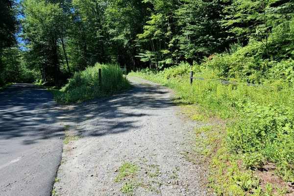
Copperas Road
This road is part of a rich history of Vermont. It is still easily navigable and has breathtaking views. Views include mountain ranges, remnants of Elizabeth Mine that was once supplying copper as far back as 1809, old structures, and stone walls. This road offers a great alternate route to Turnp...
Learn more about Copperas Road
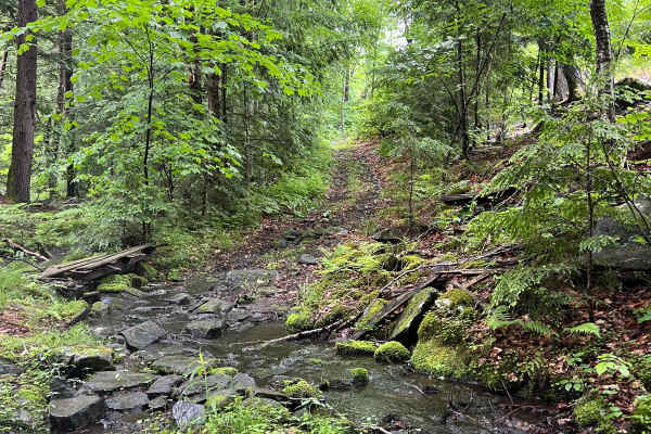
Plummer Road
A short but rewarding Class VI road. This road offers a rocky section that includes a brook crossing with stunning forest views. The ferns and tree moss in this area blossom in June, making this road a worthwhile trip. Some sections may be starting to become overgrown. This road terminates in a resi...
Learn more about Plummer Road
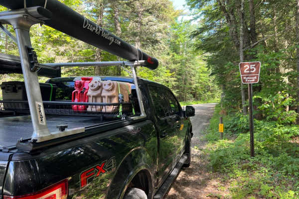
Gale River
Gale River is a well-maintained gravel road through White Mountain National Forest and has many hiking trails to access along the roadway. This winding and scenic roadway provides many views of the South Branch of the Gale River as well as designated dispersed campsites for tent and RV camping along...
Learn more about Gale River
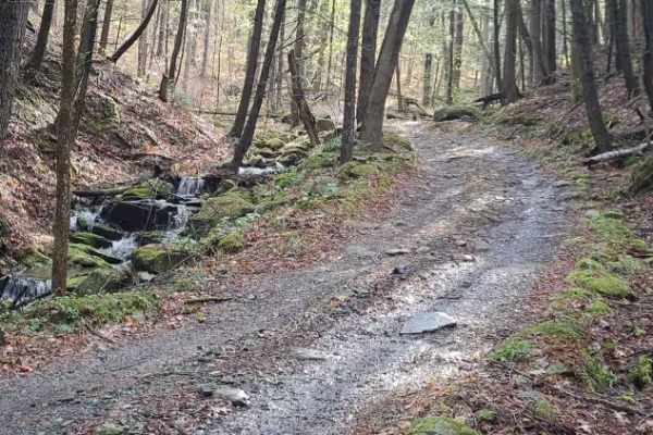
Burton Woods Road
A scenic, easy route crossing the Appalachian Trail. Along the way are ancient stone walls and foundations, a breakfast house for trail hikers with a porta-potty, and even a cemetery. There are several moderate difficulty areas with short bypass routes. The photos show the moderate difficulty ro...
Learn more about Burton Woods Road
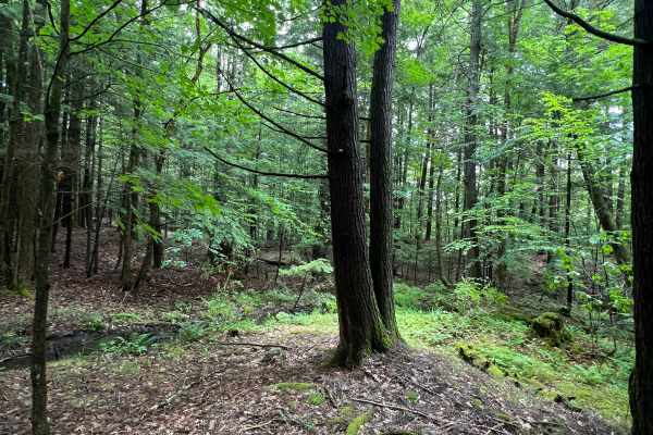
Peterson Road
A short Class VI road with plenty of small ledges, some mild off-camber washouts, and great forest scenery. This road is not often traveled, so expect some pin striping and small trees across the road. There is a bit of a gatekeeper on the east end (from Route 12-A), which is a fairly tall water ba...
Learn more about Peterson Road
Beginner ATV trails near Ashland, New Hampshire
Explore ATV-friendly trails near you. These trails are accessible for vehicles up to 50 inches wide, perfect for ATVs and smaller off-road machines.
Cass Road
Cass Road is a Class 6 road in Bridgewater, NH. This route can be driven in either direction. From East to West, it runs uphill for nearly the entire route with approximately 600 feet of elevation gain. This route is a good access road into the main part of the Class 6 road system in Bridgewater, as...
Learn more about Cass Road
Berry Hill to Old Country Road Loop
This great loop trail runs on Berry Hill and Old Country Class 6 roads in Bridgewater, NH. The trail starts and ends at the historic Bridgewater Town House (1806). Enter the access gate behind the Town House and begin an ascent up Berry Hill Road. The trail is fairly wet and covered with loose rocks...
Learn more about Berry Hill to Old Country Road Loop
Talcott Road to Old Stage Road
This route starts out on Talcott Road and follows down to Old Stage Road in Bridgewater, NH. Both roads are Class 6 unmaintained roads. The entire route is a gradual descent, with some steep hills along the way. The route starts off with the million-dollar view from the trail's high point, overlooki...
Learn more about Talcott Road to Old Stage Road
Wade Hill Road
Wade Hill Road is a Class 6 road in Hebron, NH. You can run it in both directions. Entering from the east side, you begin to ascend. You will reach the top in the middle of the trail. The trail travels through thick woods. It is muddy, has small ruts, and some loose, smaller rocks Weather will have...
Learn more about Wade Hill Road
Beginner UTV/side-by-side trails near Ashland, New Hampshire
Find UTV and side-by-side trails near you. These trails accommodate vehicles up to 60 inches wide, ideal for UTVs, side-by-sides, and wider off-road rigs.
Cass Road
Cass Road is a Class 6 road in Bridgewater, NH. This route can be driven in either direction. From East to West, it runs uphill for nearly the entire route with approximately 600 feet of elevation gain. This route is a good access road into the main part of the Class 6 road system in Bridgewater, as...
Learn more about Cass Road
Berry Hill to Old Country Road Loop
This great loop trail runs on Berry Hill and Old Country Class 6 roads in Bridgewater, NH. The trail starts and ends at the historic Bridgewater Town House (1806). Enter the access gate behind the Town House and begin an ascent up Berry Hill Road. The trail is fairly wet and covered with loose rocks...
Learn more about Berry Hill to Old Country Road Loop
Talcott Road to Old Stage Road
This route starts out on Talcott Road and follows down to Old Stage Road in Bridgewater, NH. Both roads are Class 6 unmaintained roads. The entire route is a gradual descent, with some steep hills along the way. The route starts off with the million-dollar view from the trail's high point, overlooki...
Learn more about Talcott Road to Old Stage Road
Wade Hill Road
Wade Hill Road is a Class 6 road in Hebron, NH. You can run it in both directions. Entering from the east side, you begin to ascend. You will reach the top in the middle of the trail. The trail travels through thick woods. It is muddy, has small ruts, and some loose, smaller rocks Weather will have...
Learn more about Wade Hill Road
The onX Offroad Difference
onX Offroad combines trail photos, descriptions, difficulty ratings, width restrictions, seasonality, and more in a user-friendly interface. Available on all devices, with offline access and full compatibility with CarPlay and Android Auto. Discover what you're missing today!
Open Trail Map