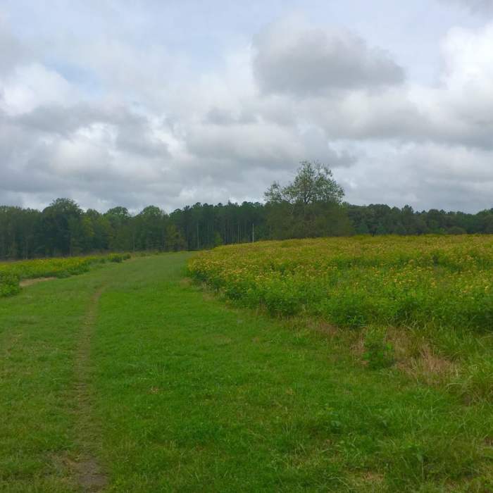
Near Encampment Trail
Singletrack on Poor Creek Trail with Taylor Farm/Site of Fort Morton.

Looking for more photos?

View All Photos
Driving Directions
Hike Trail

Encampment Trail

3.5 (2 Ratings)
A great trail with some nice, smooth elevation that feeds into other trails.
1.4
mi
Distance
13
ft
Gain
moderate
Difficulty
BirdingFall ColorsRiver/CreekWildlife
Access Issues
Park is open from dawn to dusk.

Route Details

Flatter
Steeper
1.45mi
Distance
13ft
Elevation Gain
73ft
Elevation Loss
10%
Max Grade
135ft
High Point
71ft
Low Point
Path Type
Point to Point
Description
You can start at the double A (AA) trail marker of the Park Tour Road/Siege Road. The trail is wide enough for two and has some small elevation gains along this mostly wooded route. You can easily get to Taylor's Creek Trail from the T trail marker and loop back using Willcox Trail or Poor Creek Trail for a little extra distance. Approaching from the U trail marker at the other end will require parking past the Park Resources Building Road. The picnic area is a little far and will require you to hike a bit on Park Tour Road/Siege Road to get to the trail on this end.

Route Conditions

Report Conditions
No Condition Reports
Report Conditions

Nearby Hike Routes

PB&J 5k Loop

Hike Route

PB&J 5k Loop

Birding
easy
3.23 mi
+121 ft
Petersburg Battlefield Trail

Hike Route

Petersburg Battlefield Trail

Fall Colors
moderate
7.12 mi
+240 ft
Colonial Heights Appomattox River Trail - Northern Section

Hike Route

Colonial Heights Appomattox River Trail - Northern Section

Birding
easy
3.05 mi
+33 ft
Appomattox River Park Loop

Hike Route

Appomattox River Park Loop

Birding
moderate
1.4 mi
+106 ft
Radcliffe Conservation Area Loop

Hike Route

Radcliffe Conservation Area Loop

Birding
strenuous
2.82 mi
+87 ft
Dutch Gap Run

Hike Route

Dutch Gap Run

Birding
moderate
4.63 mi
+42 ft
Contributors
Omar Delgado
