

Ready to explore this trail?
View Trail Map in AppAccessing the trailhead requires navigating rough forest roads; a high-clearance, four-wheel-drive vehicle is highly recommended.
Because the route traverses the La Garita Wilderness, visitors must adhere to strict wilderness regulations, including group size limitations and campfire restrictions.
Path Type
Loop
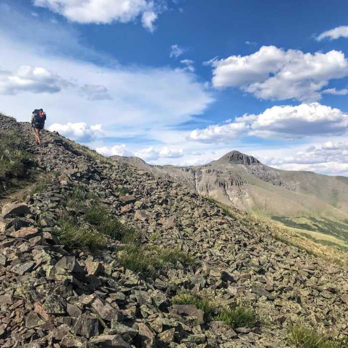
San Luis Peak Loop is a demanding 30-mile route through the La Garita Mountains, featuring the summit of San Luis Peak (14,014 feet), the highest point in the La Garita Wilderness. Located north of Creede, Colorado, within the Gunnison National Forest, this loop combines the two primary approaches to the peak: ascending the south ridge and descending the northeast ridge toward Stewart Creek. The journey showcases diverse alpine environments, including dense forests, wildflower-filled meadows, rugged talus slopes, and sweeping views of the Rio Grande and San Luis valleys.
With an elevation range starting at 10,317 feet and reaching 14,019 feet at the summit, this route requires climbing approximately 6,458 feet. It is a challenging but exceptionally scenic adventure suitable for prepared backpackers, hikers, and trail runners.
The trail begins where Forest Road 503 transitions into a 4x4 road. Follow this road for 1.8 miles to the West Willow Creek Trailhead. Proceed along the San Luis Pass Trail to San Luis Pass, then turn right to follow the Colorado Trail north. After approximately 7 miles, reach the trail junction and begin the ascent up the southern ridge of San Luis Peak. After summiting, descend the northeast ridge along the Stewart Creek Trail to the Stewart Creek Trailhead. Follow Stewart Creek to its junction with the Colorado Trail / Continental Divide Trail (CT/CDT). Follow the CT/CDT south, pass the initial southern ridge junction, and retrace the path back to the starting trailhead.
Summer is the most accessible time to complete this loop when trails are largely free of snow. However, summer afternoons in the high Rockies frequently bring severe thunderstorms and dangerous lightning. Hikers should plan for early morning starts to ensure they are off the exposed ridges and summit before storms develop. Due to the sustained high elevation, visitors must prepare for rapid weather changes and monitor for symptoms of altitude sickness.
No Condition Reports
San Luis Peak: South Ridge Route
San Luis Peak: South Ridge Route
Continental Divide Trail: Colorado Section 13
Continental Divide Trail: Colorado Section 13
Phoenix Falls Hike
Phoenix Falls Hike
Miner's Creek Trail
Miner's Creek Trail
San Luis Peak: Northeast Ridge Route
San Luis Peak: Northeast Ridge Route
Skyline Trail #465
Skyline Trail #465
Contributors

