

Ready to explore this trail?
View Trail Map in AppRegional Classic
A must do route for the area handpicked by local experts.
No permits are required to hike this route. High-clearance, four-wheel-drive vehicles are necessary to reach the upper trailhead in American Basin, and Cinnamon Pass Road is seasonally closed by snow from late October through May.
The route lies within the 16,636-acre Handies Peak Wilderness Study Area, which is managed by the Bureau of Land Management (BLM) and subject to specific regulations to protect its wilderness character:
* **Prohibited Equipment:** Motorized vehicles and mechanized equipment—including mountain bikes, carts, chainsaws, and hang gliders—are prohibited.
* **Camping Restrictions:** Camping is prohibited above the treeline. Below the treeline, camp only in existing campsites. Camping and recreational livestock grazing are prohibited within 200 feet of lakes and streams.
* **Campfires:** Campfires are not allowed near or above the treeline; use a camp stove for cooking.
* **Group Size:** Group sizes are strictly limited to a maximum of 25 people and pack animals combined.
* **Waste Management:** All solid waste, toilet paper, hygiene products, and food scraps (including biodegradable items like fruit peels and nut shells) must be packed out. To protect fragile alpine vegetation from being damaged by wildlife seeking salt, avoid urinating on plants and instead urinate on durable rock surfaces.
Path Type
There and Back
This route begins and ends at the American Basin Trailhead after reaching the summit of Handies Peak.
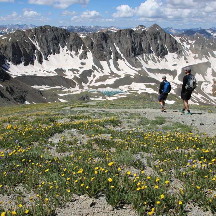
From the trailhead at 11,600 feet, follow the well-defined trail east into American Basin. At 1.0 mile, keep left at the junction to remain on the American Basin Trail. Follow the trail south and ascend a series of switchbacks, gaining 300 vertical feet. At 1.5 miles, pass Sloan Lake on the right.
Cross a section of talus to the left before regaining grassy slopes. Climb another series of steep switchbacks to reach the saddle below Handies Peak at 2.3 miles. Turn left at the saddle and ascend the steep, gravelly southwest ridge to the summit of Handies Peak at 2.75 miles.
Crux: The steepest and most demanding section is the loose, gravelly pitch immediately below the 14,058-foot summit — footing is less secure here than anywhere else on the route, and the altitude makes the final push noticeably harder. A brief talus traverse just below the 13,500-foot saddle also requires some footwork, but the trail is well-defined throughout and overall technical difficulty remains low.
Retrace your steps to return to the trailhead.
Handies Peak stands at 14,058 feet (4,285 meters), making it the highest summit managed by the Bureau of Land Management (BLM) in the contiguous United States, as well as the highest point in the BLM's National Conservation Lands system.
The surrounding 16,636-acre Handies Peak Wilderness Study Area was designated to preserve the region's remarkable high-alpine ecosystem. The area showcases classic alpine glacial geology, characterized by steep cirques, active rock glaciers, and talus slopes, alongside a diverse array of subalpine and alpine tundra plant communities.
All Clear
All Clear
All Clear
All Clear
Looking for more condition reports?
Handies Peak East Slopes
Handies Peak East Slopes
Sunshine Peak via Redcloud Peak
Sunshine Peak via Redcloud Peak
Redcloud Peak
Redcloud Peak
Sunshine Peak Northwest Face
Sunshine Peak Northwest Face
Redcloud Peak + Sunshine Peak Loop
Redcloud Peak + Sunshine Peak Loop
Sunshine Peak East Ridge
Sunshine Peak East Ridge
Contributors

