The Fifty+ and onX Backcountry

Try the ultimate offline backcountry skiing and splitboarding GPS maps for 14 days FREE or save 20% off.

20% off only valid only for purchases through onxmaps.com through 11:59pm MDT on April 1st, 2026

Go Behind The Lines with “Mapping The FIFTY+”

Go Behind The Lines with “Mapping The FIFTY+”

Watch Cody break down the lines from the Fifty+ in onX Backcountry
Videos

Mapping The 
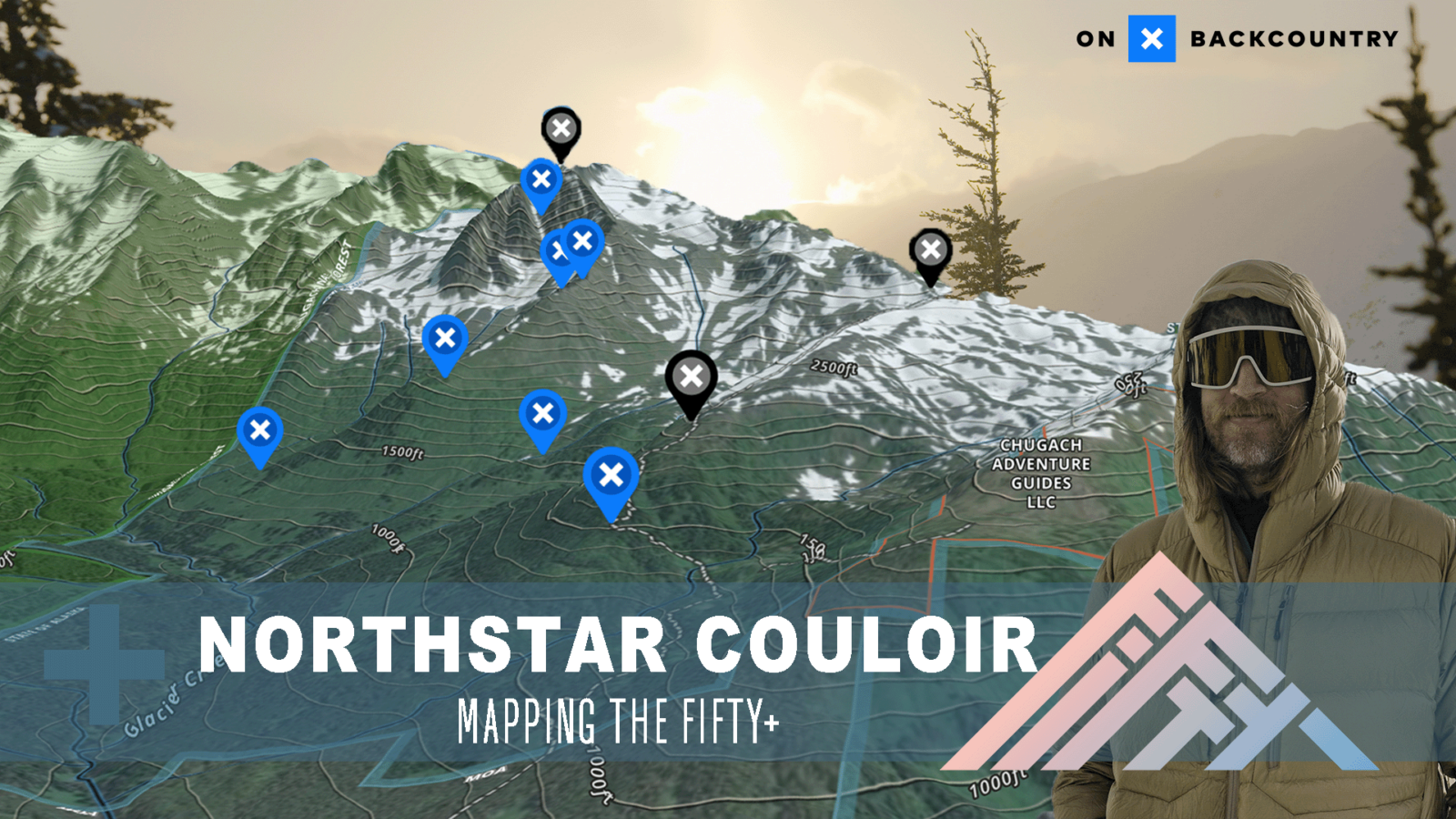
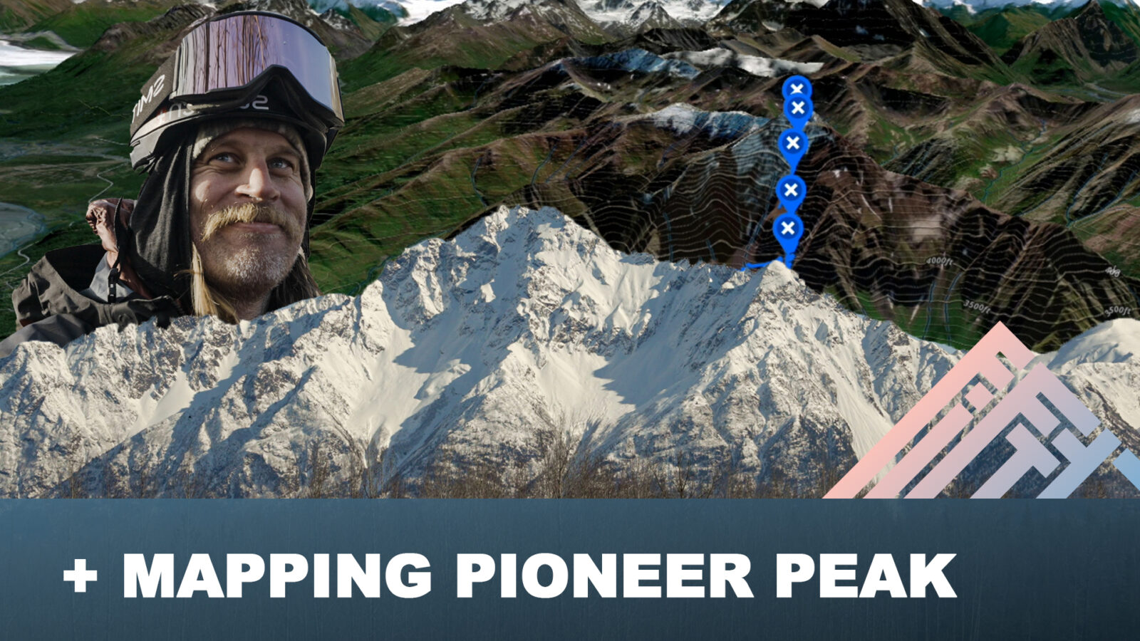
Fifty+: Pioneer Peak

Duration 18:18
In Mapping The FIFTY+: Pioneer Peak, join Cody Townsend as he takes you behind the scenes of climbing and skiing this Alaskan giant. Discover how Cody navigates the complexities of backcountry planning—evaluating avalanche risks, analyzing terrain features, and charting his route with onX Backcountry. This video offers an unfiltered look at the meticulous preparation and decision-making that go into achieving a safe and successful backcountry adventure.

Mapping The Fifty+: Northstar Couloir

Duration 21:02
In Mapping The FIFTY+: Northstar Couloir, go behind the scenes with  @CodyTownsend  as he breaks down the logistics of tackling the Northstar Couloir. Get an inside look at how Cody evaluates potential avalanche hazards, studies terrain features, and plans his route using onX Backcountry. This video gives you an unfiltered and inside look at how Cody preps and makes decisions for a successful day in the backcountry.

Find Your Fifty with onX Backcountry

Cody is hooking you up with 20% off of an annual onX Backcountry Premium Subscription. Find backcountry ski and splitboard lines in onX Backcountry, plan your route, and take offline maps with you to carry in the backcountry. Use code fifty20

Premium

Find awe-inspiring backcountry ski lines and tools that help you get out and back. With Premium you’ll have access to hundreds of guidebook quality backcountry ski routes, unlimited Offline Maps, and Tracker.

Elite

All the features you love from Premium, overlaid with Private and Public land boundaries to keep you from trespassing. Find the goods and stay on publicly accessible ground using Elite.

Start Your Free Trial

Mapping The Fifty+

onX Backcountry has partnered with Cody Townsend to bring you behind the scenes content to break down how he approaches these lines, minimizes his risk, and plans his objective using onX Backcountry. Click one of the following episodes to see behind the scenes videos, a map of his route, and a description of the route written by Cody himself.

About onX Backcountry

With onX Backcountry, you have a suite of tools at your fingertips to make better decisions in the backcountry. With guidebook quality route descriptions, detailed topo & 3D maps, slope angle & aspect maps, and avalanche observations and fatalities you will have all of the tools you’ll need in one app.

Digital Guidebooks

This is your new go-to resource when backcountry skiing in Colorado or Washington. onX Backcountry has partnered with Beacon Guidebooks, leaders in backcountry ski guidebooks, to create a first of its kind digital experience which pairs their highly vetted ski lines with our set of critical avalanche safety and navigation information. Learn More

Winter Satellite Imagery

Winter aerial satellite imagery provides an in-depth look at what a mountain looks like with snowpack. Use this to evaluate safe zones, turnaround spots, and avalanche prone areas. Use satellite imagery in conjunction with our snow layers to help plan your route.

Avalanche Forecasts

In partnership with every U.S. based avalanche forecast center, daily forecasts are pulled into the App making it easy to read, drink your coffee, and plan your day’s tour.

Slope Aspect

Absolutely integral to avalanche safety—slope aspect is the cardinal direction the slope of a mountain faces. Understanding this allows you to gauge how much sun exposure that slope experiences, how much snow it could hold, and how prone it is to slide. Learn More.

Slope Angle

This map Layer color-codes the angle of the slope on a given terrain feature with green representing lower angles and purple representing steeper. Mainly applied in a backcountry ski and splitboard setting, Slope Angle is the most vital measure of avalanche risk. Learn More.

SNOTEL Station Data

The best data source for current snow accumulation data in the mountains is SNOTEL (Snow Telemetry) which uses remote stations to measure snow depth, snow/water equivalent, and temperature. Learn More.