Lee Gabbert
Jun 27, 2026
Open
Muddy/Wet
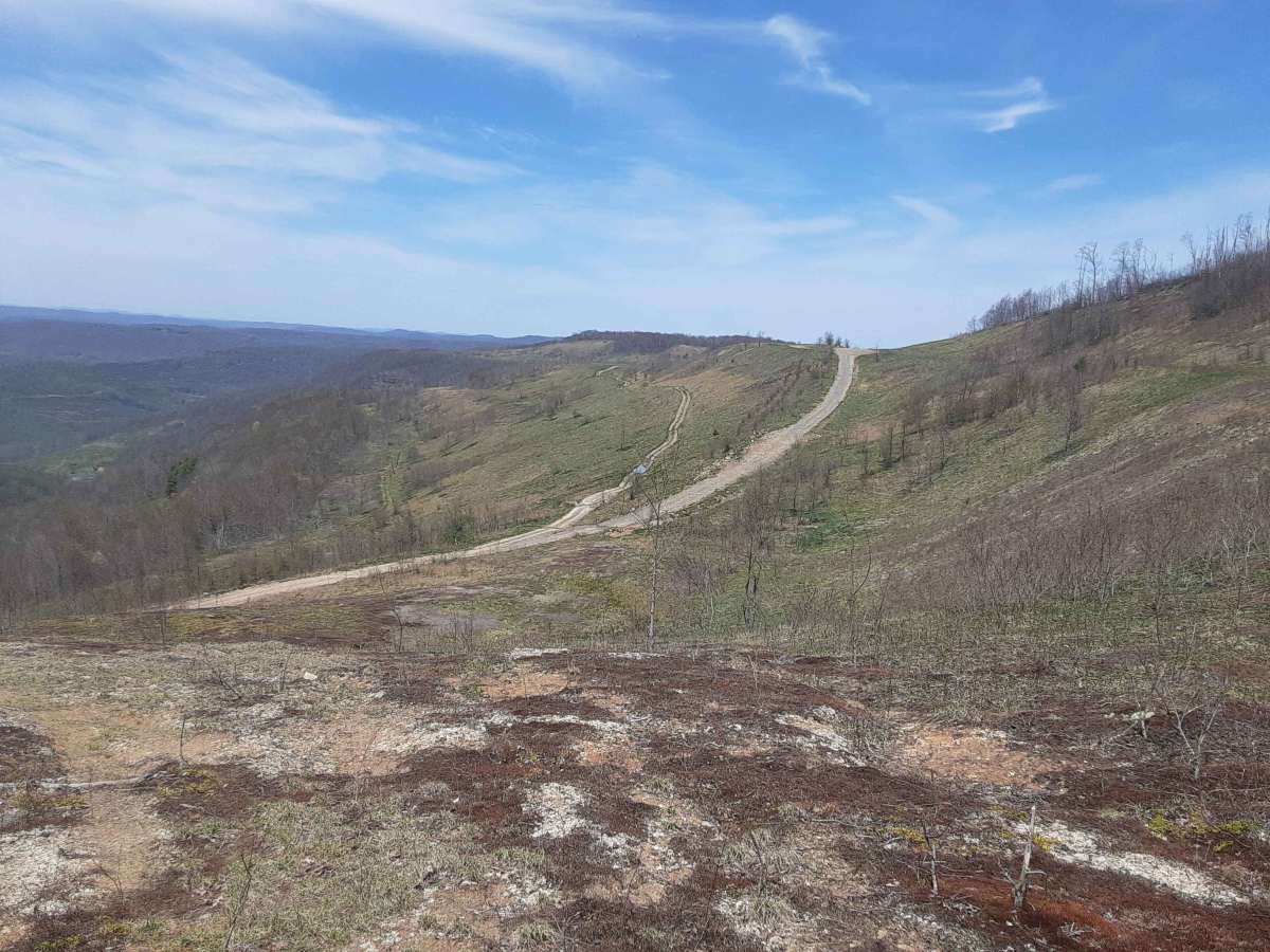
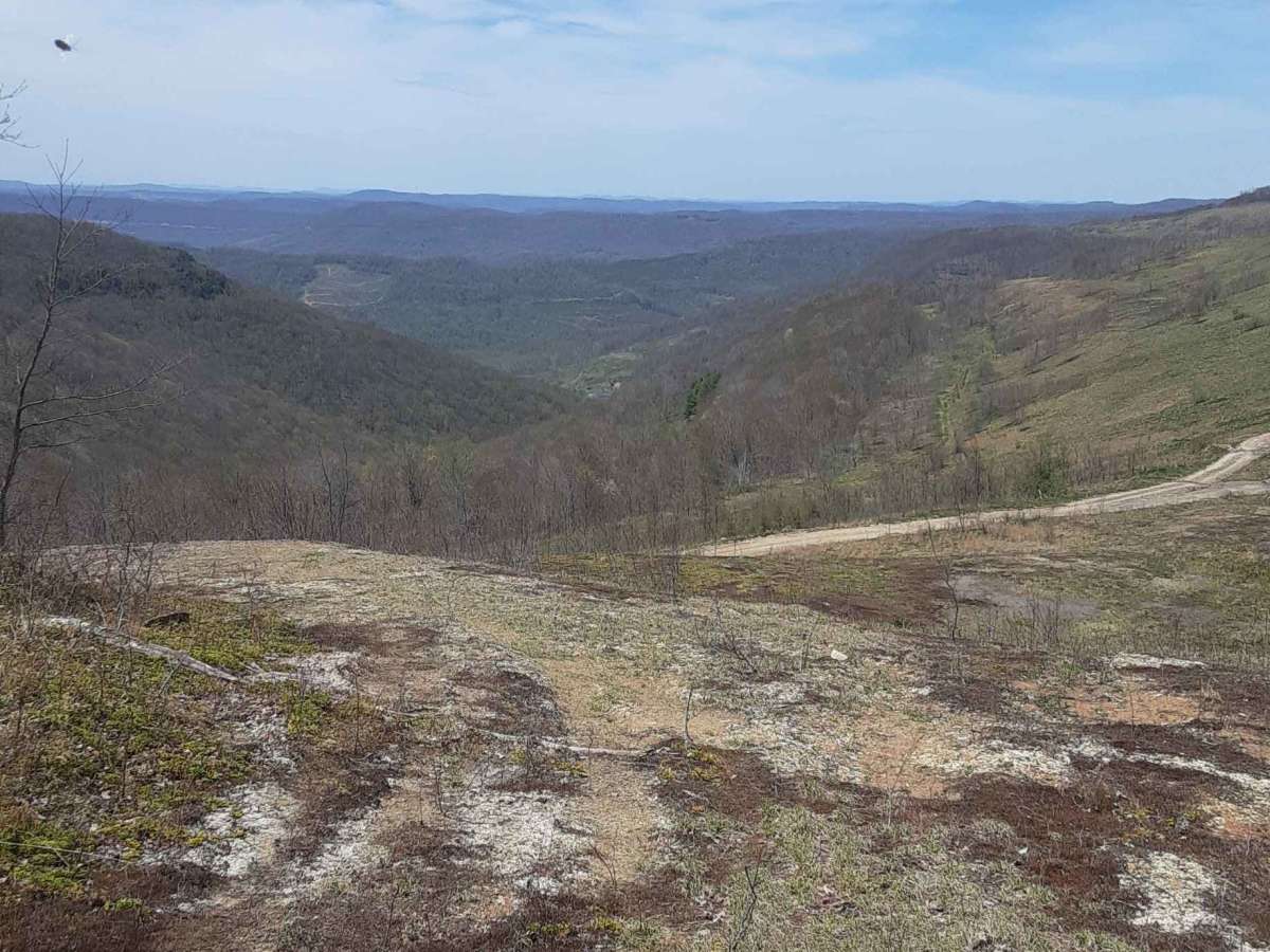
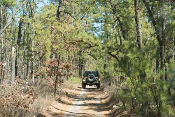
Apparently the gate at the southern entrance gets randomly closed because it was open this day. I took the logging access (public) road to bypass the gate based on previous reports. It follows little clear creek for several miles and allows you to enter the trail past the southern gate. If the northern section is open you can enter and exit using this road. It is wide enough for vehicles to pass safely and is a well maintained gravel road. Great views near Cross Mountain.
Scott R
Jun 13, 2026
2024 Jeep Gladiator
Temporarily Closed
Closed Gate
My buddies and I came in from the north side and cleared all the down trees that were across the trail a few miles from the south entrance. The gate at the south entrance is still closed and locked.
Preston Murrell
Jun 10, 2026
2018 Ford F-Series
Obstructed
Downed Tree
Started from south end off from hwy 64 and got 2 to 3 miles in following the onx mapping and found a huge tree down at the Y in the trail.... Left being just an over look and right being the trail according to onx and its blocked
Jeremy
Jun 06, 2026
2022 Ford Bronco
Permanently Closed
Locked GateHeavily Barricaded with Natural Material
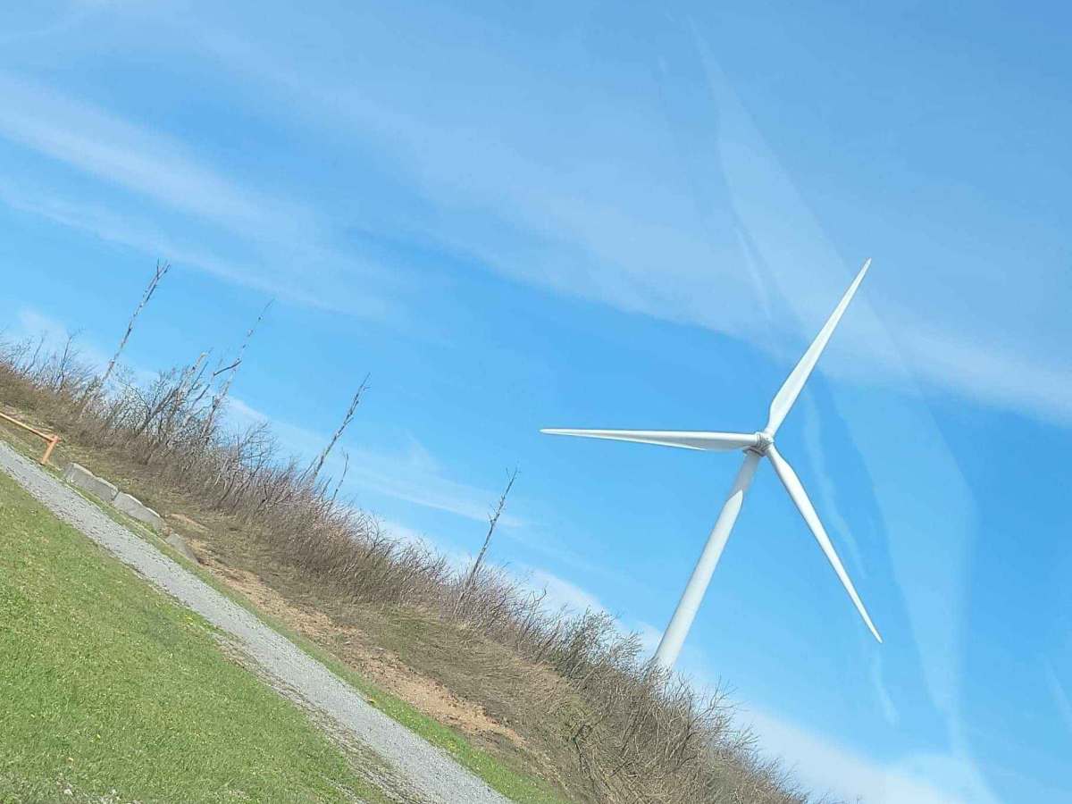
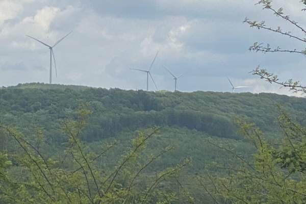
The Trail is sort of open but closed as presented/ But not as ONX shows on Map. I entered at the Richwood end and got to past the turn at Hickory Ridge to find trees down blocking the rest of the trail. Since the end of the trial shows it connects Little Clear Creek, I was then able to turn around and go back and turn on to an earlier connection point Little Clear Creek before cross mountain and get back onto pavement. As I passed the ONX exit point I could see a gate blocking off the ONX route from the road. The trail provides some views of creeks streams, mining, windmills, and wild turkeys.
David R. Gustafson
Mar 29, 2026
2025 Subaru Forester Wilderness
Temporarily Closed
Made it about ten miles in from the south side only to find the trail closed before it intersects with the Nettle to Richmond trail but up to that point it’s passable and quite the fun trail. A little bit of a challenge early of but fun and smooth after that.
Nathan Mitchem
Sep 14, 2025
2021 Ford Bronco
Open
Dusty
Great day with the family out in the bronco
Jedediah Smith
May 26, 2025
Permanently Closed
Posted Private Property
Richie hunter
May 06, 2025
Permanently Closed
Thomas zippelli
Mar 28, 2025
2023 Ford F-Series
Temporarily Closed
Posted Sign
it turns out this is not actual public land and it is leased private land, we got stopped by land owners in a side by side
Louis Rios
Mar 13, 2025
Open
Really cool trail. Lots to see and discover. Use Go and Track cuz it's easy to go off the main trail. You can spend all day out there. Have fun!
Louis Rios
Nov 06, 2024
Open
If you stay on the main trail, then you'll have an easy ride. Lots of great views and some oddities, as well. A picnic area. The gravesight of Nancy Hart, a revolutionary war heroine. A bunch of wind turbines. A row of small houses; probably for miners. An RV trailer in the middle of nowhere with a boot on the wheel..lol! If you go on offshoot trails, you will be challenged, and have lots of fun!
Noah W
Oct 10, 2024
2021 Toyota Tacoma
Open
NormalRough/Deteriorated
Started at the Rupert side of the trail, gate was wide open so no problem starting there. Beginning of the trail can get rough at times when you’re starting up the mountain but it smooths out considerably once you reach the top and eventually turns into a service road for the wind turbines and mines. Lots of other trails branch off from this one if you’re wanting to explore more, most are also marked with signs.
Tommy Hodges
Jul 13, 2024
Temporarily Closed
Closed Gate
Southern most gate closed. Has a path around that I fit my Tundra through. Rest of road is open and may be able to come through another bypass. We traveled from Richwood
walter summers
Jun 15, 2024
2022 Toyota 4Runner
Permanently Closed
Locked Gate
Locked gate at the start/end of the most southern part of the trail. you can still take the main road, it will run you back onto the trail
Matt Holland
Jun 15, 2024
Temporarily Closed
Closed Gate
Gate was closed. But there was a “path” around the gate that has been used well.