Flagpole Knob

Total Miles 12.8
Technical Rating
2 Easy
Best Time Spring, Summer, Fall, Winter
Trail Type Full-Width Road
Accessible By
Open Trail Map

Trail Overview

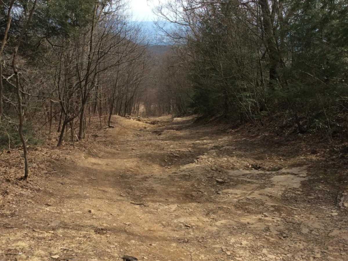
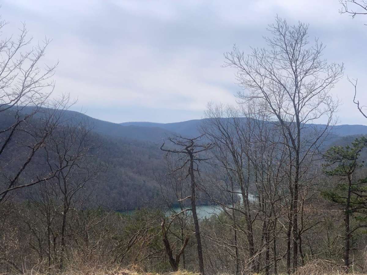
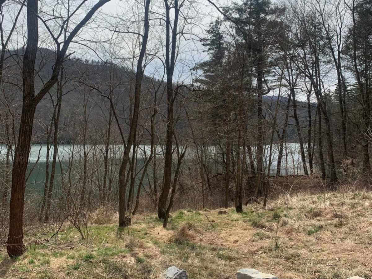
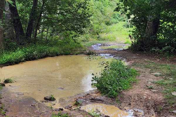
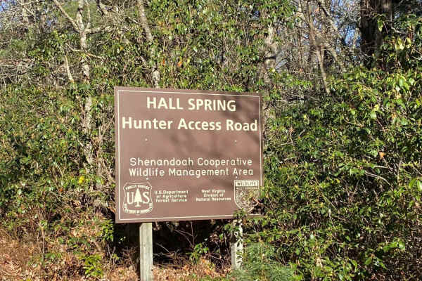
Flagpole Knob is located in the George Washington National Forest, along the border of Virginia and West Virginia. Open year-round, access to Flagpole Knob can be from Switzer Lake Road, Union Springs, or Briery Branch Gap. The route shown begins on Switzer Lake Road off Hwy 33, 20 miles west of Harrisonburg, and ends at Briery Branch Gap. This easy, stock-friendly 12-plus mile ride will take you past numerous camping spots, beautiful streams and offers great views from Flagpole Knob. Along the way, there are a few mud holes and obstacles just off the main trail. For another great view at the end of the run, when exiting at Briery Branch Gap, go straight across and up to Reddish Knob. For those wanting a more challenging route, Union Springs is an option. Generally not much cell service at lower elevations, but usually okay at Flagpole. Don't forget to download maps before heading out.

Photos of Flagpole Knob

Difficulty

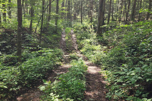
Although rated as easy, you're still covering more than 12 miles, with more than 2,000 feet of elevation gain, on a mountain trail. Much of the trail is just one-vehicle wide, being mindful of where the occasional pull-off spots are will be helpful when encountering approaching vehicles. During certain months of the year, overgrowth can make parts of the trail tight and vehicle pinstripes are likely. During winter, snow and ice can make this normally easy trail almost impassable. Please check conditions before heading out.

Technical Rating

2

Status Reports

Add Status Report
Alex B
Dec 16, 2025
Open
Snowy and ice but doable in a stock 4x4. Bring a friend.
Matt P
Dec 03, 2025
Open
Too the route up from Switzer lake. Lots of ice and a few sections were pretty sketchy. My Rubicon did fine but still slipped in a few spots. I wouldn’t recommend going alone. Wait until the ice clears I probably wouldn’t have done it if I knew how much ice was on the trail.
John
Nov 30, 2025
Open
Wide trail for the most part, some sections narrowed but nothing a full size vehicle can't make it through., some obstacles that required 4WD
Trent Dickson
Nov 27, 2025
Open
James May
Nov 15, 2025
Open
Went south -Skidmore Lake to Reddish K nob Washouts are getting bigger compared to last year. Trail was wet and slick after rain so was more challenging. Rating of 3 or 4. Vehicle had 4x4 with a rear locker so walked all the obstacles, was up on 2 or 3 wheels through the washouts.
Christian Hernandez
Nov 11, 2025
Open
Mark Aner
Nov 08, 2025
Open
We went from Reddish to Flagpole (Skidmore Fork Lake). Most of the trail from the Reddish side was pretty easy, my buddies and I stayed in 2WD for the most part. But once you pass the junction where it splits off toward Union Springs and Skidmore Fork, things start to get more technical. The trail was heavily rutted and washed out from recent rains, which made it a bit tricky. Some of the ruts tilt your vehicle at awkward angles, especially if it’s not very wide. My buddy with a lifted Jeep and wider tires made it through without a problem, but my other friend and I, both in mostly stock Tacomas, had a few challenging spots to get through. I would not rate this trail a 2, maybe 3 or 4.
Thomas V
Nov 06, 2025
Open
Camped at flagpole and rode trail down to the lake. I’d recommend airing down, 4Runner on 265 BFGs, 2in bilstein lift , JBA uppers and was gotten rattled on the rocks. Actual trail itself wasn’t hard going south to north, but I can imagine it’s harder going opposite direction. The switch back section is the worst, ruts had the 4Runner on 3 wheels twice but it’s doable. Buddy in the wrangler on 35s had 0 issue and did it in 2wd
david nb
Oct 25, 2025
Open
Came up the WVa side of Flagpole, went down the Union Springs side. Main trail was busy but not challenging for the group. I was in a stock Rubicon 33" tires no lift. Plenty of off camber stuff and some tallish rocks but traversed most in 4H. There are still the side quests for more challenging obstacles and bypasses on the steeper rocks and deeper mud holes. Was a great learning experience for a new wheeler. Disbursed camping was packed at the foot of the mountain but plenty further up. Only downside is there was more trash around than last time I went. Also note, if you venture to Switzer lake, be prepared for some pinstripping along the way.
Michael Lilly
Oct 18, 2025
Open
Great day on the trail. South side is maybe a 2 at max. However going back towards Harrisonburg going downhill was probably a 3. Watch here for the weekend trip. https://youtu.be/n3zCcjAuVDs
Brandon T
Oct 18, 2025
Open
Great time of year to visit. Rain hasn’t gotten heavy and the leaves have turned but not fallen. Relatively busy day as I had 6-8 vehicles behind me coming from the north side midday. No one in a rush so was a great ride. Trail was good and not overly dusty. Some puddles but nothing crazy. Rocky instances and ruts coming from the north but easier approach if coming from near reddish knob trail. Saw a few town and countries come from that side. Saw a bunch of motorcycles side by sides and atv as well.
Ismael Molina
Oct 14, 2025
Open
We took Briery Branch Rd west up to the ridge line then headed north towards Flagpole Knob. Then headed north towards Skidmore Lake. I can see why this is the #1 trail in Virginia. Great views, fun/easy obstacles, plenty of campsites, and easily accessible. Definitely recommend.
Thomas P
Sep 28, 2025
Open
Another great day on this trail. Took this trail going South from Rt 33 to "Union Springs". The first couple miles by the lake are fairly easy, and there are some really nice campsites there. Cool and quiet getaways in the valley. The next couple miles going up in elevation toward the intersection with "Union Springs" are more difficult. This section of the trail now rates a 3 for sure. It is quite rutted in some spots. Some stock vehicles may struggle with this section.
andy thomas
Sep 27, 2025
Open
at some point fr85 and dunkle hollow Rd (fr 227) need to be separated and rated accordingly. fr 85 is a typical narrow rocky gw forest road. from briery branch rd can be done in 2wd in any vehicle with 8" of clearance. dunkle hollow Rd should be a 4 given the 2-2.5' washouts and ruts and quite a few places with foot tall exposed rocks and baby head rocks for most of the upper trail. dunkle hollow can be done in most high clearance 4wd and modified crossovers by picking good lines through the big ruts but may get some rubbing and plenty of wheel lifts.
Jason Green
Sep 18, 2025
Open
Great trail. One step above Peter’s Mill as far as challenging. A few areas are critical in picking the right line. Stock Jeep may get some bottoming out if you don’t take the proper line. Creek crossings are all dry. A few minor spots where pin stripping can occur. I wouldn’t make this your first trail and definitely go with a buddy. Luckily I went through the week so we saw little to no others. Passing areas can be hard to come by.

Flagpole Knob Trail can be accessed by the following ride types:

  • High Clearance
  • Full Width

Flagpole Knob Map

The onX Offroad Difference

onX Offroad combines trail photos, descriptions, difficulty ratings, width restrictions, seasonality, and more in a user-friendly interface. Available on all devices, with offline access and full compatibility with CarPlay and Android Auto. Discover what you're missing today!

Open Trail Map