Smith Mesa

Total Miles 19
Technical Rating
2 Easy
Best Time Summer, Fall, Spring
Trail Type Full-Width Road
Accessible By
Open Trail Map

Trail Overview

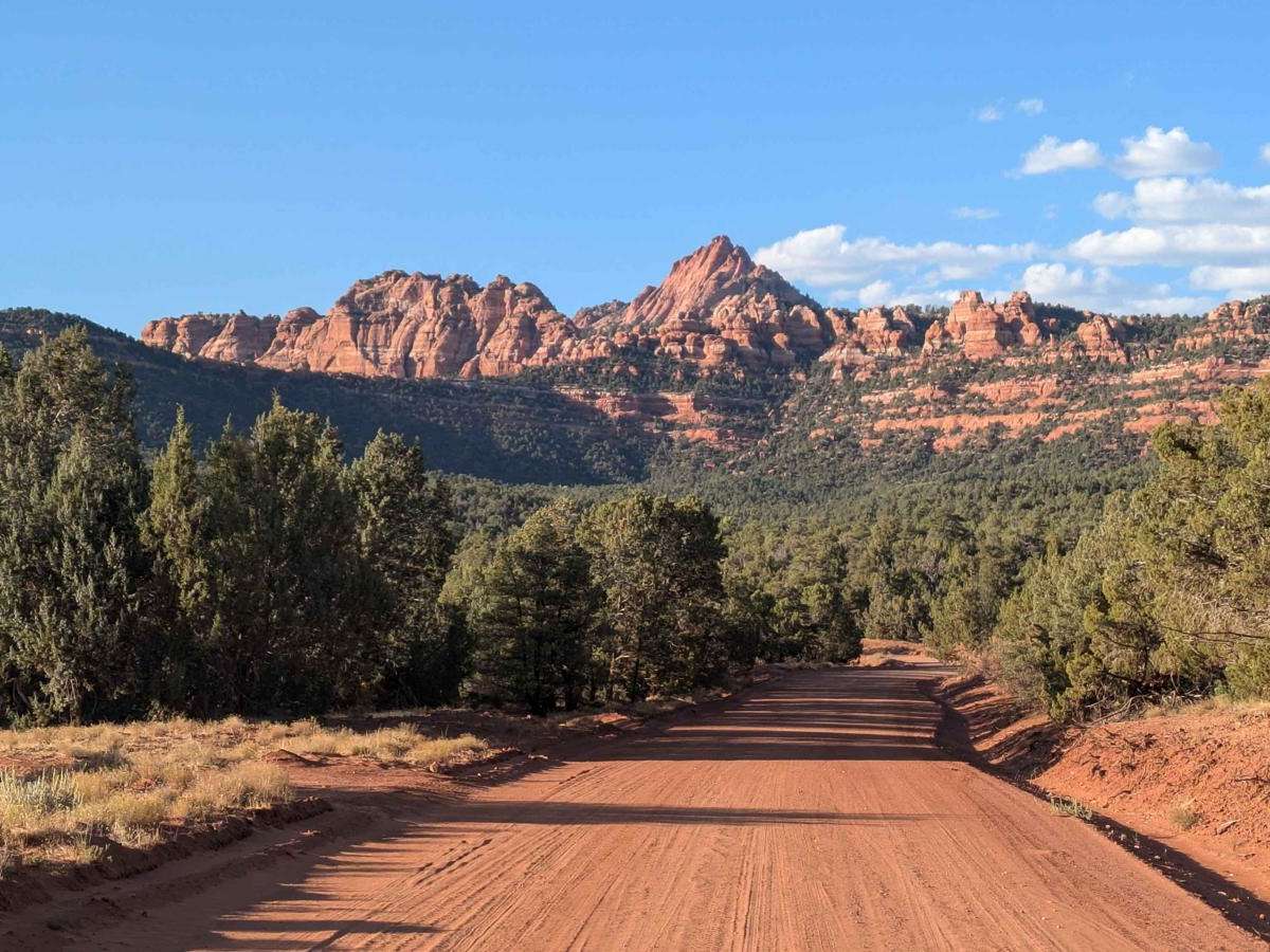
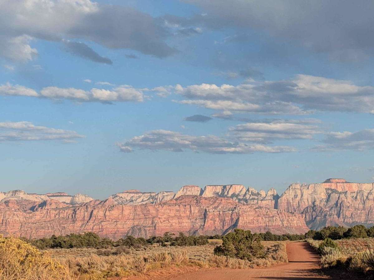
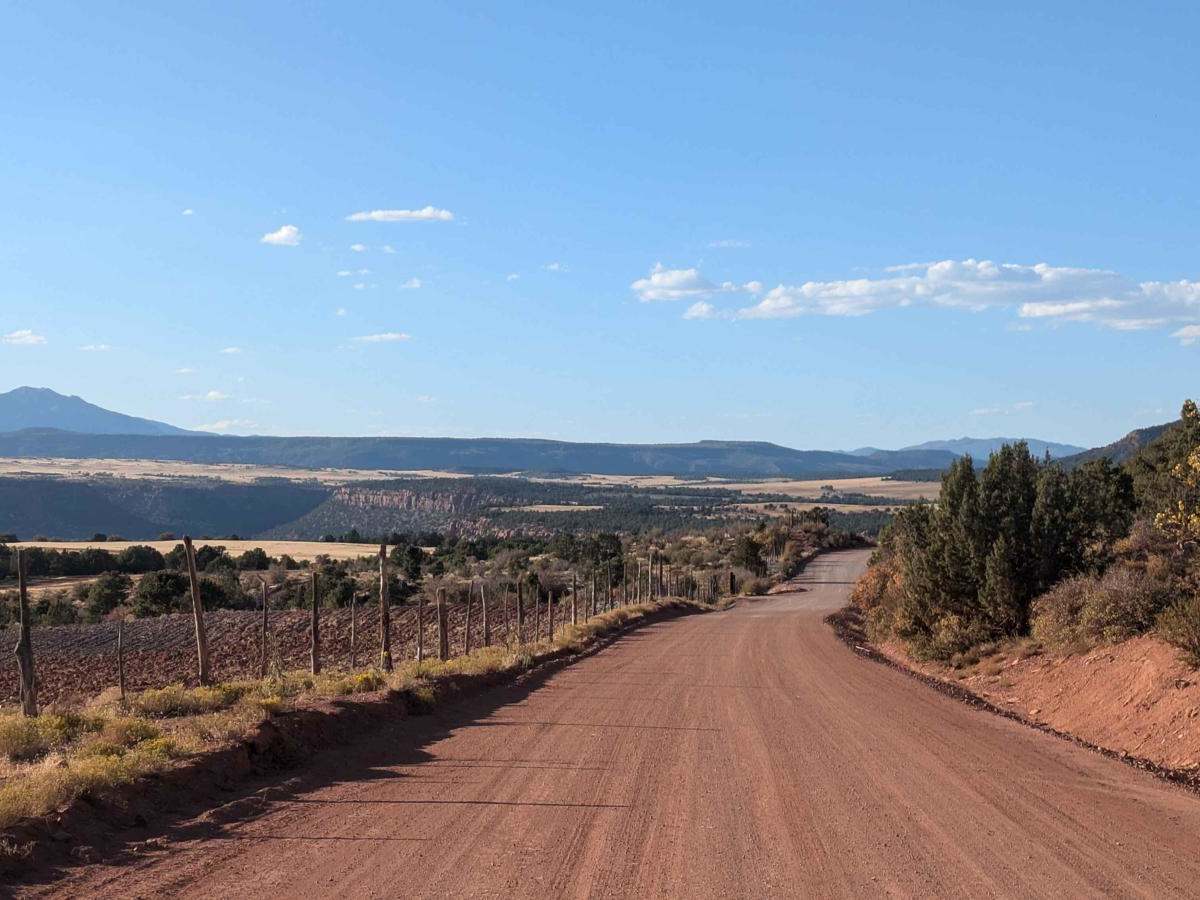
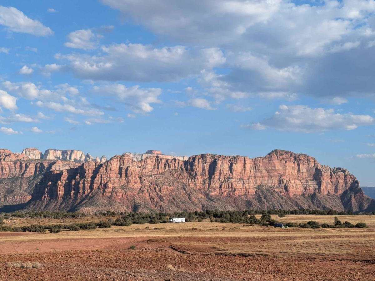
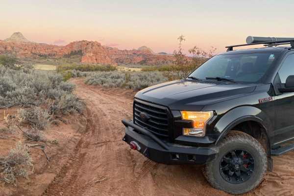
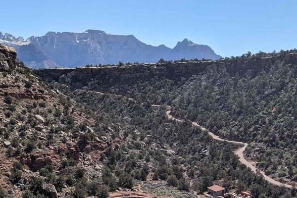
This trail travels for almost 20 miles on the Smith Mesa Plateau. The east side entrance, at 4800 feet, is just inside the West Kolob Canyon Entrance to Zion National Park. The trail winds on red dirt for 6 miles through pinyon and juniper trees. It offers stunning, up-close views of rock formations. At mile 6, it reaches the plateau and turns into open meadows that appear to have been farmlands. The next 10 miles open up and skirt around the farmland. This is where you get majestic views of Zion National Park to the East, Red Butte Wilderness to the North, and Blackridge Wilderness to the West. All of this land is private except for BLM land just off the plateau but not accessible from the road. The last 3 miles, on the West side, drop 500 feet ending on the paved Mesa Road.

Photos of Smith Mesa

Difficulty

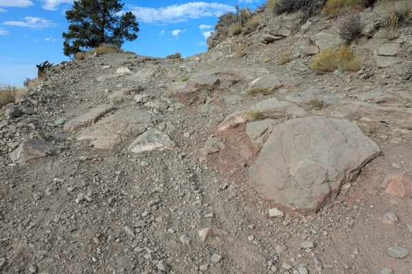
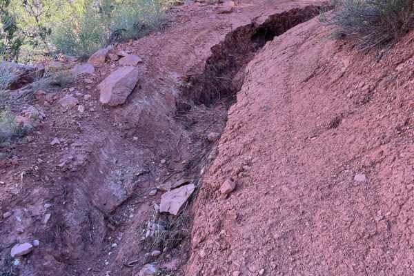
The trail was well-graded. It was rated 2 only due to the warning signs and possible challenges in wet or snow. The West side access road is paved but very steep on runs along a cliff. Once it gets to dirt, the first three miles ascend over 500 feet. There are warning signs that the road can be impassable. Apparently, it can get very slippery and hard to travel when wet. The road was newly graded and smooth when I ran it. Some reports have been made that washboards and washouts have happened after heavy rains and travel. There were also signs on the West side warning against trailers. I did observe a semi-truck come up the West side and back down hours later after making a delivery.

History

In the past, homesteaders on the mesa grew crops like wheat, corn, beans, melons, and squash without irrigation. They used a system of planting one crop, harvesting it the next year, and letting it lie fallow the year after.

Technical Rating

2

Status Reports

Add Status Report
Sualata Savini Jr
Nov 28, 2025
Open
Trail was smooth and wide. Great views, especially towards the last end of the trail. Be sure to stop off at any of the pull offs when you enter the last BLM section.
Devin Stephens
Jul 18, 2025
Open
Was super easy and much faster than the stated two hour drive. Finished in about 45-50 minutes with a few quick stops for pictures. If you often air down to have a nicer trail experience that is unnecessary with this trail.
Esther and Tom Newcomb
Jun 15, 2025
Open
Trail is a great way to see some of Utah without rockclimbing. Nice easy trail, all dirt. Cars can do this road also.
Tom Newcomb
Jun 15, 2025
Open
The trail was in great shape, doable with a regular car. The road was smooth, it is better than I40 through NM, and the views are incredible. I'd been wanting to see the plateaus I'd been looking at from the lower sections and is everything I imagined and more. There are plenty of spots to camp but make sure you're in a designated camping area because there's a lot of private land in the area. Make sure you respect the land that way if you accidentally end up on private land they'll have no reason to complain or call the authorities.
Daniel Alonso
Feb 23, 2025
Open
We entered on the south side of this trail by UT-9. The first couple of miles was fresh asphalt, shortly after it becomes dirt gravel road. The climb amazing and the view undescribable. There are several camp spots along the way on both sides.
AARON LEHNHARDT
Nov 29, 2024
Open
Chris Paulsen
Nov 14, 2024
Open
Bruce Sullivan
Oct 11, 2024
Open
Super easy to get to. Just be ready for scratches if you aren’t paying attention. But we did get a Two Vans, three Jeeps and one tesla Y in there. Awesome views and good times.

Smith Mesa Trail can be accessed by the following ride types:

  • High Clearance
  • Full Width

Smith Mesa Map

The onX Offroad Difference

onX Offroad combines trail photos, descriptions, difficulty ratings, width restrictions, seasonality, and more in a user-friendly interface. Available on all devices, with offline access and full compatibility with CarPlay and Android Auto. Discover what you're missing today!

Open Trail Map