Sevenmile Rim

Total Miles 14.9
Technical Rating
4 Moderate
Best Time Spring, Summer, Fall, Winter
Trail Type High-Clearance 4x4 Trail
Accessible By
Open Trail Map

Trail Overview

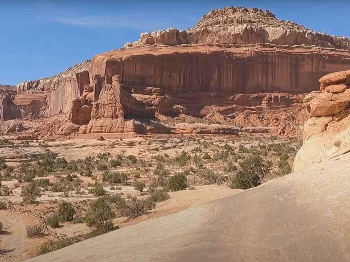
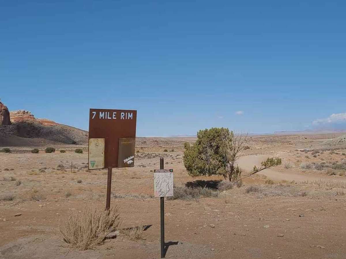
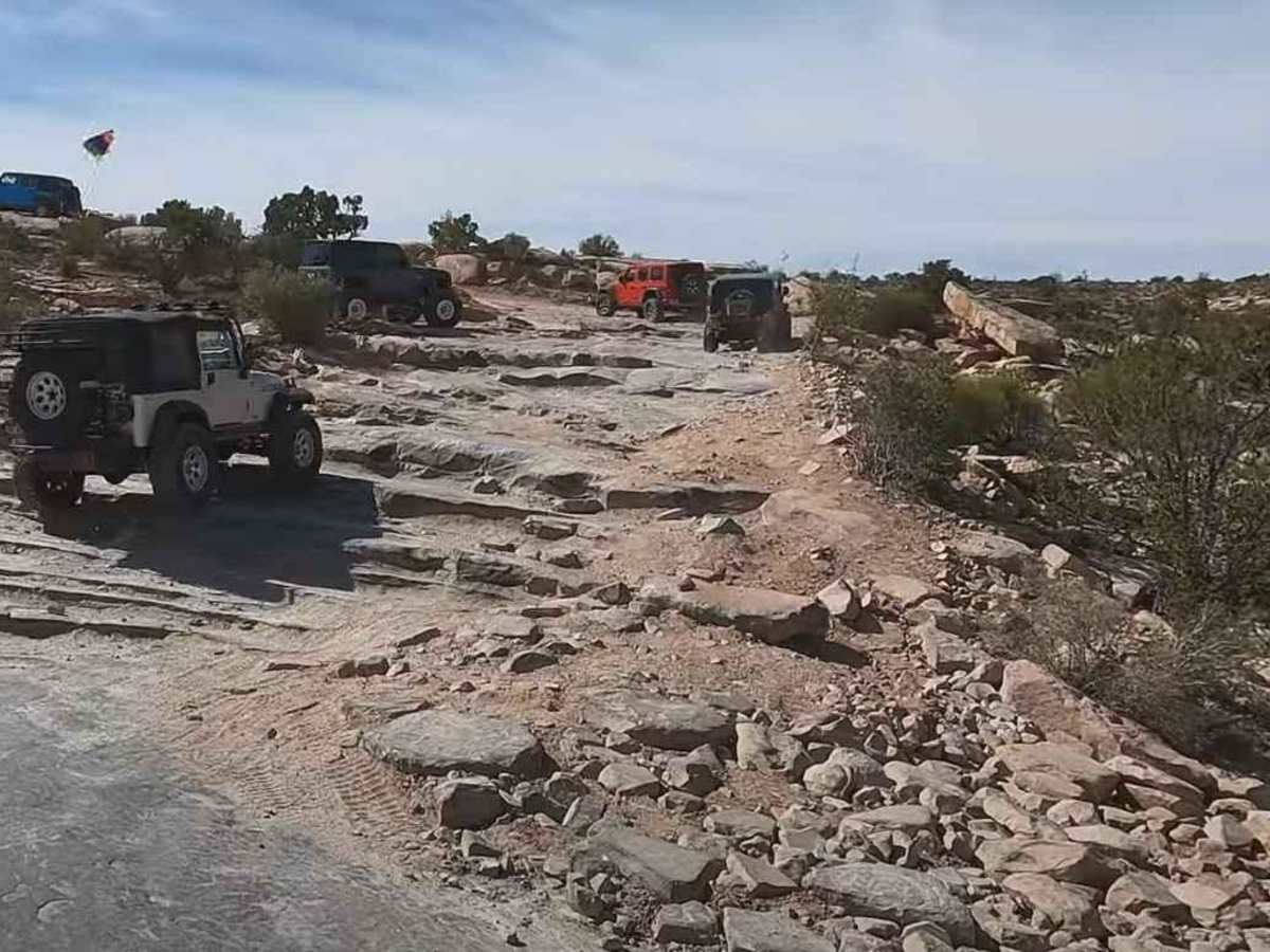
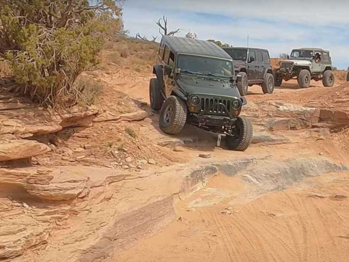
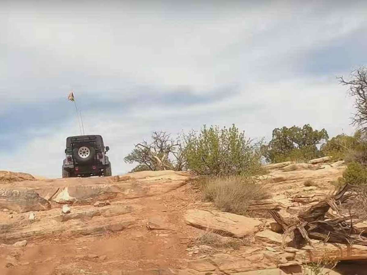
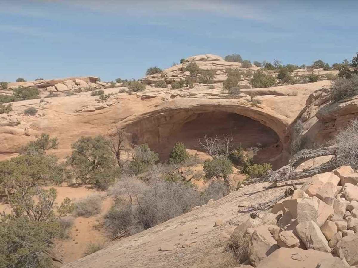
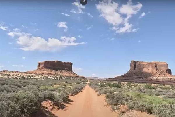
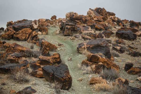
Sevenmile Rim trail is a 16.3-mile point-to-point trail rated 4 of 10 located outside Moab in Grand County, Utah. Sevenmile Rim trail passes the old Cotter uranium mine and switches back to reach the cliff rim above the mine and Highway 191. The intense mining activity left a maze of core-drilling roads on the mesa top, and the trail seeks the most interesting of these. At the southern end of the rim the trail turns west to parallel UT 313. Along the way the trail passes Uranium Arch which is worth a stop. The trail joins other roads in the vicinity of Merrimac and Monitor Buttes before tucking up near Big Mesa. After passing the buttes the trail crosses over the top of Wipe Out Hill but does not descend. The trail passes near Determination Towers before entering into the Tusher Pass and dropping into Tusher Wash and the Estrada that follows. The trail route is near the Moab Fault, a geological fracture that left the trademark rocks of Canyonlands standing higher than the surrounding colorful Morrison formation. Entrada Sandstone cliffs are constantly in view. The rim views include Sevenmile Canyon, the Arches National Park area, and the Book Cliffs to the north. There is considerable two-track dirt trail, lots of slickrock, some sandy sections, a sandy wash bottom, and a sandy hill near the end. The Sevenmile Rim trail passes the old Cotter uranium mine and switches back to reach the cliff rim above the mine. The intense mining activity left a maze of core-drilling roads on the mesa top, and the trail seeks the most interesting of these. Most of the trail is easy but has an optional climb near Uranium Arch and a sandy hill near the end that is sometimes full of holes. A sidehill slickrock portion around the south side of Merrimac Butte may be intimidating due to the off-camber nature of the turn. The Uranium arch is unique, and Monitor and Merrimac Buttes, as well as the Determination Towers size is inspiring. The buttes are named for their likeness to the Civil War ships of the same name. There seems to be a constant wind that blows between the buttes so much that the ground is worn down to bar rock. After spending the entire trail riding on a sandy surface, it is a shock to come up on this area with no sand or vegetation of any type. There are several steps to either climb or descend as well as a couple of 3-foot ledges which the trail drops over. Some off-camber slickrock turns complete the list of obstacles that must be conquered on this trail. Once you are on the trail, the route is pretty well marked with signs at all the major intersections. Some of the signs are small and just say "7M," but they are easily seen and they are not hard to follow. Cell phone service is intermittent and the nearest services are in Moab.

Photos of Sevenmile Rim

Difficulty

Trail consisting of loose rock, dirt, and sand with some slickrock surfaces. Some erosion; washes, gulches and rock steps no higher than 18". Tall tires (33" plus) and limited slip are a plus. 4WD is required. Enhanced suspension travel and good ground clearance are helpful. Good driving skills a plus.

Technical Rating

4

Status Reports

Add Status Report
Race Hobson
Dec 29, 2025
Open
Loved this trail. All the major obstacles were big enough to give you a sense of accomplishment but very manageable and safe. I would rate the trail a 5 compared to all the Colorado trails we have done. We have 35’s and a 1.5in lift on our Land Cruiser and even we had 2 spots where our rock sliders or rear bumper scraped. The most pucker factor we had was actually going down the last obstacle called “wicked ledge” which was pretty loose and washed out when we were there. So far our favorite trail in Moab! Took us a little under 4 hours with plenty of stops.
Andrew Mair
Nov 28, 2025
Open
Fun and very scenic trail. I would rate it a 5. There were a lot of steps and drops. I have a 14 Tacoma with 2" lift and 34" tires. I made it just fine. Towards the end, I turned off and did 3D trail, which made for a long day, but I did both in about 7.5 hrs. And of course, both had beautiful scenery.
David Gray
Nov 25, 2025
Open
Stunning scenery on 90% of this trail one of my Moab favorites. Most obstacles don't require getting out of the truck but some absolutely demand your attention and good route selection. Good trail for all abilities with bypasses where needed. Don't forget to check out the bonus obstacle wipe out Hill for a real challenge
Kris Terry
Nov 05, 2025
Open
David Gray
Nov 03, 2025
Open
Mark Baumgaertner
Sep 16, 2025
Open
Our 3rd trail we ran in Moab on a stock RMAX4 compact, it was fun loved seeing the Uranium Arch well worth the trip!
Leslie Holloway
Sep 11, 2025
Open
First time out on trails in Moab, seven mile rim was a good workout for the Tacoma. Rocky climb at entrance the ledge after ledge with some steep downhill ledges. At the end of the trail some 20 degree plus off camber slick rock. Was a great first outing on a long level 4 trail
Steve Nunn
Jul 15, 2025
Open
Great fun but a little difficult for my stock Tacoma Off Road. We made it with help from the skid plates.
Anthony Panza
May 21, 2025
Open
Luke Smolich
May 04, 2025
Open
A near perfect balance of technical offroading & rock crawling mixed with amazing scenery.
Doug Turnquist
Apr 06, 2025
Open
Trail was in good condition. There were a couple of groups of SxS, and a few motorcycles on the trail, but it wasn't crowded. We had two jeeps in our group. It took us 6 hours from end to end including stopping for lunch and not being in a rush. Solid 4 rating, lockers not required. A lift is good, but a 4runner stock and a Gladiator stock in another group completed the trail just fine. Fun trail in the 4 rating catagory.
John Lynn
Mar 24, 2025
Open
Completed in a 4Runner with a 1 inch lift on stock size tires. A couple of VERY challenging sections to navigate that would be a breeze with larger tires. Overall very enjoyable day with terrific scenery.
Robyn G
Feb 21, 2025
Open
Roach Off-Road
Jan 17, 2025
Open
Neal Jordan
Jan 02, 2025
Open

Sevenmile Rim Trail can be accessed by the following ride types:

  • Single Track
  • 50 Inch
  • 60 Inch
  • High Clearance

Sevenmile Rim Map

The onX Offroad Difference

onX Offroad combines trail photos, descriptions, difficulty ratings, width restrictions, seasonality, and more in a user-friendly interface. Available on all devices, with offline access and full compatibility with CarPlay and Android Auto. Discover what you're missing today!

Open Trail Map