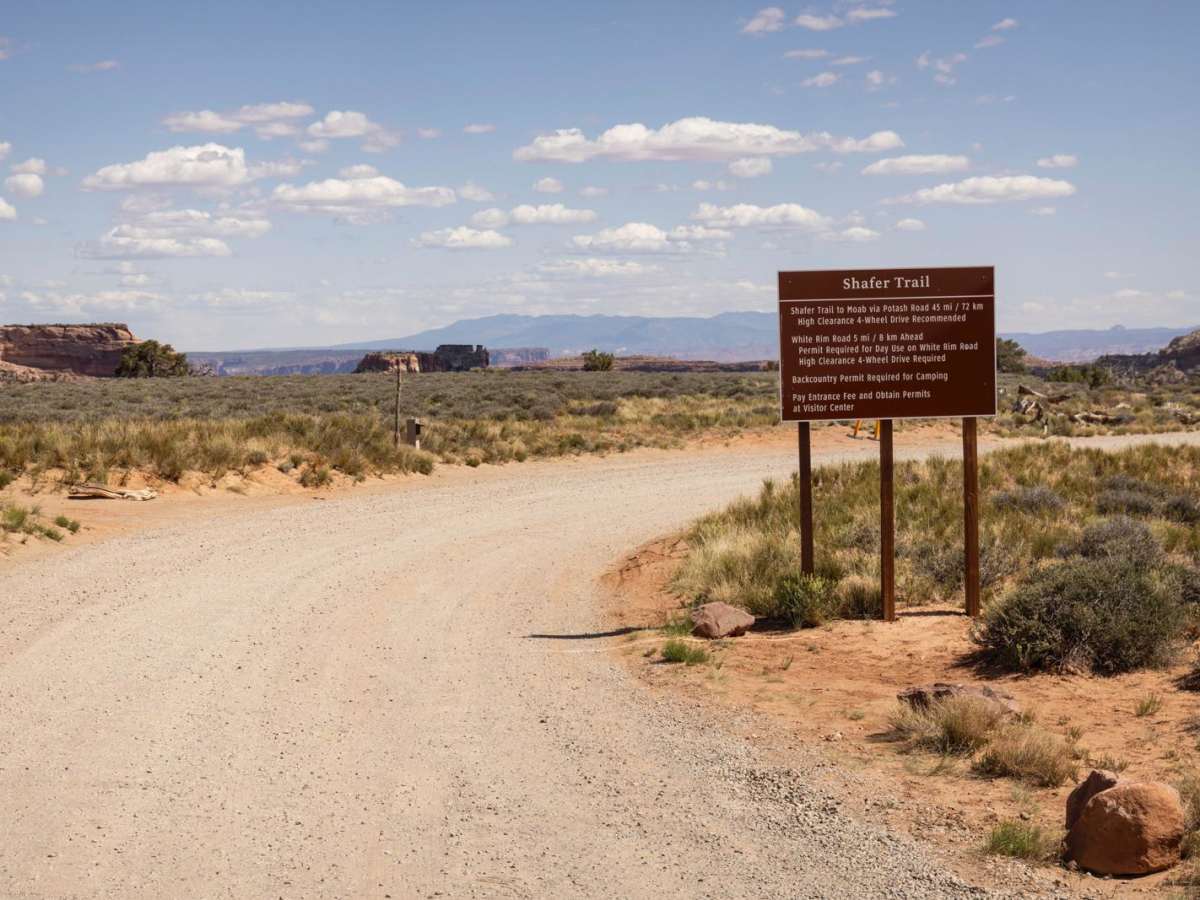
Potash Road / Shafer Switchbacks

Total Miles 18.4
Technical Rating
3 Easy
Best Time Spring, Summer, Fall
Trail Type Full-Width Road
Accessible By
Open Trail Map

Trail Overview

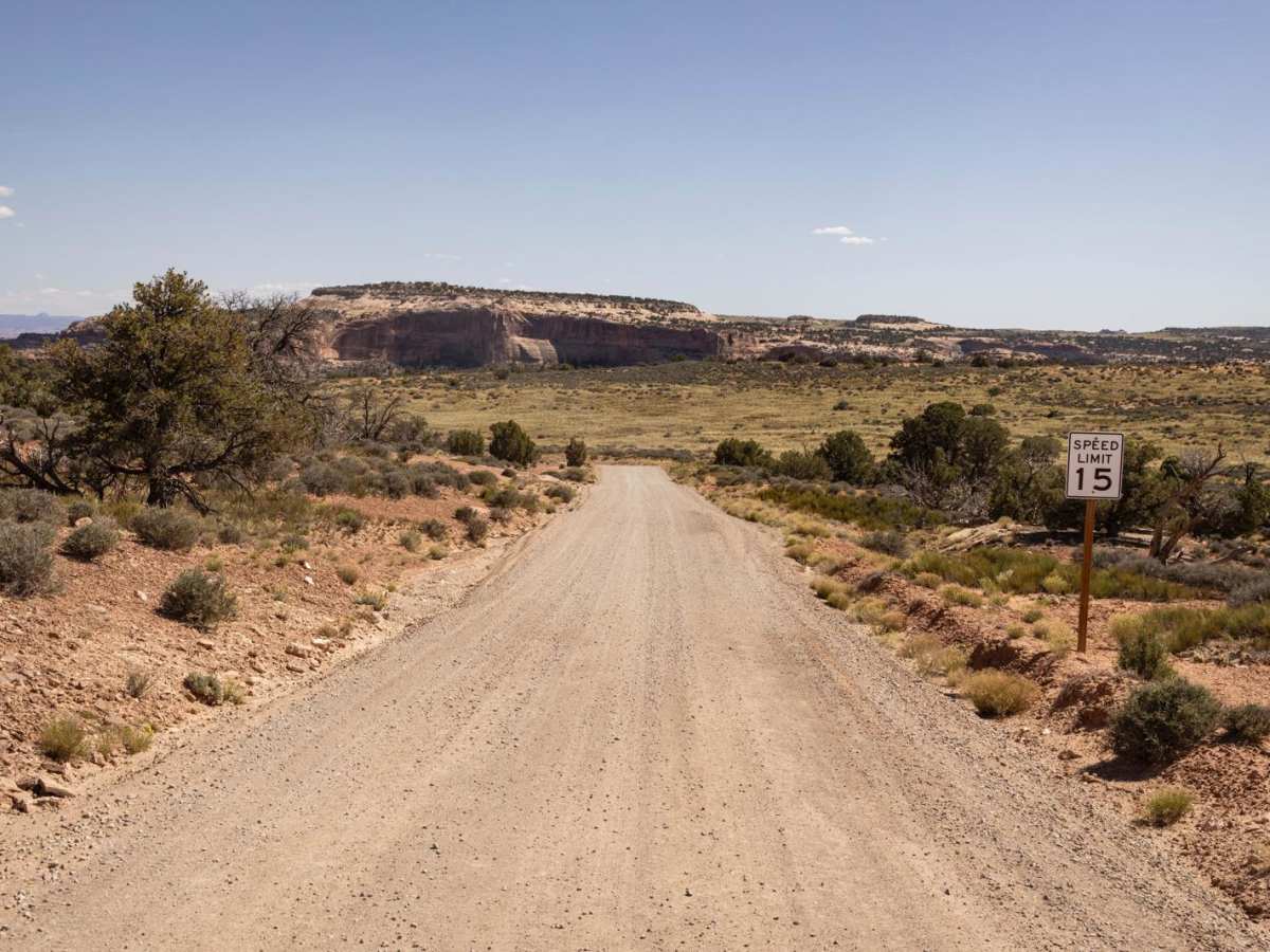
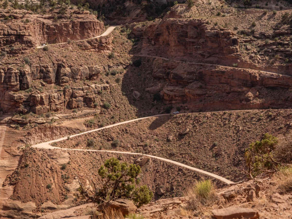
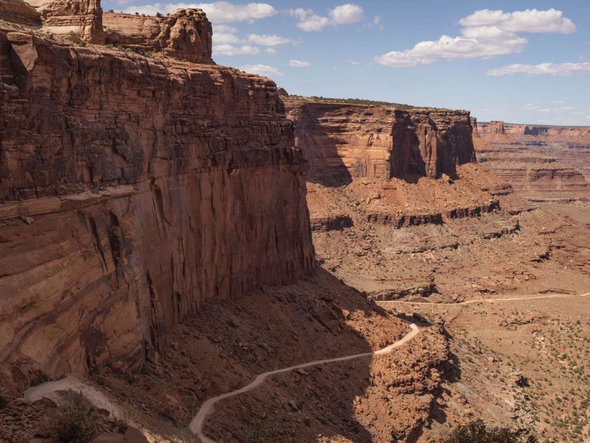
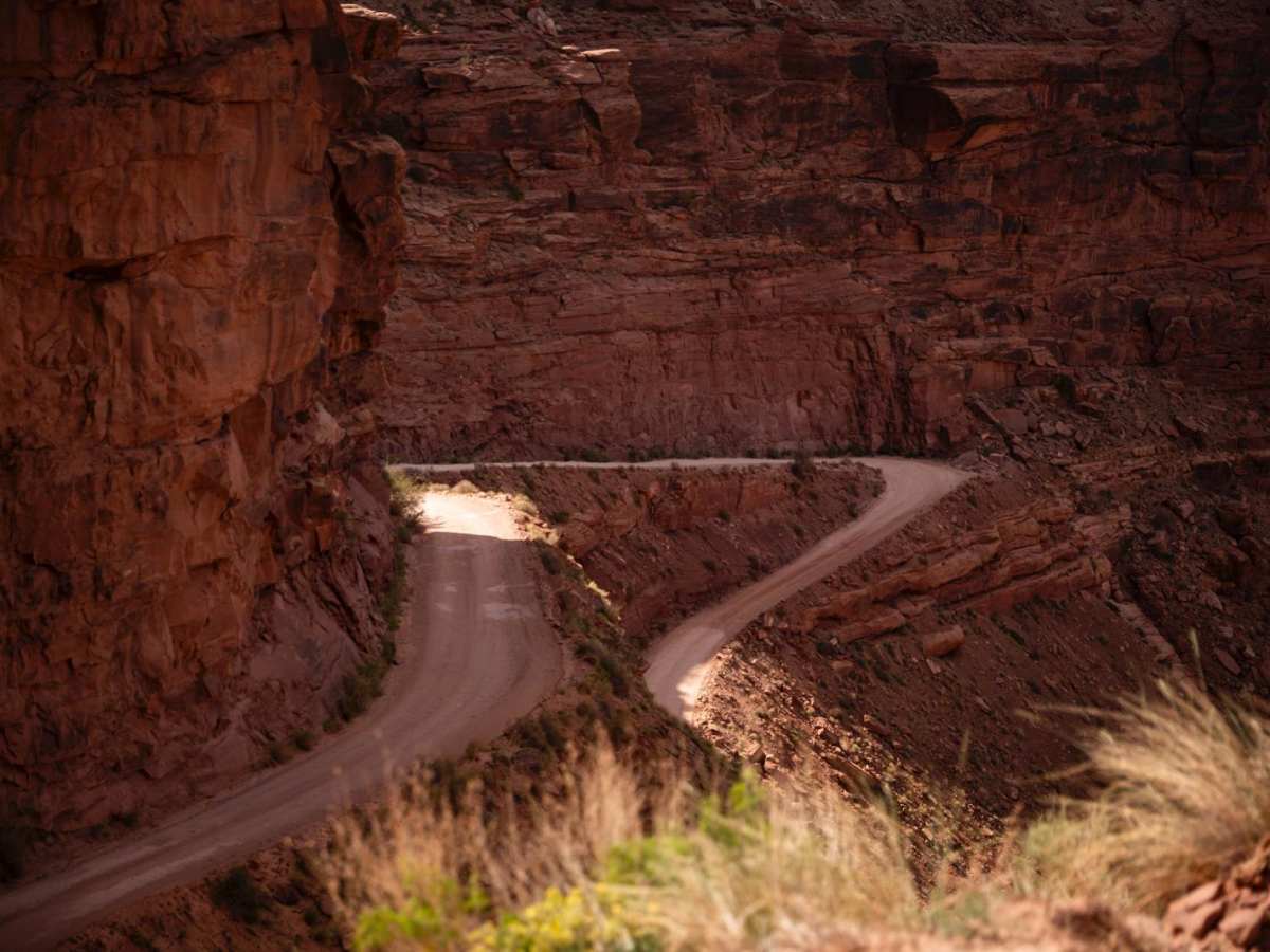
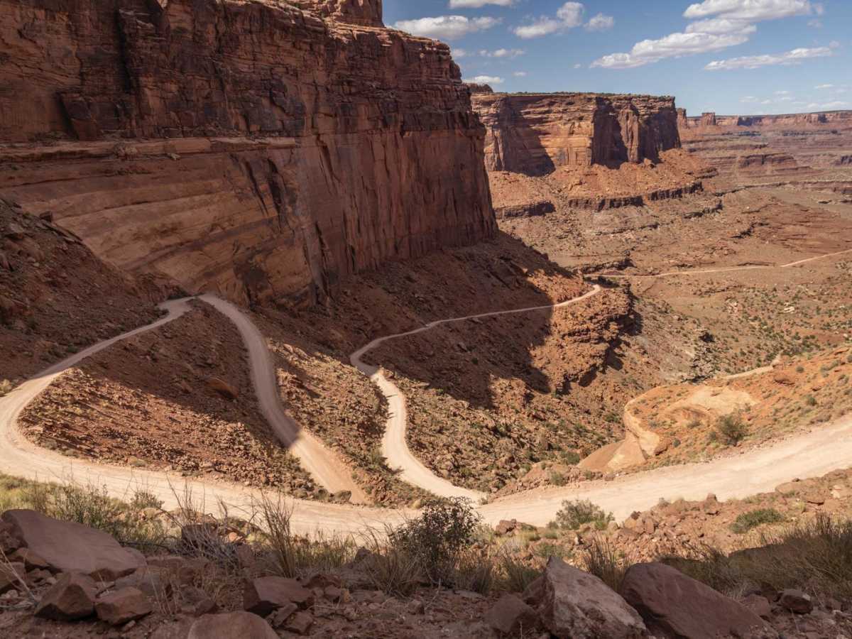
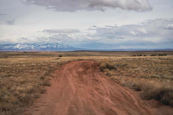
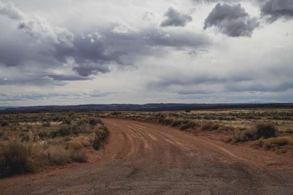
Potash Road / Shafer Switchbacks is a quintessential scenic drive through the red rock heart of Canyon Country—accessible to most vehicles, yet packed with epic views, geologic marvels, and enough exposure to make your palms sweat (just a little). The route begins as Potash Road, a mostly two-lane dirt and gravel track winding along the Colorado River, flanked by sheer cliffs and ancient petroglyph panels. The terrain is generally smooth with some bumpy bedrock sections, but no true obstacles, making it suitable for stock SUVs with moderate clearance. As you approach Shafer Canyon, the route begins its iconic climb via a series of steep, tightly stacked switchbacks. This section is narrower, and drivers should proceed slowly due to exposure and tight corners. While still passable by many vehicles, it requires focus—especially when navigating around oncoming traffic on the cliffs. There are numerous pullouts and viewpoint stops throughout, offering panoramic views of the canyon, the river below, and the La Sal Mountains in the distance. Two well-placed pit toilets make this a convenient route for longer days out. This drive connects with multiple other trail systems and the Island in the Sky District of Canyonlands, making it a popular gateway route for exploring more rugged terrain—or simply soaking in Utah's otherworldly beauty at a gentler pace.

Photos of Potash Road / Shafer Switchbacks

Difficulty

This trail is mostly two lanes, with room for pullouts. Expect small ruts, washboarding, and obstacles around 12 inches. There are numerous points of interest along the trail, with viewpoints along the river and further up the canyon. If it's busy, you'll want to pay closer attention, especially in the switchback section.

History

The Shafer Trail, also known as Shafer Switchbacks, is a scenic and challenging dirt road in Canyonlands National Park, with a history rooted in ranching and mineral extraction. Originally, it was a path for cattle herders, later upgraded by the Atomic Energy Commission to facilitate uranium mining operations, and now a popular route for off-road enthusiasts.

Technical Rating

3

Status Reports

Add Status Report
Alex Kukota
Jun 11, 2026
Open
Amazing trail, w/ superb scenery. Very fun & at times challenging, usually has bypass options. Highly recommend.
Andrew Bielawski
Jun 03, 2026
Open
Trail was pretty empty only passed 2 vehicles on the switchbacks. Not technical at all but if you’re scared of heights you might want to close your eyes . The scenery is beautiful, a must do drive
Jordan Kennedy
May 25, 2026
Open
Awesome, yet easy trail. The shelf road portion might not be for everyone but if you can handle shelf roads, its a 10/10 must do while you’re in Moab.
Suzanne W
May 20, 2026
Open
Tight switchbacks and some steep decent when going from the Canyonlands side towards Moab. One section by a wash where we were on 3 out of our 4 tires but got through it. The prior smaller 2wd SUV before us filled in the ruts with rocks so they could get up. All in all a fun ride the entire trail.
Jake
May 20, 2026
Open
Was a nice easy trail, saw everything from suburbans to full size trucks, and even a rav4 at one point. Stock 4x4 friendly.
Hunny Badger
May 19, 2026
Open
Went fairly early, one other person. The switch backs are in pretty good shape.
Michael Hall
May 03, 2026
Open
Trail was great, nice and easy…just a nice scenic drive for 2 sxs with a few couples… Only problem we had was, once you get into the Canyonlands, SXS are no longer allowed, there are numerous signs saying SXS are not allowed… we had to turn around and not go through the switchbacks, which was the main purpose of this trail. ONYX has SXS listed on the allowed vehicles…that needs to be changed!!!
Don Hayes
May 01, 2026
Open
We had a blast in the Bronco Sport. No issues with clearance or ruts. I assume most off-roaders would say it is an ‘easy’ trail, and it is, however the views and the pucker factor of meeting downhill travelers on the switchbacks were no joke!! We only got a few pics because my wife wouldn’t look out the window!!🤣🤣. Definitely recommend it.
Nichole Paine
Apr 26, 2026
Open
This was easily the most epic trail I have ever experienced. We entered off of 134 and experienced the switchbacks last. The drive was not technical, but the psych factor is no joke.
Greer Peed
Apr 25, 2026
Open
Really Cool trail, definitely take Potash road. It’s a great way to get back to Moab.
jeff brandt
Apr 24, 2026
Open
Christopher Ballard
Apr 18, 2026
Open
My first time down the trail and, as a beginner, everything seemed normal. Nothing too scary (unless you're afraid of the machines taking over and driving off a sheer cliff face), lost the trail a couple of times (both at main crossroad points so I was not alone), and definitely needed my main lightbar (at a minimum) to help see in the waning hour. Incredible views of, and amid the Moab Anticline there: rocks going every which way, great drive, thank you.
Shawn Enos
Apr 12, 2026
Open
The views are amazing. Did the trail in a little over 2 hours. Could have spent more time exploring.
Josh Daigle
Apr 12, 2026
Open
Beautiful day on the switchbacks. Road is rough but easily doable by most vehicles. Some rougher areas demand some careful tire placement… but anything with a bit of clearance would have zero issues.
will g
Apr 11, 2026
Open
Incredible views, nothing technical- just really enjoyable and varied. Rode trail on dualsport from east to west (uphill) which made the switchbacks at the end a steady, steep, first gear climb. The corners on the switchbacks aren't terrible but do require some line choice. I think going down the switchbacks on a motorcycle would be miserable and overheat brakes and engine.

Potash Road / Shafer Switchbacks Trail can be accessed by the following ride types:

  • Single Track
  • 50 Inch
  • 60 Inch
  • High Clearance
  • Full Width

Potash Road / Shafer Switchbacks Map

The onX Offroad Difference

onX Offroad combines trail photos, descriptions, difficulty ratings, width restrictions, seasonality, and more in a user-friendly interface. Available on all devices, with offline access and full compatibility with CarPlay and Android Auto. Discover what you're missing today!

Open Trail Map