Jeremy Sutton
Apr 23, 2026
2026 Jeep Wrangler Rubicon
Open
Normal
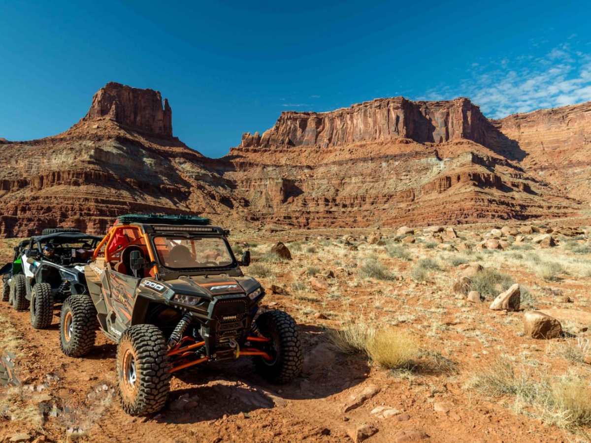
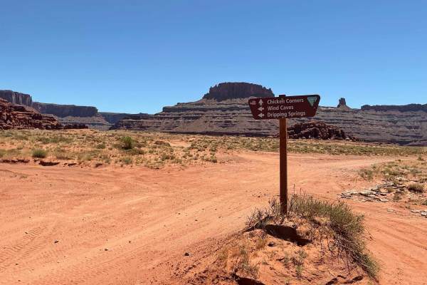
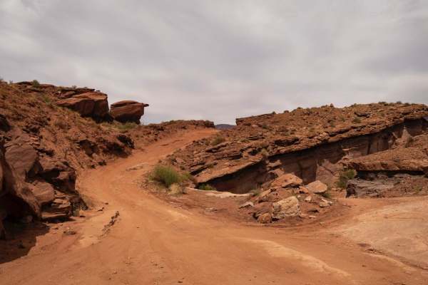
Ran the Lockhart Basin Road from north to south. As others have described the trail gets challenging from the chicken corners turn until it’s on top of the canyon rim, and heads west. 1 to 1.5 miles from chicken corners trail. I ran the trail in a stock 4 door Wrangler Rubicon with the factory 35” bfg tire option. I got through just fine with some skid plate work. I would not recommend this trail for a standard stock wrangler. You’ll need to disconnect the sway bars and lockers would be very helpful. You’ll also be using the skid plates a lot! After the trail is on top of the rim, it has some shelf’s sections and a few ledges to work through, once you get to the Lockhart canyon area it’s been well maintained, and can be traveled 20+ mph all the way to hamburger rock area. All in all I got it done in about 6 hours with minimal stopping. Great trail! very remote area, be prepared to be self sufficient if an issue comes up.
Kody Jones
Feb 14, 2026
Open
NormalRough/Deteriorated
The rating on this trail is way too low. We traveled north to south on this trail. As the description indicated the first several miles was very technical: I was in a stock jeep wrangler with slightly larger tires. We were traveling with 4 other vehicles. The ones with lift kits and larger tires were able to navigate over some of the larger obstacles with just stacking a few rocks. We had to winch both stock jeeps over one large rock about a half mile south of the junction with chicken corners. Everyone in our group was very experienced in navigating obstacles and all have worked in the vehicle recovery business. The south end of the trail was probably about a 3 rating but the north end is definitely not a 4!! We didn’t damage any vehicles but took us several hours to go the first few miles. I have included images of the largest obstacle. There were several other areas were we had to stop and fill holes with rocks but was able to get through with a little sweat and fresh underwear.
Rob Mc
Feb 14, 2026
2023 Ford Bronco
Open
Rough/Deteriorated
Onyx got the rating on this one wrong. I saw similar comments from others but thought they must be noobs, but nope, the rating is definitely too low. The south half of the trail is pretty easy. I would rate it a 3 except for a few ledges that would definitely be a 4. The part of the trail south of Chicken Corners is very technical. I was going south to north. I don’t think I could have done it the other way. Definite possibility of damage. I would rate it a 7. I have done lots of 5 and 6 trails. Just a few 7s but this was right up there with them. It cost me a tire and some new underwear after coming close to a rollover. I was in a Bronco Badlands, 35”tires 3”lift.
Michael Dornik
Nov 29, 2025
Open
Rough/Deteriorated
I would also say this trail is not a 4/10 by any means. It definitely is from hurrah pass to chicken corners. Shortly after chicken corners, it is as hard or harder than Kane creek for a number of sections. If that earlier section is 4/10, this part more like 6-8/10.
Wayne & Dana
Nov 19, 2025
2023 Can-Am Maverick X3 Max RR
Obstructed
Almost immediately from the fork near Chicken Corners where this trail begins, this trail has eroded with all of the recent rains. It's a solid 7 now and we turned around when we came across an obstacle that we felt was an 8. We have a very capable modified CanAm Maverick with 35s, so buyer beware.
Gary Rogers
Sep 22, 2025
Open
Dusty
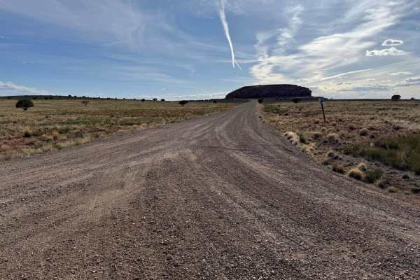
We got a late start, drove from south to north including Hurrah Pass and it took us nine hours to finish and arrive in Moab. The trail was dry and bumpy starting about 15 miles from the pavement. Bumpy turned into occasional fun challenges that required 4wd and a rear locker once in a while. Even had to use the front locker once. The descent down the narrow canyon just before Chicken Corners made me happy that I wasn't going up. Sometimes gravity can be your friend. Can't wait to do it again some day. Plenty of camping. Definitely would recommend.
James Israelsen
Sep 19, 2025
Open
Rough/DeterioratedDusty
Aaron ba
May 08, 2025
Open
Great adventure. Lots of camp spots. I got a bit stuck on the climb right before the major hairpin coming from chicken corners. Needed more ground clearance (on 33s). Definitely thankful for my sliders and skids.
Norb Veit
Apr 19, 2025
Open
DustyRough/Deteriorated
Sorry this isn't more specific, we started this trail from the south and headed north towards Moab. The color coding for this trail and indeed the app in general is not helpful. The trail was easy (green) for the first 12 miles or so. After that the trail became more technical and fit it's moderate (blue) color coding. About 22 miles in, we got to a very difficult spot in the trail which had 2 tough (for me) obstacles very close to one another. I felt it would have been an easy place to get stuck between the 2. The second one was a 2 foot uneven shelf where I was afraid of rolling my 4Runner. Moreover, I didn't have skid plates and there were skid plate scars all over the top of the shelf. I'm a novice off-roader and this extreme obstacle was too much for me. Turned around and drove back the way we came. I think the trail should have been color coded red for that section. I wish the app would color code sections of the trail instead of what appears to be a rating based on averaging the easy with the extreme.
Corey
Jan 18, 2025
Open
DustyNormal
I read a bunch of trail reports before we took this trail. I figured it would be rough but we had no issues. There are some technical sections and they are mostly within the 1 or so miles south of chicken corners but we cleared all sections with stock Bronco Badlands without any help needed. Our rigs do have fwd and aft lockers and 35s. We did scrape bottom and rims have some new character but that's to be expected in these environments. Temps were cold camping was very cold. Overall good times.
Garrett DuFort
Jan 04, 2025
Open
Rough/Deteriorated
Didn’t get any photos of the rough spots. But about 2 miles south of chickens corners was pretty rough on the f150 on 35’s. But if you don’t care if your vehicle gets dented. It’s a fun challenge.
Jim Preston
Dec 24, 2024
Obstructed
Washout
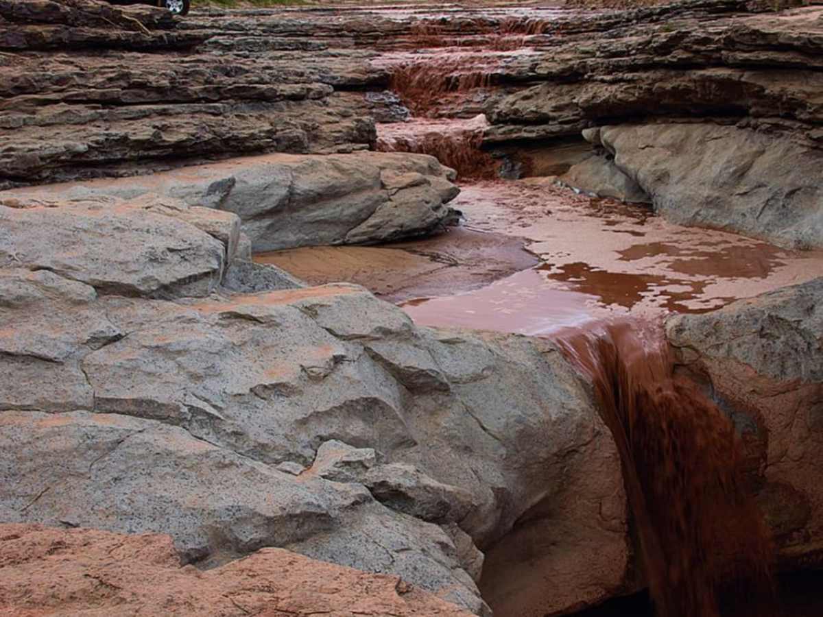
Oct 26, 2024: The northern third of the trail is very challenging based on Jeepers we met going south. We knew we couldn't drive it so drove up from the south to the washout in this photo which is just north of Lockhart Basin. The few Jeepers we met seemed terrified of what they just went through. One woman passenger was still panicked and was so happy to see us and learn that the rest of the route south was maybe 2/10. We off-road in our AWD Transit a lot in the region, we live in Grand Junction, but I haven't experienced Jeepers like this before. So my guess is that the trail north of Lockhart Basin is probably more like 7/10. It definitely isn't 4/10 and wasn't before the storms. 4/10 is routine for us.
Bryan Hargett
Nov 17, 2024
Open
NormalDusty
This trail has a couple obstacles at the north end that are more like 7s. The first mile coming from chicken corners is no joke.
Chris Dunlop
Aug 30, 2024
2016 Toyota 4Runner
Open
DustyRough/Deteriorated
The storms about 3 weeks ago that took out Black Bear and Imogene in the San Juans nailed Moab as well. Well we felt that as we had to clear the route from a few debris fields/slides. it also undercut some of the obstacles and made them a bit more challenging. Took us about 7 hours when coupled with Hurrah Pass. Amazing day though and highly recommended. We also came across 3 motorcycles throughout the day (only people we saw) who we had to resupply with water. Don't underestimate the heat!
Mark Johnson
Aug 27, 2024
Open
The first few miles past the Chicken Corners junction are challenging, with steep, off-camber ledges up to three feet tall. This trail should be rated a six, not a four.