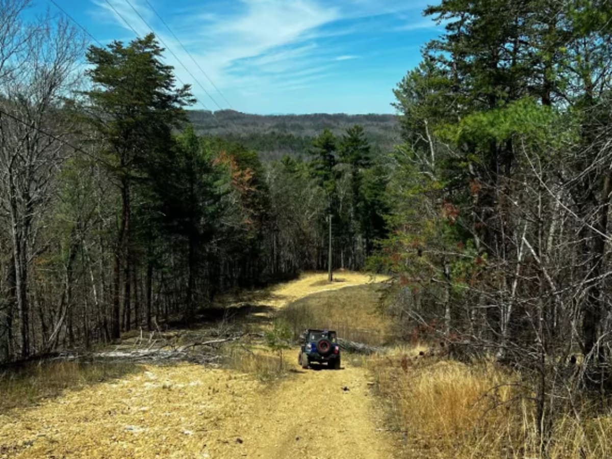
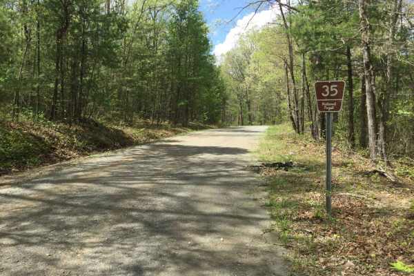
Mad Dog

Total Miles 3
Technical Rating
3 Easy
Best Time Spring, Summer, Fall, Winter
Trail Type Full-Width Road
Accessible By
Open Trail Map

Trail Overview

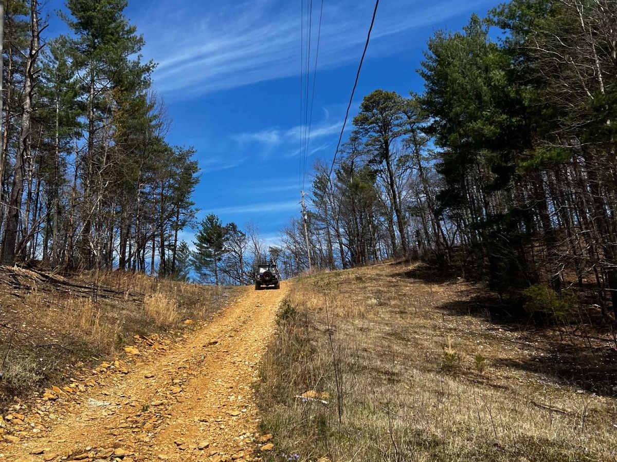
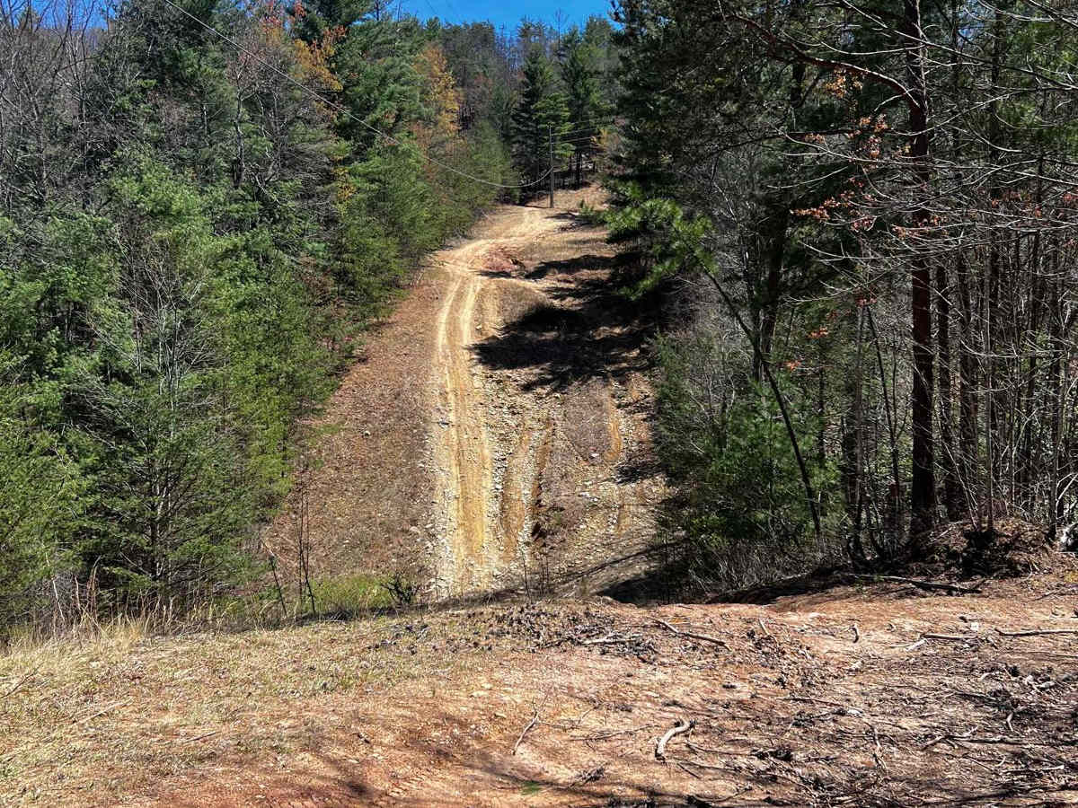
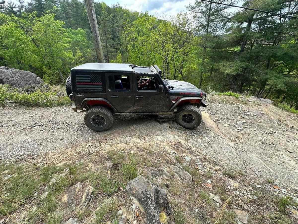
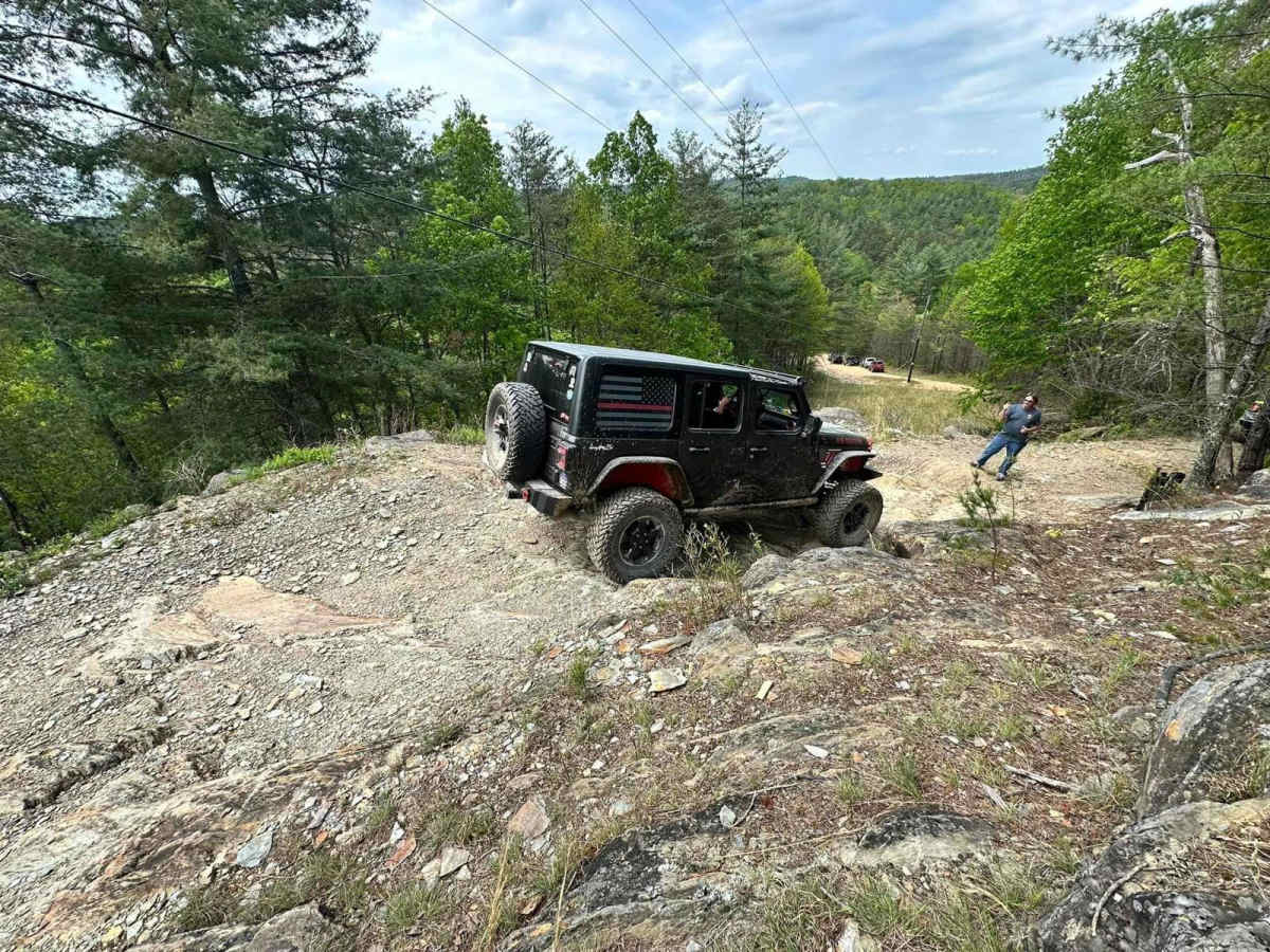
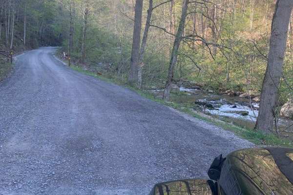
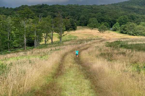
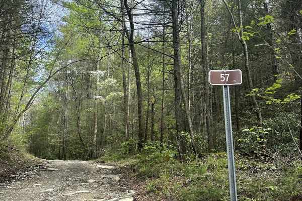
This trail runs from North River Rd Shortcut - 216 to the Cherohala Skyway in the Cherokee National Forest. This trail is mainly dirt with some small rocks. It winds through clearings and forest. Beware that pinstriping is very likely in the spring-fall months. At around 2 miles in, you come across a small rock ledge approximately 18-24 inches tall that is easily navigable with a good spotter. Once you clear this obstacle, you come upon a short rock garden with an approximate 12- to 18-inch ledge, and this one will get you slightly off-camber. Continue down the hill and you will see the Devil's Bowl. It's a steep 20-30 degree descent followed by a 20-30 degree ascent, with an optional 2nd hill climb up onto a bald. The Devil's Bowl could be tricky after a heavy rain. If you choose not to do the 2nd hill climb, just follow the trail to the right at the top of the first hill. You will then be met by a couple of creek crossings 12-18 inches deep. The trail ends between trees and a guardrail running parallel to the Cherohala Skyway. Use caution here due to pinstriping and traffic coming down the Skyway as you try to exit the trail.

Photos of Mad Dog

Difficulty

Expect steep inclines and declines, small rock ledges, and rutting. Potential water crossings are up to 18 inches deep. There are mild off-camber areas. Most of the trail is one lane wide with wider spaces to pass.

Technical Rating

3

Status Reports

Add Status Report
John B.
Dec 12, 2025
Open
Definitely NOT a 3/10. I would rate this as a 6. I could not make it up the rocky ledges due to not having a winch. My rig has front and rear lockers with 33's and I was forced to turn around. There are also a number of other connecting trails that don't seem to go anywhere. What a PITA!
Jonah Wilson
Dec 12, 2025
Open
Absolutely not a 3-4 anymore, severe washout and lack of maintenance. I got through it fine on tons and 40s, but couldn’t see anything with less then 35s making it through without tons of issues.
Charles Bourgeois
Nov 26, 2025
Open
While 90% of this trail is easy the north end is anything but easy. Very tight and good technical obstacles. I would rate this more of a 4 or 5 just on the those two back to back rocky sections. It is also not a trail for a full size rig. Over all it was fun but not worth the pinstripes.
Kadin Bloom
Nov 17, 2025
Open
Not a good trail to do alone at night, definitely take another vehicle with you and make sure you have 4x especially if it’s rained anytime within the past week. Trail is tight in spots. I done it in a stock height jku with 33s but almost got high centered a couple times , would recommend least a 2 inch lift with 33s on a jeep.
David Cagle
Nov 08, 2025
Open
The trail is severely washout right before you jump on the skyway. We made it down the trail but expect some harsh off-camber experience and some very slick rocks. It did rain the previous night so take that into account. Overall highly recommended.
Christopher White
Nov 07, 2025
Open
The Trail is very tight for full size rigs, not very many places to pass if any on the east side. I Came across an awd ford car that had been abandoned on an obstacle. looked for the driver for a bit and ended up having to back up a portion of the trail and go down the power line to get around. All in all a fun trail. Definitely wouldn't say it's easy and would recommend good tires and a decent clearance for some if the ledges and rocks on the western portion.
Scott Anthony
Nov 05, 2025
Open
At a 3/10 rating I had no issues going through the Mad Dog, but it was considerably worse than advertised. At this point my AWD is still stuck on the trail. It's definitely more like a 5 or 6 rating, and not for any AWD vehicles. Note that my Escape is not stock, and would have no issues on a 3 or 4 trail.
kelm hun
Oct 19, 2025
Open
Definitely not a three. Lots of steep drop offs. Water shallow was okay but steep hills up and down. 4/10 would not do it again alone. Fun yet crazy since this was the hardest a pushed the beast. Didnt get pictures of the craziest section due to just trying to not flip over or slide off the side by myself in the woods on a rainy day. Overall had a blast soloing this route but definitely go with friends next time. Try to stay on the trail since it splits a couple of sections and I honestly couldn’t tell which was was hard. Although I do like a challenge. New to off-roading and this is for sure the hardest jf I have pushed her.
chase Mo
Sep 20, 2025
Open
Eric Tassler
Sep 06, 2025
Open
Ran from South to North. Some mild overgrowth and some small branches crossing the trail (less than 4”). Mild off-camber areas. Rated as a 5. I was happy to have a spotter for the downhill obstacles towards the end - definitely 4 Low worthy. Would prefer to run it in reverse next time (from Cherohala Skyway). Devils Bowl was a fun little climb.
Andy B
Jun 27, 2025
Open
Matthew Kansier
Jun 01, 2025
Open
Rob Smith
May 24, 2025
Open
Gate is closed blocking the trail. Didn’t check to see if it was unlocked and we were allowed to open it or not
Eric Mitchell
Oct 31, 2024
Open
Large tree down about halfway between North River shortcut and the Cherohala...maybe a bit closer to the Cherohala side. We had to double back. A couple folks with a saw and a winch could clear it pretty quickly. Other than that it was a fun ride.
David Tallent
Oct 22, 2024
Open
Fun trail. It’s get tight in a few spot and for sure picked up a few new pinstripes. Should really be rated closer to a 5. I came from North River and ended on the Cherohala. Some spots would have been much easier with a spotter, but I made it in my Ranger without issues. This was my first time on this trail. I would like to do this trail again from the opposite direction, but I will probably not do it alone.

Mad Dog Trail can be accessed by the following ride types:

  • Single Track
  • 50 Inch
  • 60 Inch
  • High Clearance
  • Full Width

Mad Dog Map

The onX Offroad Difference

onX Offroad combines trail photos, descriptions, difficulty ratings, width restrictions, seasonality, and more in a user-friendly interface. Available on all devices, with offline access and full compatibility with CarPlay and Android Auto. Discover what you're missing today!

Open Trail Map