Views and Falls #2143

Total Miles 12.1
Technical Rating
1 Easy
Best Time Summer, Spring, Fall
Trail Type Full-Width Road
Accessible By
Open Trail Map

Trail Overview

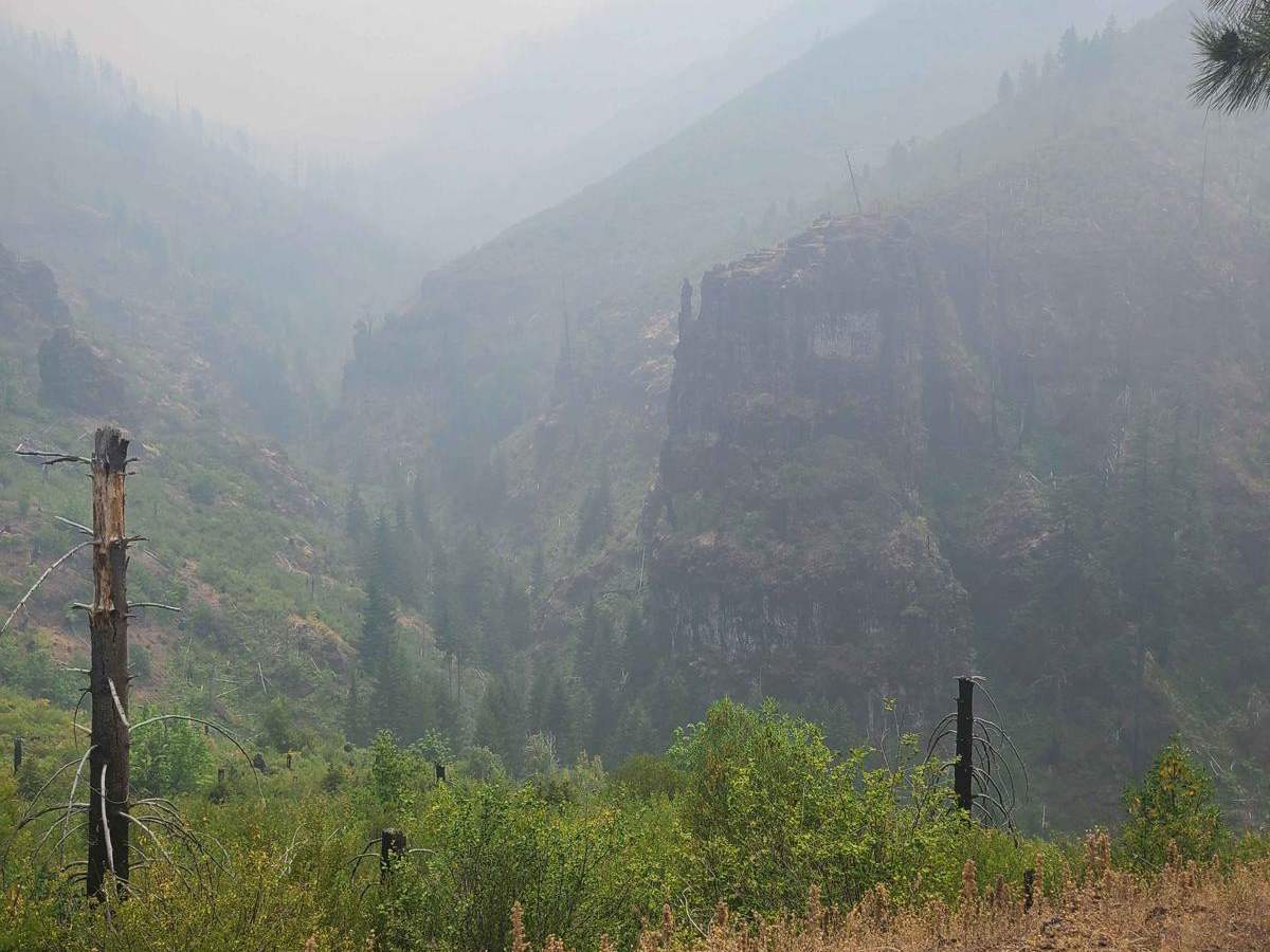
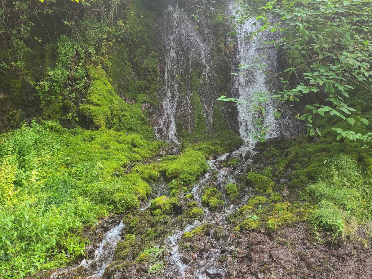
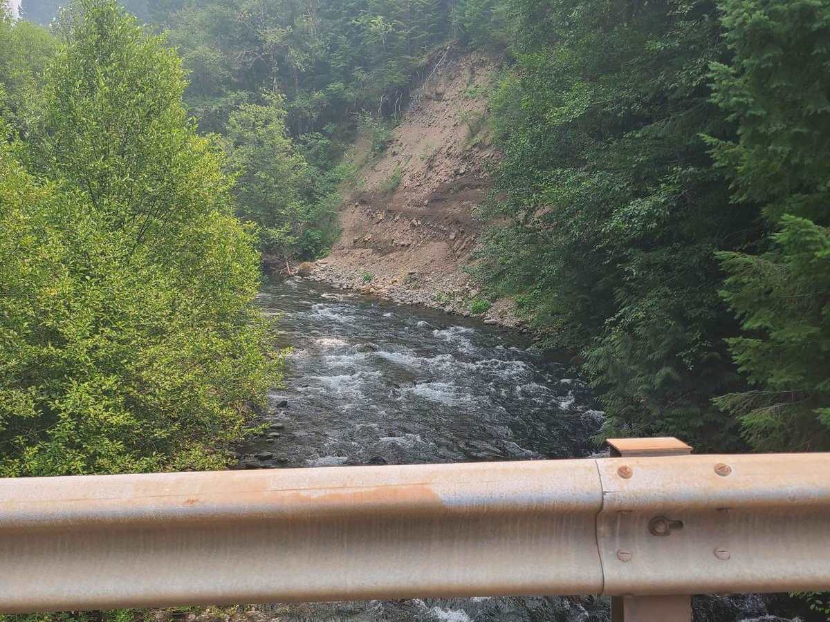
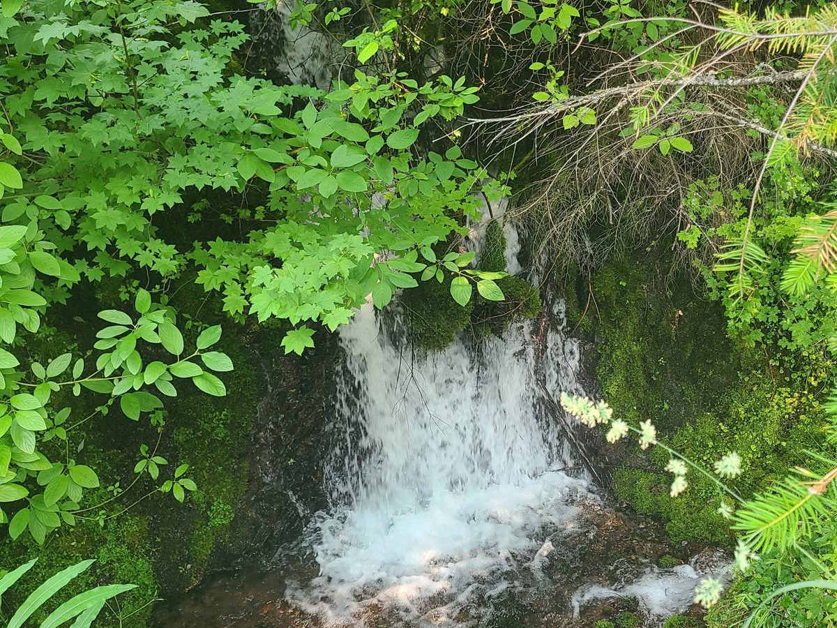
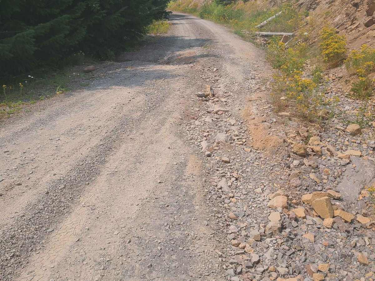
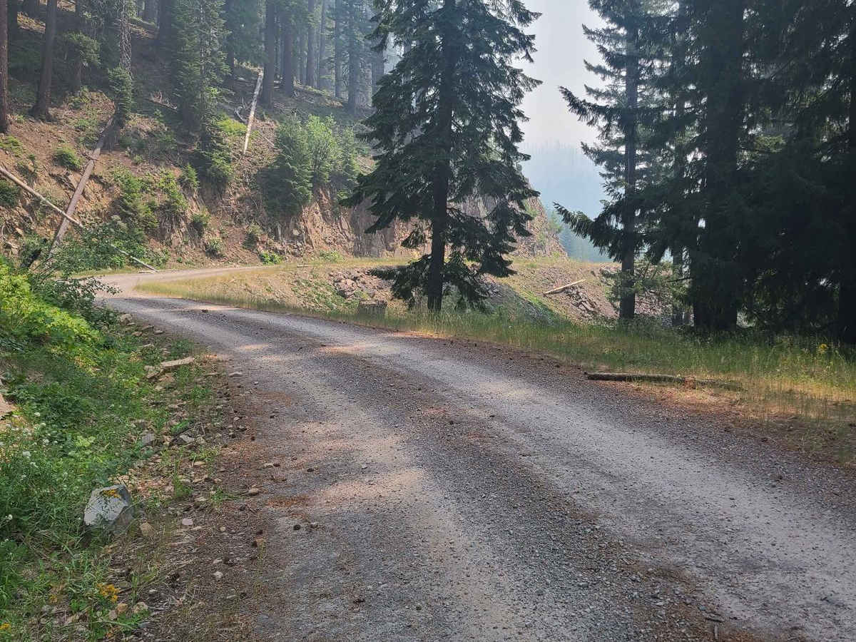
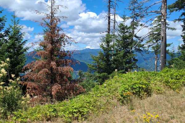
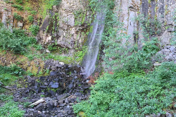
This road is an easy trail that a 2WD vehicle can access. There is one section that has washed out a bit, but even for 2WD in good weather with the right tire placement, you will be able to pass it. On a beautiful clear day, you won't be disappointed with the views, between the burned trees, you will be blessed with amazing valley views with towering rock formations. If you stop and stand to listen for just a moment, you might be able to hear the wind howling through the trees and rock; it's something spectacular. There are multiple water sources on this road, from a small stream, the Middle Fork Willamette River, and two small yet insanely loud waterfalls hidden in the thick brush. If you are into hiking, mountain biking, or horseback riding, there is a multi-use trail that is 32 miles long called The Middle Fork Willamette Trail #3609. There is little to no cellphone service in this area. If you need reception, the Dairy Queen near Chevron offers WiFi. Stop for breakfast or a full menu all day. Remember to always pack it in and pack it out, tread lightly, and keep our trails open!

Photos of Views and Falls #2143

Difficulty

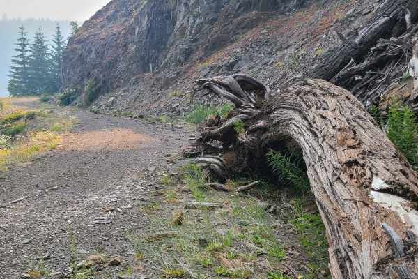
There is minimal difficulty on this road. The road is typically unmaintained during winter and can be subject to closures. Downed trees after a large storm are possible, as well as rocks or debris in the road.

Technical Rating

1

Status Reports

Add Status Report
Steve m
Aug 25, 2025
Open
Emigrant Fire Closure Order • The closure applies to the NFS areas, roads, trails and trailheads described below. The closure area is depicted on the attached map, which is incorporated into this Order as “Exhibit A”. All areas, roads, trails, campgrounds, and recreation sites in this closure area, as well as sites in the Timpanogas Lake area are closed. All roads forming the boundary of the closure are included in the closure. Recreation sites, trails and campgrounds closed by this Order are listed below. The Emigrant Fire Closure Area begins at the junction of FSR 21 and 2134 in Township 21 S, 3 E, Section 13. It progresses east on FSR 21 until it meets with the junction of FSR 2154 in Township 24, Range 5E, Section 24. It then follows and includes FSR 2154 south, then southwest to its junction with FSR 2136 in Township 25 S, Range 5E, Section 30. It then follows and includes FSR 2136 north to the intersection with FSR 2134 and ending at the original junction of FSR 2134 and FSR 21.
Revere Overland
Jun 26, 2024
Open

Views and Falls #2143 Trail can be accessed by the following ride types:

  • Single Track
  • 50 Inch
  • 60 Inch
  • High Clearance
  • Full Width

Views and Falls #2143 Map

The onX Offroad Difference

onX Offroad combines trail photos, descriptions, difficulty ratings, width restrictions, seasonality, and more in a user-friendly interface. Available on all devices, with offline access and full compatibility with CarPlay and Android Auto. Discover what you're missing today!

Open Trail Map