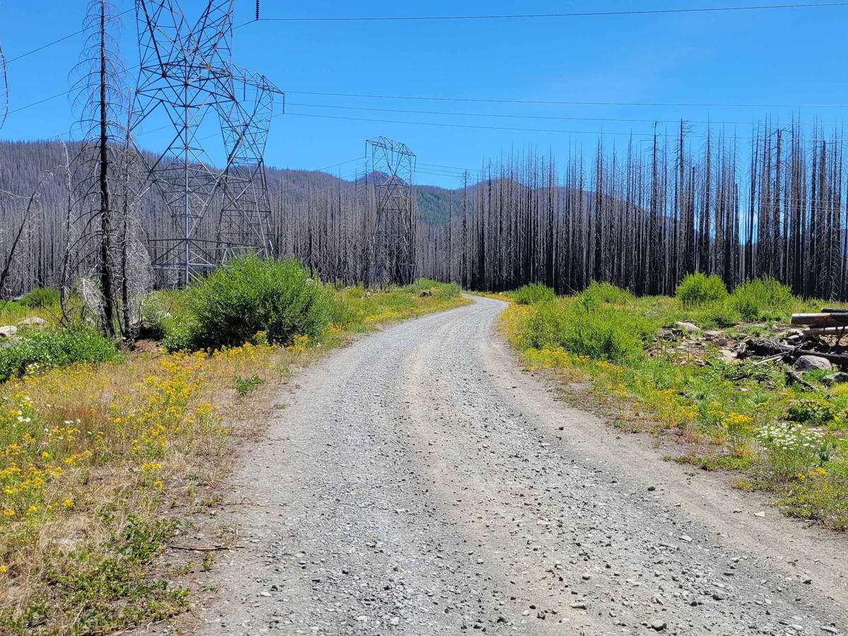
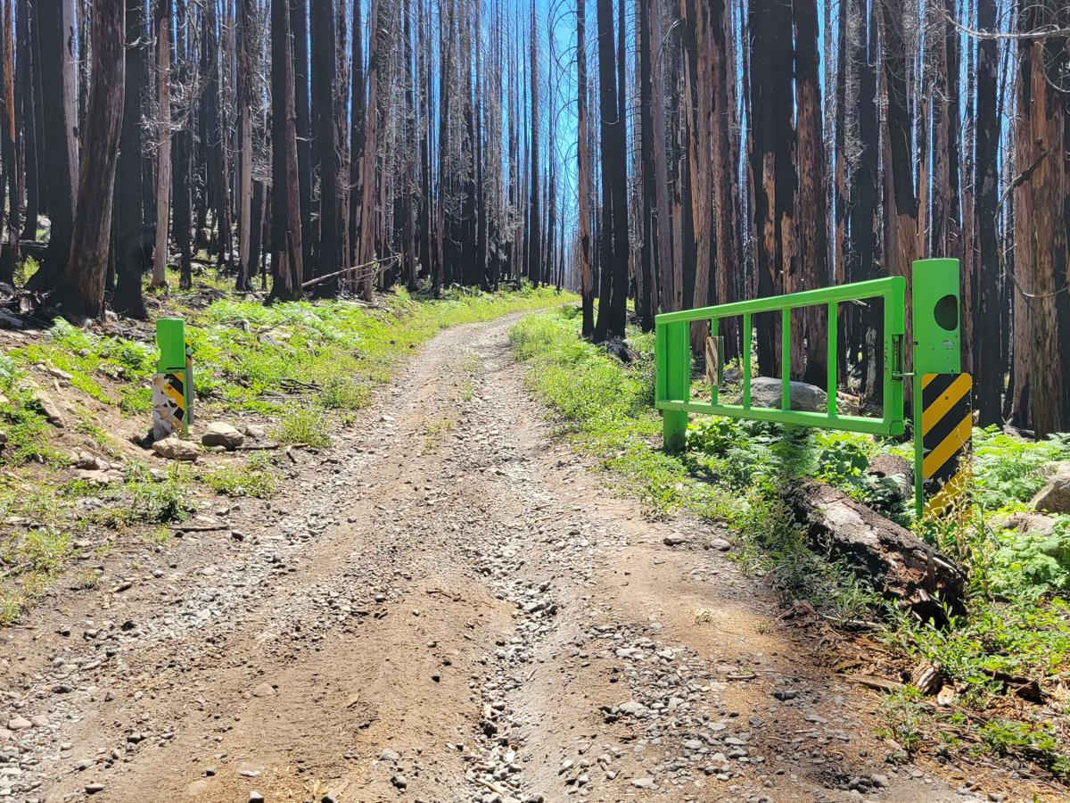
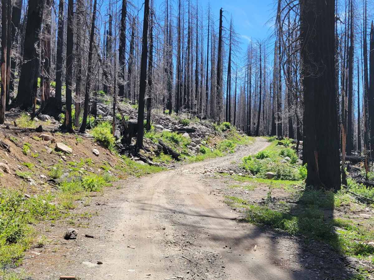
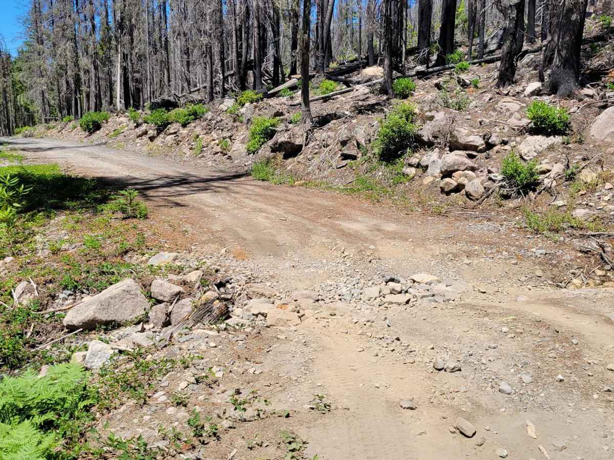
FR 4220

Total Miles 6.7
Technical Rating
4 Moderate
Best Time Fall, Summer
Trail Type Full-Width Road
Accessible By
Open Trail Map

Trail Overview

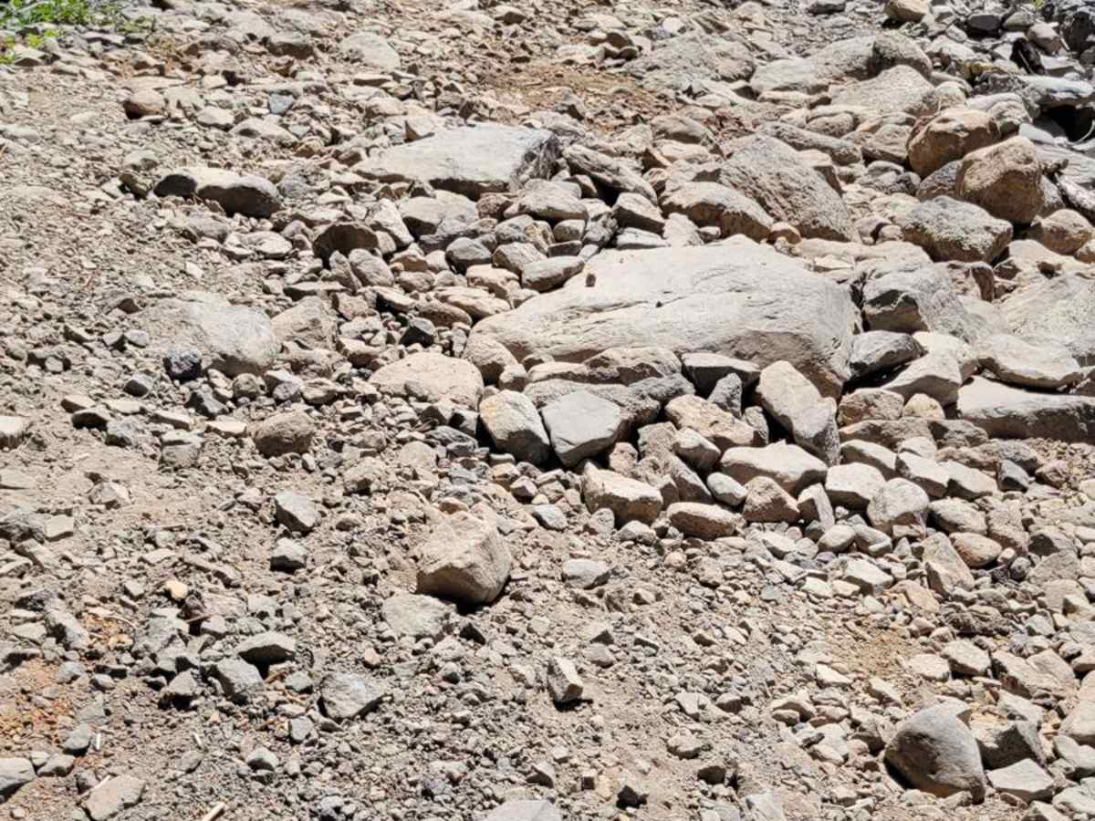
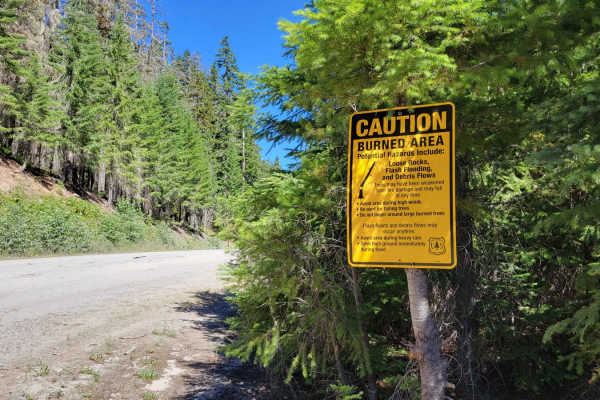
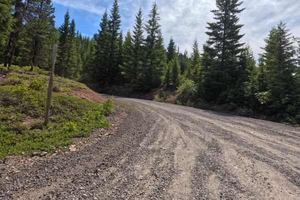
Forest Road 4220 is a very rocky mountain trail that leads deep into the Mount Jefferson wilderness, arriving at Breitenbush PCT trailhead and Breitenbush Lake. It's a bumpy and more slow-going trail with larger rocks and deep erosion ruts to navigate. 4x4 would certainly make the going easier, but 2WD vehicles were noted at the hiking trailhead at the top. Sadly, nearly all of the trail has been burned and is now a skeletal forest. There are posted warning signs in the area in regard to the burned area - be cautious in times of high winds and heavy rain. There is one small section that is overgrown with vegetation and will brush wider vehicles. The trail does appear to continue beyond where the track ends and may connect all the way to Horshoe Lake Campground. Breitenbush Lake Campground is closed. Coming down the trail, there are some beautiful views downhill. The trail is unmaintained (closed) in the winter and early spring months. No cell service.

Photos of FR 4220

Difficulty

Bumpy and more slow-going trail with larger rocks and deep erosion ruts to navigate. 4x4 would certainly make the going easier, but 2WD vehicles were noted at the trailhead. There is one small section that is overgrown and will brush wider vehicles.

Technical Rating

4

Status Reports

Add Status Report
Casey LaDoux
Dec 23, 2025
Open
Narrow with multiple washouts. Very technical
John Mayernik
Dec 12, 2025
Open
Bring a chainsaw with a minimum bar length of 20" and at least one gallon of gas and bar oil to make three refills. I topped of my saw of three times yesterday. I cleared the entire trail of fallen trees. There must have been over twenty plus trees down. Some 16"-26" diameters. Came across two other vehicles, one Honda hybrid and two wheel drive Toyota pickup. A few areas required high clearance 4x4. Take it slow up the steep rocky exposed hill climb section and stay on the uphill side. A little slick from wet rocks at the upper end of the climb but very manageable in 4x4 low. All in all a fun trail, keeps you on the end of your seat in a few areas, beautiful views and a lot of forest fire destruction. Very sad to see this area hit this hard by fires, the Western Hemlock thrived in this region. Good luck to all and keep all for tires on the trail.
Cooper Dort
Nov 22, 2025
Open
First half of trail is still passable with summer conditions. Ice in gravel melts in the afternoon and makes it muddy but not impassable. At 4.3mi in, there is a shady section that has a light covering of snow which could make it difficult to navigate with a less capable vehicle. 4WD / snow tire vehicles should still be able to make it to the trailhead with no issue.
Jordan Lindblom
Oct 08, 2025
Open
This trail is definitely easy as a lot of the road has been redone recently with fresh gravel
John Gaffney
Aug 15, 2025
Open
Dave Friesen
Aug 08, 2025
Open
Fun trail! We took it all the way from the power lines at FR46 to Ollalie Lake and back to FR46 on the north. The road smooths out at Horseshoe Lake.
Disco Overlander
Jun 24, 2025
Open
I started at the top and headed down. it's definitely not a four. there were no shelves or big rocks over 3 to 4 in really can be more treacherous if it's wet for sure. Pat mostly a two a little three in it
Connor Williams
Sep 23, 2023
Open
Hans v
Sep 10, 2023
Open

FR 4220 Trail can be accessed by the following ride types:

  • Single Track
  • 50 Inch
  • 60 Inch
  • High Clearance
  • Full Width

FR 4220 Map

The onX Offroad Difference

onX Offroad combines trail photos, descriptions, difficulty ratings, width restrictions, seasonality, and more in a user-friendly interface. Available on all devices, with offline access and full compatibility with CarPlay and Android Auto. Discover what you're missing today!

Open Trail Map