Josh Sutton
Dec 29, 2025
Open
Normal
Was in great Shape.
Kyle Aragona
Dec 20, 2025
2016 Jeep Grand Cherokee
Open
WashboardNormal
Awesome trail! my 2016 jeep grand charokee overland with highway tread did fantastic in 2 high threw most of the trail. On the steep hill climb I did use 4 low in 2nd gear this was only on the way into the trail heading to the river, on the way back out in some places I had to use hill decent assistance to not smoke my brakes. The camp site at the bottom is worth the trip. Enough room for several rigs on 1 camp site. Would definitely watch drive clearance, and a few trees you have to drive under. Any rig with working 4 low will make it in and out.
Joe Robinson
Dec 14, 2025
2020 Jeep Gladiator
Open
Normal
Nice easy trail for the most part. Some of the climbs / decents are steep, but a couple in my group were in stock wranglers and made it just fine in 2wd.
Will Davenport
Nov 16, 2025
2022 Ford Bronco
Open
Normal
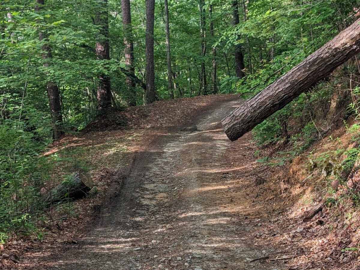
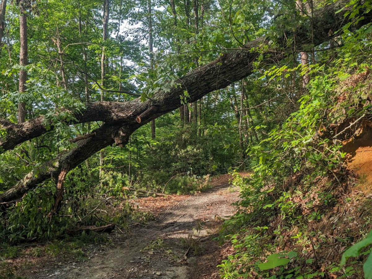
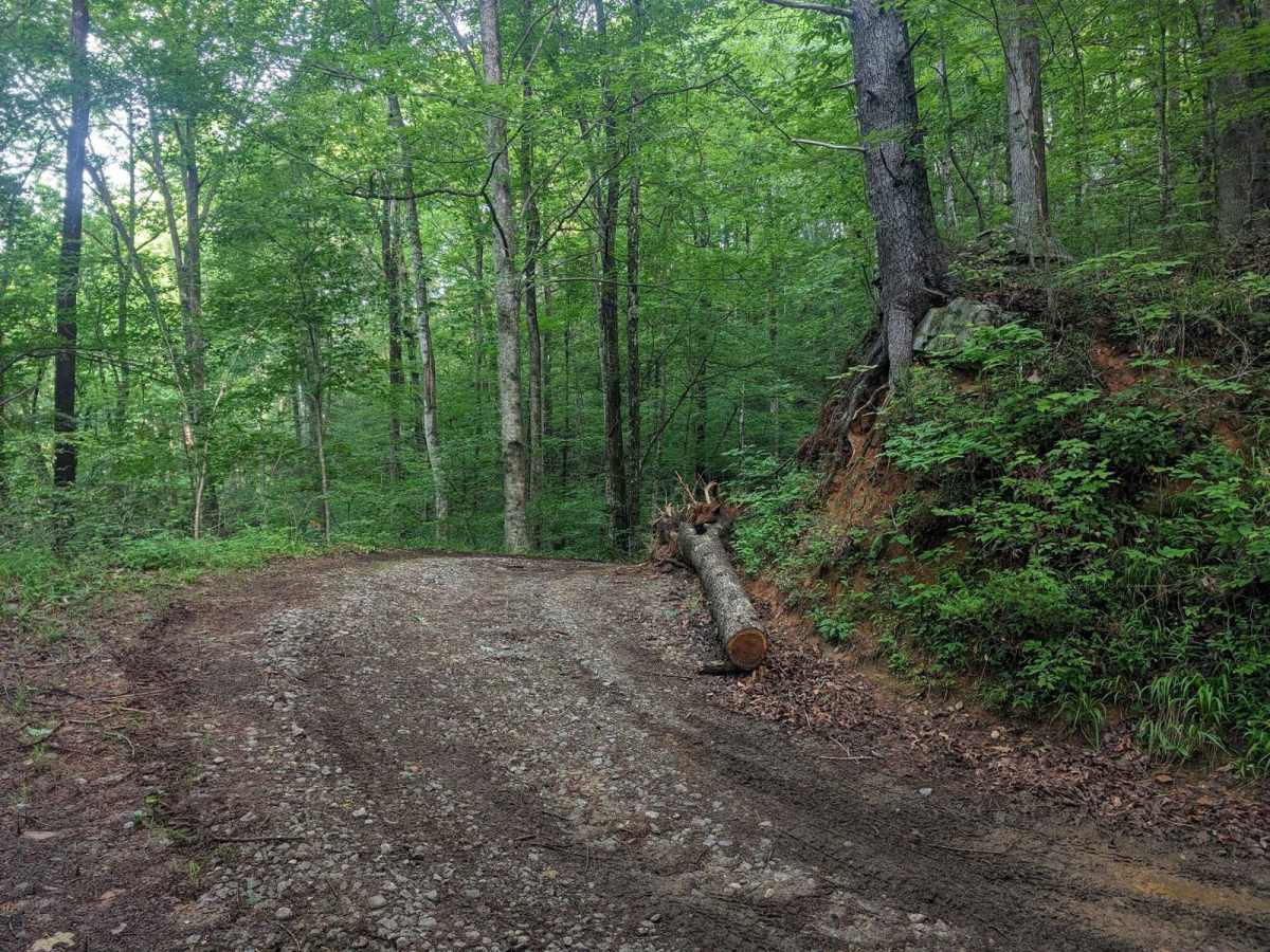
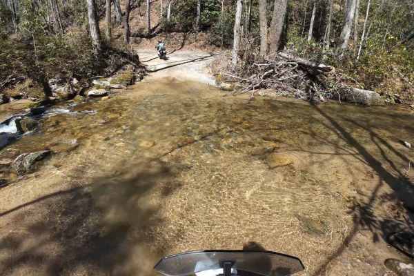
Super long trail. Longer than the highlighted trail on the map. My dad and I still haven’t completed the entirety because the trail splits off into multiple different trails. The roads had gravel and rock hills. Had great elevation changes. There were multiple trees that have fallen to create tree canopies. One tree was super close to my roof. I definitely don’t recommend trying to go under that one in particular because the road is closed up ahead and is not worth it. There is also a really cool bridge that crosses over a river which is definitely a great place to get some cool pictures of your rig!
Meghan Heckman
Nov 09, 2025
2021 Jeep Gladiator
Open
Normal
4H the whole way. Exciting trail with some switchbacks and shallow creek crossings. Hilly and bumpy, but overall not a difficult drive. Narrow at times, only wide enough for one vehicle. Some downed trees which have been cleared of the trail but remain close enough to make the trail more narrow. Several vehicles on trail, all 4WD with at least 8” clearance.
Brent Densmore
Aug 24, 2025
Open
Normal
Trail was in good condition. Few old downed trees that made it tight in areas. River had a couple campers. Went across the bridge at the river until the closed gate at the state line. Easy turnout and enjoyed the trip back out. Doesn’t have the Mountain View’s some of the other trails nearby have. But an enjoyable trail through the woods with creeks and the river.
Cheyenne Beus
Jul 29, 2025
2023 Ford Bronco
Open
Muddy/WetRough/Deteriorated
trail was more intense than was stated by others. it was wet when i went but having a rear locker was necessary. wasnt an issue in my bronco with front and rear lockers on 35s but not for lower or non built vehicles. a 4wd vehicle that didnt have skid plates was broken on the trail when i went. not sure what happened but the undercarriage was torn up so i can assume they didnt have the clearence they thought they had. i would say minimum 8-9 is necessary. one section is quite loose and a minimum 25% grade on it. was fun but if you dont have the right vehicle or driver i wouldnt try it.
Brandon Fredrickson
Jul 25, 2025
2021 Subaru Forester
Open
NormalMuddy/Wet
onX wouldn’t let me copy and paste my review from g maps so check my pictures for the recap. Didn’t get many pics of the trail itself, only one will show a fun decline. Terrain gets much worse than what’s pictured above
JT Taylor
Jul 15, 2025
Open
Normal
Good trail if you’re looking for a little more than the typical gravel FSR. 4x4 is a must to get back up the hills due to the loose rock. We didn’t encounter any other vehicles the entire time. The gate on the bridge was open and could have proceeded on the other side of the river (Auger Hole Rd) but there’s no information to be found on it in this app. I didn’t want to come to a closed gate at the other end. It started to thunder so we headed back the way we came. Don’t know how it would be to get out if down there and it started raining.
Robert Chamberlain
Jul 11, 2025
Obstructed
Downed Tree
Tree down across the road once you turn into the Toxaway Gamelands section about 200 yards in. We didn’t have a chainsaw and should be an easy clear once someone sees it.
j. Olin
Jun 14, 2025
Open
Muddy/Wet
Great ride. 6 miles from pavement to the bridge. You can go further than the onX trail that is marked, but takes 50-60 minutes to cover the marked trail. Another 40-50 to get back out. There are a couple steep climbs (21 degrees) on lose gravel/dirt but manageable in 4 Low. Trail requires 8" minimum clearance, I recommend 10". There is a campsite right next to the river at the bottom. Beautiful spot.
Zach Wright
Jun 07, 2025
2015 Jeep Wrangler
Open
Normal
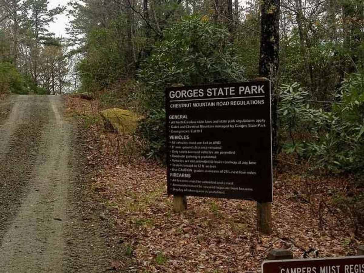
Basic trail but pretty little drive through the woods. I rate it a 2 at most. Entered through Gorges State Park. A couple of sharp turns and a lot of heavy brake use descending down to the river. I did read from other reports that it would be the case. Of course that means long hill climbs coming back. Nice camping spots at Horse Pasture. I don’t usually encounter any other people on the trails as I go on weekdays, but this was a Saturday and I passed a couple other Jeeps and other rigs going the opposite direction. 5 vehicles total. Fortunately I had a small place to pull over each time. Also a few people camping next to the river. Not sure why anyone would rate this anything more than a 2 at most.
Erik Christy
Jun 07, 2025
Open
NormalDusty
Alan Thompson
Apr 18, 2025
2019 Jeep Grand Cherokee
Open
Normal
Pretty easy and fun trail. A few of the inclines could be sketchy without 4wd. 4wd definitely helped keep the brakes cool, otherwise you’d be riding them a lot. Definitely need 8”+. Mine is supposedly 8.6 and we bottomed out a few times.
Matt Hall
Apr 11, 2025
2020 Toyota Sequoia
Open
This is a very cool drive that we checked out today - we got about 3/4 in and turned back. It was getting late, and it's a fairly gnarly trail. Go during the week to avoid other vehicles (passing will be a challenge). If you can go when the leaves aren't on the trees you'll have some pretty cool views at various points of the trail. The Gorges State Park campground is amazing, too. We can't wait to go back.