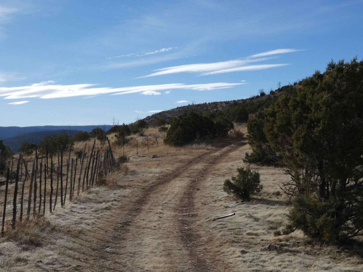
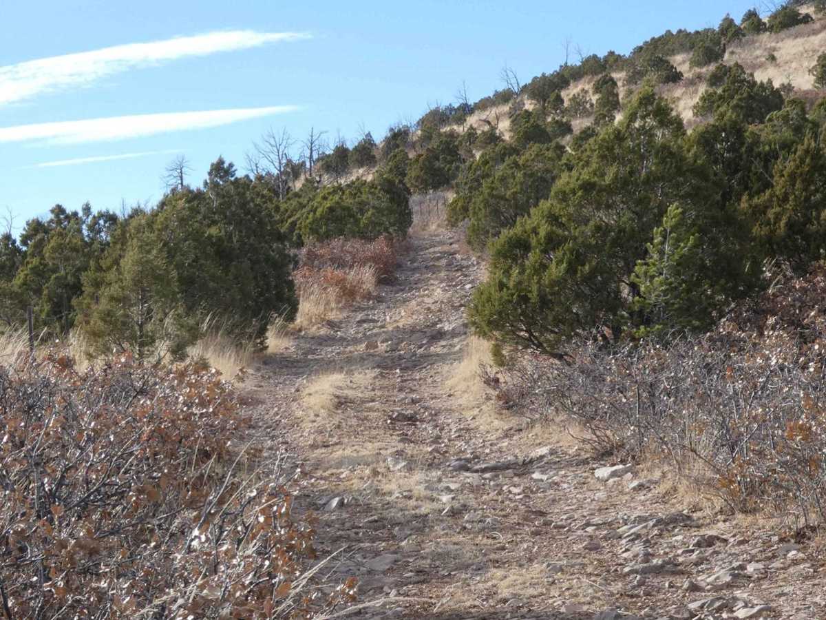
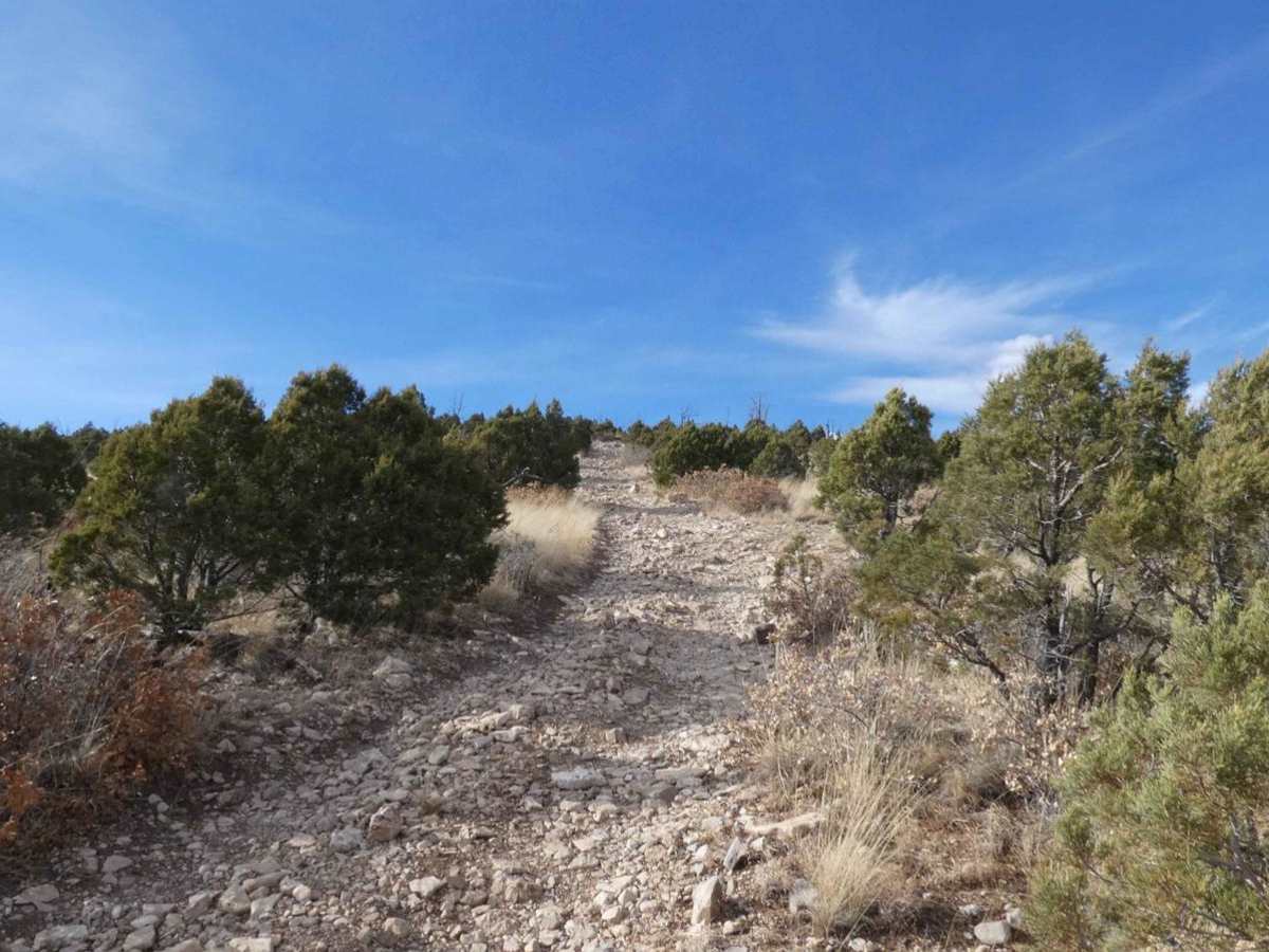
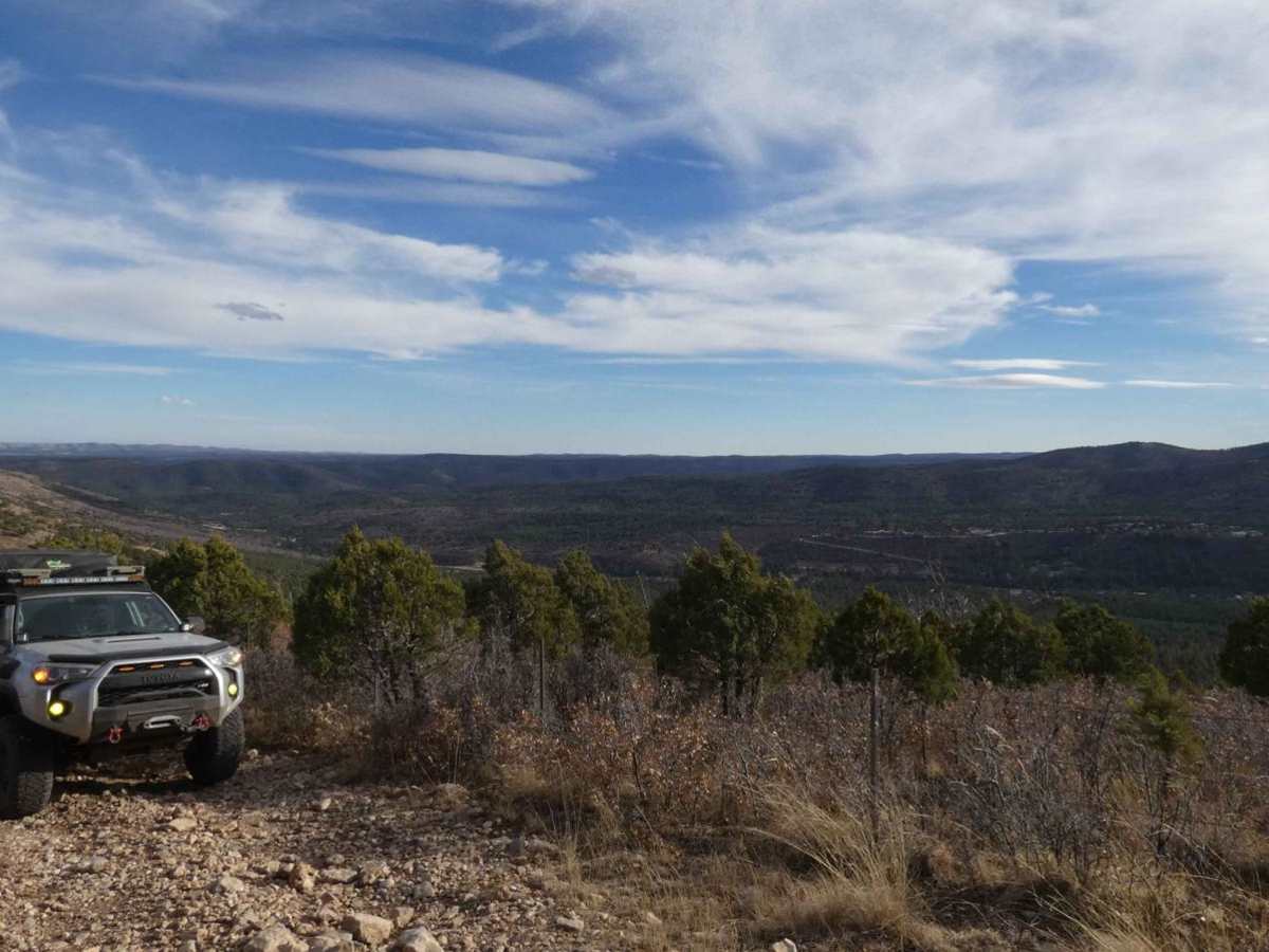
Fuel Break

Total Miles 3.4
Technical Rating
5 Moderate
Best Time Spring, Summer, Fall
Trail Type Full-Width Road
Accessible By
Open Trail Map

Trail Overview

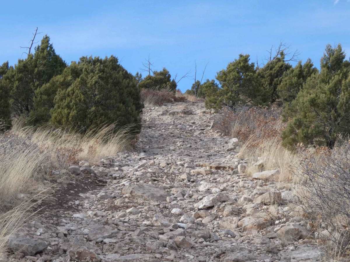
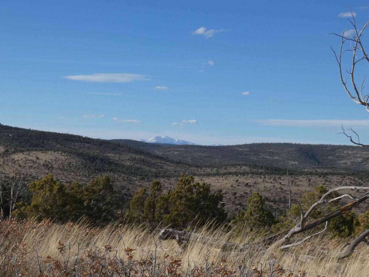
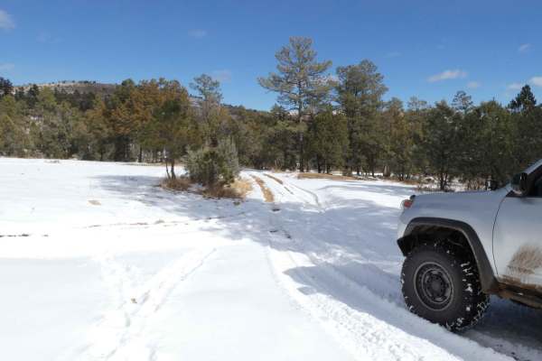
Fuel Break is a trail that is difficult to access, and difficult to traverse and should be run with a group and experienced drivers. Featuring a very loose rocky surface with inclines and slopes in excess of 20% grades, the potential for damage is high, and little to no room to turn around. Some rock gardens provide more solid ground and can have steps in excess of 20 inches, surrounded by loose rocks that increase the difficulty and potential for damage to the vehicle. There is no room to pass on the slopes or inclines and lines should be selected carefully before proceeding as the rocks are very loose throughout the trail. Areas of the trail are off-camber with large obstacles that make the angles more extreme. Some overgrowth does impede the trail and will damage vehicle paint/body panels. Views at the first peak are wide and give a glimpse at the first big climb up. Cell service is strong after the first half mile and becomes weaker towards the end. This is an out-and-back trail and should only be attempted with modified 4x4s and experienced drivers. There is one spur (Latham Can 620A) towards the end that could be used as an exit but it does run into private land before intersecting Three Mile Canyon Road. There are other spurs that are not legal for public use, study the trail, terrain, and surrounding area before attempting.

Photos of Fuel Break

Difficulty

Inclines and slopes in excess of 20% grades. Large obstacles up to 24". Large loose rocks. Sharp rocks will damage tires. Moderately off-camber areas. Heavy overgrowth and potential for paint/body damage.

Technical Rating

5

Status Reports

Add Status Report
Eric Yi
Dec 13, 2025
Open
READ IF YOU ARE PLANNING TO GO TO END OF THE TRAIL: the final route 620 on onX in gray does NOT exist. You have to take a different unmarked road. I added a photo of my recorded route. It is unmaintained so might have to clear/cut branches yourself. REVIEW: It is 95% rocks. Inclines/declines of up to 20°. It is unmaintained and tight, you WILL get pinstripes. The entire trail is hill climbs and descents. Pretty fun, and good views. My Gladiator Rubicon X is on 33” tires and has a 1.5” level kit in the front. No issues.
Steven Baker
Sep 27, 2025
Open
Steep climbs and descents with loose rocks, lots of brush and close trees. You will get pinstripes. Exited north end of trail to FS228. With a group of 10 vehicles, some full size 4x4’s.
John Inabinette
Jul 06, 2024
Open
It was very pretty ride. There are lots of loose rocks and large rocks. Steep grades and minimal turn outs.

Fuel Break Trail can be accessed by the following ride types:

  • Single Track
  • 50 Inch
  • 60 Inch
  • High Clearance
  • Full Width

Fuel Break Map

The onX Offroad Difference

onX Offroad combines trail photos, descriptions, difficulty ratings, width restrictions, seasonality, and more in a user-friendly interface. Available on all devices, with offline access and full compatibility with CarPlay and Android Auto. Discover what you're missing today!

Open Trail Map