Trail Overview
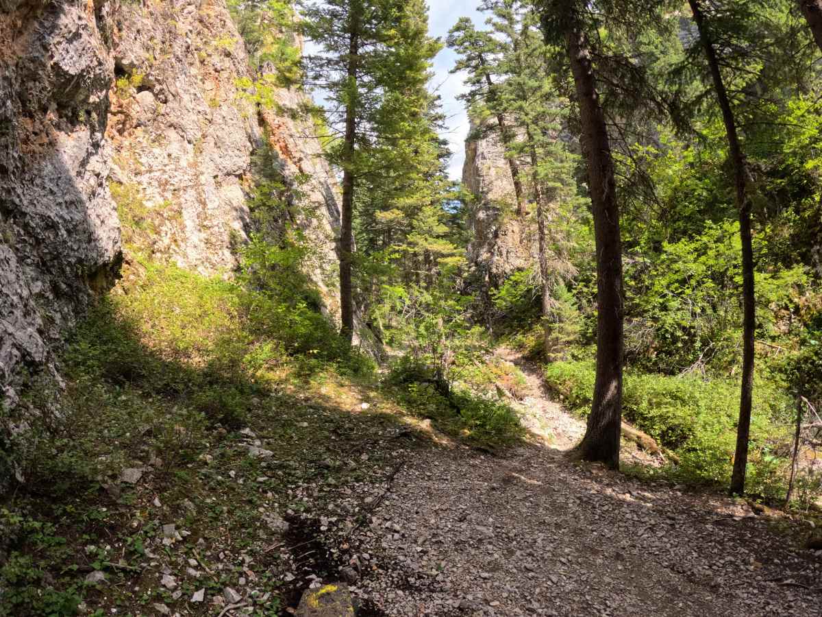
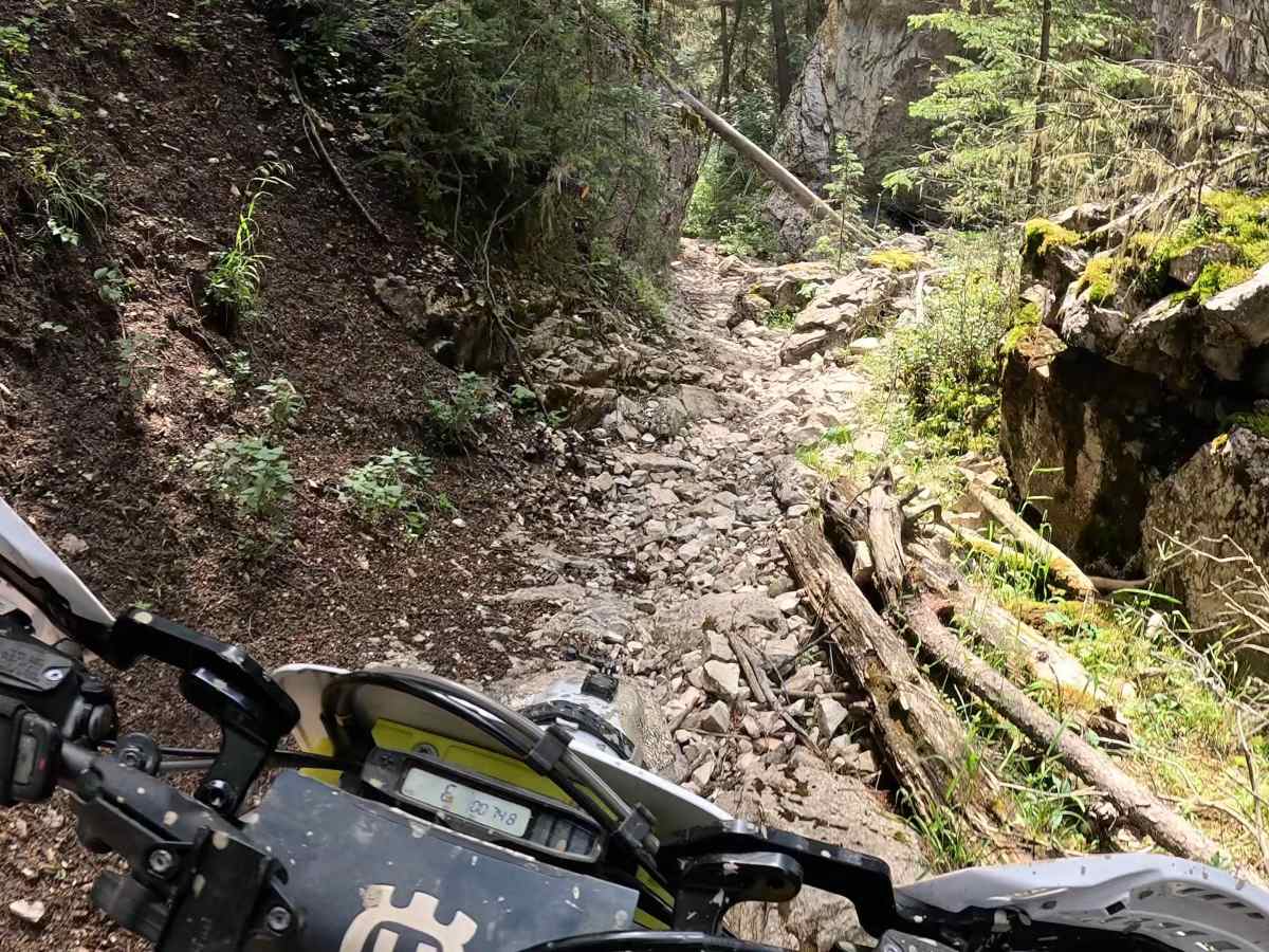
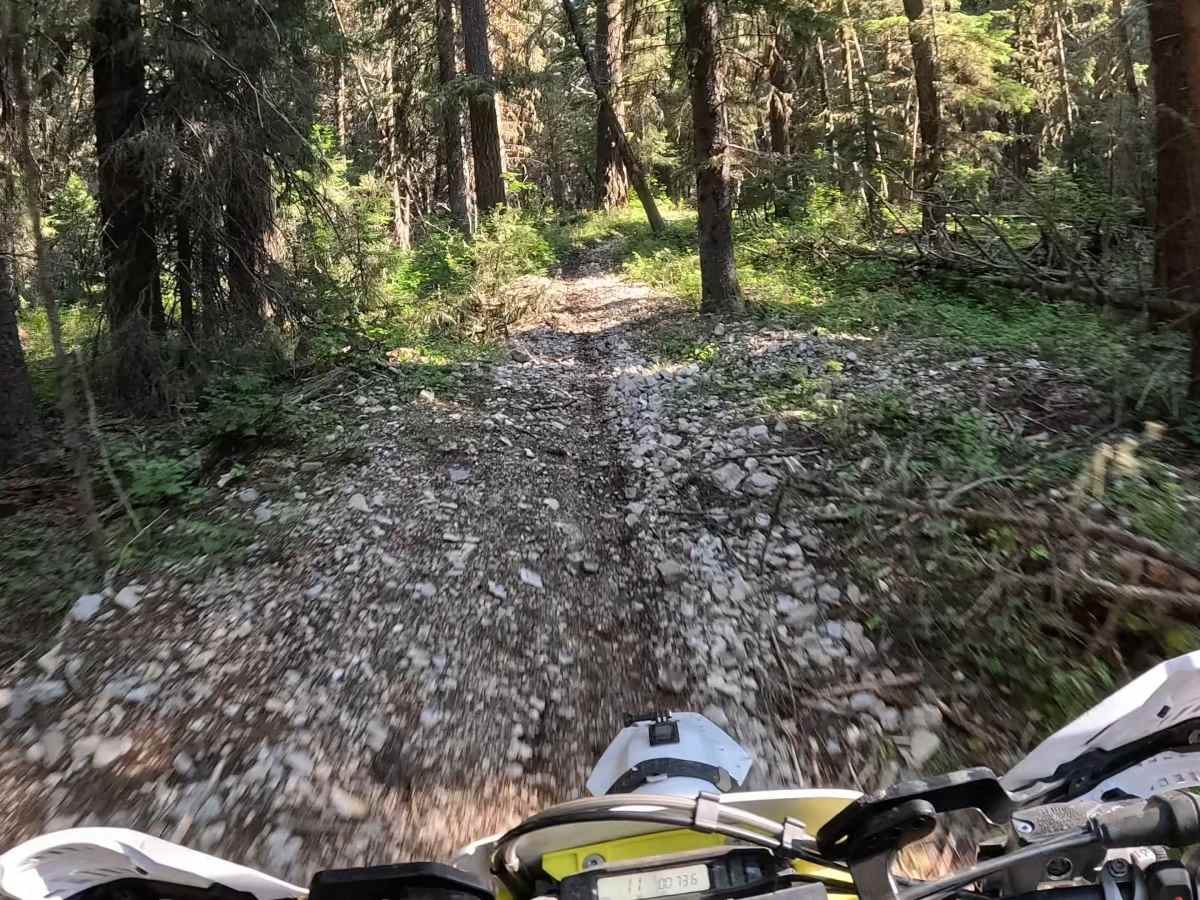
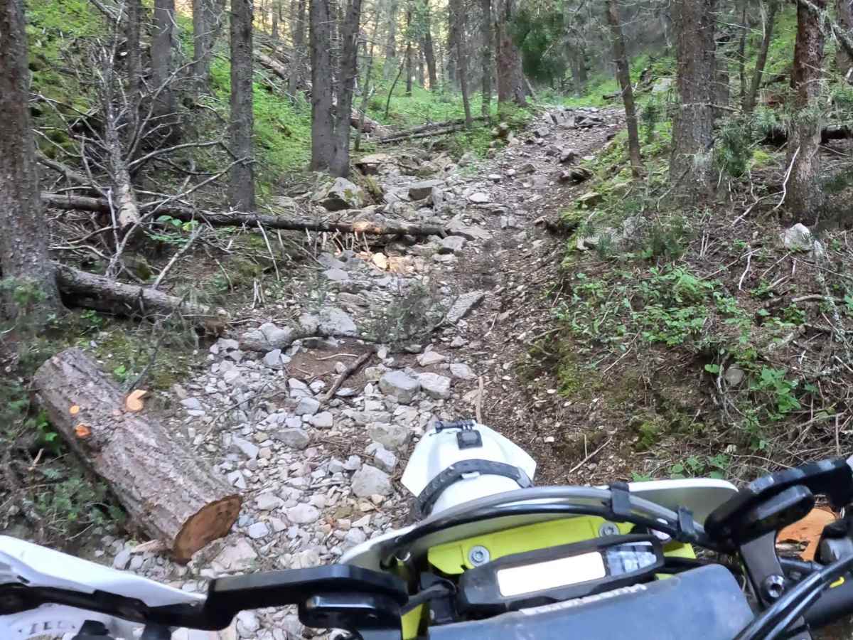
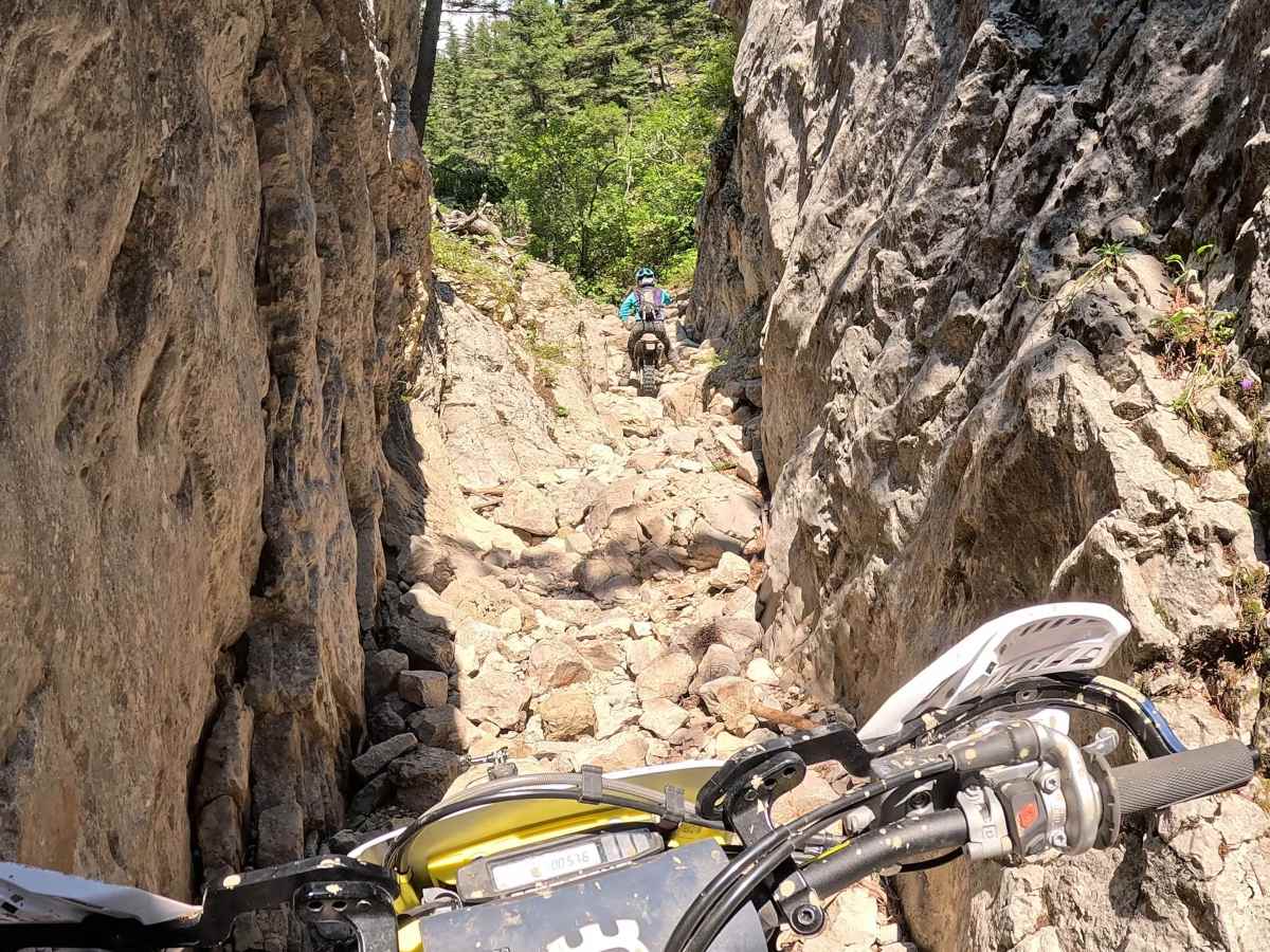
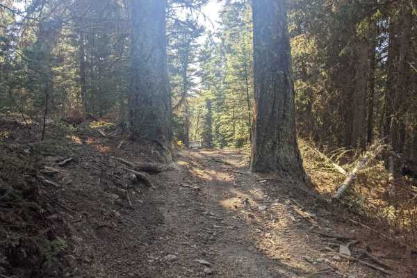
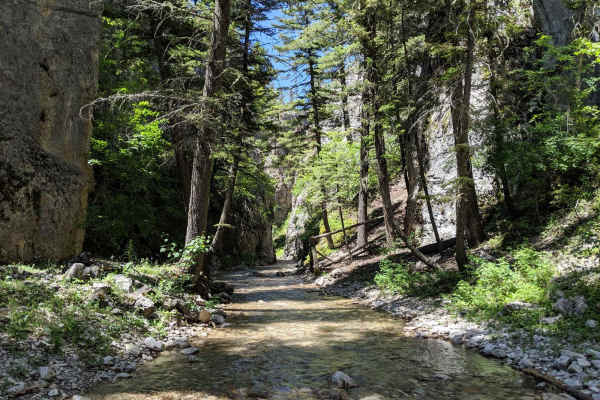
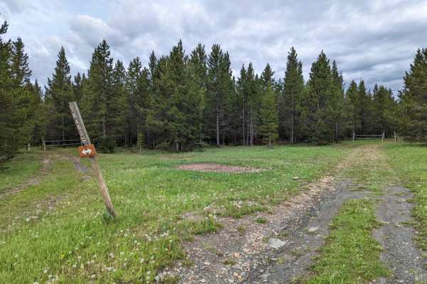
Starting at the Daisy Dean campground, take the Mud Creek jeep trail. After about 1.5 miles, the trail turns to single track. You will pass through some awesome meadows and ride along a creek for most of this loop. Mud Creek trail will merge with a few other trails, turn on Lucky Boy trail. This trail is wide enough for SxS. Lucky Boy will merge into FS 189. Keep on FS 189 and turn on Willow Park/Daisy Canyon. That will take you to Nevada Creek. From here on out it's all single track. The start of the trail is loose rocks, dirt, and mud. Several small creek crossings at the beginning of the trail. On the Forest Service roads that you take to connect to Nevada Creek, the trail is hard-packed dirt with ruts and some areas that will have deep mud holes. Once you turn off onto Nevada Creek, the trail is dirt with some larger rocks, roots. Once you hit Morrisy Creek, you will be riding down a Creek bed. Large rocks, down trees, and water are very common. Once you think you have defeated the water and large rocks, you will have to ride up Nevada Narrows. Depending on the time of year, the water mixed with the rocks makes it a real challenge. Be prepared for any situation; it's likely you might not see another rider. I would advise not to ride this trail alone.
Difficulty
This trail features mud, large rocks, downed trees, and several creek crossings, creating a consistently challenging route. Conditions may require careful navigation and steady vehicle control throughout.