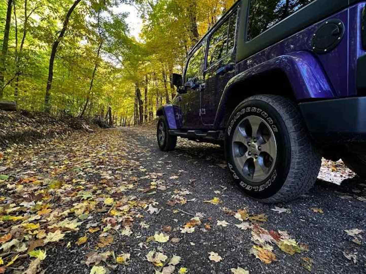
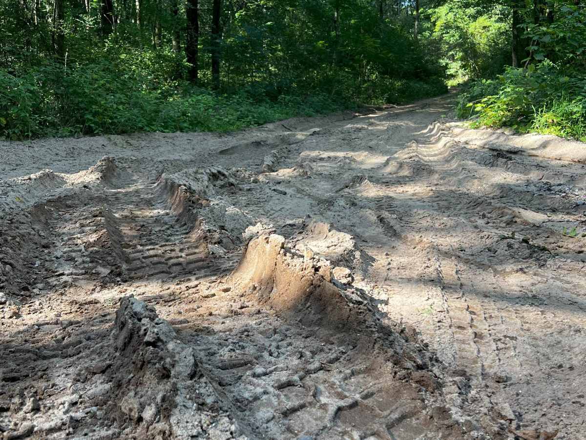
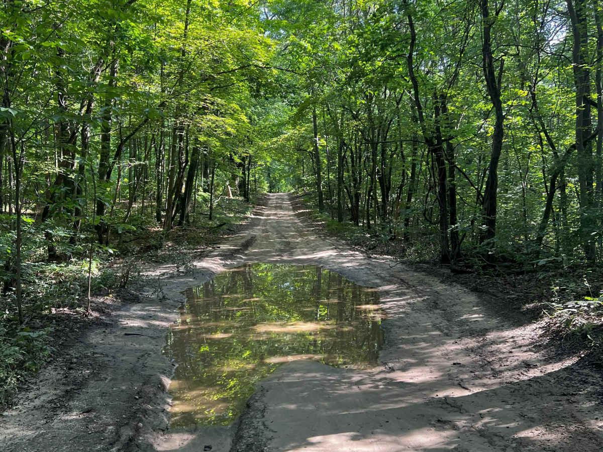
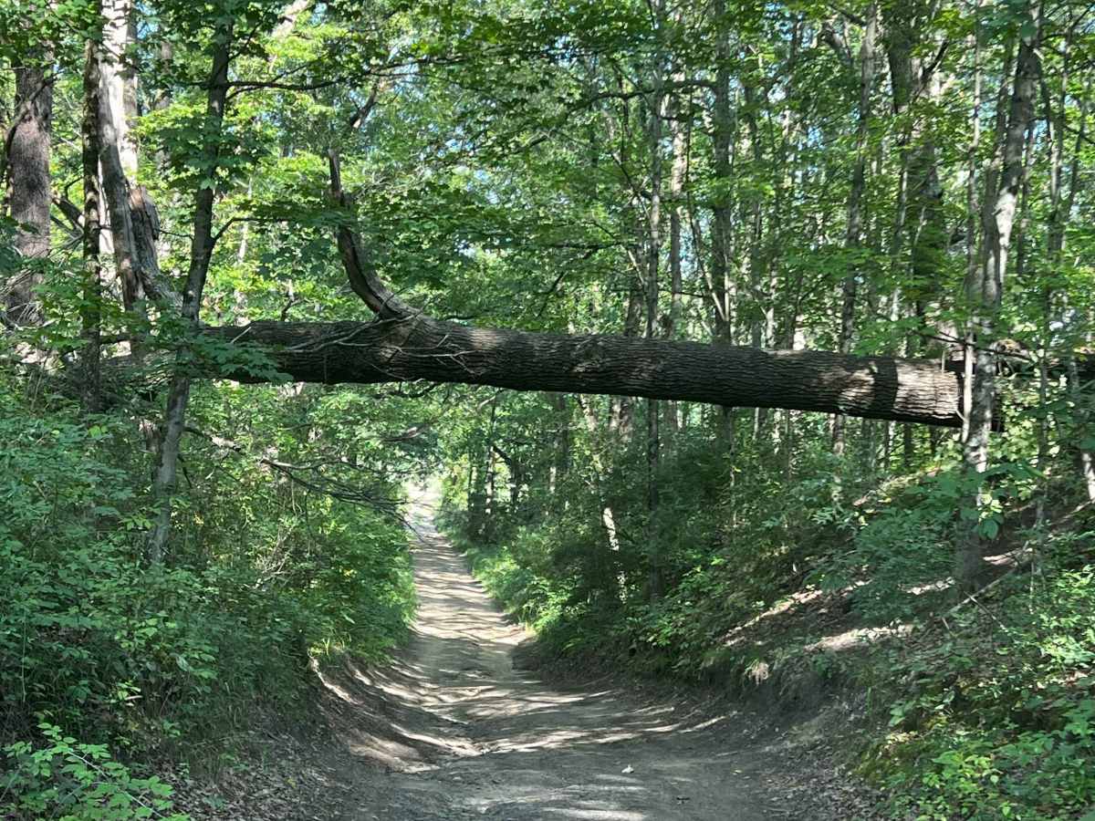
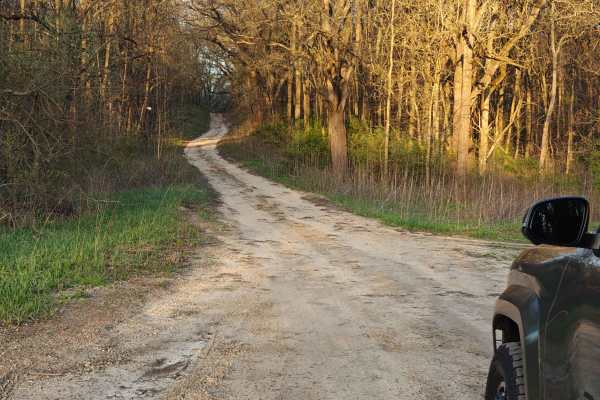
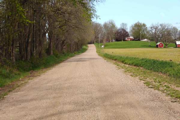
Yankee Springs Loop

Total Miles 20.1
Technical Rating
4 Moderate
Best Time Fall, Summer
Trail Type Full-Width Road
Accessible By
Open Trail Map

Trail Overview

Yankee Springs Loop is a route that connects the various main trails and roads throughout the Yankee Springs State Recreation Area and the Barry State Game Area. You can also run a bunch of "off-shoot" trails from this route as well. This route is just a nice loop that connects the main trails into one continuously flowing ride. There are other activities that can be done off this route, including hiking and mountain biking. This route starts at a great spot at the gas station where you can stage up to roughly 20 vehicles. You can either start at the waypoint designated Trailhead or you can run this route in reverse and start it from the waypoint designated Finish. The trail is made up of sand, dirt, mud, gravel, and rock. The majority of the trail surface is sand, but depending on the recent weather conditions, you may encounter more mud than sand. This route is solely dependent on the recent weather as to how the conditions will be. If it's been dry in recent weeks, a 2WD car can make it through this trail with ease. The local DNR has been very good in 2023 about keeping the trails as smooth as possible and has removed a lot of the rutted areas that would have troubled any 2WD car. There are still some areas that are rutted, so please use caution. If the weather has been non-stop rain, these trails will become a mud pit. Mud holes can range from small puddles to large suction ruts that can get a Jeep on 35s stuck. Most of the time during normal conditions, the mud holes can be avoided to one side or the other, but not all of them. This is a very scenic route in the fall with the fall foliage. Be cautious in the fall during hunting season. Know the laws of when you can and cannot be on the trails in State Game Areas based on that time of year. Winter presents new challenges usually on the steep grades with ice and snow. Again, use caution based on weather conditions. These trails are really an easy stroll in a stock Jeep Wrangler or Gladiator. Weather-causing mud holes, washouts, and deep water are really the only potential concerns. Even then, a high-clearance vehicle with 4x4 should have no issue with navigating this route. There is a large rock obstacle along the trail that is optional to go over. Lastly, a great end to this route is a stop at the beautiful Dagget Lake. Stop and take a break, stretch your legs, and enjoy the water in the middle of the forest. Finish off the rest of the trail as it crosses over the North Country National Scenic Trail and ends back on the pavement. The technical rating and difficulty has been given a 4 due to the one rock obstacle, the potential deep water crossings, mud holes, sandy washes, steep grades, and the trail is only wide enough for one vehicle with places to pass.

Photos of Yankee Springs Loop

Difficulty

The technical rating and difficulty is a 4 due to the one rock obstacle, the potential deep water crossings, mud holes, sandy washes, steep grades, and the trail being only wide enough for one vehicle with places to pass. It's solely weather dependent. If in recent weeks it's been dry, this route would be rated a 2, but due to what conditions could pose for this trail, it's designated as a 4 rating.

Technical Rating

4

Status Reports

Add Status Report
Ben Dinger
Dec 28, 2025
Open
Anthony
Dec 24, 2025
Open
Was about 4 inches of ice on all trails, one of the bigger downslopes was a little sketchy because of the ice brakes were doing nothing had to just let it eat and came out fine. First time taking the zr2 off the pavement and it handled everything with ease. 4-hi most of the trip had to hit 4lo and lock in the front and rear differentials 2 times.
hunter b
Nov 22, 2025
Open
Beware the hunters
Samuel Eder
Nov 06, 2025
Open
Trail was open and washboarded. Saw a couple hikers but no other vehicles. The difficulty level was only do to some of the washouts.
bano k
Oct 29, 2025
Open
I saw one car on the trail, every trails pretty clear but the smaller ones not highlighted have cars blocking them off so stick to the main route for the most part but if you see a side trail thats clear, run it, go down to dagget lake you can get your car right by the water and theres a big circle for "fun", lots of leaves on the trails and hard to see that its very rutted, went a Lil too hard and blew up a tire on the highway after, run through first before you RUN through
Daniel Carlton
Oct 23, 2025
Open
Trail conditions were pretty wet during my visit — we had several days of rain leading up to the run. Fall colors were in full force, making the drive really scenic. There were quite a few water holes along the trail, but nothing deeper than about 6 inches. A few mild ruts here and there, but overall the trail was easy-going. I didn’t need to air down or use 4x4 at any point. Only saw a couple other trucks out there, so it was a nice, quiet ride through the woods.
Ryan Kuchenmeister
Oct 11, 2025
Open
Pretty chill trail. Scenic and relaxing drive. We aired down for comfort, but never even took it out of 2WD. Most of this trail is seasonal roads or mild 2-track. Nice drive, zero obstacles other than bumps.
Jason Hilty
Oct 03, 2025
Open
Beautiful day for a drive. The trails were clear and only passed one other vehicle. I'll be coming back for sure.
Ranger Danger Cody Sturg
Sep 20, 2025
Open
conner fong
Sep 13, 2025
Open
The “no ORV” don’t apply to cars
Michael Gannon
Sep 06, 2025
Open
The large trees that were down have been cleared. Logging in progress just off the trail.
Tonia Lancaster
Aug 14, 2025
Open
Shaw Rd still has downed trees in 2 different spots blocking off a good chunk of that trail. Otherwise the rest is open and a pretty easy ride. With all the rain lately there are lots of puddles to drive through and lots of ruts. A few sections have small washouts along the edges but if you stay in the middle you should be fine. We saw one truck that was stuck, looks like the sand had pulled him off to the side, but we were able to pass easily. (Yes he had someone on the way to help, but we did offer).
Santiago G
Jul 08, 2025
Open
Shaw Rd section is still blocked by trees. Spoke with a DNR guy I ran into who said they have a logging company coming in to remove/salvage the trees. But he doesn’t think it’ll all be cleared before the end of the summer. Said the tornadoes that went through there hit that section pretty hard. A few sections towards the end had some mild washboarding going on. And some parts are overgrown. So pinstriping is possible for full-size trucks. Other than that, fun trail. Didn’t run into a single other person while I was on it. Everything was dry of course since it hasn’t rained in a while. Easy but scenic trail overall.
Derrick B
Jun 28, 2025
Open
This trail is awesome! Stayed in 2 wheel drive pretty much the whole time. Great trails for stargazing! Especially down by the lake! A couple downed trees my chainsaw couldn’t handle. Also the Lake access is blocked off by a downed tree. The other downed tree is located on the Shaw Rd trail. The trail is completely blocked on Shaw Rd and it requires a chainsaw with over a 36in bar.
Collin Deyoung
Jun 27, 2025
Open
Shaw rd trail has a downed tree, fairly big and will require a saw if not machinery. The trail south of sager rd is unsurpassable.

Yankee Springs Loop Trail can be accessed by the following ride types:

  • High Clearance
  • Full Width

Yankee Springs Loop Map

The onX Offroad Difference

onX Offroad combines trail photos, descriptions, difficulty ratings, width restrictions, seasonality, and more in a user-friendly interface. Available on all devices, with offline access and full compatibility with CarPlay and Android Auto. Discover what you're missing today!

Open Trail Map