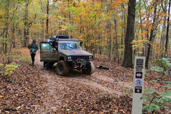
Trail Overview
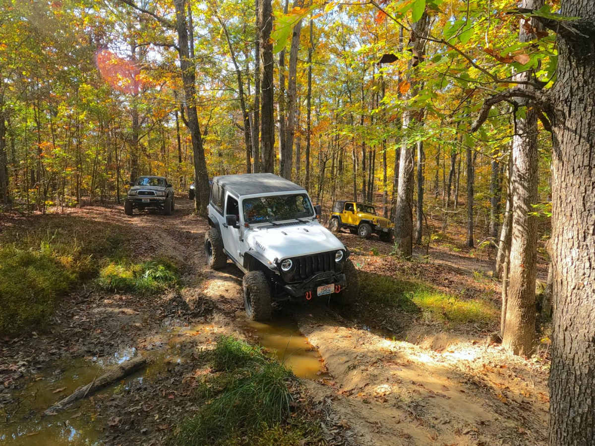
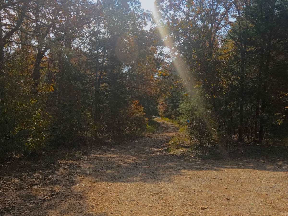
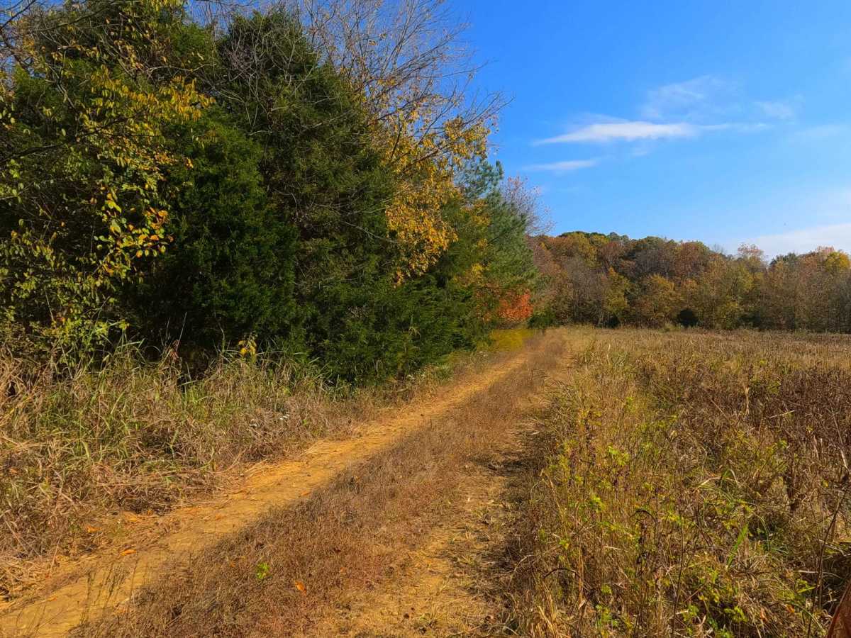
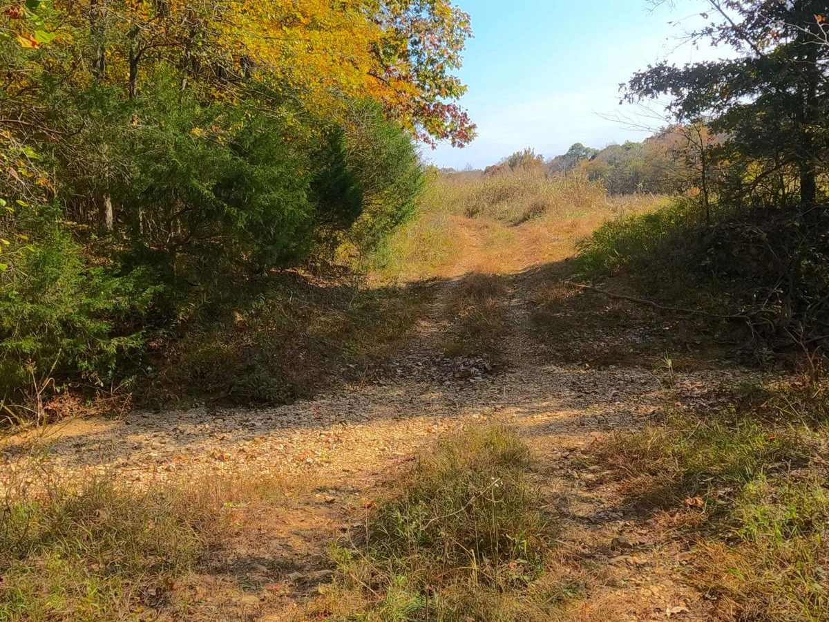
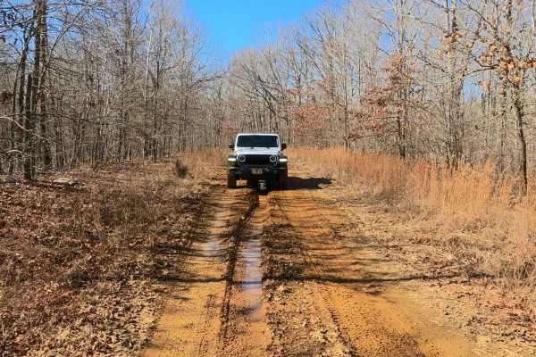
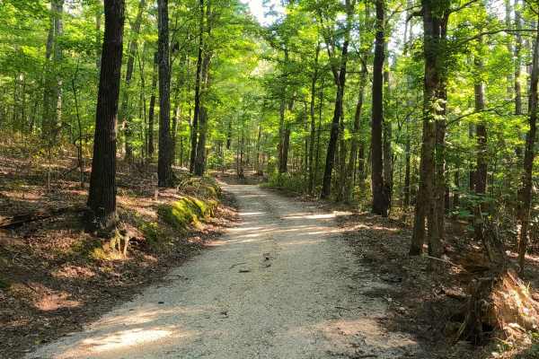
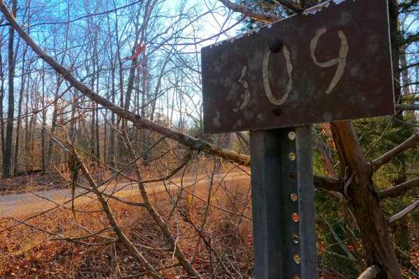
Kelsie Road FS 308 is a natural-improved forest service road through the center-west Kentucky section, Kentucky Lake side, of the Land Between the Lakes National Recreation Area. This trail connects Fulk Cemetery FS 309/Duncan Bay FS 132 and Newby Cemetery FS 130 and has an annual seasonal closure for turkey season 3/27-5/5. Kelsie Road features one of the most diverse tracks within LBL, featuring an agriculture field road, turning into the powerline trunk road, crossing creek bottoms, and witnessing scenic forest over hills and valleys with the terrain of mud, natural rock, and erosion. Perhaps the only box it does not check is going to the edge of one of the two main Lakes, but it does have the more obscure and much smaller Duncan Lake at its southern end via the FS 308A. This lake is a wildlife refuge area known for having waterfowl and bald eagles, but this area is gated from Nov 1st, November 1st,1 Mar 15th11th, and motorize 15th toss but doesn't require too much of a hike. Overall, the FS 308 is a thrilling experience within the Land Between the Lakes, even stands out in the 300 road realm, and is worth enjoying with as many friends as can be convinced to come.. but it is advised to bring at least one, with recovery gear and a winch.
Difficulty
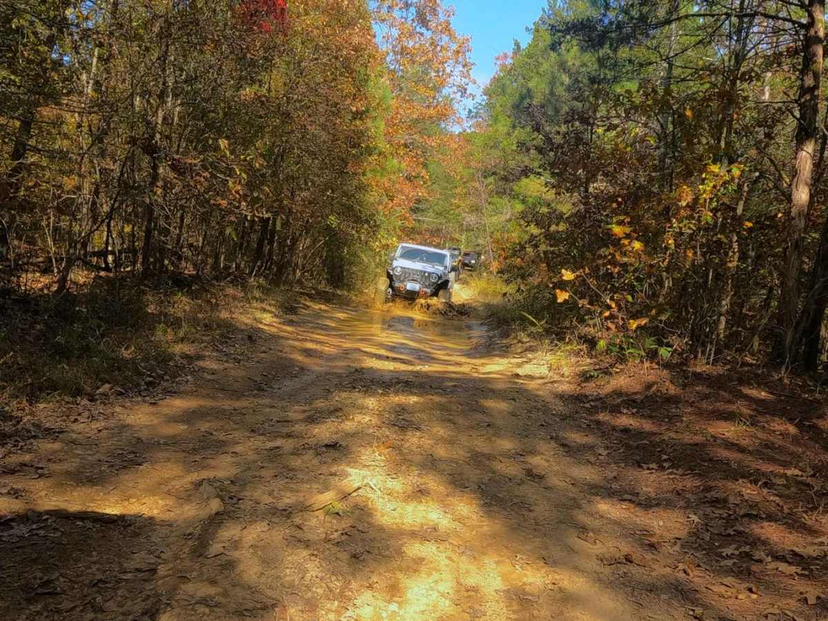
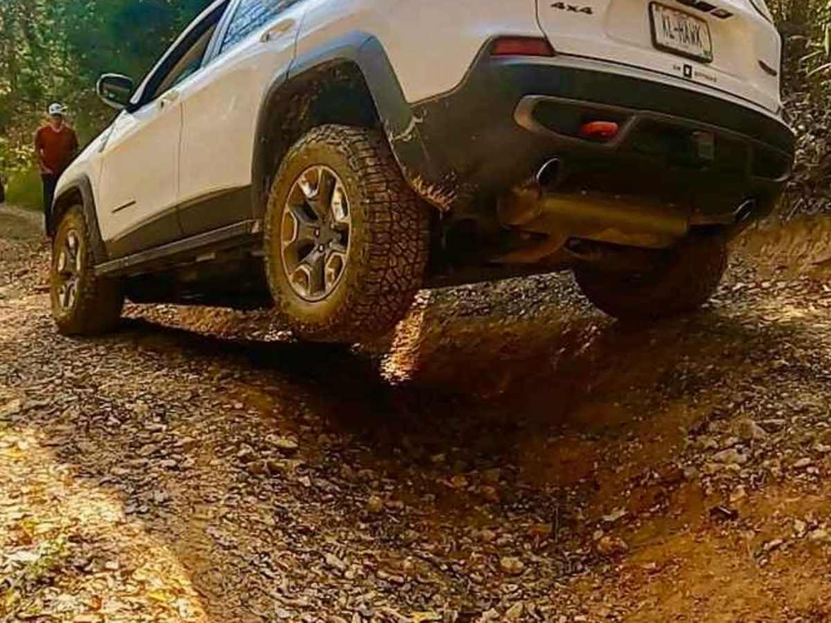
Kelsie Road is given a base rating of 5/10, featuring mild/moderate grade hills, with active erosion ranging from 1 to 3 feet at deepest, leading to moderate off-camber situations, in these areas the trail has exposed natural coarse rock mostly of large gravel to cobble size (10" and below), this erosion is on full display at the powerline cutout portion. Mid-track there is two creek crossings where loose rock creek beds are found in dry seasons, but should be assumed to have a tickle or mild depth when it is seasonally wet, or rain is in the area. In the agriculture portion of the track, valleys, and ridge tops the trail often turns completely to dirt, featuring soft-bottomed mudhole sections where the range of depth can be misleading, some holes are very deep, but are usually accompanied by a much more shallow counterpart, in the dry season when this was documented (10-2024) a 12" deep soft bottom mudhole was still mandatory to the trail but had very obvious signs that in the wet seasons range towards 18" potentially 24" when topped off with water, it is highly recommended to probe out the mudholes and determine where the best line is, check for ruts and tire width trunklines where the center mound can high-center on axles and undercarriage. Unsung difficulties, trees are tight, making the trail not ideal for full-size vehicles, but also not impossible, as the deep mudholes become mandatory. Due to the dynamics of the southeast USA rating can vary, with some wise line choices, or the trail being bone dry, there are times this trail can be run as a 4/10 but also has optional mudholes ranging in the 6/10 range or greater, and difficulty will increase in times of wet seasons. It is advised to not take on this trail alone.