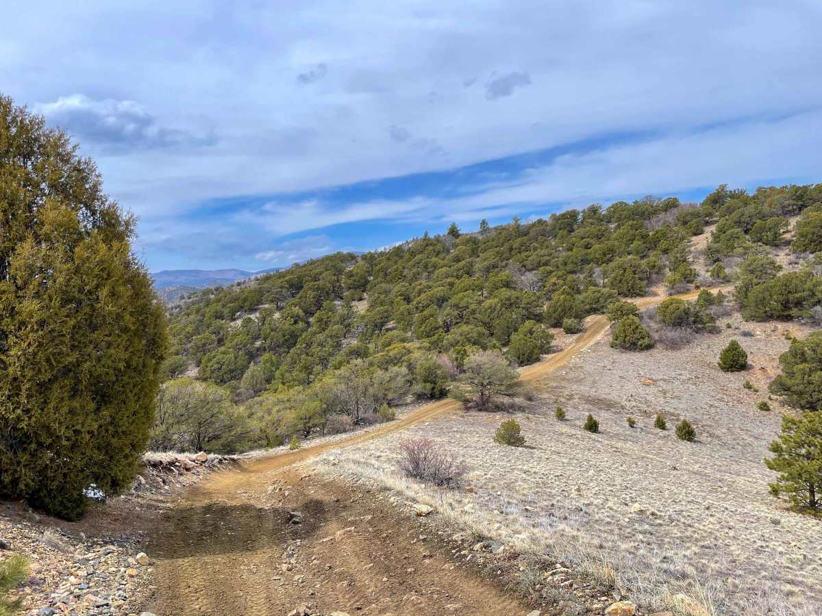
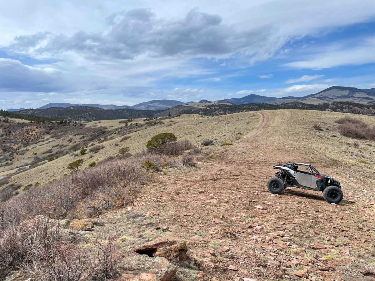
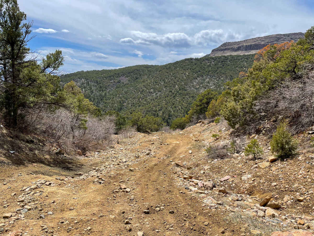
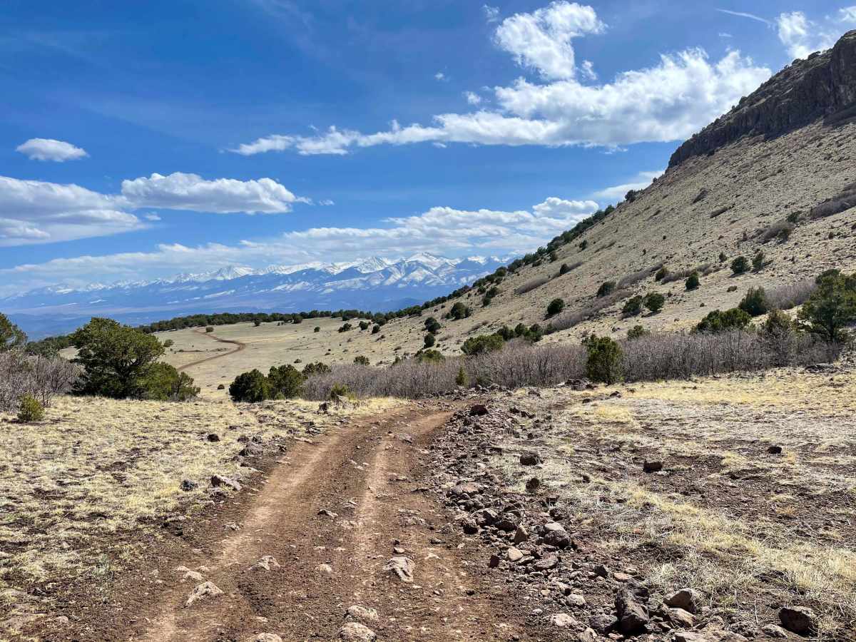
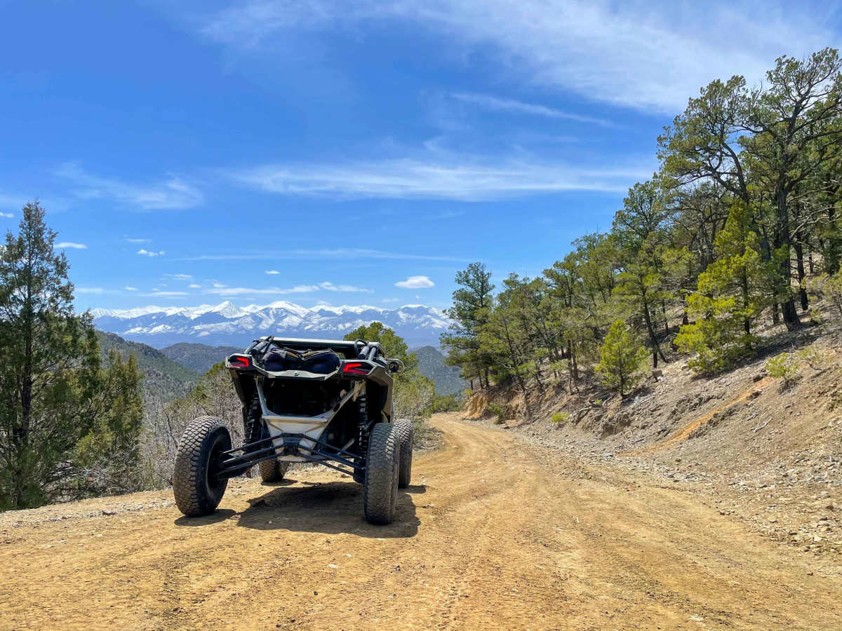
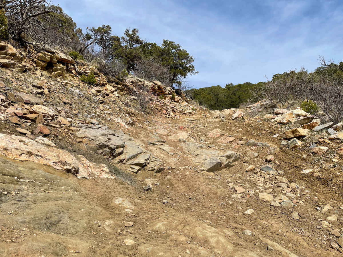
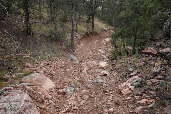
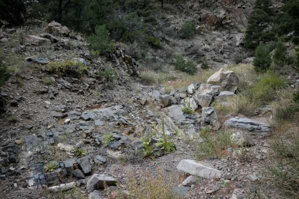
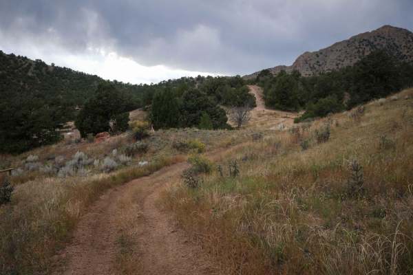
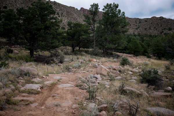
Tiger Trail

Total Miles 7.8
Technical Rating
5 Moderate
Best Time Spring, Summer, Fall
Trail Type High-Clearance 4x4 Trail
Accessible By
Open Trail Map

Trail Overview

This is a two-way trail that can only fit one vehicle for the majority but has multiple areas to pull off for passing. The trails are all marked with numbers and signs. The beginning of the trail is a rocky/dirt road with undulations and obstacles that are not difficult. After that, the trail transitions into a narrow sandy and rocky creek bed with multiple large rocks protruding into the trail. There are some off-camber areas as well. After the creek bed, there are switchbacks leading up the side of the mountain that are very rocky with big drop-offs on the side. The switchbacks have multiple pull-off areas that provide views of the surrounding mountain ranges. The top of the mountain is faster/smoother trails with isolated areas of rocky sections and one ledge/obstacle that has a bypass route. The end of the trail leads to a rocky outcrop point on the top of the mountain that overlooks the areas surrounding. In the spring, there are small areas of mud and snow spots. In the summer and fall it is mostly dry. Cellular service is spotty in some areas, but the majority of the area has no service. The closest town would be the area of the Royal Gorge and then Canon City, Colorado.

Photos of Tiger Trail

Difficulty

There are no real obstacles that a UTV cannot make, and most Jeeps/4x4s could make them as well.

Technical Rating

5

Status Reports

Add Status Report
Vern Thompson
Sep 14, 2024
Open
5 is probably way underestimated with current conditions and erosion. had to make a turn around as I didn't feel comfortable continuing in a 4x4 offroad truck.
Mick DeNudt
Aug 31, 2024
Open
narrow and bumpy...we actually aired down just to be more comfortable, not many trees for shade, the side trails are probably fun to loop out on, but the road is an out and back. Dirt bike and quads have lots of options and it's very close to Canyon City
Ken Athow
Aug 03, 2024
Open
We were going to make the loop bu turning left at the end of the trail, but its closed to 4x4 vehicles both directions, so its an out and back Nice trail, a few technical sections, including a downhill washout toward the end that you are going to have to make some difficult choices. I stuck to the wall and straddled it on the way down, but to get back up, had to put the tires in the washout and it was really close to the wall and 22-24 degrees of roll. Concerned about dropping in the ditch unintentionally and rolling it. Your mileage may vary. Very few campers, this is a nice place to spend the night and super dark.
Shane Harrison
Jul 12, 2024
Open
Called BLM I was told the Texas Creek OHV area has been open for about 2 weeks now.
Dustin Fetter
May 23, 2024
Open
The bridge to access the texas creek riding area is closed until further notice. No update on timing of the bridge repairs. The entire area is inaccessible.
Jacob Moore
Apr 22, 2024
Open
The bridge at Texas Creek is closed due to a failed inspection. You can't even get to the start of the trail. I don't know what the county's plans are for repairing the bridge.
Mick DeNudt
Mar 24, 2024
Open
bridge repair/maintenance
Barry Bonner
Mar 05, 2024
Open
Bridge is closed until further notice
Michael DeHerrera
Feb 18, 2024
Open
Very rocky in some areas along with some snow but packed down enough for it not to be an issue. Trail does start to get technical where tire placement becomes somewhat critical. Expect passing on trail, remember where you can backup we had to do this at least 3 times. After Table Mountain snow is extremely deep and in my opinion you should turn around unless you have recovery gear ready and a few rigs with you to finish the trail.
Ashley Cassidy
Sep 03, 2023
Open
Jason Parham
Jun 18, 2023
Open

Tiger Trail Trail can be accessed by the following ride types:

  • Single Track
  • 50 Inch
  • 60 Inch
  • High Clearance

Tiger Trail Map

The onX Offroad Difference

onX Offroad combines trail photos, descriptions, difficulty ratings, width restrictions, seasonality, and more in a user-friendly interface. Available on all devices, with offline access and full compatibility with CarPlay and Android Auto. Discover what you're missing today!

Open Trail Map