Randy Hattesohl
Jul 18, 2026
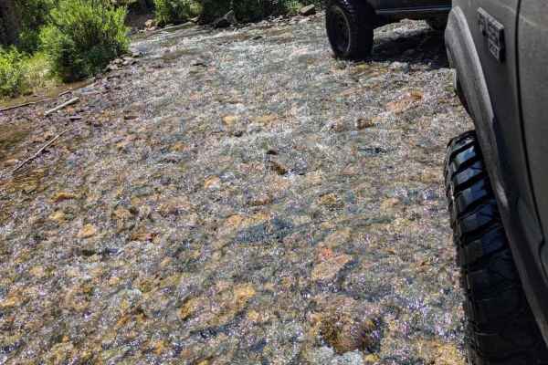
2023 Jeep Wrangler
Open
NormalDusty
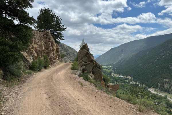
The trail was easy to navigate. We took our time and made it to the turnoff for Cascade Creek in about 2 hours. There were some large boulders to drive around and some other areas with washouts. Very scenic. Just don’t take yours eyes off the path while you’re moving.
Terry Smith
Jun 09, 2026
Open
NormalDustyRough/Deteriorated
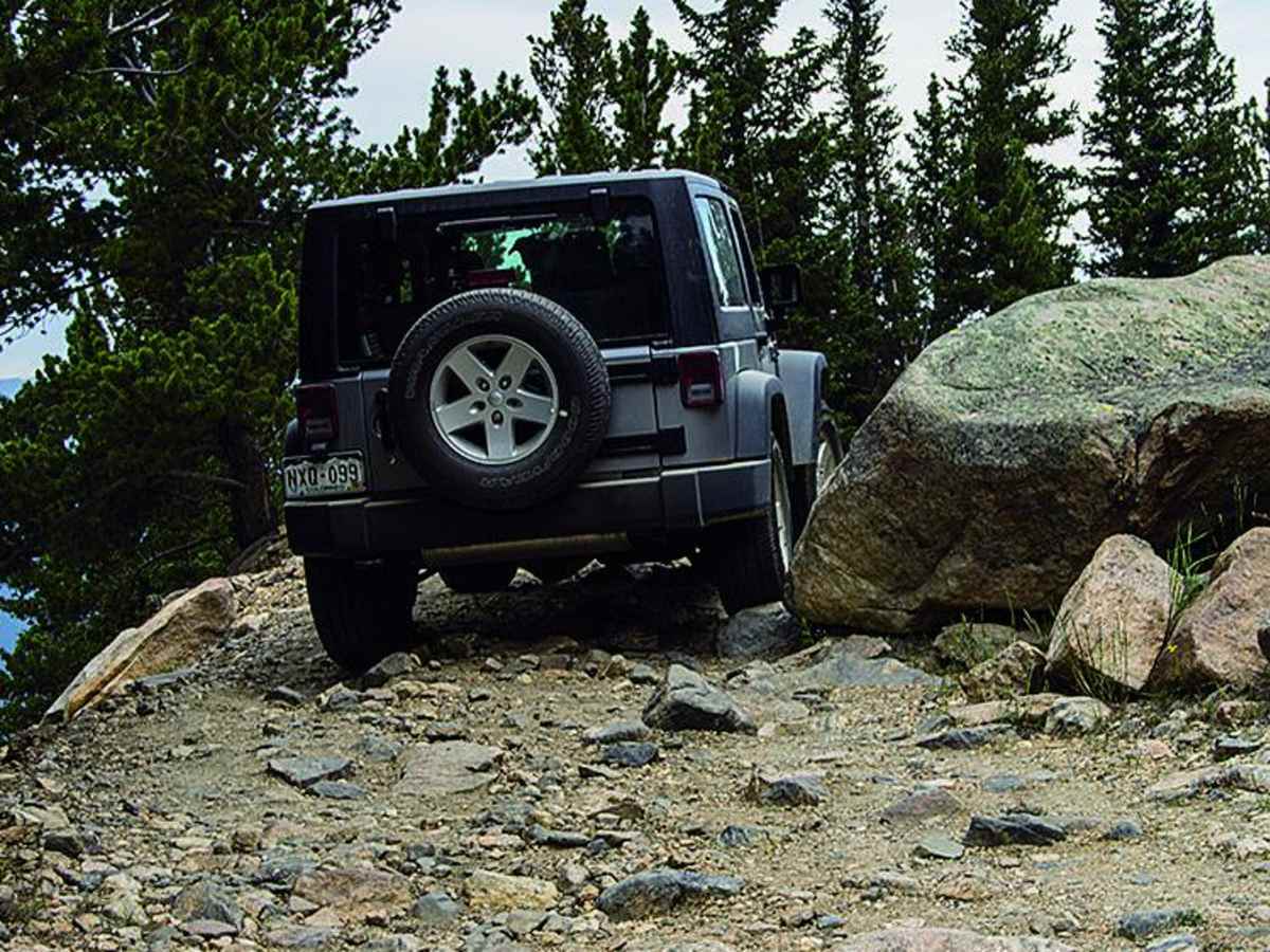
Mostly rockcrawling. Beautiful at the top
Matt Williams
Jun 06, 2026
2024 Kawasaki Teryx KRX4 1000
Open
Normal
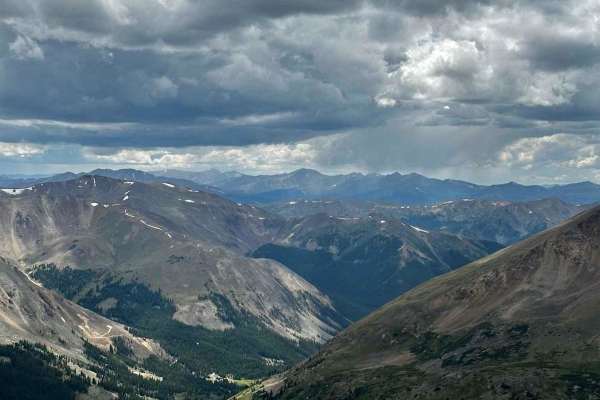
Probably one of the best views out of any trail we’ve done so far
Chad
Jun 05, 2026
2023 Jeep Gladiator
Open
Normal
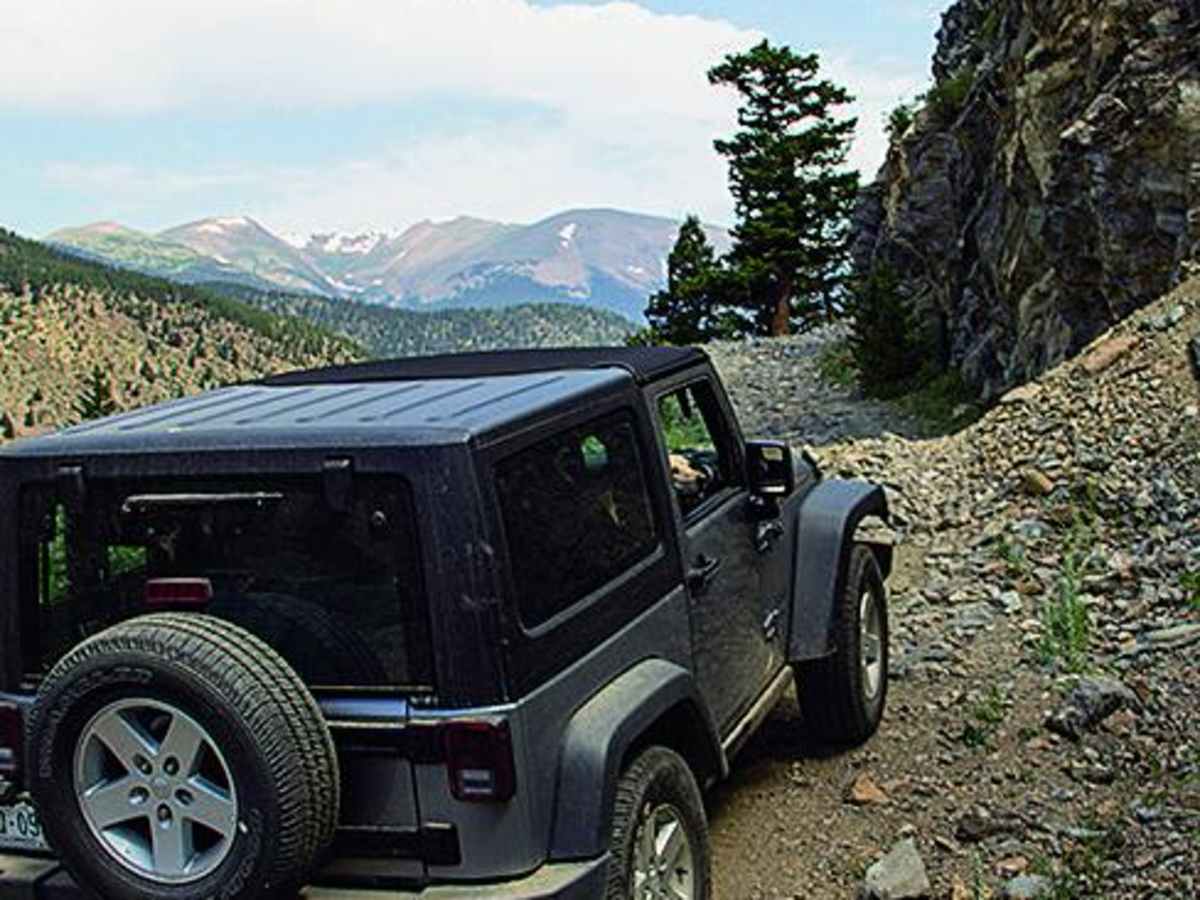
The trail is more challenging towards the top. If you don't like the beginning, find a place to turn around. A couple of the obstacles are tight and could be difficult in a full size truck.
Nicholas Young
Apr 18, 2026
2002 Toyota Tundra
Open
NormalMuddy/WetSnow/Ice
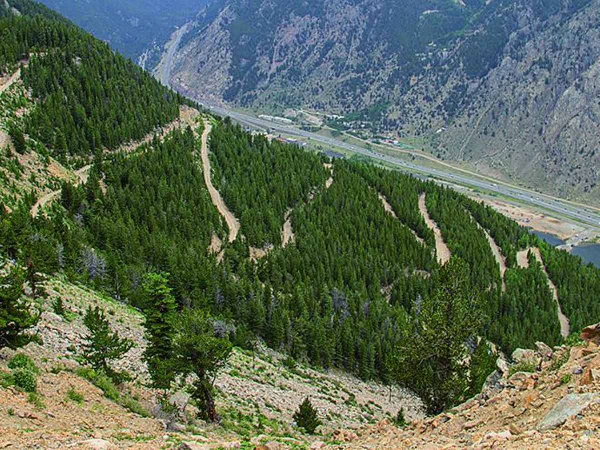
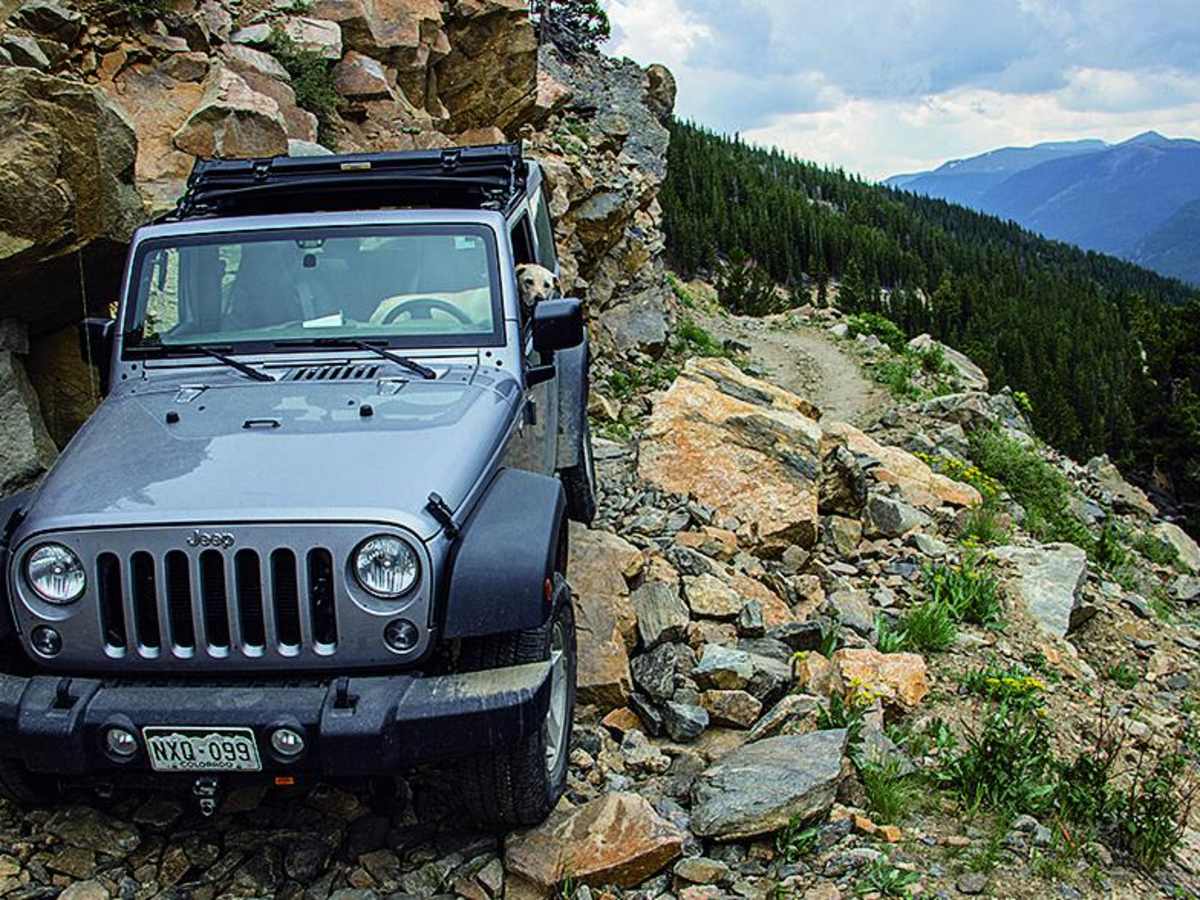
First time doing the trail but was able to get up it no problem. The switchbacks are crazy once you get up higher if youre starting in Georgetown since the driver side is facing the drop off most the time. The higher we went the more snow we found but it wasn't much. Take it easy going up and get some cool pictures
Jesse Lawrence
Mar 29, 2026
Open
Snow/IceRough/Deteriorated
pretty rocky requiring to be mindful of which line you pick. definitely some pretty sketchy areas, especially near the top with a rock overhang on the right side of the trail going up, right after a spot where you need to stay on the right to climb/roll up a 2ish foot rock that tilts you towards the edge of a cliff. This trail made me question my life choices at that point but definitely gave me a good adrenaline rush as I had to keep going due to not being able to turn around. Took cascade creek back down because there was no way i was going back down that trail.
Devon Whiteman
Mar 28, 2026
1992 Ford Explorer
Open
Normal
Turned around at the 12th switchback due to time restraints. No snow on trail. Very rough/rocky trail but not very challenging technically with some ground clearance. Would recommend airing down.
Austin McBride
Nov 28, 2025
2016 Jeep Wrangler
Open
Normal
Trail was in good condition, do major washouts or slides.
Justin Sierra
Nov 15, 2025
Obstructed
Broken Down Vehicle
My jeep is broken down on to of the mountain
Ian Boyd
Sep 22, 2025
Open
Trail open -- beautiful fall color. Lots of rocks. Switchbacks tough for a longer wheelbase vehicle, but still navigable. Managed in a nearly stock long bed Colorado. Knocked the skidplate a few times, but this trail had nothing too crazy.
Logan Kerns
Aug 07, 2025
Open
NormalRough/Deteriorated
This trail is almost entirely a rock garden. None of it is especially difficult but there are a few spots in which landslides have increased the exposure considerably. I did this in a lifted 4runner on 32s and I scraped/hit my skid plates a few times. I wouldn’t want to take anything with a longer wheelbase than my vehicle. Overall, I did not particularly enjoy this trail.
Ryan Hubbard
Aug 07, 2025
2014 Toyota FJ Cruiser
Open
NormalRough/Deteriorated
Fairly easy trail. Had no issues in my FJ on 33s. The landslides were the most technical part, but were easily passable. Anything longer than a 4Runner would have issues on the switchbacks. Be prepared for hours of rocks.
A F
Jul 10, 2025
2023 Toyota Tacoma
Open
I just did this in a stock 2023 Tacoma Sport in 4lo. This is a trail that will remind you why it is called the ROCKY mountains!! 2.5 miles in there is 1 of 2 landslides that have been cleared but still require you to cross a narrow shelf that tilts you about 15-20 degrees down the mountain. There are 2-3 few other large rocks that require a tight flatter shelf road. or technical line. At the very top of the switchbacks there is a milder landslide/tilted shelf road, and then its pretty groovy to the top.
I took Cascade Creek back down due to an afternoon storm which provied to be significantly more technical wit hlarger rock objects
Kirk Thompson
Jul 06, 2025
2023 Ford Bronco
Open
DustyRough/Deteriorated
Are you ready to rock and roll!!?? But seriously trail is really narrow at spots and just a rock garden the whole way. I didn’t find it particularly enjoyable. Great views of Georgetown lake on the way up and great views at the top. You can however get the views at the top by taking a cascade creek and cutting over which is what I highly suggest.
Ben Gehret
Jun 30, 2025
Open
NormalRough/Deteriorated
Great views at the top. Well worth the effort. The rating of 4 is warranted, but the estimated time to complete is way off. I’m in a Bronco Raptor, and it took me 3 hours total to get to the summit and return, and I wasn’t going slow.