Usal Road (Southern Portion)

Total Miles 6.2
Technical Rating
2 Easy
Best Time Spring, Summer, Fall, Winter
Trail Type Full-Width Road
Accessible By
Open Trail Map

Trail Overview

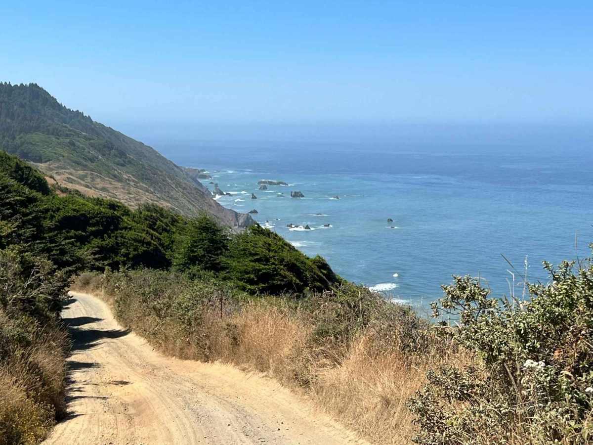
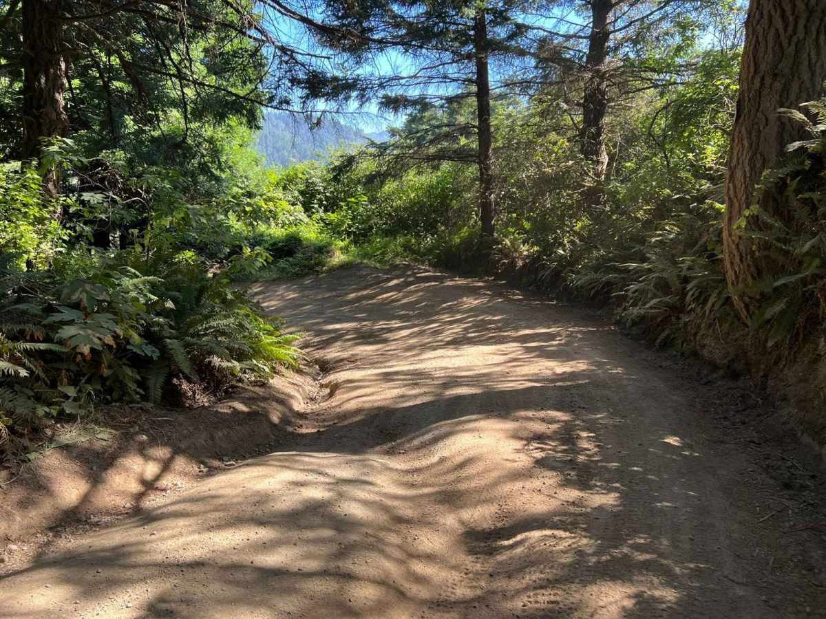
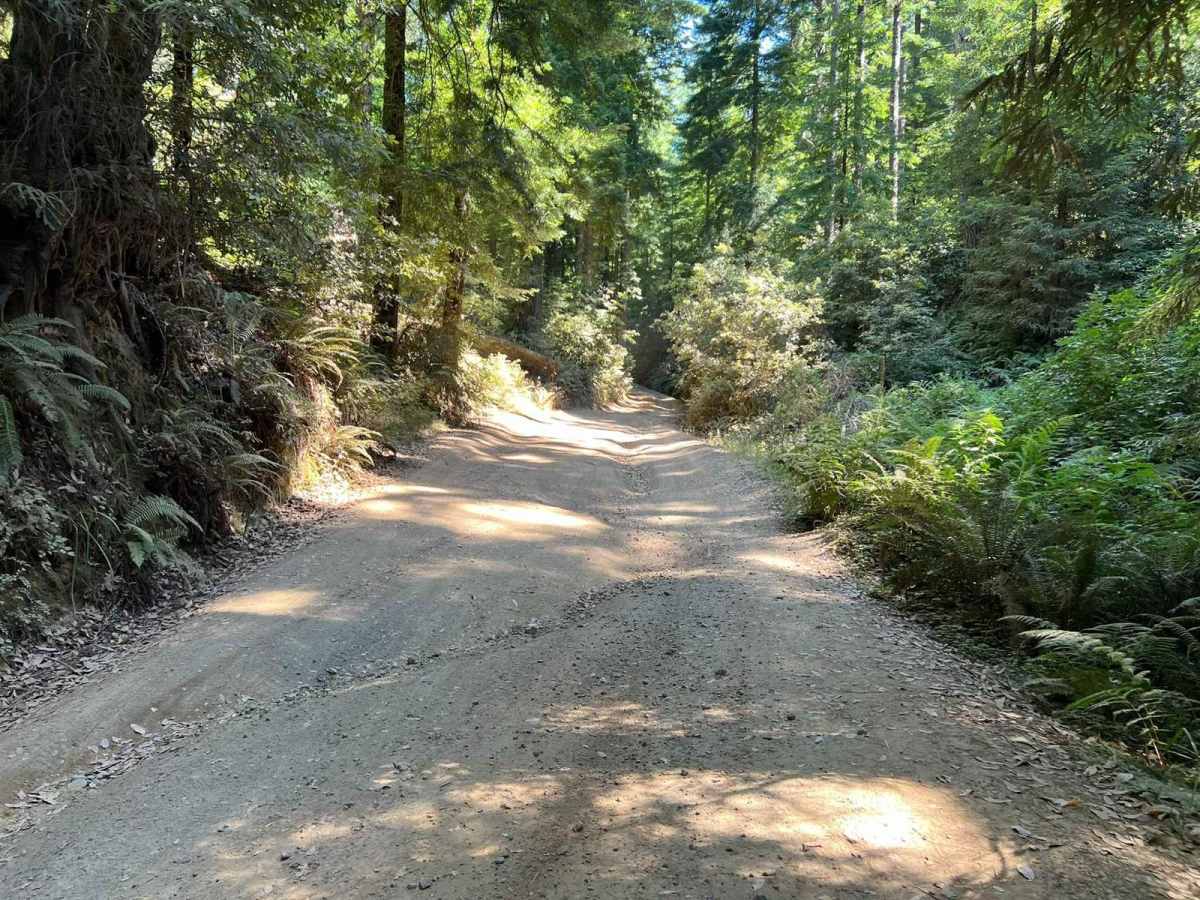
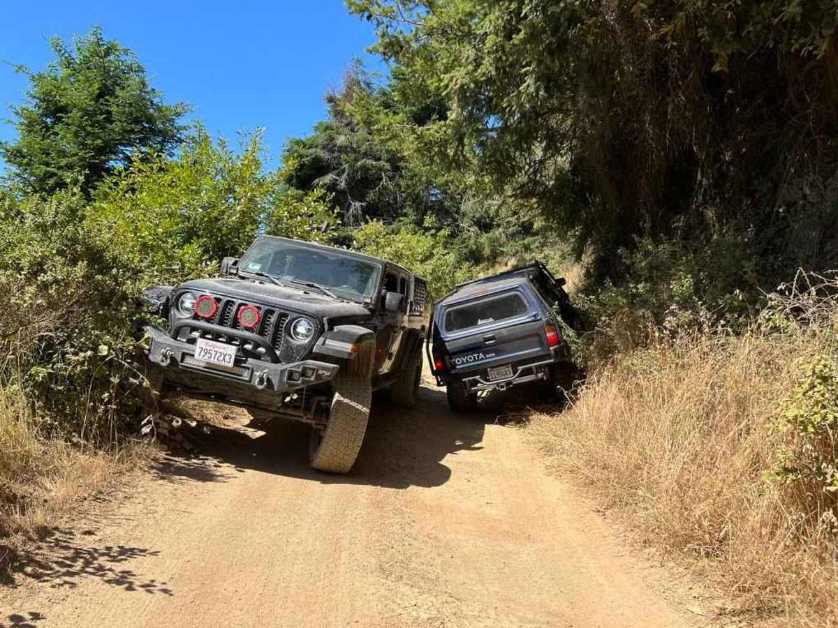
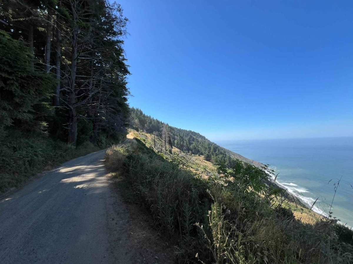
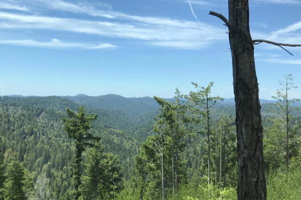
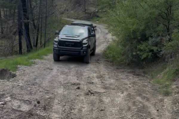
This is a steep one-lane dirt road that is not very heavily used and is reasonably well maintained by the county. On about sixty percent of the trail, two rigs can slowly and carefully pass by each other, thirty percent will require one of the two rigs to move out of the way and the rest will require someone backing up and working it out. Trailers are not recommended but small off-road trailers can make it just fine. Expect to find rutted-out conditions in the steeper sections of the forested area but nothing too severe. In dry conditions, sedans can make it. When it rains mud turns some sections into a bit of a slip-and-slide. You may encounter sizable muddy puddles six or more inches deep. Check to make sure the weather conditions are appropriate for your rig. After crossing a two-track wooden bridge over the Usal Creek turn left. There are numerous campsites in the forested area that provide shelter from the elements. Continue to the beach itself where you can camp on the sand facing the open ocean. Camping and driving on the beach south of Usal Creek is prohibited. There is a very rudimentary outhouse, you should bring your own solution. There is no potable water, and you must pack your trash out. There is no cell phone service on eighty percent of the route. Along the route, you will see enormous coastal redwoods and/or scenic vistas of the rugged California coastline. Just before the end of the route, by the Usal Creek bridge is the start of the well-maintained Peter Douglas Coastal Trail. A ten-minute hike up the hill will reveal the first of the amazing "candelabra" redwood trees. Mendocino County Department of Transportation may occasionally close Usal Road in winter months for road preservation. Visit their website or call for status.

Photos of Usal Road (Southern Portion)

Difficulty

In dry conditions, you can make it in a sedan. Wet conditions make it much harder for less capable vehicles. Passenger vehicles have been known to have to extend their stay at the campground for a day after heavy rains.

History

Usal Beach Campground was historically seldomly patrolled due to its remote location, so it unfortunately became somewhat of a "free-for-all" area. Illegal activities such as fireworks, loud music into early morning hours, target practice, reckless driving on the beach, ATVs, etc. are all too common.

Technical Rating

2

Status Reports

Add Status Report
Captain Minty
Dec 29, 2025
Open
Road closed and barricaded
Derek
Nov 08, 2025
Open
Sean b
Aug 15, 2025
Open
The southern portion of usal is way more picturesque cause you are closer to the coast. It’s a dirt roads with ruts. We passed two other vehicles on a Friday between 11 AM and 1pm before we stopped at lunch at usal Beach betweenUsal Road north and usal Road south. The southern portion was our favorite and the beach area is fantastic spot for lunch.
Rick Grenadier
Aug 04, 2025
Open
Usal Rd South, in and out. Road is pretty beat up at the moment. Lots of ruts. Not tire swallowing in size as of yet. If you attempt to take a vehicle with all season tires and not sufficient clearance you will bust up plastic. When it rains it’ll be bad. Some sections are getting bad from use and rain. That’s the bad. Otherwise enjoyable little run. Not bad on traffic. Great spot but people need to be considerate or we’ll lose it. . Weather was great. Cool, not too windy. I stayed on the beach. Someone reported they were smoothing out the north road. So by the time of this writing the Cat dozer might have smoothed it out.
Kenneth Trejos
Jul 05, 2025
Open
Josh Moen
Jun 20, 2025
Open
We came across quite a few people (it was the Friday of a holiday weekend so that was to be expected), so some maneuvering was required to let each other pass. The trail was pretty washboarded, but nothing too crazy. Really enjoyable trail down to the beach.
Thomas Carpio
Jun 18, 2025
Open
Entrance is right off of Hwy, aired down to 28psi just in case. Very narrow trail with some wide spots to let someone through. beginning of trail is intimidating but once quarter mile in, I realized I’ve been to more challenging trails. Some deep ruts but my 2” lifted Honda Passport had no problem taking on. It’s more of a fun with very little to no challenge for AWD cars but definitely an easy drive for lifted 4wd.
Mitchell Tucker
Jun 17, 2025
Open
Chris paras
May 18, 2025
Open
Lee BaltimoreBaja
May 06, 2025
Open
DO NOT ATTEMPT IN A SEDAN (as suggested in description) you will not make it. Road is deteriorated. That said I only hit 2 or 3 spots that gave the Baja (7.3 clearance, AT tires) any real challenge.
Glenn Reeve
May 04, 2025
Open
Road is in a lot worse shape than usual. I got thru with a trailer, and we had multiple CRV and a forester that made it without much issues, including a 2 wheel drive truck, but caution is advised for anyone not in a 4x4
Zack Parks
Apr 12, 2025
Open
Mostly dry, a couple of small mud pits on the trail, but the trail was overall much rougher than usual.
Chris Hull
Mar 24, 2025
Open
Matthew Mangus
Mar 18, 2025
Open
wet and muddy but passable.
Ariel Jacklyn
Feb 06, 2025
Open
Muddy, water crossings, easy to navigate, not too washed out. Be aware of fallen trees! Bring a chainsaw or axe

Usal Road (Southern Portion) Trail can be accessed by the following ride types:

  • Single Track
  • High Clearance
  • Full Width

Usal Road (Southern Portion) Map

The onX Offroad Difference

onX Offroad combines trail photos, descriptions, difficulty ratings, width restrictions, seasonality, and more in a user-friendly interface. Available on all devices, with offline access and full compatibility with CarPlay and Android Auto. Discover what you're missing today!

Open Trail Map