Two Bar Ridge

Total Miles 13.4
Technical Rating
5 Moderate
Best Time Summer, Fall, Spring, Winter
Trail Type High-Clearance 4x4 Trail
Accessible By
Open Trail Map

Trail Overview

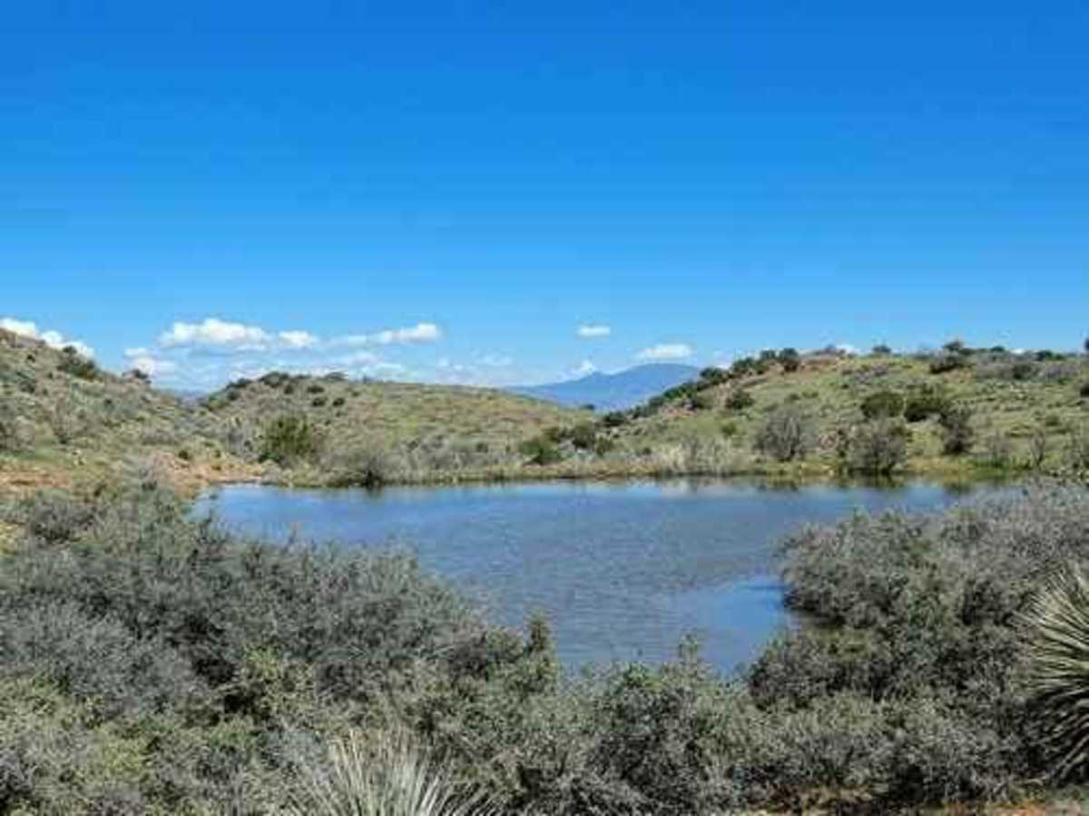
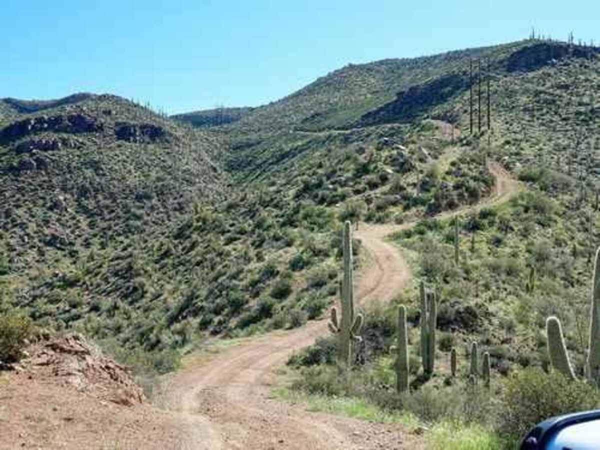
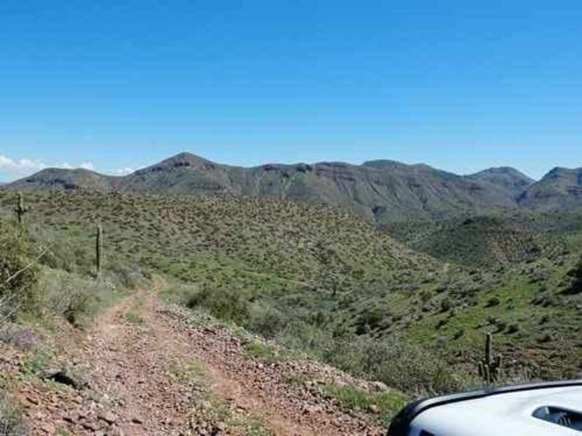
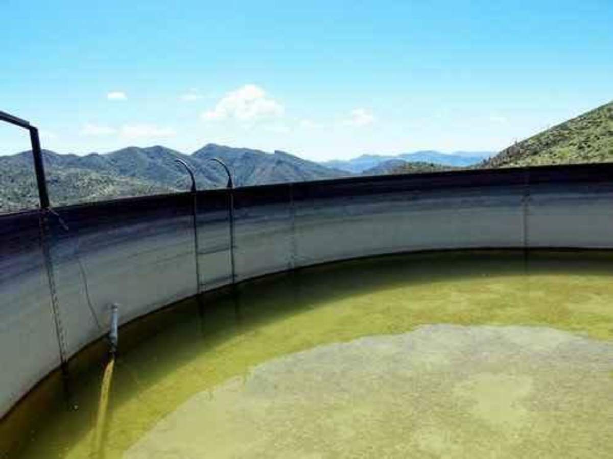
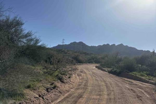
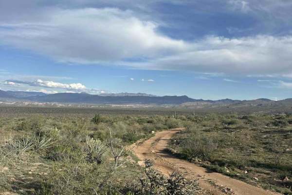
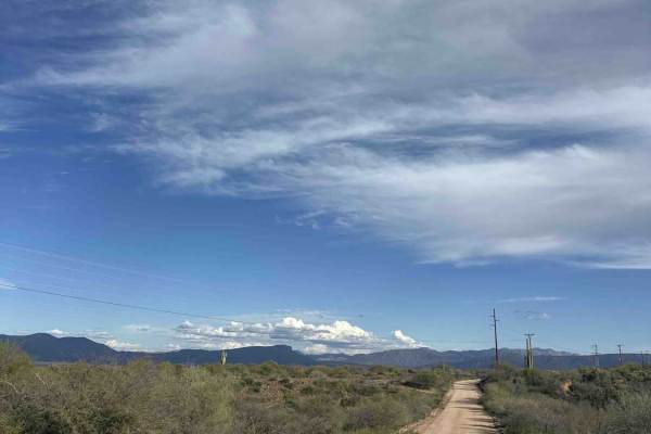
This trail boasts a crested saguaro and great views from a ridge high above Apache and Roosevelt Lakes. It's a fun trail at the north end of Apache Trail GP. This trail starts from Apache Trail near Apache Lake, climbs nearly 2,000 feet, and runs along Two Bar Ridge in the Superstition Mountains. It then drops back down to Highway 188 near Roosevelt Lake. This description details Apache Trail to Highway 188, but it can be run in either direction. Climb up to Two Bar Ridge on a road built to construct the power line. A few of the original poles are still standing. There are great views back the way you came. There is a large, wide spot part-way up that is ideal for a break or lunch--you can probably park a dozen Jeeps. There is an in-and-out spur leading south along Two Bar Ridge. This road is rockier and bumpier but still is a nice trip. There are nice views toward the Mogollon Rim from the highest point on the trail, and there is a cattle tank at the end of the spur. It is all downhill after leaving the water tank. Drop down the side of Two Bar Ridge into Cottonwood Creek and follow along it toward Roosevelt Lake. The part along Cottonwood Creek is where you will find the crested saguaro. This trail ends by running through a mobile home/RV park. If you do the trail in the other direction, you will start by driving through the park. Please close the gate.

Photos of Two Bar Ridge

Difficulty

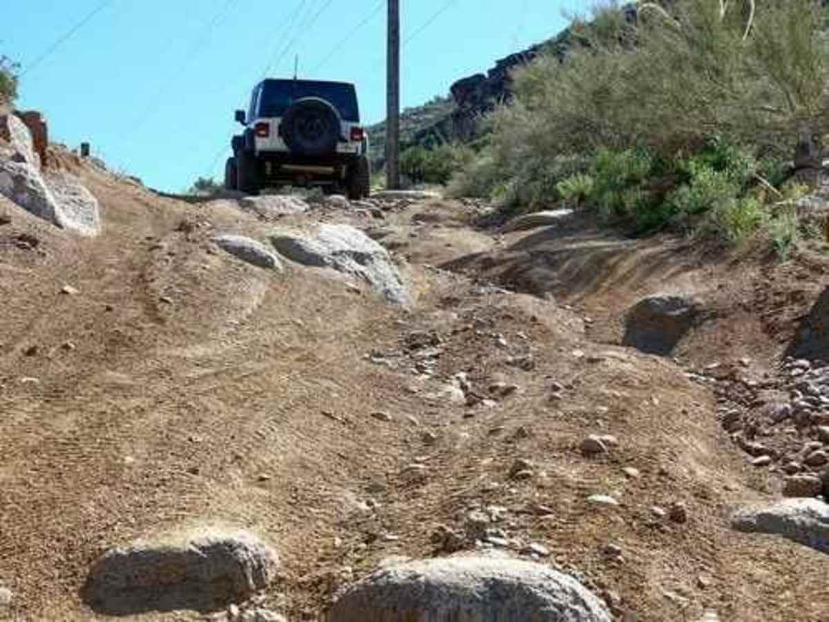
This is an uneven, rutted dirt trail with loose rocks, sand, erosion, and washes. There are potential water crossings up to 18 inches deep, mud holes, and obstacles up to 2 feet, including ledges and short, steep grades.

Technical Rating

5

Status Reports

Add Status Report
Brodie Bergeson
Dec 09, 2025
Open
What an incredible ride. I was alone and halfway through the ride to Frazier CG decided that I was a bit intimidated by the steep slopes and may be getting over my head. Turned around (kinda whimpy of me) but with limited skills and solo I didn’t want to get into some trouble. What I did accomplish was one of the best times of my life.
Tony Bonifasi
May 26, 2025
Open
The trail offers some fantastic views of Saguaro Cactus. I mean, there are THOUSANDS OF THEM!! I was not able to locate the Crested Saguaro. We started our Journey from the north. It can be taken either way safely. I would rate this as a 3. There is not one obstacle to speak of. It is just steep and loose. A Stock 4x4 will do the trick.
mohave Gladiator
May 09, 2025
Open
starts out steep with loose rocks. The road is narrow with steep shelf roads at times. only 8 miles long and took 1 1/2 hours to complete. Fairly short but very scenic views from above of the lakes.
John Beckman
Mar 01, 2025
Open
J E
Feb 09, 2025
Open
Challenging but Worth It! This off-road trail starts off steep and loose, especially around the power lines, making for an exciting and technical beginning. After passing the first gate, I had second thoughts about continuing since my rig is wider than a full-size. However, after spotting a couple of mid-sized rigs making their way up, I figured the trail could accommodate mine as well. The real highlight of this trail is the non-stop adrenaline rush from ridge line and canyon driving. The views are absolutely stunning, and the reward at the end—a breathtaking overlook of Roosevelt—is well worth the challenge. I highly recommend this trail to anyone looking for a thrilling off-road adventure with unforgettable scenery!
Ed Koegel
Sep 21, 2024
Open
Paul Orton
Apr 06, 2023
Open

Two Bar Ridge Trail can be accessed by the following ride types:

  • Single Track
  • 50 Inch
  • 60 Inch
  • High Clearance

Two Bar Ridge Map

The onX Offroad Difference

onX Offroad combines trail photos, descriptions, difficulty ratings, width restrictions, seasonality, and more in a user-friendly interface. Available on all devices, with offline access and full compatibility with CarPlay and Android Auto. Discover what you're missing today!

Open Trail Map