bespoke Outdoors
Dec 27, 2025
Open
Normal
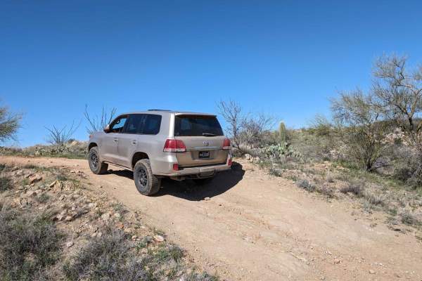
My son (3.5y/o) andI did this trail from north to south (ending at the Titan Missile Site) and it was great. Much longer than expected and very rocky. The hotel was littered with thousands on nails so be aware. The river was 3’+ deep and was at the start for us. Not a problem for me to get through but it was just a tad lower than the door line and my 2021 Rubicon is on 37’s with a full 3.5” lift (adjustable to 4.5”). Overall, the route was fun and it was amazing to see how free the desert can get and be. Took us 2.5 hours and we stopped a few times for my son to ride his balance bike. As
Paul Wilso
Dec 02, 2025
Open
Muddy/WetNormal
WARNING!!! NOT QUITE IMPASSABLE BUT NOT IMPOSSIBLE DUE TO WATER NEAR NORTHER END OF TRAIL!!! I had started the route towards the south end near the missile silo and worked my way up. Route had some ruts from previous washout, but nothing a stock 4x4 couldn't handle. I made it through the route in 2wd in a stock Colorado Zr2 (3rd Gen). Towards the end of my route, about a mile or 2 after the road smoothed out, I came upon water flowing over the roadway. Tested the waters and decided to make the plunge as the water came up to the bottom edge of my doors. Again, I am in a stock Colo Zr2 for reference.
WKND WRIR
Nov 30, 2025
1998 Jeep Cherokee
Open
NormalRough/DeterioratedWashboard
I started on the South end of the trail and worked my way around to the North end. Most of the trail was tame but some of the dried up water crossings were deteriorated. About midway through the trail I found some cattle on the road. As I moved to the Northern part of the trail I saw a few more people. Note that some abandoned buildings are used for recreational shooting, so watch out coming up on those too quickly. The river crossing at the North end of the trail was completely flooded at noon and was 3+ feet deep. My lifted ‘98 Jeep made it through but a stock vehicle likely would not. It took me about 2.5 - 3 hours to complete the loop (including time spent out of the vehicle exploring some sections on foot).
Justin burlie
Nov 27, 2025
2021 Toyota Tacoma
Open
Muddy/WetRough/Deteriorated
Trail was a bit washed out from the rain last weekend the wash was full burlie made it through.
Joe Williams
Sep 21, 2025
Open
Much easier that listed. I did the whole trail in 2HI, not an issue. Watch for animals. I thought the little guy in the picture was a rock and I almost ran over him. There are also lots of cows, and some like to lay down in the middle of the road. Nice scenery and a good way to pass an hour or so.
Aaron Herman
Apr 27, 2025
2024 Nissan Frontier
Open
DustyWashboardRough/Deteriorated
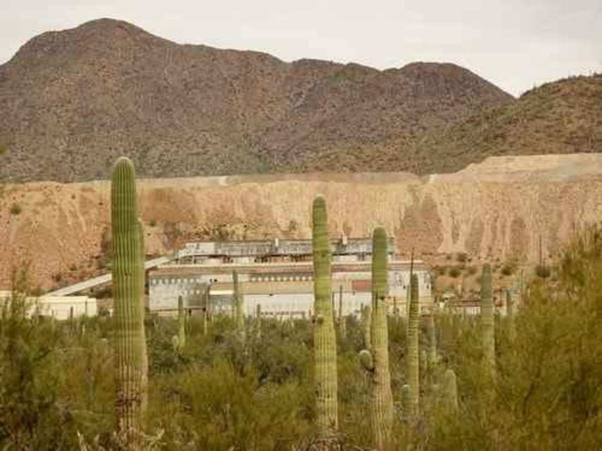
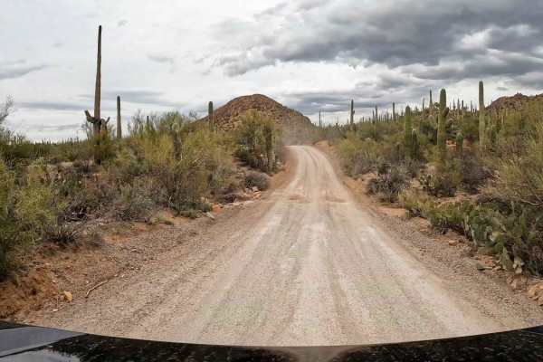
Started from the south side. The trail doesn't actually start until you reach the gates to the mine just past the Titan II stop. The first 2 miles are a washboarded red dirt/gravel road that pretty much any vehicle could get through on. The next 8 miles around the back of the mountain get pretty rough, with the worst 2 being an extremely rutted out climb out of a wash that will test your ground clearance and flex out most vehicles, followed by a 16% grade climb a little further up. After than the northern section transitions back to a dirt road with some washboard. If you want to skip the water crossing, you can turn off on Silverbell Rd and connect back to civilization that way as well, that's how I ended up going.
Dave Eisenhuth
Apr 21, 2025
2006 Jeep TJ
Open
NormalWashboard
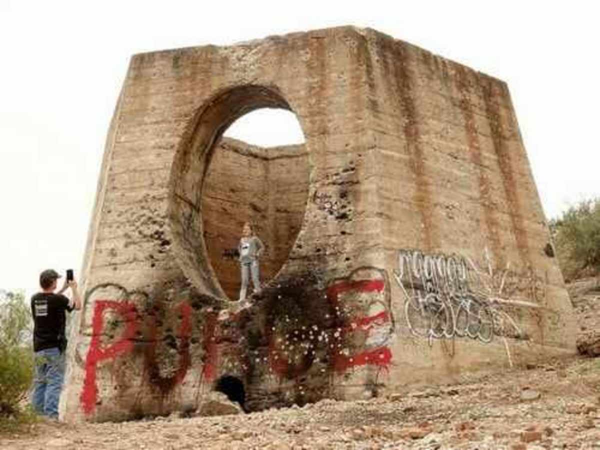
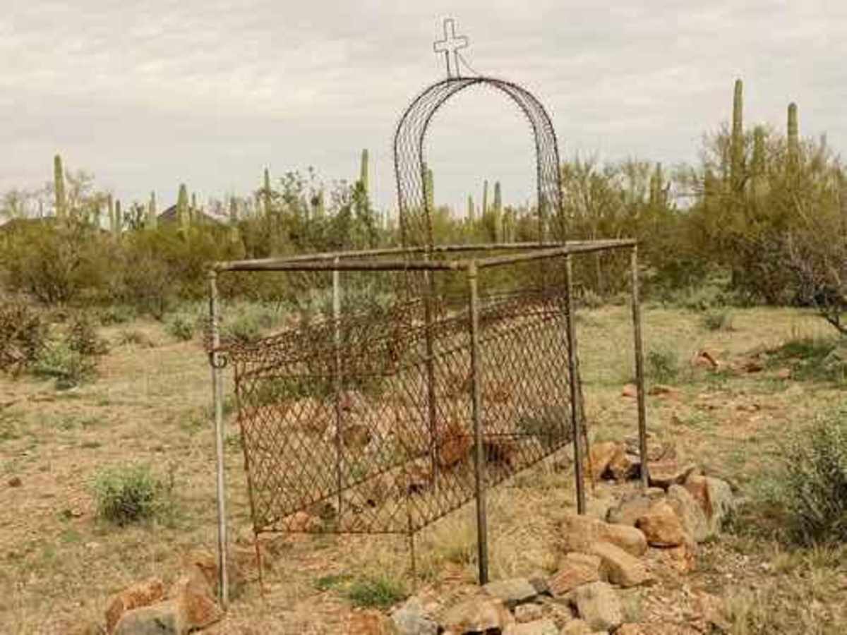
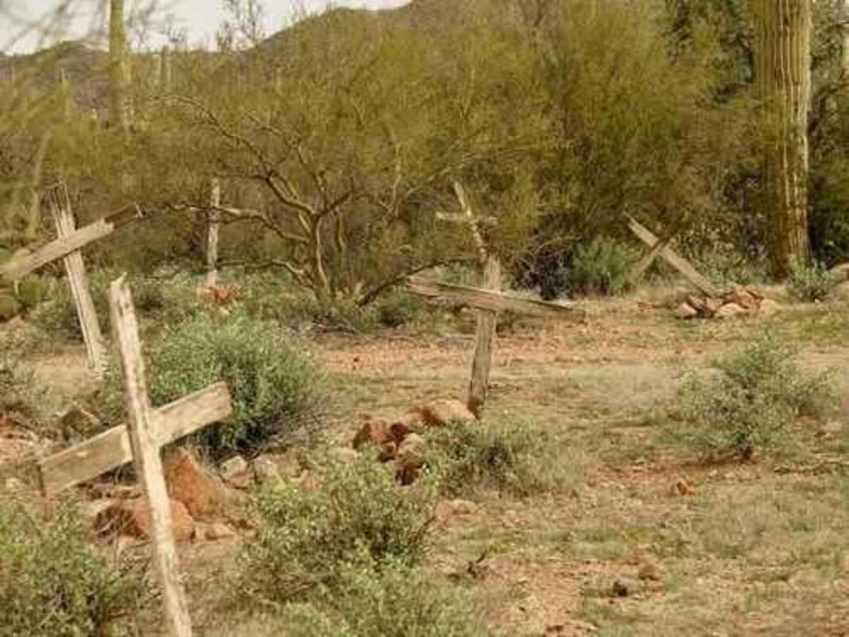
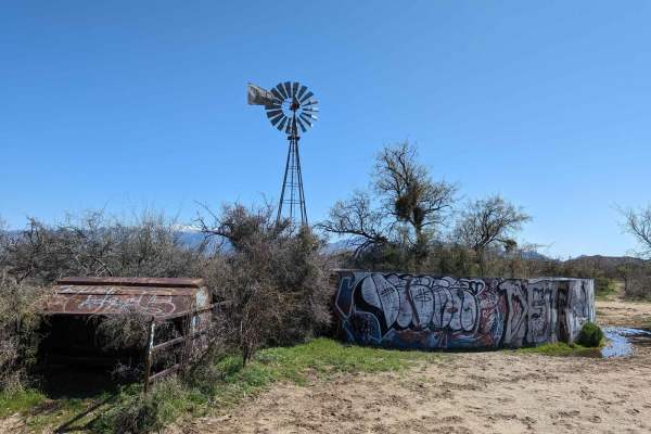
We did the trail from South to North, there was some construction as you are going up past Anway Road. A couple of nice side roots that really don’t go anywhere. I would say trail rating is pretty spot on however there a couple of technical washouts. The Titan missile interpretive center was nice however, a lot of work needs to be done on the signage but still very very cool a nice quarter mile walk around shows where everything was and if you’re a rockhound, there are plenty to look at. Further on you’ll come up to some slag piles behind Silverbell mine including a really cool feature, showing in the picture where you actually can park on top of a flat and slag pile that looks like tile.
Jimmy Billy Z
Apr 02, 2025
2006 Lexus GX
Open
Normal
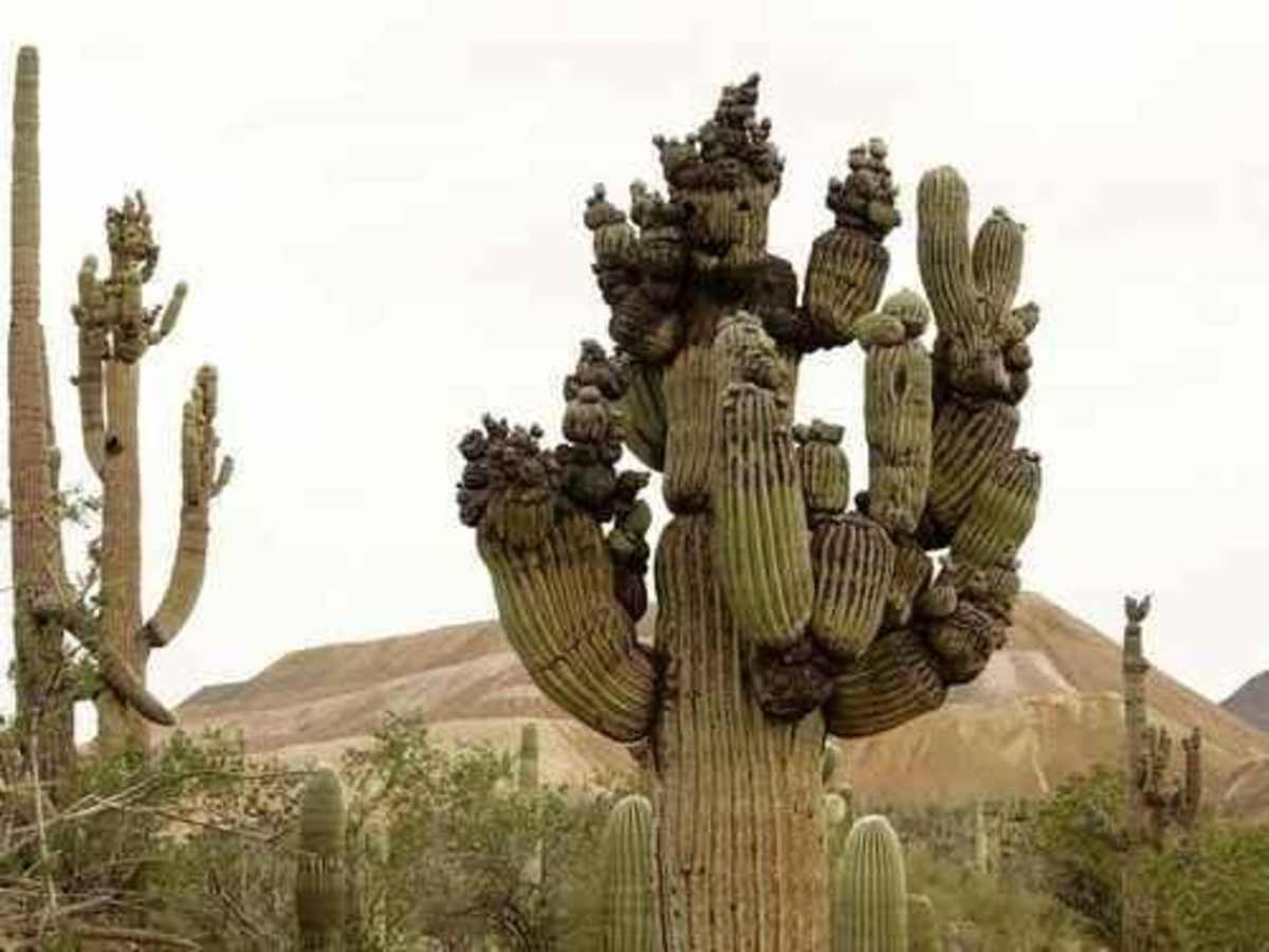
Nice trail with sights off the beaten path if you follow the spurs. We started at North entrance and the water crossing was about 12”. Most of the trail was bumpy with nice views of the mountains. On South side of the loop just East of the missile sight we saw this crazy cactus just off the South side of the road. Wish it was marked by OnX but we got lucky and a couple there told us it was a famous saguaro called the Shiva Cactus. 2wd with higher clearance can do this loop depending on water depth near North entrance. AJ from Buckin’ Life Offroad on YT has a nice video of this trail.
Robert Cox
Mar 17, 2025
2016 Subaru Outback
Open
Normal
Water at north end was passable at about 5" deep. Trail was generally in decent condition for our Subaru Outback.
brandon simon
Mar 15, 2025
2021 Ford Bronco
Open
this trail was a super fun day had a little bit of everything sight seeing....ups and downs ....straights....rock gardens...and to finish it off a creek at the end easily manageable with the broncos...although there was someone shooting when we got to one of the old structures so we couldn't see much of it
Robert Gross
Mar 08, 2025
2021 Toyota Tundra
Open
Dusty
Started with cool water crossing, then saw some ruins. A ton of cactus. Road were ok, mostly dusty, but could have been done with 2wd and competent driver.
Daniel Prince
Mar 02, 2025
Open
Kirk Thompson
Feb 20, 2025
Open
Normal
Trail is easy. Done in a bronco Sasquatch in 2 wheel drive but is very side to side bumpy so prepare to get shook. Also is definitely closer to a 3 hour trip not 1 hour.
Jason Lampitt
Jan 27, 2025
2024 Toyota Sequoia
Open
Normal
Nothing really remarkable to report about trail conditions, other than the water fording at the northeast side of the trail as described. The water was pretty deep. I didn't have any way to measure it, and we waited a while to see if any locals would cross in their vehicles so we could gauge what we were getting into. Finally, we just went for it on the right side. It got deep and I had a nice bow wave coming off of my '25 Sequoia TRD Pro. Made it across just fine, but it was DEEP.
Scott Brown
Jan 17, 2025
Open
Easy trail for non sasquatch badlands 4 door. Never left 2wd. Easy water crossing on north end 12 to 18 inches max. Took about 2 1/2 hours south to north once pavement ended. Deer and cows seen.