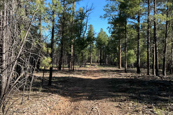
Rim Road West

Total Miles 43.4
Technical Rating
1 Easy
Best Time Spring, Summer, Fall
Trail Type Full-Width Road
Accessible By
Open Trail Map

Trail Overview

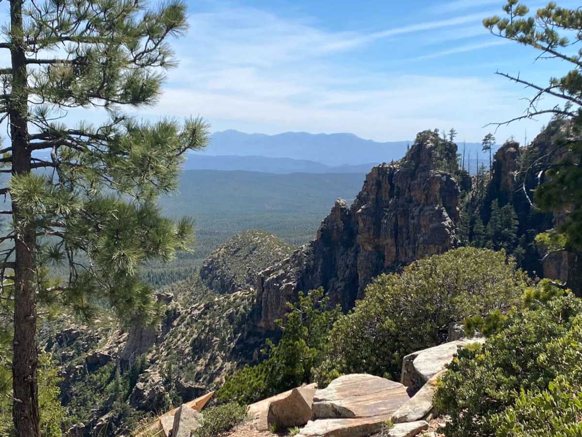
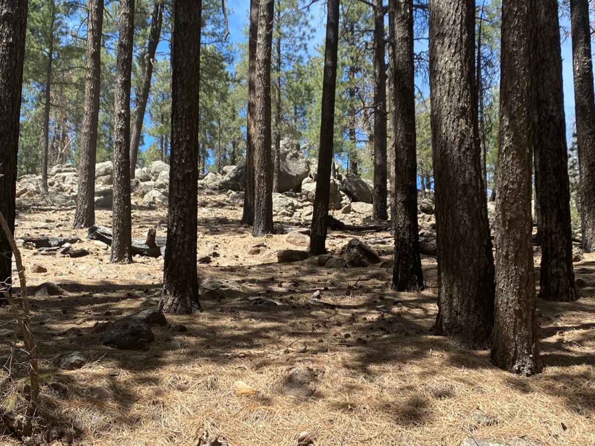
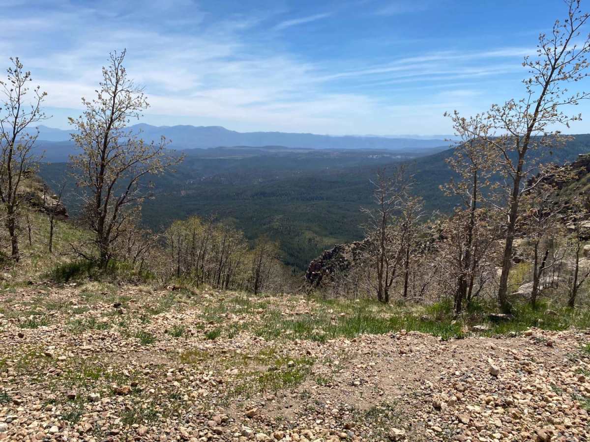
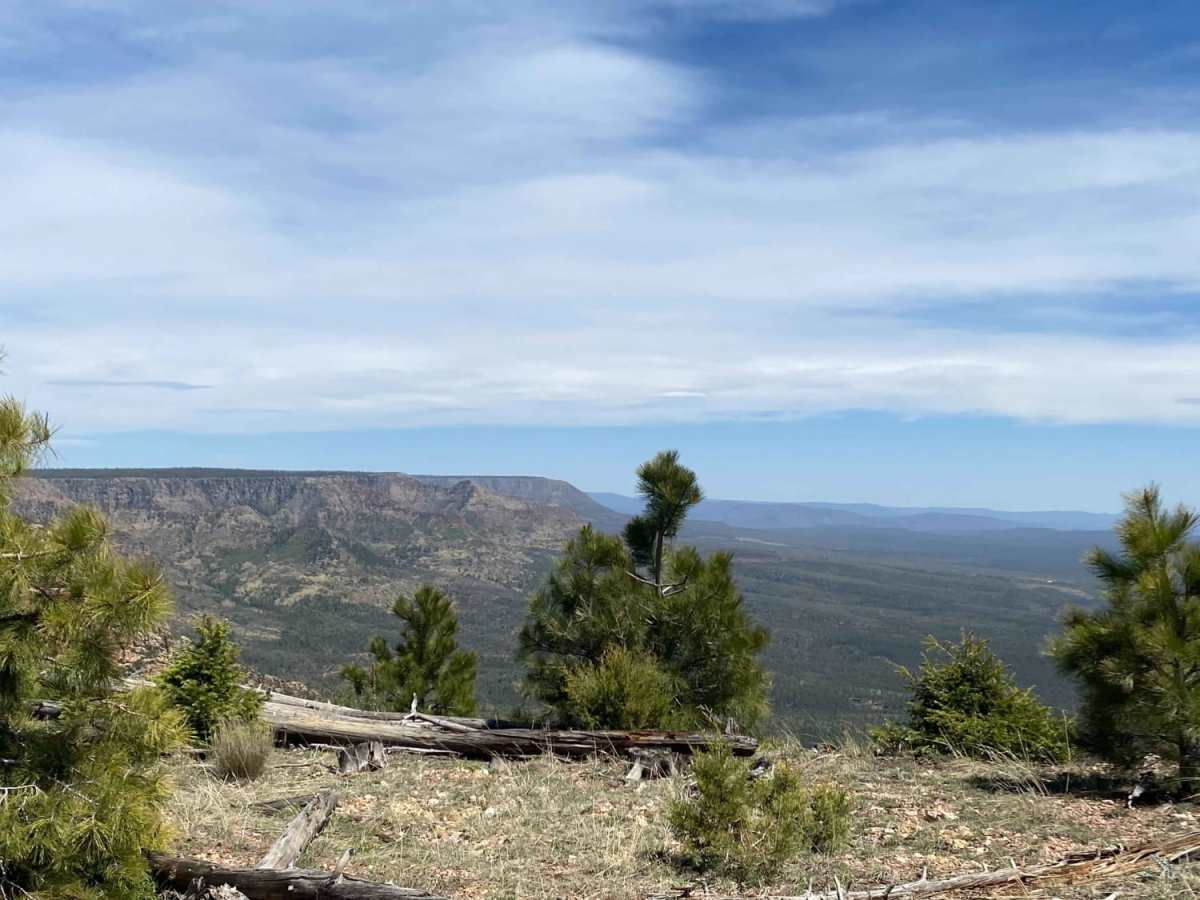
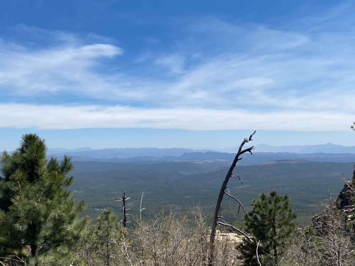
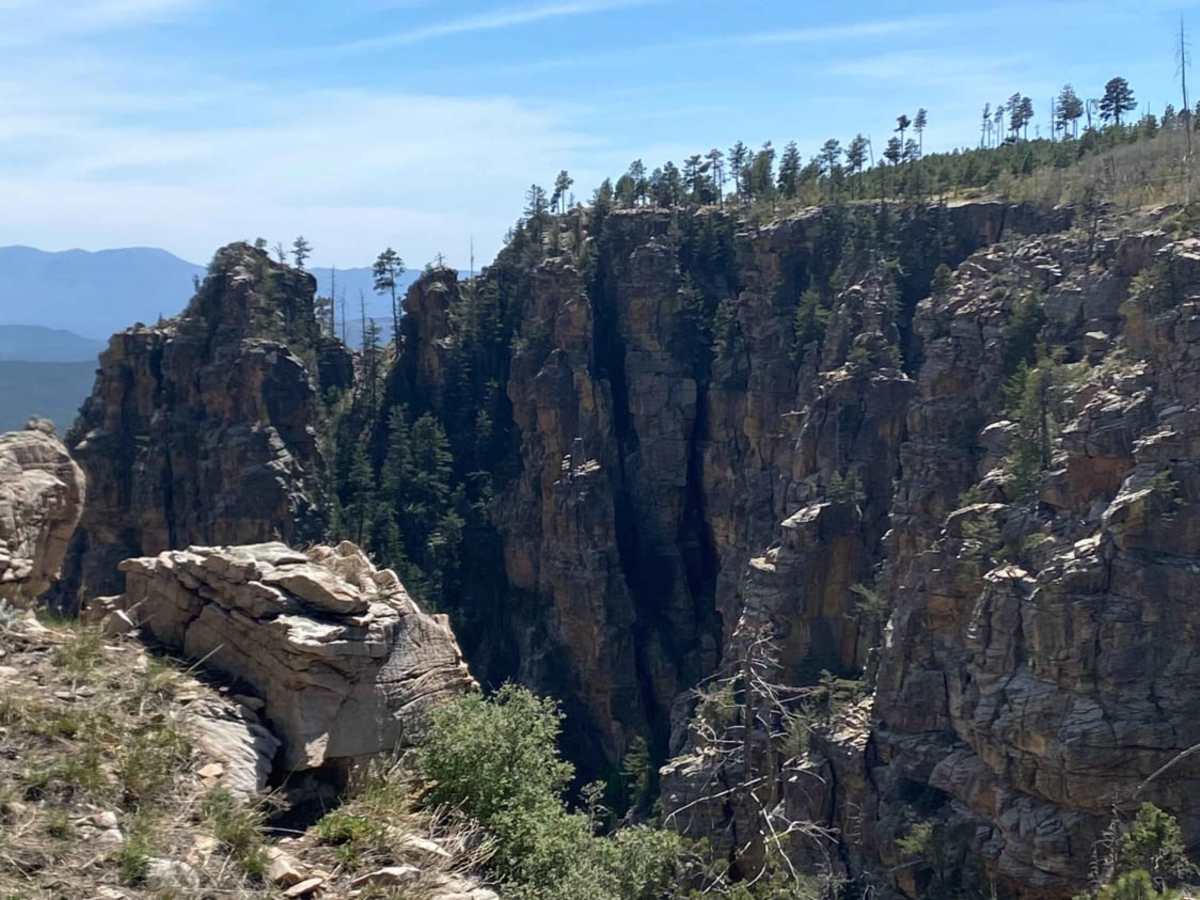
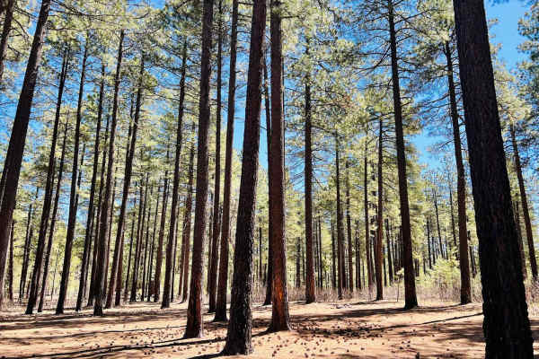
Epic vistas and endless possibilities! This trail offers little to no technical challenge but makes up for this with some of the most amazing views in the state. This is a great route for beginners and those with 2WD vehicles. Experienced drivers will find adventure here as well by adding in side routes of varying technicality. Wildlife is abundant in the area, so keep your binoculars or camera at the ready. Take your time stopping at numerous vista points along the rim or stray off the trail and explore the miles and miles of forest roads. The Mogollon Rim is truly a nature lover's playground and makes for an amazing weekend adventure. Enjoy!

Photos of Rim Road West

Difficulty

Rim Road is a graded gravel full-width road suitable for most vehicles. Side route forest roads will likely require high clearance and are typically a 2 in technical rating. There are some blind curves with two-way traffic so approach these areas slowly and carefully.

History

One of the most striking geologic features in Arizona is the Mogollon Rim. This steep escarpment, measured in thousands of feet and hundreds of miles, begins just across the border in New Mexico and stretches diagonally two thirds of the way across Arizona. As such, it forms the southern edge of the Colorado Plateau and stands as one of the most impressive overlooks in the Grand Canyon State.That precipitous drop-off is the star of this scenic drive, part of which traces the rim's edge across the Coconino. In so doing, it follows another feature of interest, the General Crook Trail which the famous Indian fighter blazed to his stronghold at Fort Apache.When you're not on the rim, you'll still find much to see along this drive, as it winds through a forest well populated with wildlife and gives you a taste of canyon country in scenic East Clear Creek and Barbershop canyons.Description found at: https://www.fs.usda.gov/recarea/coconino/recreation/scenicdrivinginfo/recarea/?recid=75019&actid=105

Technical Rating

1

Status Reports

Add Status Report
Conrad Tanasy
Oct 19, 2025
Open
Trails very nice some parts need 4x4 but other then that it is very gorgeous and amazing trail
Philip Turner
Oct 06, 2025
Open
Jack Fineberg
Sep 13, 2025
Open
majority of the road is a 1/10. in the middle there are a handful of sections that would be a 2/10 solely due to ground clearance. any stock SUV/crossover will be fine. you could probably do it in a sedan with careful tire placement, but i wouldn’t want to. heading from the west to east, the road significantly improves once you hit the ASNF boundary. the CNF portion is excellent in the west, but not so good in the east (which is the middle of the overall drive). also, the ASNF recreation areas are much more populated.
Scott Moser
Jul 29, 2025
Open
Devin Bryce
Jun 30, 2025
Open
Road is super well maintained and can easily be done by a 2wd vehicle in clear weather. Passed an active fire that was being controlled by local Hot Shot crews with no road closure. Saw at least one herd of Elk.
Landon Rainey
Apr 08, 2025
Open
Rim Road West is now paved, a few campsites were closed due to the muddy conditions from the recent snow melt.
Garrett Crane
Mar 29, 2025
Open
The road is closed until May, according to a notice on the road closure. Can still access Woods Canyon Lake.
Anthony
Mar 22, 2025
Open
No clear reason why but gate is closed as of today.
Nick Fink
Mar 15, 2025
Open
Trail is closed due to snow
Topher Dorsten
Feb 15, 2025
Open
Andrew Wachtel
Dec 15, 2024
Open
Heading east from SR 87. Coconino County Sheriff turned us around ~7 miles east of the Knoll Lake turnoff due to the Horton Fire. No expected reopening date at this time.
Bob Cusick
Nov 11, 2024
Open
The road was recently scrapped and was in good shape. The only challenge was logging trucks (18 wheel semi trucks) on the 87 side. The road is narrow in places and has blind hills and turns - just the care. BEAUTIFUL drive!
Alex Garza
Aug 17, 2024
Open
No longer a dirt road, was recently paved. We went to bear canyon lake but the tarmac kept going so I don’t know how far it goes but they are still working on it.
Larry Melanson
Jun 13, 2024
Open
Dusty but not bad with light traffic. Wouldn't want to do it on a weekend. Spectacular vistas. Easy trip. Very washboard on the east half. Looking forward to exploring side trails next trip.
Sanford Terry
Jun 08, 2024
Open
Beautiful drive. Not challenging at all; just a two lane dirt road with one or two rougher spots. But definitely doable by most any car or SUV on up. We started from the east end by the Mogollon Rim visitor ‘s center on state route 260. Busy for the first couple of miles due to weekend traffic around the lakes and campgrounds, but traffic died down after then. Give yourself time to explore the side roads, especially off the south side of the road. Magnificent vistas and views.

Rim Road West Trail can be accessed by the following ride types:

  • Single Track
  • 50 Inch
  • 60 Inch
  • High Clearance
  • Full Width

Rim Road West Map

The onX Offroad Difference

onX Offroad combines trail photos, descriptions, difficulty ratings, width restrictions, seasonality, and more in a user-friendly interface. Available on all devices, with offline access and full compatibility with CarPlay and Android Auto. Discover what you're missing today!

Open Trail Map