Trail Overview
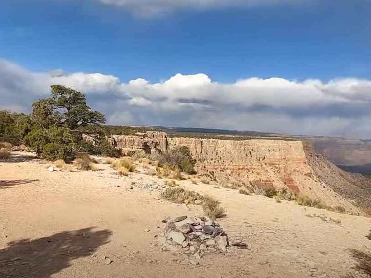
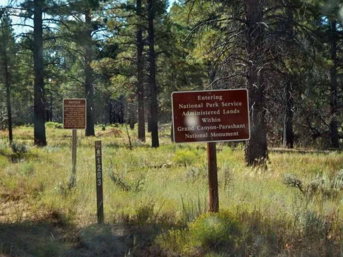
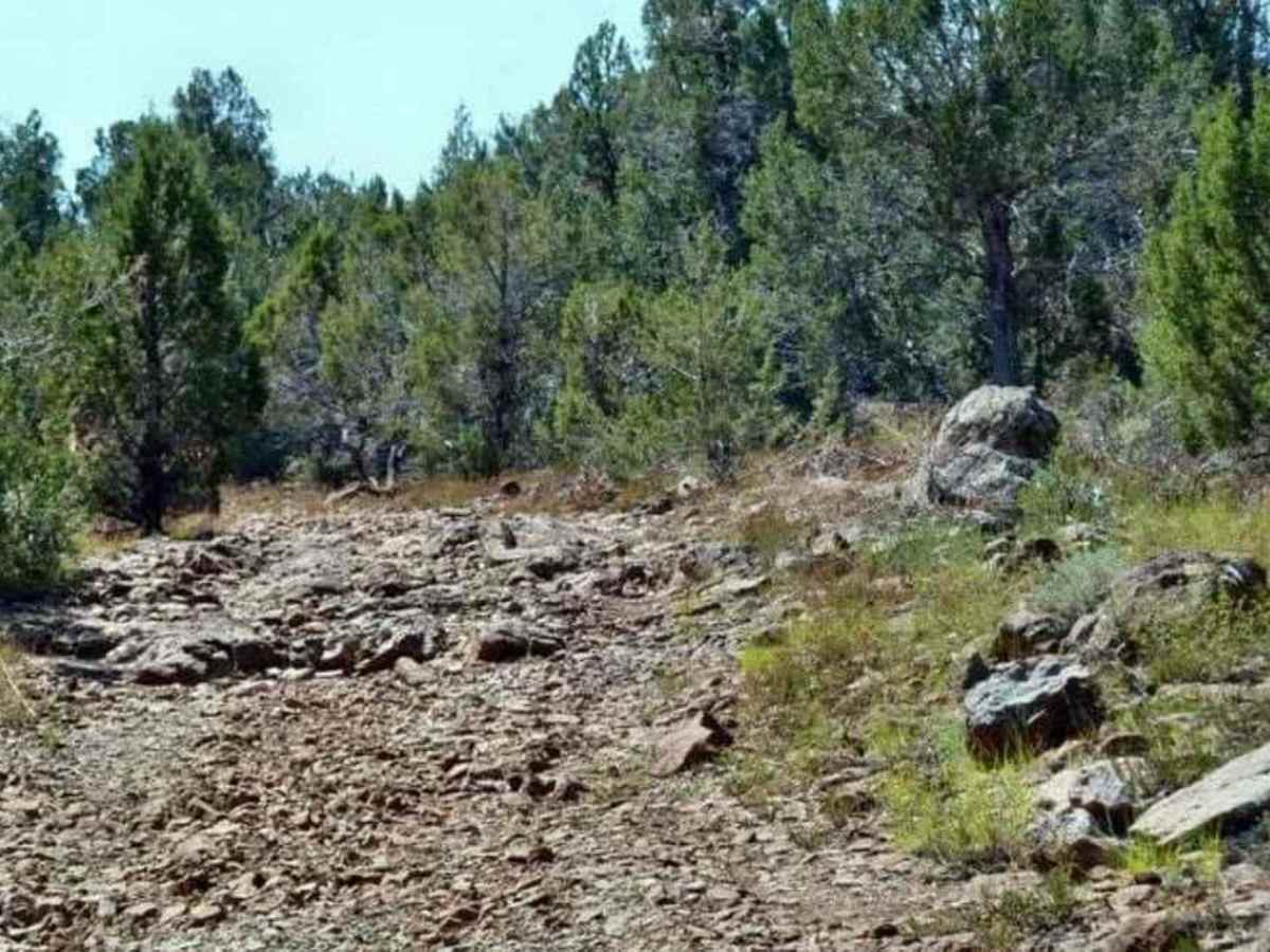
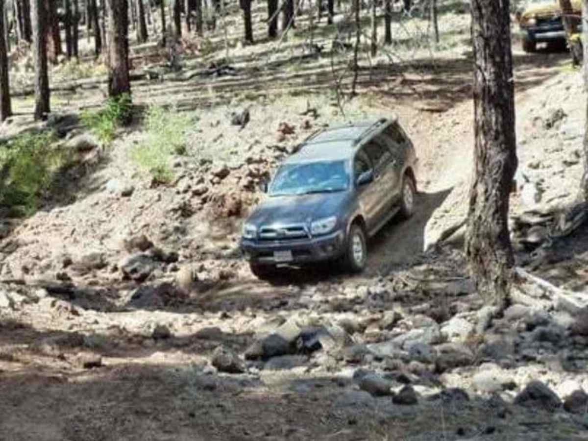
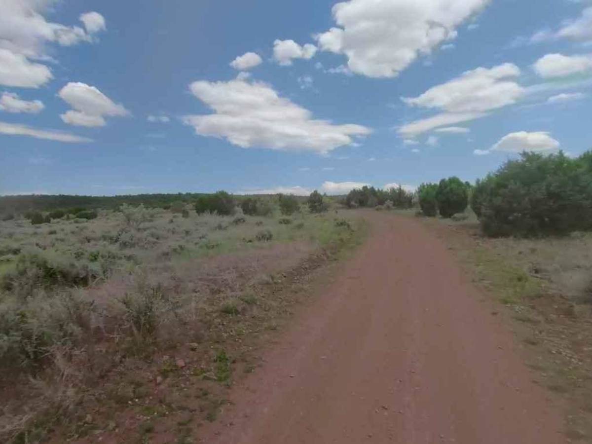
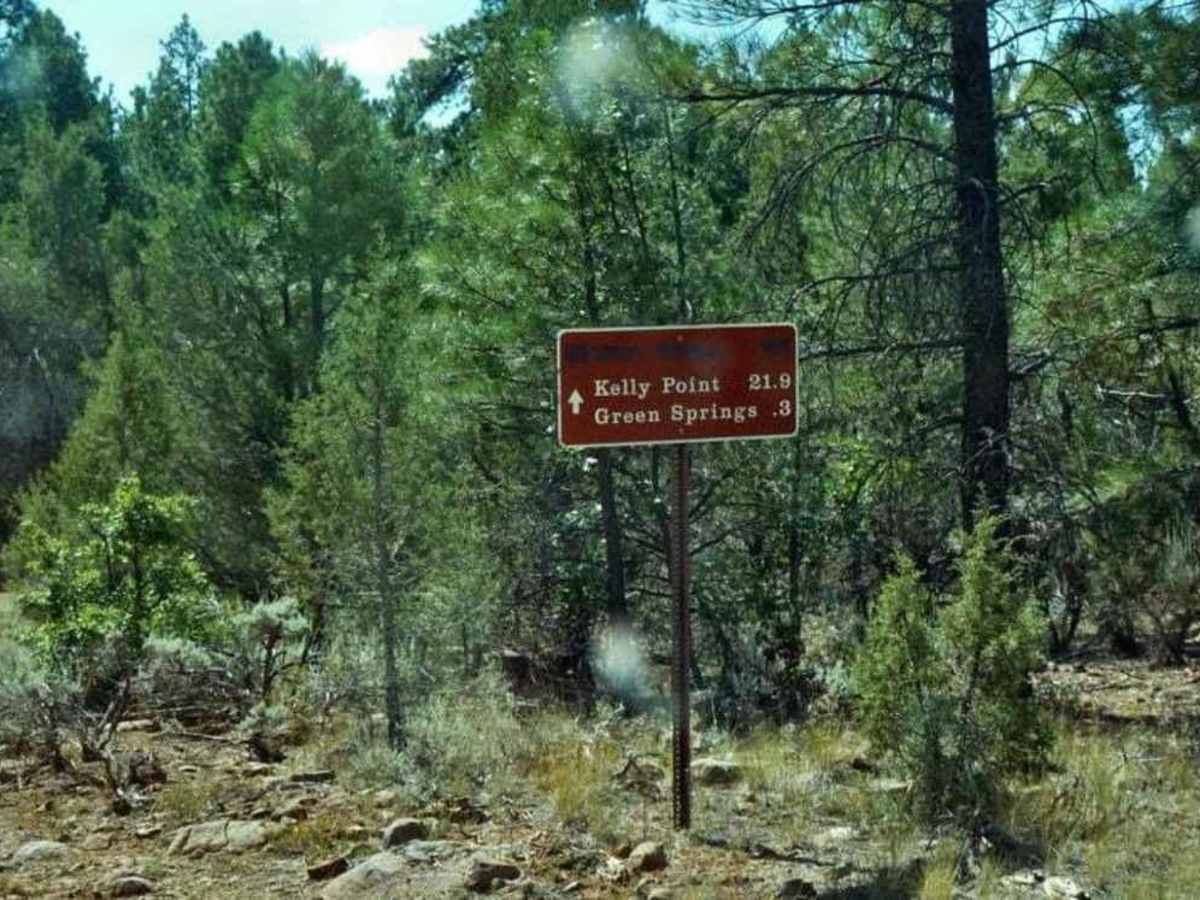
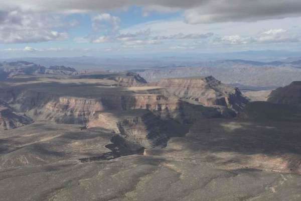
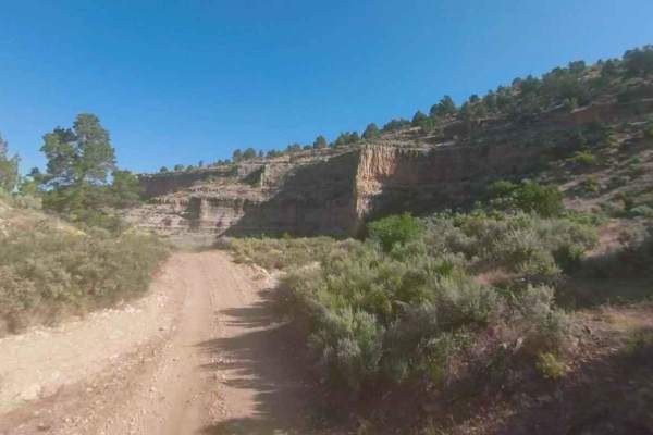
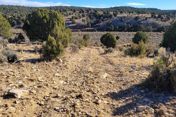
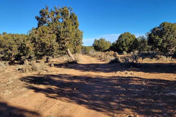
Kelly Point Trail is a 31-mile point-to-point trail rated 4 of 10 located within the Grand Canyon-Parashant National Monument and the Grand Canyon National Park. Stay left on County Road 103 which is the beginning of Kelly Point Trail. At 4.8 miles from the start, the trail passes the Mount Dellenbaugh Trailhead parking area and crosses into the Grand Canyon National Park where County Road 103 becomes NPS 1203. 6.5 miles down the trail, the Horse Valley Ranch is on the left. Continuing south, the trail crosses Ambush Water Pocket Creek at 11.5 miles which flows west into Pen Pocket Canyon. At this point, the trail becomes more difficult and rockier. At 15 miles, pass the intersection to Spencer Tank which is east of the trail. The trail is drivable but this is just another water hole along the route. At 16.8 miles, the Waring Ranch and Shanley Historic Cabin are on the left. The site consists of two tanks and a small cabin. This is one of the roughest and slowest roads in the monument. The difficult conditions start right at the Waring Ranch where the road crosses a 100-yard-long stretch of "Dragon's Teeth" bedrock. The watermelon boulder section starts a few miles further down the trail. Pass Rodger Tank at the 22.6-mile mark and Kelly Tanks at the 24.7-mile mark. At this point, there are 6.5 miles remaining to Kelly Point Overlook. The road is extremely rough and has seasonal closures. Vehicles without high clearance are not recommended. There are no camping permits, fees, or reservations needed so long as you don't descend the rim to camp. If you plan an overnight hike into the Grand Canyon from Kelly Point, you need to contact the Grand Canyon National Park Backcountry Office. Grand Canyon-Parashant National Monument is big and beautiful and remote. As one of the last truly wild places in the American Southwest, Parashant offers zero cell service and road conditions that range from "rough" to "extremely rough." A visitor can easily go days without seeing another soul, making the monument one of the worst places in Arizona to experience a breakdown. It has been reported by some visitors that Verizon customers get service (data and voice calls) at the rim of Kelly Point, but if you walk away from the rim there is no signal. There is a Verizon tower in Peach Springs across from Kelly Point (you will see the lights of Peach Springs at night). This service is not guaranteed so do not count on it for rescue.
Difficulty
The trail consists of loose rock, dirt, and sand with some slickrock surfaces. There is some erosion, but washes, gulches, and rock steps are no higher than 18 inches. Tall tires (33-inches or greater) and limited slip are a plus. 4WD is required. Enhanced suspension travel and good ground clearance are helpful. Good driving skills are also a plus.