Cherry Creek Road

Total Miles 11.2
Technical Rating
3 Easy
Best Time Spring, Summer, Fall
Trail Type Full-Width Road
Accessible By
Open Trail Map

Trail Overview

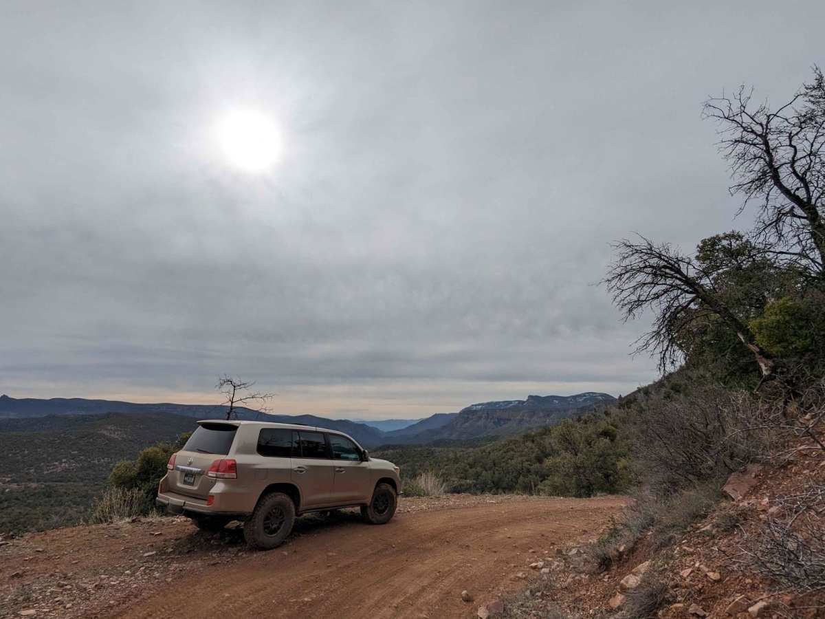
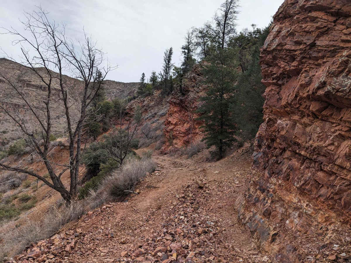
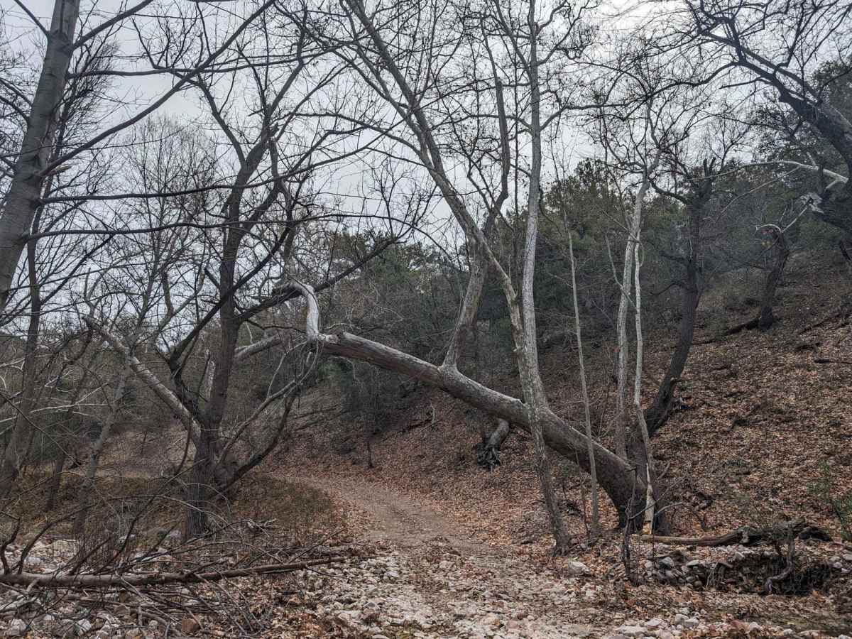
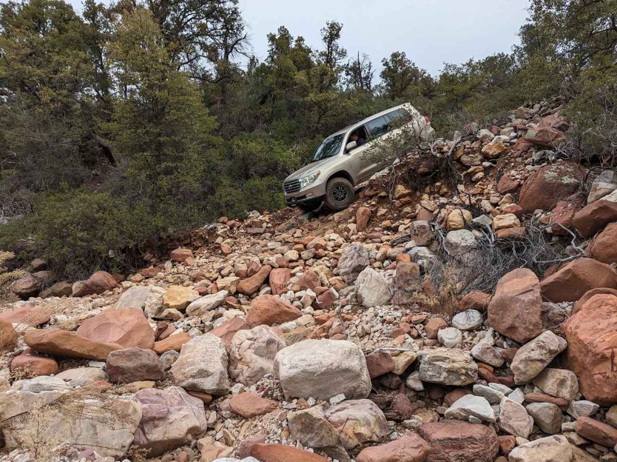
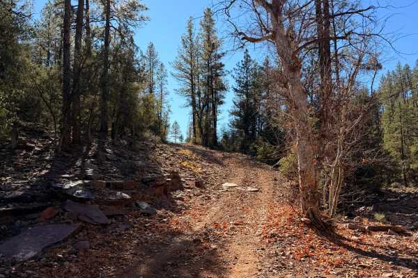
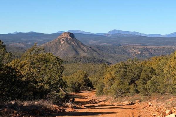
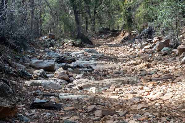
Coming from the north, the trail starts on the dirt and sometimes paved Globe-Young Highway 288. You turn onto a well-marked side road, NF-203. Descending switchbacks, the main challenges are bowling ball-sized rocks that can catch the undercarriage of a vehicle. Most vehicles with slightly oversized tires and a small lift should be okay. Stock 4x4s will need to choose good lines around the larger rocks, but this trail is still possible in a stock vehicle. Along the trail, there are a couple of sections that often get washed out over time. Currently, the washouts are minor and just require slowing down and weaving through some of the larger rocks that have been displaced. The problem with the trail is several miles down to about the halfway point. This section has been somewhat skinny and tippy for decades but was always passable by a full-size vehicle not afraid of leaning. After the last winter, this section is now undercut and only the width of a large UTV. ATVs, dirt bikes, and UTVs should still be able to pass without issue, but the undercut shelf could give way suddenly. This section isn't safe for heavier SUVs or pickup truck 4x4s.

Photos of Cherry Creek Road

Difficulty

This trail is suitable for stock vehicles, but several washouts could be difficult and require stacking or moving a rock. The mud holes are shallow and have solid bottoms.

Technical Rating

3

Status Reports

Add Status Report
CJ & Jenn H
Mar 15, 2025
Open
A lot of erosion looking over cliffs where the track was just wider than our wheels. Anything wider than our grand Cherokee Trailhawk might not make it through and could potentially slip off the trail, made my passenger very nervous. There was a lot of rain prior to us taking this trail which caused a lot of loose sand, rocks and running water. Several places where you will have to navigate steep grades while also in a sharp turn.
Warren Grantham
Feb 01, 2025
Open
Overall the trail is somewhat deteriorated but passable. There are several washouts as others have noted with one of them being almost 10 ft deep and very steep. With some decent approach and departure angles they are crossable. The worst spot is towards the south end of what Onx has marked as an easy trail. In this spot I was 18 degrees sideways and sliding off the shelf road towards the cliff. It was barely wide enough for my 4 door Jeep. I recommend bringing an extra pair of underwear. Cherry Creek was flowing well along with several other creeks that I crossed.
Steve helms Tillery
May 19, 2024
Open
Drove it up from Roosevelt in my long bed Tacoma. It was very gnarly. A lot of the early part above Ellison Ranch was as I remembered it, but once into the Juniper burn it got pretty eroded. Drainage crossings were all degraded, many of them very badly. The scariest to me was the tilted and sloughing narrow roadbeds of eroding red rock, inspiring lovely visions of sliding/rolling down to the creek bed. I won’t drive it again in anything with a long wheelbase unless the road gets a lot of attention, which seems unlikely while the arguing over the wilderness boundary is unresolved.
Greg P
May 07, 2024
Open
Wash outs of the road at the some of the multiple creek crossings. One of them we needed to help each other out and push bike through. Not for the novice rider on an adventure bike but fun and challenging for intermediate riders.

Cherry Creek Road Trail can be accessed by the following ride types:

  • Single Track
  • 50 Inch
  • 60 Inch
  • High Clearance
  • Full Width

Cherry Creek Road Map

The onX Offroad Difference

onX Offroad combines trail photos, descriptions, difficulty ratings, width restrictions, seasonality, and more in a user-friendly interface. Available on all devices, with offline access and full compatibility with CarPlay and Android Auto. Discover what you're missing today!

Open Trail Map