John Poe
Dec 27, 2025
2021 Ford Ranger
Open
Normal
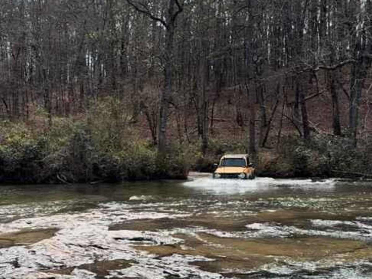
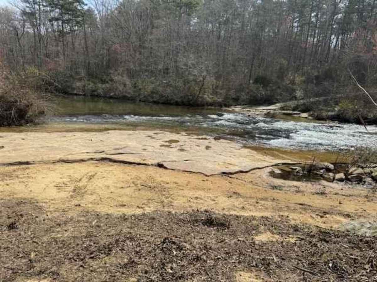
The Southern entrance starts out relatively easy, with some minor potholes and a couple creeks to splash through. The trail splits into trail 7 to the North, and trail 5 heading East. Trail 7 had a couple spots that required slowing down and picking a bit of a line to keep from high centering or dropping into washouts, but remains fairly easy. On the North end of the loop, trail 7 turns into trail 9, which starts out as essentially a gravel track. Don't be fooled, though. Trail 9 has 2 spots that are MUCH more difficult, requiring an excellent driver and spotter, with plenty of recovery gear. It's doable, but very sketchy in dry weather, but in wet weather I doubt it's possible without a completely built out rig. Once you get past those 2 spots, it goes back to pretty relaxing in dry conditions. Trail 5 goes around the eastern side, and meets up with trails 2 and 9 on the NE side. There's 2 river crossings that aren't very deep and solid rock, but those have a bypass trail.
Ron Lupica
Nov 28, 2025
2021 Jeep Wrangler
Open
Muddy/Wet
Visting from Virginia. The trail was mostly dry with some deep mud holes. The obstacles are pretty technical we watched a stock jku try to go through one and it was unable to get through. On the the main trail the obstacles, and water Crossings were amazing, absolute blast! highly recommend this trail is a hidden little gem in the area. Anything with the 2.5 lift and 35s is suitable for the main trail and offshoots.
Christopher Stanley
Jul 27, 2025
Open
Rough/Deteriorated
Jason Ouellette
Jul 26, 2025
Open
Rough/DeterioratedDusty
Lots of ruts... some technical. River crossings were fun and manageable. Trail 9 was pretty challenging but my 99 Wrangler 4.0L 5spd with 4" lift on 33's Managed without issue. Just pick good lines and have faith in your ride! Would love to come back and hang out at the river but this is 2 hours away so not sure I'll get back soon.
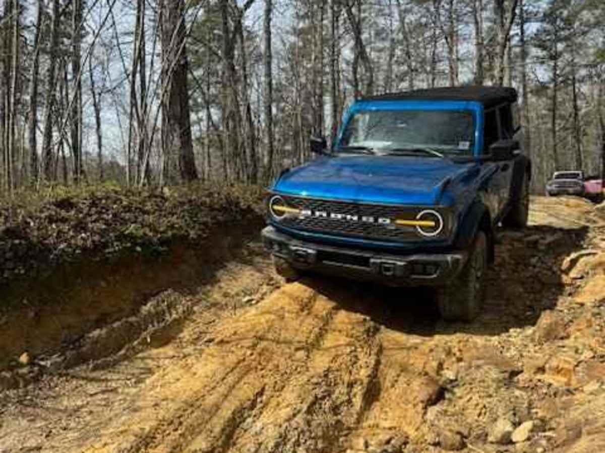
Dan Renegar
Jul 12, 2025
2022 Ford Bronco
Open
Rough/DeterioratedWashboard
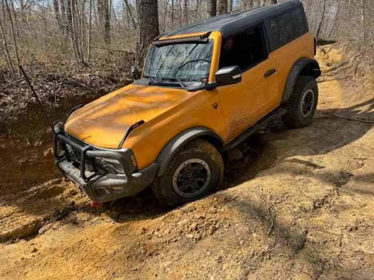
At first I thought, this doesn't look like a 5/10 rated trail. Then, we found out why. There are multiple paths to take in this area, but there are mild sections and then there are some very technical sections. We managed it in our Bronco Badlands Sasquatch, but its tricky and the harder trails will demand your full attention. Overall, this isn't a huge area really, but if you want to test your skills, this is a good place.
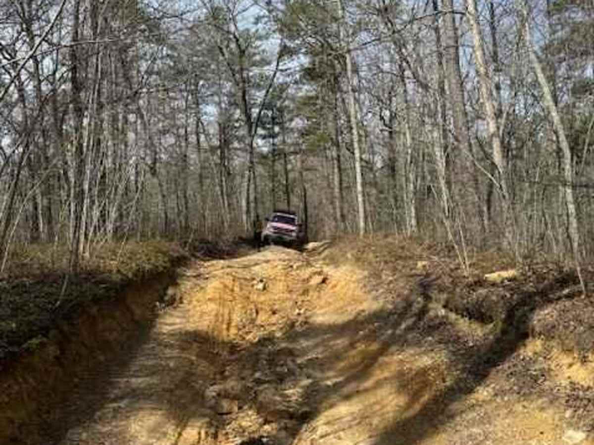
Chris B
Jul 03, 2025
Open
Rough/Deteriorated
We traveled the loop counter clockwise, so we went uphill for the bad road 9 sections. It was pretty rough. Road 8 and 7 also had some pretty bad wasjed out sections, but we traveled those down hill. Conditions were dry. It looks like there are opening up road 9 to bring in equipment to repair the bad sections of road 9, so get out there and enjoy it while you can. Both river crossings were very manageable.
Michael moss
Jun 28, 2025
Open
Muddy/WetRough/Deteriorated
I came in off county road 103 to trail 01. It starts where you stop and get the paper map. This trail has mild ruts. Then I took trail 04. The trail starts as gravel road with mild ruts. Then you will cross the river. Not that deep considering it was and had been raining. After the river you will come to some rugged ruts but you can get around them just take it slow. Pretty good trails I would like to go out there and ride them all one day. Did find some dead-end trails but had turn around. These are good trails for someone who has never been on trails in a vehicle that was built for this stuff.
Charles Rogers
Jun 28, 2025
Open
Muddy/Wet
We only got about four miles into the trail before heavy heavy rain forced us to turn around. We had already seen two deer, which the grandkids loved. The rain lasted for several hours so we drove to the falls and let the grandkids swim a little after the rain stopped. I plan on trying again soon so I can make that river crossing!
John riddle
May 11, 2025
Open
Muddy/Wet
River was to high to cross was a great ride I don’t no if it was 06/09 was pretty nasty anything smaller than 34s would probably hit axle a lot
Michael Payne
Apr 19, 2025
Open
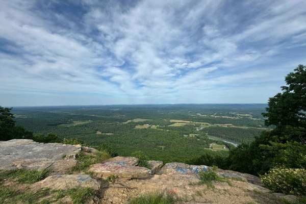
Had a great ride today. First time riding here. We rode the big loop and took a few of the side trails. Enjoyed the view from High Rock. Our dog had a ball playing fetch in the water. Awesome to see all the other Jeeps riding together.
Brandon M
Apr 05, 2025
Open
First time on this trail and it was awesome. Trail 7 at the start was a good challenge as all the trails I done before this were 2 and 3 rated. The water crossings were fun along with the mud puddles. Ran into a few Jeep groups riding as well and they were super cool folks. Will totally come back when I have added a few upgrades to the truck to tackle the more challenging trails like 10 and 11. 5/5 stars.
Cody hall
Mar 02, 2025
Open
Normal
The loop was nice was our first time there the water isn’t too high
Trae Whitehead
Mar 01, 2025
2008 Jeep Wrangler
Open
Normal
Several large washouts.
Benton Turnbull
Feb 18, 2025
Open
Muddy/Wet
Making this months late but I figured I’d put it in. Went with my buddy December 15-17 with my bone stock Tacoma on 30” all terrains, had rained the night before, did the whole loop without issue until road 9 and got absolutely decimated, the dirt was much too slick to keep high of the ruts and my ats filled with dirt quick. Got stuck at a super deep rut and some really nice guys came up from behind us and we let one of them pass to attempt it. He couldn’t get up the rut so having done 90% the trail we backed it to the start/bottom of 9 and exited there. Absolute great experience I will definitely be back soon with my recent changes to the truck to take it on again.
Connor Hofius
Jan 19, 2025
1999 Chevrolet Silverado
Open
This trail is open dawn to dusk watch out! My group got turned around by US Park Rangers