
Off-Road Trails
Near Trommald, Minnesota
Off-Road Trails Near Trommald, Minnesota
Discover the best offroad trails near you. Browse trail maps, check difficulty ratings, and find your next adventure — whether you're looking for a quick ride or an all-day expedition.
Outer Loop
Located just east of Brainerd, Minnesota, this loop is part of the Miller Hills trail system. This outer loop snakes around the outer bounds of the North East section of the trail. The single track trail features many tight turns, lots of exposed rocks, ruts, and steep hills. Many fallen trees and a...
Learn more about Outer Loop
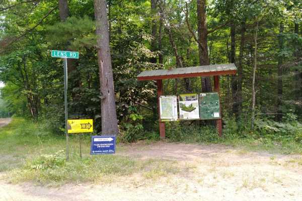
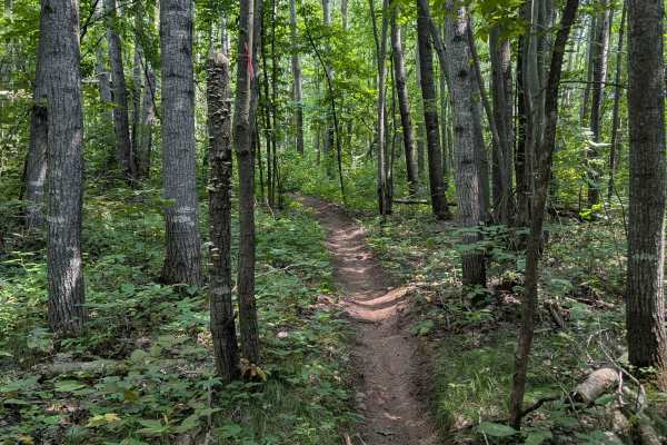
Emily - Blind Lake Trail - East 106
This section of Emily - Blind Lake Trail (East of County Road 106) is mapped from the southern Crow Wing County Road 106 trail intersection (Lens Road) to the Blind Lake Trail. This section is 8.2 miles long and takes about 45 minutes including the time it took for trail pictures. This section will ...
Learn more about Emily - Blind Lake Trail - East 106
Emily - Blind Lake Trail - West 106
This section of Emily - Blind Lake TRL(West of County Road 106) is mapped from the Bloomquist Dr. ATV parking lot in Emily to the southern Crow Wing County Road 106 trail intersection. This section is 7.9 miles long and takes about an hour, including the time it took for trail pictures and a stop at...
Learn more about Emily - Blind Lake Trail - West 106

Blind Lake Connector Trail - South 68
Blind Lake Connector Trail (South of County Road 68) is mapped from the end of the Emily Blind Lake Trail to the Aitkin County Road 68 area. This section is 10 miles long and takes about an hour including the time it took for trail pictures. This section is maintained by The Blind Lake ATV Club. The...
Learn more about Blind Lake Connector Trail - South 68
Emily/Outing ATV A Trail
Emily/Outing ATV A Trail is mapped from the B Trail to the Bloomquist Dr. ATV parking lot in Emily. This section is 4.9 miles long and takes about 22 minutes with average speed of 12.8 MPH including the time it took for trail pictures.
Learn more about Emily/Outing ATV A Trail
South of Outing on the A Trail
South of Outing on the Emily-Outing A Trail was mapped from the Outing ATV Parking lot to the Emily-Outing B Trail. The length is just under 5 miles, and it stops at the Outing gas station, which is right on the trail. A stop at the parking lot on the north end of the Pickled Loon and a stop at the ...
Learn more about South of Outing on the A Trail
North of Outing on the A Trail
North of Outing on the Emily-Outing A Trail was mapped from the Outing ATV Parking lot to the south end of the Moose River area Wren Lake Loop. This section starts from the parking lot on hardtop Cass County Road 58 for about 1700 feet to where the trail follows Sunset Hill Road NE, which is a resid...
Learn more about North of Outing on the A Trail
Blind Lake Connector Trail - North 68
Blind Lake Connector Trail (North of County Road 68) is mapped from the Aitkin County Road 68 area to the Soo Line North Trail. This section is 8.3 miles long and takes about 50 minutes including the time it took for trail pictures. This section is maintained by The Blind Lake ATV Club. The trail is...
Learn more about Blind Lake Connector Trail - North 68
Emily/Outing ATV B Trail
Emily/Outing ATV B Trail is mapped from Cass County Road 58 near Egg Lake where the trail leaves the gravel and into the woods to A Trail intersection. This section is 11.7 miles long and takes about an hour with an average speed of 11.1 MPH including the time it took for trail pictures.
Learn more about Emily/Outing ATV B Trail
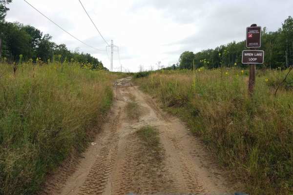
Wren Lake Loop
Wren Lake Loop which is part of the Moose River Trail system, is 10.8 miles long and takes about 1 hour and 15 minutes at an average of 9.45 MPH. Time and distance are only for the "entire loop" so remember to add time and distance to your final destination. The entire Moose River Trail system is wi...
Learn more about Wren Lake Loop
Cedar Lake Loop
Cedar Lake Loop which is part of the Moose River Trail system, is 10.2 miles long and takes just over an hour at an average of 8.6 MPH. Time and distance are only for the "entire loop" so remember to add time and distance to your final destination. The entire Moose River Trail system is within the L...
Learn more about Cedar Lake Loop
Plantation Loop
Plantation Loop, which is part of the Moose River Trail system, is 6 miles long and takes about 30 minutes at an average of 12 MPH. Time and distance are only from the Draper Tower Road ATV parking lot to the point you "loop" on the trail. (It is another mile back to the parking lot) If you go to th...
Learn more about Plantation Loop
Pikus Forest Road / County Road 58
Pikus Forest Road / County Road 58 is mapped from the Moose River Connector Trail at the Aitkin / Cass County line to Cass County Road 58 near Egg Lake where the trail leaves the gravel and into the woods. This section is 5.69 miles long and takes about 15 minutes with an average speed of 21.1 MPH i...
Learn more about Pikus Forest Road / County Road 58
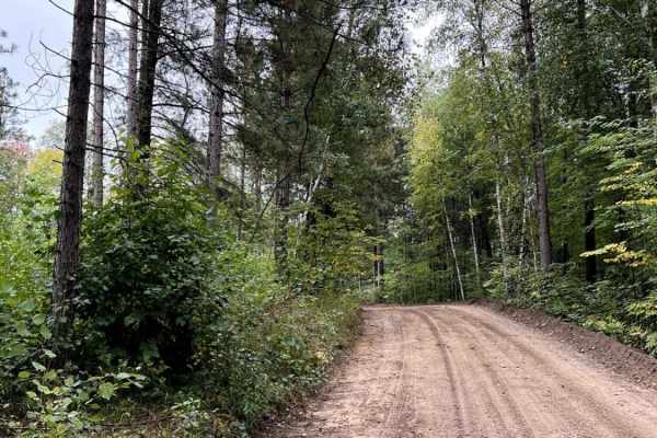
Hill City Trail
The Hill City Trail runs between the Rabey Line and Soo Line Trails, as the name suggests it takes you over, on the side of and around area hills. This trail is 14.2 miles long and takes just under an hour with average speeds of 16.3 MPH including time to take trail pictures. This trail is easy to f...
Learn more about Hill City Trail
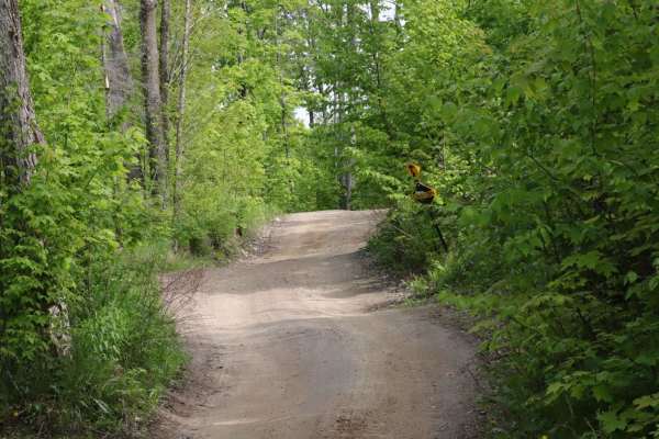
Palisade to Swatara
Palisade to Swatara on the Soo Line North is a section of converted rail grade that is 15.7 miles long and takes about 30 minutes with an average speed of 20.9 MPH. It's a great trail to run if you are in the area during a wet period or the springtime.
Learn more about Palisade to Swatara
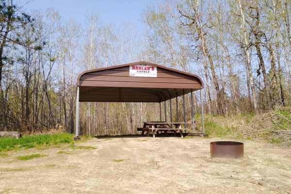
Bull Run Trail
Bull Moose Trail is an incredibly beautiful forest road with access to many activities besides trail riding. This road provides fishing access to two different backwoods lakes and plenty of dispersed camping. One lake has a small beach and appears to be fairly deep. The drive out to the two lakes at...
Learn more about Bull Run Trail
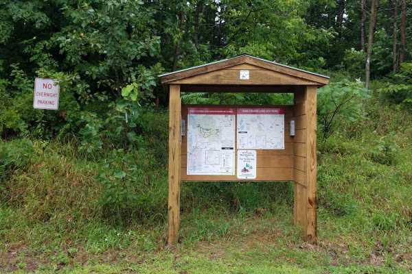
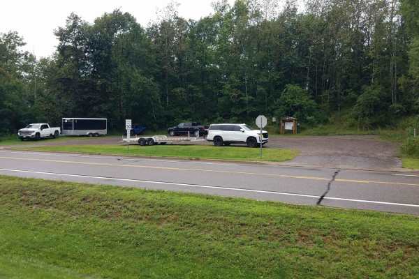
2103
From the south, this trail begins at a large, open parking area with a boat launch located beside a lake bordered by reeds and grass. Prominent signage in the area makes it clear that camping is not permitted, and the presence of a parked ranger vehicle suggests regular patrols. From the launch, the...
Learn more about 2103
Moose River Connector Trail
Moose River Connector Trail is mapped from the Soo Line North Trail to the Pikus Forest Road at the Aitkin / Cass County line. This section is 5.6 miles long and takes about 20 minutes with an average speed of 15.5 MPH including the time it took for trail pictures. About a mile SW of the Soo Line th...
Learn more about Moose River Connector Trail
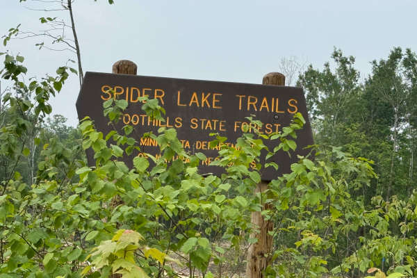
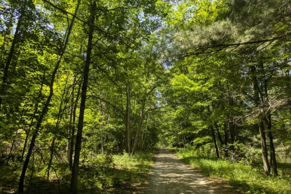
Spider Lake Trails
Spider Lake OHV trails are located within the Foothills State Forest. The Spider Lake system has 26 miles of trails to ride, which include many separate loops that wind through the dense forest. They are primarily gravel with occasional rocky sections; the trails have moderate hills and curves throu...
Learn more about Spider Lake Trails
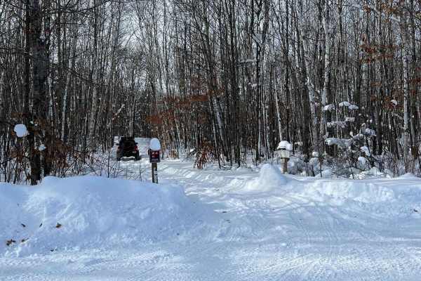
Spider Lake
This trail is a nice test loop during the winter to see if you should really venture around spider lake while winter wheeling. On the day we visited, there were 8-12 inches of fresh snow, and rigs on 3" lifts and 33" tires were struggling some. This time though it was primarily about sticking to the...
Learn more about Spider Lake
ATV trails near Trommald, Minnesota
Explore ATV-friendly trails near you. These trails are accessible for vehicles up to 50 inches wide, perfect for ATVs and smaller off-road machines.
Emily - Blind Lake Trail - East 106
This section of Emily - Blind Lake Trail (East of County Road 106) is mapped from the southern Crow Wing County Road 106 trail intersection (Lens Road) to the Blind Lake Trail. This section is 8.2 miles long and takes about 45 minutes including the time it took for trail pictures. This section will ...
Learn more about Emily - Blind Lake Trail - East 106
Emily - Blind Lake Trail - West 106
This section of Emily - Blind Lake TRL(West of County Road 106) is mapped from the Bloomquist Dr. ATV parking lot in Emily to the southern Crow Wing County Road 106 trail intersection. This section is 7.9 miles long and takes about an hour, including the time it took for trail pictures and a stop at...
Learn more about Emily - Blind Lake Trail - West 106
Blind Lake Connector Trail - South 68
Blind Lake Connector Trail (South of County Road 68) is mapped from the end of the Emily Blind Lake Trail to the Aitkin County Road 68 area. This section is 10 miles long and takes about an hour including the time it took for trail pictures. This section is maintained by The Blind Lake ATV Club. The...
Learn more about Blind Lake Connector Trail - South 68
Emily/Outing ATV A Trail
Emily/Outing ATV A Trail is mapped from the B Trail to the Bloomquist Dr. ATV parking lot in Emily. This section is 4.9 miles long and takes about 22 minutes with average speed of 12.8 MPH including the time it took for trail pictures.
Learn more about Emily/Outing ATV A Trail
UTV/side-by-side trails near Trommald, Minnesota
Find UTV and side-by-side trails near you. These trails accommodate vehicles up to 60 inches wide, ideal for UTVs, side-by-sides, and wider off-road rigs.
Emily - Blind Lake Trail - East 106
This section of Emily - Blind Lake Trail (East of County Road 106) is mapped from the southern Crow Wing County Road 106 trail intersection (Lens Road) to the Blind Lake Trail. This section is 8.2 miles long and takes about 45 minutes including the time it took for trail pictures. This section will ...
Learn more about Emily - Blind Lake Trail - East 106
Emily - Blind Lake Trail - West 106
This section of Emily - Blind Lake TRL(West of County Road 106) is mapped from the Bloomquist Dr. ATV parking lot in Emily to the southern Crow Wing County Road 106 trail intersection. This section is 7.9 miles long and takes about an hour, including the time it took for trail pictures and a stop at...
Learn more about Emily - Blind Lake Trail - West 106
Blind Lake Connector Trail - South 68
Blind Lake Connector Trail (South of County Road 68) is mapped from the end of the Emily Blind Lake Trail to the Aitkin County Road 68 area. This section is 10 miles long and takes about an hour including the time it took for trail pictures. This section is maintained by The Blind Lake ATV Club. The...
Learn more about Blind Lake Connector Trail - South 68
Emily/Outing ATV A Trail
Emily/Outing ATV A Trail is mapped from the B Trail to the Bloomquist Dr. ATV parking lot in Emily. This section is 4.9 miles long and takes about 22 minutes with average speed of 12.8 MPH including the time it took for trail pictures.
Learn more about Emily/Outing ATV A Trail
The onX Offroad Difference
onX Offroad combines trail photos, descriptions, difficulty ratings, width restrictions, seasonality, and more in a user-friendly interface. Available on all devices, with offline access and full compatibility with CarPlay and Android Auto. Discover what you're missing today!
Open Trail Map