
Off-Road Trails
Near Maple City, Michigan
Off-Road Trails Near Maple City, Michigan
Discover the best offroad trails near you. Browse trail maps, check difficulty ratings, and find your next adventure — whether you're looking for a quick ride or an all-day expedition.
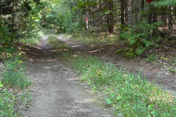
West Miller Hill Road
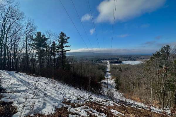
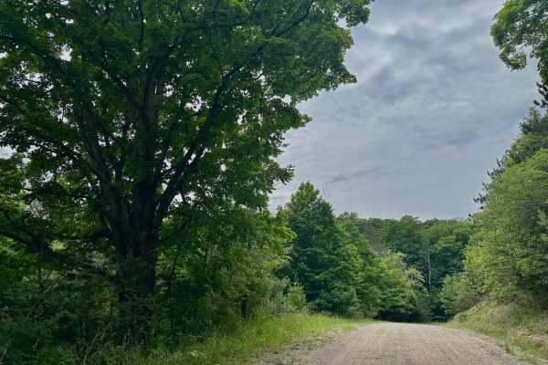
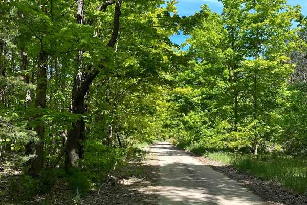
Miller Hill Road is a dirt base trail that travels up to a scenic vista looking over Glen Lake and the surrounding forest. This is one of the best overlooks in all of the Lower Peninsula. This route is slightly wider than one vehicle wide. There is cell service on top of the hill by the lookout. Som...
Learn more about West Miller Hill Road
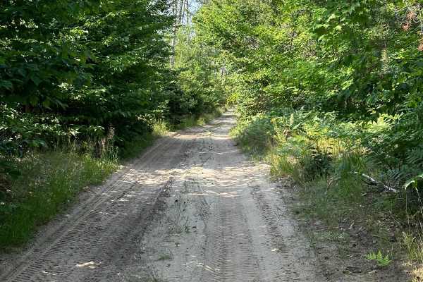
West Darwin Road
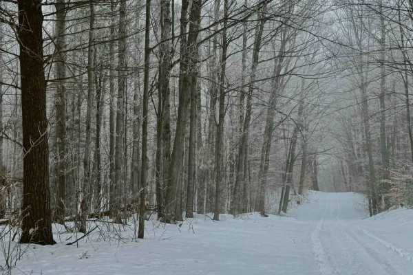
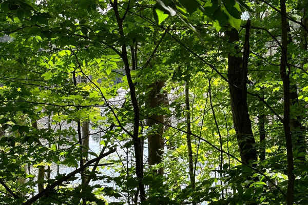
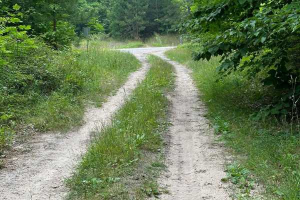
West Darwin Road travels east and west. The east side of the trail is a two-vehicle-wide dirt road and turns into a one-vehicle-wide trail once you enter Sleeping Bear National Lakeshore land. Traveling from the east, you will climb 338 feet until you meet up with South Hyland Road. The trail is dir...
Learn more about West Darwin Road
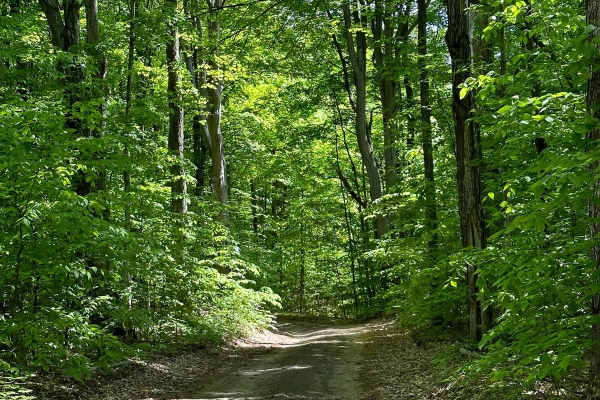
South Hyland Road
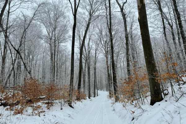
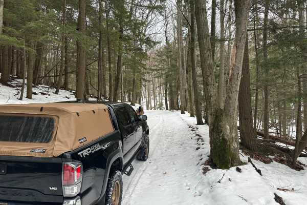
South Hyland Rd is a dirt/sand-based trail that runs east and west through Sleeping Bear Dunes National Lakeshore land. This route climbs 225 feet through dense beech/maple northern hardwood forest. Along the trail, there are great views of the hills and topography that this area is known for. Trave...
Learn more about South Hyland Road
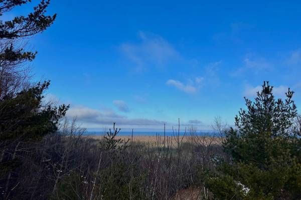
Davis Lake
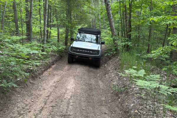
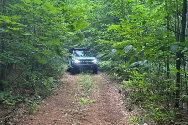
This is a seasonal road connecting South Cedar Creek Valley Road to Lake Ann Road. The trail is one vehicle wide and covers rolling terrain through the woods. The roadway is typical for the area-packed dirt and sand. There are some low points in the trail that can collect water and mud if it has bee...
Learn more about Davis Lake
Burnham Road
Burnham Road is yet another beautiful drive through a small part of the national lakeshore land. This road cuts between West Macfarlane Road on the east side and South Leelanau Highway on the west. The east side of the trail is more of a two-track while the west side opens up a bit to a gravel road ...
Learn more about Burnham Road
South Thoreson Road
South Thoreson Road offers incredible views of what this national lakeshore has to offer. From Great Lakes views to wooded forests and rolling farmlands. This route is accessible for all vehicles. The road is well-graded but can be quite dusty. The north end of the trail is two vehicles wide while t...
Learn more about South Thoreson Road
Rayle Road Part 2
Rayle Road Part 2 is a seasonal road. It starts out as a single-lane two-track. The trail is mostly dirt and sand mixed and runs along the Pearl Lake area. This trail is managed by the Traverse City Forest Management Unit. It's great for a spring ride but with the canopy, it could be an amazing ride...
Learn more about Rayle Road Part 2
South Baker Road
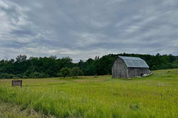
South Baker Road is located in the Port Oneida area of the National Lakeshore. The surrounding area has beautiful rolling hills through amazing farmland. Old barns and homesteads can be seen in the landscape. This road is well-graded and has areas to pass safely. Be cautious of other people walking ...
Learn more about South Baker Road
Beeman Road Spur
Beeman Road Spur starts out as a single-lane two-track. The trail is mostly dirt and has spots of soft sand. The trail is narrow, making it easy to spot raspberry bushes. The trail ends at South Plowman Road. This trail is managed by the Traverse City Forest Management Unit. It's great for a spring ...
Learn more about Beeman Road Spur
Haze Road
Haze Road is a one-lane two-track seasonal road. This trail is managed by the Traverse City Forest MGMT unit. The trail is a good solid road but as always things can change with bad weather. This trail was great for a spring ride but with the canopy, I could see this being an amazing ride in the fal...
Learn more about Haze Road
Oviatt Spur/Trail 3
Oviatt Spur is also known as Trail 3 in the winter. The trail has very soft sand in some areas. The raspberry bushes grow wild with a mixture of hardwoods and pine. The trail ends at CR 610. This trail is managed by the Traverse City Forest MGMT unit. It's great for a spring ride but with the canopy...
Learn more about Oviatt Spur/Trail 3
South Basch Road
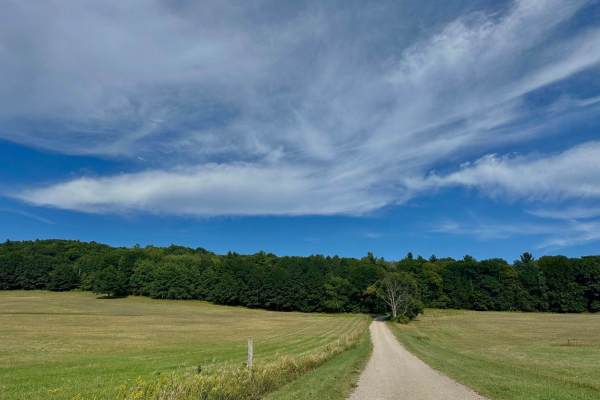
This trail travels through rolling hills and old historic farmland in the Port Oneida section of Sleeping Bear Dunes National Lakeshore. This route can be accessed from South Port Oneida Road on the west side and West Harbor Highway on the east side. Starting on the west end, it is a short stint of ...
Learn more about South Basch Road
Oviatt Road
Oviatt Road is a one-lane seasonal road. This trail is managed by the Traverse City Forest MGMT unit. The trail is a good solid road but as always things can change with bad weather. This trail was great for a spring ride but with the canopy, I could see this being an amazing ride in the fall.
Learn more about Oviatt Road
Spear Road/48062
Spear Road/48062 is another trail managed by the Traverse City Forest MGMT unit. This trail is a narrow single-lane trail made up of dirt and sand with some minor washouts. Brush lines on both sides of the trail in some areas. Starting the trail at 610 Road it will lead you to Rayle Road making this...
Learn more about Spear Road/48062
Shauger Hill Road
This is a wonderful drive through Sleeping Bear Dunes National Lakeshore. The trail is accessed off of South Dune Highway or off of North Bar Lake Road. The terrain is quite hilly and is primarily a beech-maple forest. Starting the trail off of North Bar Lake, you will start with ascending 368 feet ...
Learn more about Shauger Hill Road
Pinstriper
This trail connects Spear Road at the north end to Rayle Road at the south. The north end of the trail is relatively covered. It is less traveled than either Spear Road or Rayle Road. It is a single vehicle wide two-track trail that follows a ridge in a relatively straight line. There is a single dr...
Learn more about Pinstriper
Deer Track Trail
Deer Track Trail gets its name from the immense amount of deer signs in the area. This is definitely a great trail to take if you want to see some incredible wildlife. This route is mostly a dirt/sand mix. Most of the trail is tight and will require some slower careful driving. This trail loops thro...
Learn more about Deer Track Trail
Fortine Road
This is a moderate route that cuts through the Traverse City Forest Management Unit. The trail is primarily sandy with some areas that have a rocky base. There isn't any specific obstacles other then some deep sandy corners. It would be advisable to air the tires down to give you a more enjoyable ri...
Learn more about Fortine Road
Eliza Lake Trail
Eliza Lake Trail is another trail managed by the Traverse City Forest MGMT unit. This trail is a single lane trail made up of dirt and sand. Brush lines both sides of the trail in some areas. By starting the trail at Brozofsky Road it will lead you to Rayle Road making this a nice easy ride through ...
Learn more about Eliza Lake Trail
Ransom Lake Trail
This is a fun trail crossing state land north of Lake Dubonnet. The trail consists mostly of sandy two tracks easily passable by most vehicles. There are sections, however, with tight turns in wooded areas and some relatively steep climbs with exposed roots. Longer vehicles and those with ground cle...
Learn more about Ransom Lake Trail
ATV trails near Maple City, Michigan
Explore ATV-friendly trails near you. These trails are accessible for vehicles up to 50 inches wide, perfect for ATVs and smaller off-road machines.
West Miller Hill Road
Miller Hill Road is a dirt base trail that travels up to a scenic vista looking over Glen Lake and the surrounding forest. This is one of the best overlooks in all of the Lower Peninsula. This route is slightly wider than one vehicle wide. There is cell service on top of the hill by the lookout. Som...
Learn more about West Miller Hill Road
West Darwin Road
West Darwin Road travels east and west. The east side of the trail is a two-vehicle-wide dirt road and turns into a one-vehicle-wide trail once you enter Sleeping Bear National Lakeshore land. Traveling from the east, you will climb 338 feet until you meet up with South Hyland Road. The trail is dir...
Learn more about West Darwin Road
South Hyland Road
South Hyland Rd is a dirt/sand-based trail that runs east and west through Sleeping Bear Dunes National Lakeshore land. This route climbs 225 feet through dense beech/maple northern hardwood forest. Along the trail, there are great views of the hills and topography that this area is known for. Trave...
Learn more about South Hyland Road
Davis Lake
This is a seasonal road connecting South Cedar Creek Valley Road to Lake Ann Road. The trail is one vehicle wide and covers rolling terrain through the woods. The roadway is typical for the area-packed dirt and sand. There are some low points in the trail that can collect water and mud if it has bee...
Learn more about Davis Lake
UTV/side-by-side trails near Maple City, Michigan
Find UTV and side-by-side trails near you. These trails accommodate vehicles up to 60 inches wide, ideal for UTVs, side-by-sides, and wider off-road rigs.
West Miller Hill Road
Miller Hill Road is a dirt base trail that travels up to a scenic vista looking over Glen Lake and the surrounding forest. This is one of the best overlooks in all of the Lower Peninsula. This route is slightly wider than one vehicle wide. There is cell service on top of the hill by the lookout. Som...
Learn more about West Miller Hill Road
West Darwin Road
West Darwin Road travels east and west. The east side of the trail is a two-vehicle-wide dirt road and turns into a one-vehicle-wide trail once you enter Sleeping Bear National Lakeshore land. Traveling from the east, you will climb 338 feet until you meet up with South Hyland Road. The trail is dir...
Learn more about West Darwin Road
South Hyland Road
South Hyland Rd is a dirt/sand-based trail that runs east and west through Sleeping Bear Dunes National Lakeshore land. This route climbs 225 feet through dense beech/maple northern hardwood forest. Along the trail, there are great views of the hills and topography that this area is known for. Trave...
Learn more about South Hyland Road
Davis Lake
This is a seasonal road connecting South Cedar Creek Valley Road to Lake Ann Road. The trail is one vehicle wide and covers rolling terrain through the woods. The roadway is typical for the area-packed dirt and sand. There are some low points in the trail that can collect water and mud if it has bee...
Learn more about Davis Lake
The onX Offroad Difference
onX Offroad combines trail photos, descriptions, difficulty ratings, width restrictions, seasonality, and more in a user-friendly interface. Available on all devices, with offline access and full compatibility with CarPlay and Android Auto. Discover what you're missing today!
Open Trail Map