
Off-Road Trails Near Geneseo, Kansas
Discover the best offroad trails near you. Browse trail maps, check difficulty ratings, and find your next adventure — whether you're looking for a quick ride or an all-day expedition.
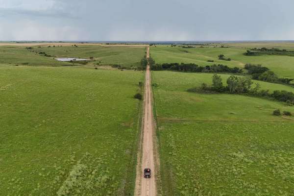
Explorers Trail
This route will take you through some of the beautiful and unique landscapes of central Kansas, combining scenic drives with opportunities to explore natural and historical sites. It consists primarily of gravel roads, with a few being dirt and low-maintenance, so be sure to keep an eye on the weath...
Learn more about Explorers Trail
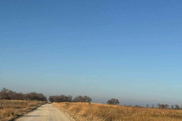
Big Salt Marsh Road
This well-maintained gravel road follows along the Big Salt Marsh in Quivira National Wildlife Refuge. It consists of around 22,000 acres of a rare inland salt marsh and sand prairie. The area is used by over 300 species of migratory and resident birds and waterfowl. You will see plenty of wildlife,...
Learn more about Big Salt Marsh Road
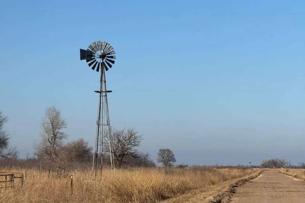
Little Salt Marsh Road
This trail features well-maintained gravel road with a few narrow bridges. On the north end, there is a small section of maintained dirt road that can get muddy after rain. This trail goes through the heart of the Quivira National Wildlife Refuge. Here you will see lots of wildlife, including deer, ...
Learn more about Little Salt Marsh Road
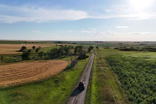
Waconda
This trail follows around the south side of Waconda Lake. The Lake was created in 1969, but before it was a lake, it was known as Waconda Springs, and was a sacred gathering place for the various Native American Tribes. Several access points along this trail allow you to get down to the lake. Don't...
Learn more about Waconda

Sandy Bottom Boulevard
This trail provides access to what is the easiest entrance to the Arkansas River sandbar, making it a preferred route for those looking to reach the river without tackling extreme terrain. The trail itself is mild, with no major obstacles and only a few shallow mud holes, all of which appear to have...
Learn more about Sandy Bottom Boulevard

Crankshaft Crack
This trail is generally simple to navigate, making it an easy route for most 4WD vehicles. However, drivers of wider or longer wheelbase rigs should be aware of a tight turn that may require careful maneuvering to avoid brushing against trees or backing up to reposition. Throughout the trail, there ...
Learn more about Crankshaft Crack

Test Bench Run
This trail leads directly down to the Arkansas River, ending at a sandbar that can offer scenic access, if conditions allow. However, drivers should pay close attention to river levels, as high water can quickly wash over the sandbar or change its shape overnight, making it unsafe or unusable. The a...
Learn more about Test Bench Run

Beater Boulevard
This trail is generally smooth with no major obstacles, making it suitable for most 4WD vehicles, including stock setups. Along the way, you’ll encounter a few mud holes, but they have solid bottoms during mapping and were not excessively deep. These muddy sections may still require cautious driving...
Learn more about Beater Boulevard

Shop Floor Shortcut
This trail is heavily overgrown, with thick weeds and brush lining both sides of the path. Much of the vegetation is covered in cockleburs, which are notorious for clinging to clothing, pets, and even soft top material on vehicles. While there are no major obstacles, the dense overgrowth makes this ...
Learn more about Shop Floor Shortcut

Torque Spec Trail
This trail is generally mild and easy to navigate. However, it does feature several mud holes that can become increasingly challenging with heavy rain or frequent trail use. These sections may develop deeper ruts and slick surfaces, requiring careful throttle control and proper tire placement. Outsi...
Learn more about Torque Spec Trail

Smoke Show Climb
This trail is easily a close second for the most difficult entry to the Arkansas River sandbar. As you reach the river’s edge, the descent becomes extremely steep, combined with a deep hole at the bottom that adds to the severity of the obstacle. Attempting to climb back out will put your vehicle in...
Learn more about Smoke Show Climb

Kansas Chaos
This is considered the third most difficult route down to the Arkansas River sandbar, and while it is not the most extreme, it still demands respect. The descent is steep enough to put your vehicle at a near-vertical angle, requiring four-wheel drive, solid ground clearance, and enough horsepower to...
Learn more about Kansas Chaos

Brake Cleaner Bend
This trail serves primarily as an access route to some of the deepest and most notorious mud holes in the park on Champlin’s Challenge. The path itself has no major obstacles, making it easy to travel for most 4WD vehicles. However, drivers should be fully aware of what lies ahead, as once you conti...
Learn more about Brake Cleaner Bend

Diesel Drip Drive
This short trail winds gently through an open grassy prairie, offering a peaceful and relaxed drive with no major obstacles along the way. The path is smooth and flat, making it ideal for those who want to enjoy a calm break from more challenging terrain. It provides a scenic stretch that highlights...
Learn more about Diesel Drip Drive

Redneck Science Incline
This is the most difficult and unforgiving lines leading down to the Arkansas River sandbar. At the base of the descent, a deep, washed-out hole sits right at the edge of the sandbar, forcing your vehicle into a near-vertical position as you attempt to exit. This is not a route for stock or lightly ...
Learn more about Redneck Science Incline

Kingpin Climb
This trail descends directly to the Arkansas River sand bar and should be considered a highly challenging trail. The final approach to the water is extremely steep, putting your vehicle in a near-vertical position as you drop in or attempt to climb out. The ground near the river is a mix of loose sa...
Learn more about Kingpin Climb

Tire Shine Pass
This is a very short connector trail that serves primarily as a bypass around a deeper mud hole found on Beater Boulevard. Rather than diving into the ruts or mud, this path offers a simple and dry alternative through open prairie terrain. The trail is mostly flat and grassy, with no major obstacles...
Learn more about Tire Shine Pass

Rattle Trap Run
This is primarily a mild trail, suitable for most 4WD vehicles, but it does include one brief section that demands a bit of attention. As the trail drops off a small incline, it becomes slightly off-camber and steeper for a short distance, which can unsettle vehicles with lower clearance or longer w...
Learn more about Rattle Trap Run

Piston Pit
This trail drops down to the Arkansas River sandbar and should be approached with serious caution. As you reach the riverside, the exit hills are extremely steep, forcing your vehicle into a near-vertical climb when attempting to leave the sandbar. The combination of loose sand and mud at the base m...
Learn more about Piston Pit

Cummins Corner
This track features a mix of deep ruts and thick mud, making it a challenging route once you descend into the wooded section. The most demanding part of the trail is a large mud hole that requires serious wheel speed and horsepower to push through, especially when conditions are wet. The mud is heav...
Learn more about Cummins Corner
ATV trails near Geneseo, Kansas
Explore ATV-friendly trails near you. These trails are accessible for vehicles up to 50 inches wide, perfect for ATVs and smaller off-road machines.

Waconda
This trail follows around the south side of Waconda Lake. The Lake was created in 1969, but before it was a lake, it was known as Waconda Springs, and was a sacred gathering place for the various Native American Tribes. Several access points along this trail allow you to get down to the lake. Don't...
Learn more about Waconda

River Run Spur
River Run Spur is mostly gravel roads that are less maintained and that follows along the edge of Tuttle Creek Lake, This trail will take you through the beautiful flint hills area where you see plenty of wildlife and have access points to Tuttle creek lake. Enjoy exploring the area and take time to...
Learn more about River Run Spur
UTV/side-by-side trails near Geneseo, Kansas
Find UTV and side-by-side trails near you. These trails accommodate vehicles up to 60 inches wide, ideal for UTVs, side-by-sides, and wider off-road rigs.

Waconda
This trail follows around the south side of Waconda Lake. The Lake was created in 1969, but before it was a lake, it was known as Waconda Springs, and was a sacred gathering place for the various Native American Tribes. Several access points along this trail allow you to get down to the lake. Don't...
Learn more about Waconda

Sandy Bottom Boulevard
This trail provides access to what is the easiest entrance to the Arkansas River sandbar, making it a preferred route for those looking to reach the river without tackling extreme terrain. The trail itself is mild, with no major obstacles and only a few shallow mud holes, all of which appear to have...
Learn more about Sandy Bottom Boulevard

Crankshaft Crack
This trail is generally simple to navigate, making it an easy route for most 4WD vehicles. However, drivers of wider or longer wheelbase rigs should be aware of a tight turn that may require careful maneuvering to avoid brushing against trees or backing up to reposition. Throughout the trail, there ...
Learn more about Crankshaft Crack

Test Bench Run
This trail leads directly down to the Arkansas River, ending at a sandbar that can offer scenic access, if conditions allow. However, drivers should pay close attention to river levels, as high water can quickly wash over the sandbar or change its shape overnight, making it unsafe or unusable. The a...
Learn more about Test Bench Run
The onX Offroad Difference
onX Offroad combines trail photos, descriptions, difficulty ratings, width restrictions, seasonality, and more in a user-friendly interface. Available on all devices, with offline access and full compatibility with CarPlay and Android Auto. Discover what you're missing today!
Open Trail Map