
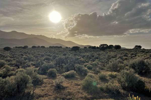
Dirt Bike Trails
Near Wendover, Utah
Explore All Dirt Bike Trails Near Wendover, Utah
Dirt Bike Trails Near Wendover, Utah
Discover the best dirt bike trails near you. Browse trail maps, check difficulty ratings, and find your next adventure — whether you're looking for a quick ride or an all-day expedition.
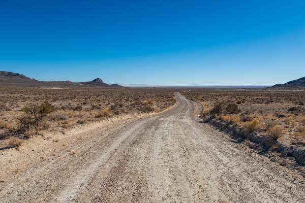
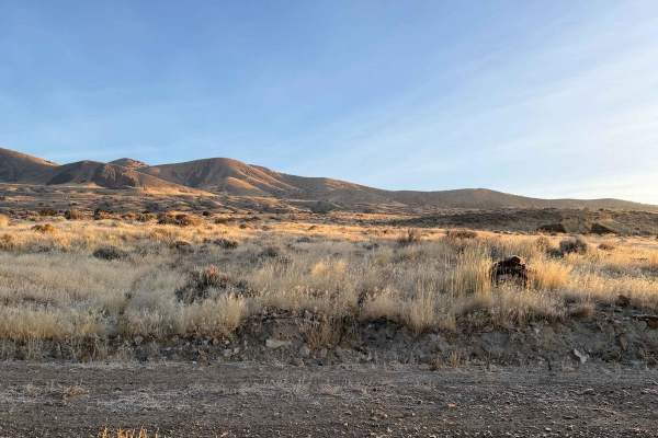
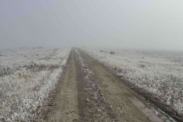
Bonneville Salt Flats to Eureka Nevada
This route takes you from the Bonneville Salt Flats in West Wendover to Eureka, Nevada, through the Goshute Mountains, over the Pequop Mountains, along the Ruby Lake Wildlife Refuge, along the Old Pony Express Route, and over the Diamond Mountains to just outside of Eureka, Nevada. Along the way, th...
Learn more about Bonneville Salt Flats to Eureka Nevada
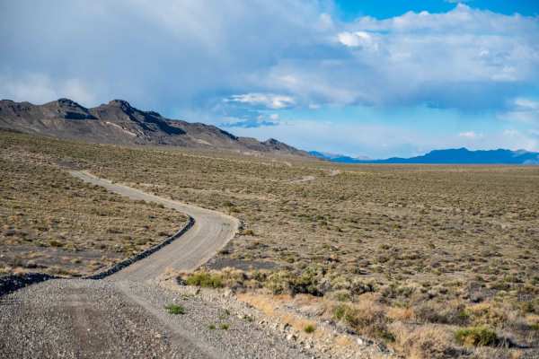
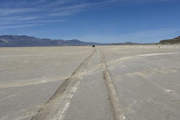
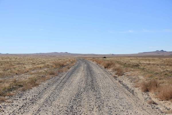
Silver Island Mountains Backcountry Byway
The Silver Island Mountains Backcountry Byway is a 53-mile route that loops around the Silver Island Range and offers a great way to experience the remoteness of Utah's West Desert for those short on time or with little off-road experience. The maintained gravel trail can be run in either direction....
Learn more about Silver Island Mountains Backcountry Byway

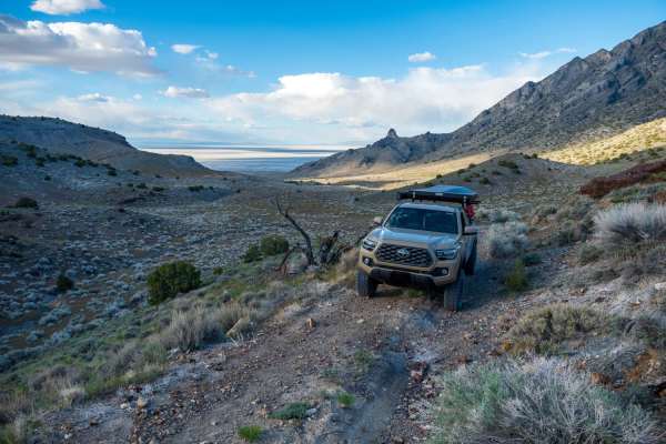
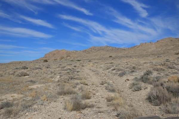
Pilot Mountain Road
The southern portion of this route poses more of a challenge as it consists of single-vehicle roads and leads to a vast open area. It is a dirt road that runs alongside the mountain base, providing breathtaking mountain scenery on one side and a stunning view of the Bonneville Salt Flats on the othe...
Learn more about Pilot Mountain Road
Silver Island Pass
Silver Island Pass is a short trail that connects the east and west sides of the Silver Island Backcountry Byway. It could be used as a cutoff for those not looking to complete the full byway loop. The road is wide, graded, and consists mostly of gravel. On the west side, there is one flat wash and ...
Learn more about Silver Island Pass
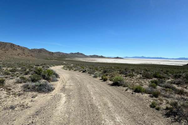
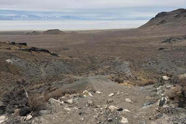
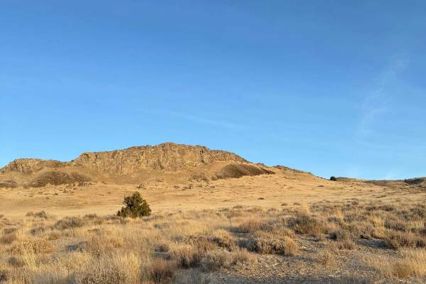
Crater Island
This trail goes from the historic Donner-Reed Pass out to the end of Crater Island. There are great views overlooking the salt flats, mud flats, and the Pilot Mountain range. This trail has several spurs that lead to the mud flats. The trail is mostly a smooth two-track trail but has a couple of roc...
Learn more about Crater Island
Silver Island Canyon
Silver Island Canyon is in the northeast corner of the Silver Island range in Utah's West Desert. The trail runs north to south, and while non-technical, due to remoteness, you will want good tires as most of the trail is comprised of small loose rock and gravel. The southern portion is mostly smoot...
Learn more about Silver Island Canyon
West Crater Island
This is a unique trail that travels along the west side of Crater Island over the mud flats. The landscape feels other-worldly and has nice views of Crater Island and the Pilot Mountain Range. The trail can be a little difficult to follow at times; stick to the tire tracks and keep an eye on the map...
Learn more about West Crater Island
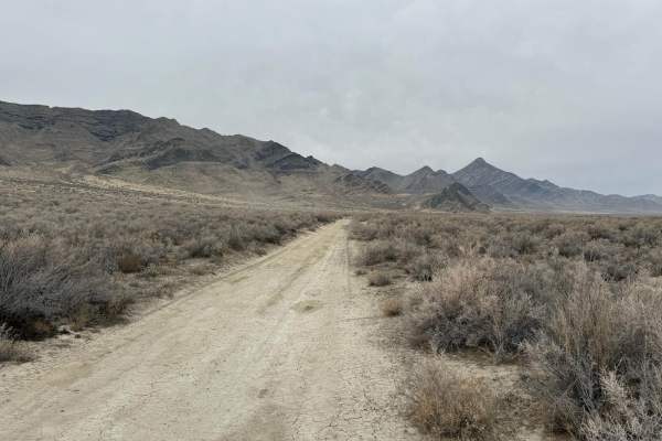
West Newfoundland Road
This trail follows the west side of the Newfoundland Mountains, a very remote mountain range located in the middle of the Great Salt Lake Desert. This trail runs from the Railroad tracks in the North and ends at a gate for the Utah Test and Training Range near the Southern end of the mountains. The ...
Learn more about West Newfoundland Road
Dust to Glory
This trail transitions from dusty two-track to rocky hill climbs. You will get a good mix of both along this route. It starts from lower elevation and quickly climbs up the mountain where the terrain gets much rockier and more technical. After the technical section, it drops you right back down the ...
Learn more about Dust to Glory
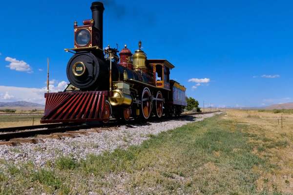
Golden Spike Auto Tour, Transcontinental Railroad Byway
This historic trail follows the last 90 miles of the Transcontinental Railroad. The trail is the actual grade where the railroad tracks were. There are slight detours around the wooden trestles, but 90 percent is the original grade. Along the way, there are several signs talking about the constructi...
Learn more about Golden Spike Auto Tour, Transcontinental Railroad Byway
Big Pass
This trail runs up and over the Newfoundland Mountains, a remote mountain range in the middle of the Great Salt Lake Desert. It is the southernmost point to cross over the range since the southern tip of the mountain range is closed for the military. It can make a great spot to turn your trip to the...
Learn more about Big Pass
Old Historic Route 93
Old Route 93, which is now a gravel trail, takes the scenic route to the Pony Express trail. The trail is mostly flat with some brush on either side and ample great views in all directions. You will see herds of wild horses all around. The trail does have some low spots to allow the rainfall to flow...
Learn more about Old Historic Route 93
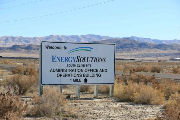
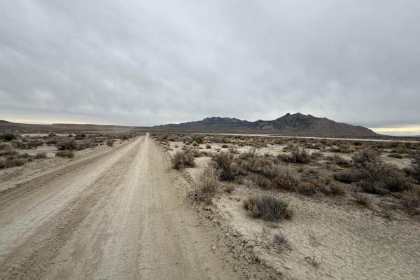
Deseret Wells Road
This easy, graded trail connects I-80 to the Cedar Mountain West trail. Coming from I-80, the trail starts after veering off of pavement onto a dirt road that bypasses the Energy Solutions plant. The trail is easy and graded most of the way. It is only one vehicle wide when driving along Energy Solu...
Learn more about Deseret Wells Road
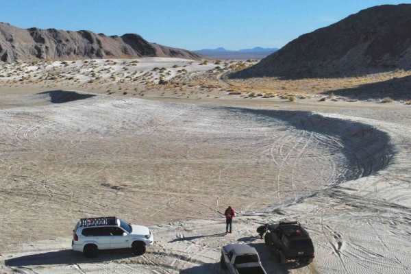
Ripple Valley Road
This off-road trail features a unique, soft dirt surface, resembling the feel of a dry lakebed. It offers an easy-going ride when the conditions are dry, with smooth, expansive stretches perfect for cruising. However, be cautious when rain or melting snow is present, as the trail can quickly turn in...
Learn more about Ripple Valley Road
TC02218
This is a moderately difficult trail that, despite appearing to wrap around, dead-ends at an impassable wash. Along this trail, there are deep washes and rock gardens. It is a narrow trail with no room to pass. A high clearance vehicle equipped with 4WD is required, 4 LO recommended. It appears that...
Learn more about TC02218
Lower Finger Ridge
This trail offers a rugged yet manageable adventure, primarily consisting of gravel with occasional larger rocks scattered along the path. While most of the trail is passable, several washouts can present challenges, particularly for vehicles with low ground clearance. These washouts can make the dr...
Learn more about Lower Finger Ridge
East Newfoundland Road
This trail follows the east side of the Newfoundland Mountains, a very remote mountain range located in the middle of the Great Salt Lake Desert. This trail runs from the Railroad tracks in the North and ends at a gate for the Utah Test and Training Range near the Southern end of the mountains. The ...
Learn more about East Newfoundland Road
Puddle Valley Road
This off-road trail is accessible from either end, offering flexibility for your adventure. The majority of the route is composed of gravel, with most sections wide enough for two vehicles to pass comfortably, though there are a few tighter areas where space is limited. The road itself is smooth, wi...
Learn more about Puddle Valley Road
Aragonite Western Pacific Road
This trail either begins at the old town of Aragonite or ends at Aragonite, depending on the direction of travel. The trail is easy, graded, and wide enough for vehicles to pass. The trail connects to Hastings Pass Road on one side and Deseret Well Road on the other. There are a few items remaining ...
Learn more about Aragonite Western Pacific Road
Grassy Mountain Ranch
Grassy Mountain Ranch runs North to South and connects Ripple Valley to the Grassy Mountain Ridge Trail. The trail heads across Ripple Valley and has a couple of washouts along the way. Make sure to have a decent approach angle because a lifted Subaru Outback scraped in the deepest wash. Nonetheless...
Learn more about Grassy Mountain Ranch
ATV trails near Wendover, Utah
Explore ATV-friendly trails near you. These trails are accessible for vehicles up to 50 inches wide, perfect for ATVs and smaller off-road machines.
Bonneville Salt Flats to Eureka Nevada
This route takes you from the Bonneville Salt Flats in West Wendover to Eureka, Nevada, through the Goshute Mountains, over the Pequop Mountains, along the Ruby Lake Wildlife Refuge, along the Old Pony Express Route, and over the Diamond Mountains to just outside of Eureka, Nevada. Along the way, th...
Learn more about Bonneville Salt Flats to Eureka Nevada
Silver Island Mountains Backcountry Byway
The Silver Island Mountains Backcountry Byway is a 53-mile route that loops around the Silver Island Range and offers a great way to experience the remoteness of Utah's West Desert for those short on time or with little off-road experience. The maintained gravel trail can be run in either direction....
Learn more about Silver Island Mountains Backcountry Byway
Pilot Mountain Road
The southern portion of this route poses more of a challenge as it consists of single-vehicle roads and leads to a vast open area. It is a dirt road that runs alongside the mountain base, providing breathtaking mountain scenery on one side and a stunning view of the Bonneville Salt Flats on the othe...
Learn more about Pilot Mountain Road
Silver Island Pass
Silver Island Pass is a short trail that connects the east and west sides of the Silver Island Backcountry Byway. It could be used as a cutoff for those not looking to complete the full byway loop. The road is wide, graded, and consists mostly of gravel. On the west side, there is one flat wash and ...
Learn more about Silver Island Pass
UTV/side-by-side trails near Wendover, Utah
Find UTV and side-by-side trails near you. These trails accommodate vehicles up to 60 inches wide, ideal for UTVs, side-by-sides, and wider off-road rigs.
Bonneville Salt Flats to Eureka Nevada
This route takes you from the Bonneville Salt Flats in West Wendover to Eureka, Nevada, through the Goshute Mountains, over the Pequop Mountains, along the Ruby Lake Wildlife Refuge, along the Old Pony Express Route, and over the Diamond Mountains to just outside of Eureka, Nevada. Along the way, th...
Learn more about Bonneville Salt Flats to Eureka Nevada
Silver Island Mountains Backcountry Byway
The Silver Island Mountains Backcountry Byway is a 53-mile route that loops around the Silver Island Range and offers a great way to experience the remoteness of Utah's West Desert for those short on time or with little off-road experience. The maintained gravel trail can be run in either direction....
Learn more about Silver Island Mountains Backcountry Byway
Pilot Mountain Road
The southern portion of this route poses more of a challenge as it consists of single-vehicle roads and leads to a vast open area. It is a dirt road that runs alongside the mountain base, providing breathtaking mountain scenery on one side and a stunning view of the Bonneville Salt Flats on the othe...
Learn more about Pilot Mountain Road
Silver Island Pass
Silver Island Pass is a short trail that connects the east and west sides of the Silver Island Backcountry Byway. It could be used as a cutoff for those not looking to complete the full byway loop. The road is wide, graded, and consists mostly of gravel. On the west side, there is one flat wash and ...
Learn more about Silver Island Pass
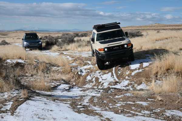
The onX Offroad Difference
onX Offroad combines trail photos, descriptions, difficulty ratings, width restrictions, seasonality, and more in a user-friendly interface. Available on all devices, with offline access and full compatibility with CarPlay and Android Auto. Discover what you're missing today!
Open Trail Map