
Dirt Bike Trails
Near Tuscumbia, Alabama
Explore All Dirt Bike Trails Near Tuscumbia, Alabama
Dirt Bike Trails Near Tuscumbia, Alabama
Discover the best dirt bike trails near you. Browse trail maps, check difficulty ratings, and find your next adventure — whether you're looking for a quick ride or an all-day expedition.
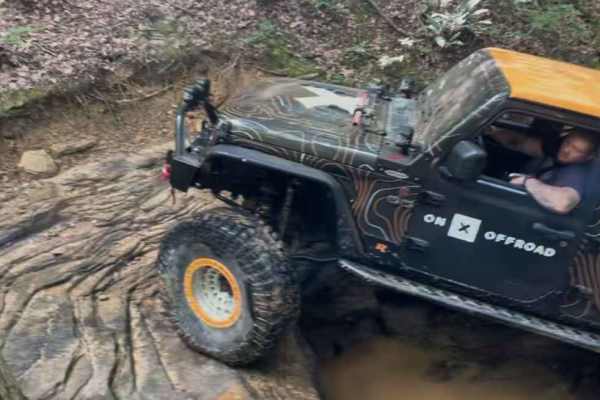
#100 Whiskey Run
This trail starts with a very large V-notch rock that you will fall into. Followed by a large rock garden through the trail to a seven-foot ledge climb. The remainder of the trail is very rocky. This trail is a dried-out creek bed. Multiple areas where we had to climb the banks to prevent damage fro...
Learn more about #100 Whiskey Run
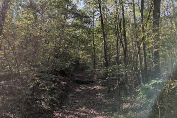
#102 Jake's Hill
Trail #102 – Jake’s Hill lives up to its reputation — and whoever Jake was, he clearly had nerves of steel. This is a very steep and demanding hill climb featuring massive rock ledges exceeding 7 feet in height, loose dirt, and deep ruts that challenge even the most capable rigs. It’s true rock-boun...
Learn more about #102 Jake's Hill
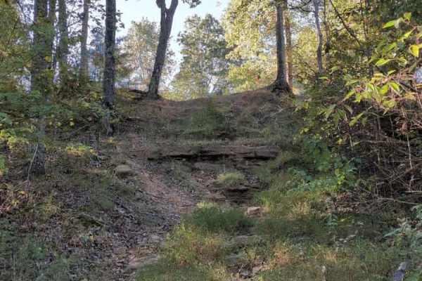
#103 Vertical Limit
Trail #103 – Vertical Limit is an extremely steep and hazardous hill climb located on the north end of the park. About halfway up, the trail splits into three separate lines, each presenting near-vertical ascents with loose rock and deep ruts. These climbs are among the most difficult in the park — ...
Learn more about #103 Vertical Limit
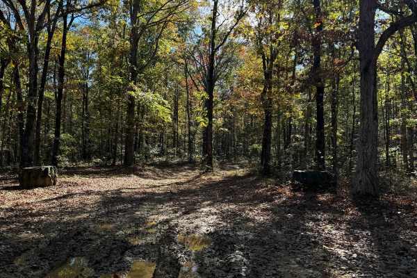
#81 Ridgeline Trail
This Trail is a connector trail that connects two parts of the outfitter trail. This trail follows the ridgeline of Hawkpride Mountain, so it is very flat and forested. The entrance is marked by two big tractor tires sitting on each side of the road. The trail is short and easy to follow since there...
Learn more about #81 Ridgeline Trail
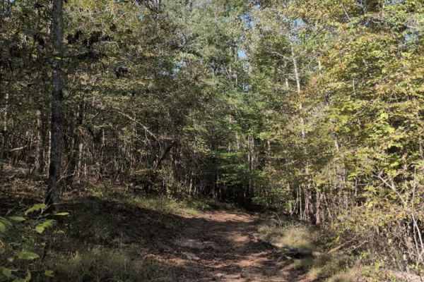
#101 Lower Ridge Line
Trail #111 – Lower Ridgeline is a steep access trail that leads to the start of Trail #100 (Whiskey Run) and several challenging hill climbs located at the north end of the park. While primarily used as a connector, it still offers a bit of character — with a few washouts, small rock obstacles, and ...
Learn more about #101 Lower Ridge Line
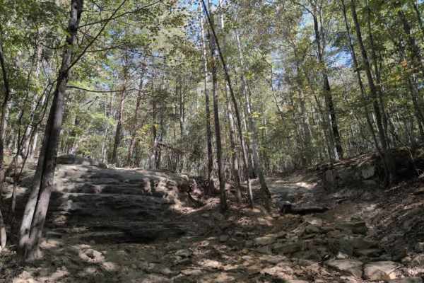
#140 Ed's Ledge
Trail #140 – Ed’s Ledge connects the Polaris Outfitter Trail to Trail #88 (Allen’s Way). As the name suggests, the trail’s main feature is a large rock ledge that presents a serious challenge for most vehicles. Fortunately, an alternate line with a smaller, more manageable ledge runs beside it, thou...
Learn more about #140 Ed's Ledge
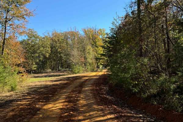
#80 Road to Primitive Camping
This road runs right in front of the cabins in the main parking area. Right past the cabin, you will see the area for primitive camping. This road also leads to the Polaris Outfitter Trail which is the longest and most popular trail in the park. This trail is very short and is really just used as a ...
Learn more about #80 Road to Primitive Camping
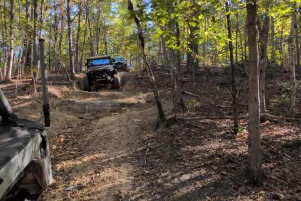
#136a Fatty's Way
Trail – Fatty’s Way descends from the Polaris Outfitter Trail and leads directly to the start of Trail #136 (Fatty’s Crack). Continuing past that junction brings you to the entrance of Trail #115 (Commandments), after which the route runs roughly parallel to Fatty’s Crack before looping back up to r...
Learn more about #136a Fatty's Way
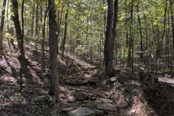
#83 Allen's Way
#83 Allen's Way is essentially a continuation of #136 Fatty's Crack. You can continue to ride the creek bed or some of the flat dirt trails running alongside it. There are some narrow spots and trees to watch out for, but this trail is milder than Fatty's Crack.
Learn more about #83 Allen's Way
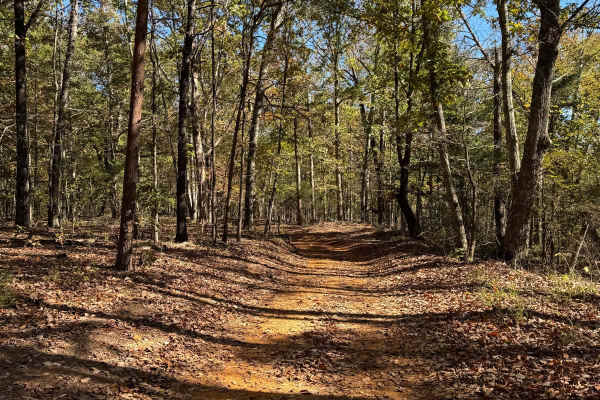
Blue Polaris Outfitter Trail
The Blue Polaris Outfitter Trail is one of the signature trails of Hawkpride Mountain Offroad Park. This trail is mainly a dirty road with the occasional mudhole here and there. You are riding in trees most of the trail, so there is always a chance a limb or two could have fallen. Along this trail, ...
Learn more about Blue Polaris Outfitter Trail
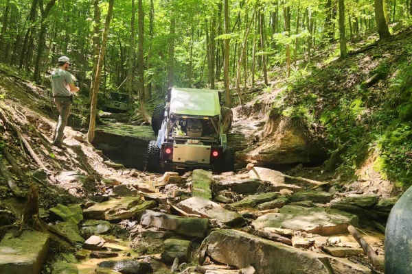
#115 Commandments
Trail #115 Commandments is a rocky climb from the north end of the park all the way back to the power lines. It has a lot of off-camber areas and tight trees to contend with. The trail also features large rock ledges 5 or 6 feet tall to contend with.
Learn more about #115 Commandments
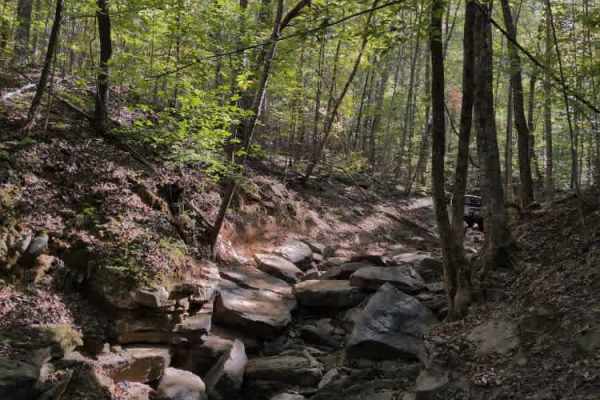
#136 - Fatty's Crack
Fatty's Crack is another popular and talked-about trail at Hawk Pride. It’s a very rough and rocky route characterized by large boulders, steep undercut ledges, and a couple of off-camber sections that challenge even experienced drivers. Fatty's Way runs parallel and offers a safe vantage point to w...
Learn more about #136 - Fatty's Crack
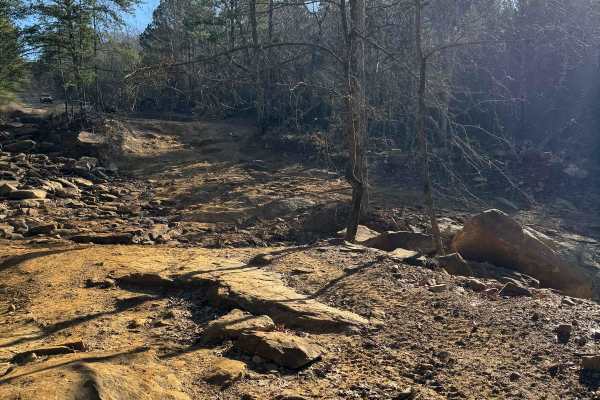
#1 Big Hill
The big hill is one of the main trails to get into the park. This trail starts from the parking lot and then goes down a Big hill that can get slick when wet. There is a great photo opportunity at the top of the big hill with a great view. This trail is plenty wide for two vehicles and due to all th...
Learn more about #1 Big Hill
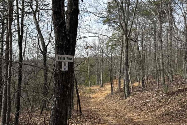
#68 Valley View
#68 Valley View is the upper access trail for trails 14, 16, 122, 123, 124, 133, & 135. Continuing on as a middle access road for trails 8, 9, and 13. Finishes on #6 Mountainside. The trail mostly consists of dirt and small rocks, and it could be pretty muddy after rain. Deeper ruts are encountered ...
Learn more about #68 Valley View
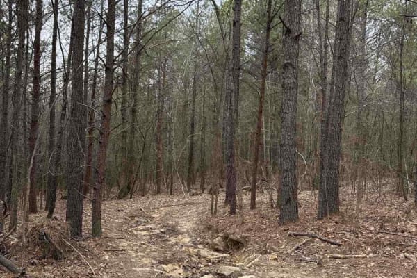
#86 Stinger
Trail #86 Stinger presents a rutted dirt trail heavily strewn with rocks, demanding careful tire placement and a steady hand. Expect frequent bumps and jostles as you navigate the uneven terrain. Occasional mud holes add to the challenge, requiring a bit of finesse. While challenging, Stinger is gen...
Learn more about #86 Stinger
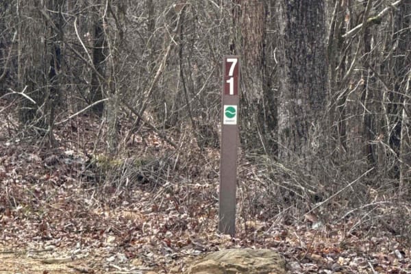
#71 Thompson Trail
#71 Thompson Trail offers a pleasant, albeit slightly bumpy, offroad experience. This predominantly dirt path features light ruts that provide a gentle challenge and occasional mudholes to navigate. Beginning its journey directly off of Trail #1, Thompson Trail meanders its way before ultimately con...
Learn more about #71 Thompson Trail
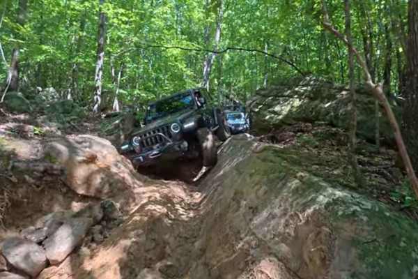
#113 Uphill Both Ways
One of the toughest badge of honor trails that I have run. This trail starts with a gnarly V-notch. There is a lot of scenery and a couple of roundabouts that take you to the same trail. There is one large boulder in the middle of the trail that you can go around. There are a couple of areas with ti...
Learn more about #113 Uphill Both Ways
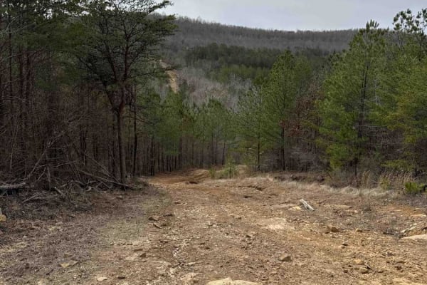
#72 Mall of America
#72 Mall of America is a predominantly dirt trail scattered with rocks. Light ruts provide subtle guidance along the path, and while you'll encounter occasional mudholes, they are typically not overly deep or treacherous. Beginning its journey from the end of #71, this trail provides a scenic route ...
Learn more about #72 Mall of America
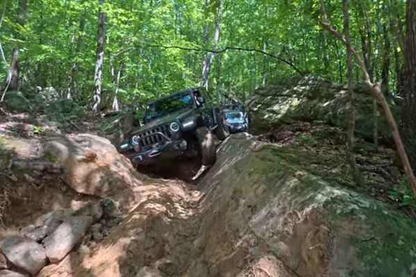
71A
Trail 71A is a long windy trail that runs along park boundaries with one creek crossing. This trail is an easy path through the woods with no major rock or mud obstacles. The creek was dry at the time of mapping, but it gets up to one foot deep in the rainy season.
Learn more about 71A
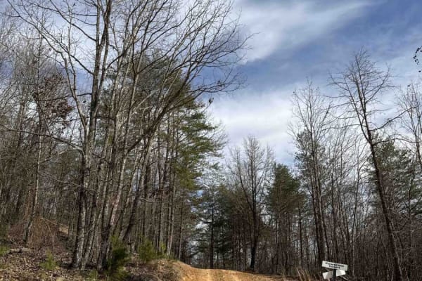
#2 Bluff Trail
#2 Bluff Trail crosses above Race Hills, then continues on as the lower access trail for trails 14, 16, 122, 123, 124, 133, & 135. Finishes on #6 Mountainside. The trail mostly consists of dirt and small rocks, could be pretty muddy after a rain. Several viewing areas are located along the trail to ...
Learn more about #2 Bluff Trail
ATV trails near Tuscumbia, Alabama
Explore ATV-friendly trails near you. These trails are accessible for vehicles up to 50 inches wide, perfect for ATVs and smaller off-road machines.
#100 Whiskey Run
This trail starts with a very large V-notch rock that you will fall into. Followed by a large rock garden through the trail to a seven-foot ledge climb. The remainder of the trail is very rocky. This trail is a dried-out creek bed. Multiple areas where we had to climb the banks to prevent damage fro...
Learn more about #100 Whiskey Run
#102 Jake's Hill
Trail #102 – Jake’s Hill lives up to its reputation — and whoever Jake was, he clearly had nerves of steel. This is a very steep and demanding hill climb featuring massive rock ledges exceeding 7 feet in height, loose dirt, and deep ruts that challenge even the most capable rigs. It’s true rock-boun...
Learn more about #102 Jake's Hill
#103 Vertical Limit
Trail #103 – Vertical Limit is an extremely steep and hazardous hill climb located on the north end of the park. About halfway up, the trail splits into three separate lines, each presenting near-vertical ascents with loose rock and deep ruts. These climbs are among the most difficult in the park — ...
Learn more about #103 Vertical Limit
#81 Ridgeline Trail
This Trail is a connector trail that connects two parts of the outfitter trail. This trail follows the ridgeline of Hawkpride Mountain, so it is very flat and forested. The entrance is marked by two big tractor tires sitting on each side of the road. The trail is short and easy to follow since there...
Learn more about #81 Ridgeline Trail
UTV/side-by-side trails near Tuscumbia, Alabama
Find UTV and side-by-side trails near you. These trails accommodate vehicles up to 60 inches wide, ideal for UTVs, side-by-sides, and wider off-road rigs.
#100 Whiskey Run
This trail starts with a very large V-notch rock that you will fall into. Followed by a large rock garden through the trail to a seven-foot ledge climb. The remainder of the trail is very rocky. This trail is a dried-out creek bed. Multiple areas where we had to climb the banks to prevent damage fro...
Learn more about #100 Whiskey Run
#102 Jake's Hill
Trail #102 – Jake’s Hill lives up to its reputation — and whoever Jake was, he clearly had nerves of steel. This is a very steep and demanding hill climb featuring massive rock ledges exceeding 7 feet in height, loose dirt, and deep ruts that challenge even the most capable rigs. It’s true rock-boun...
Learn more about #102 Jake's Hill
#103 Vertical Limit
Trail #103 – Vertical Limit is an extremely steep and hazardous hill climb located on the north end of the park. About halfway up, the trail splits into three separate lines, each presenting near-vertical ascents with loose rock and deep ruts. These climbs are among the most difficult in the park — ...
Learn more about #103 Vertical Limit
#81 Ridgeline Trail
This Trail is a connector trail that connects two parts of the outfitter trail. This trail follows the ridgeline of Hawkpride Mountain, so it is very flat and forested. The entrance is marked by two big tractor tires sitting on each side of the road. The trail is short and easy to follow since there...
Learn more about #81 Ridgeline Trail
The onX Offroad Difference
onX Offroad combines trail photos, descriptions, difficulty ratings, width restrictions, seasonality, and more in a user-friendly interface. Available on all devices, with offline access and full compatibility with CarPlay and Android Auto. Discover what you're missing today!
Open Trail Map