
Dirt Bike Trails
Near Tazewell, Virginia
Explore All Dirt Bike Trails Near Tazewell, Virginia
Dirt Bike Trails Near Tazewell, Virginia
Discover the best dirt bike trails near you. Browse trail maps, check difficulty ratings, and find your next adventure — whether you're looking for a quick ride or an all-day expedition.
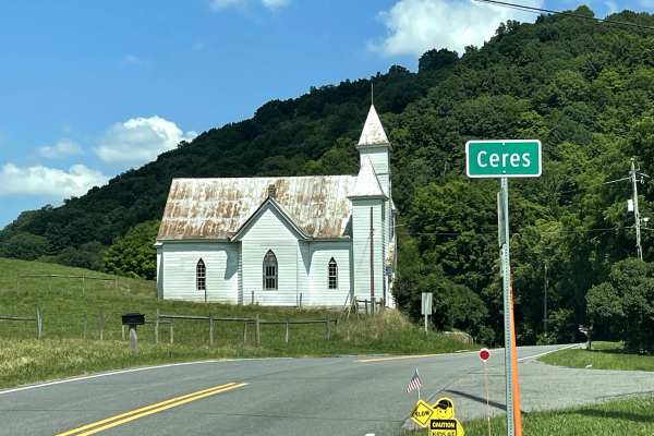
State Route 625
State Route 625 is accessed from the small backcountry community of Ceres and provides a scenic connection to Poor Valley Road (FS 222). This route follows a combination of hard-packed gravel and dirt surfaces, offering travelers an opportunity to extend their off-pavement adventure while remaining ...
Learn more about State Route 625
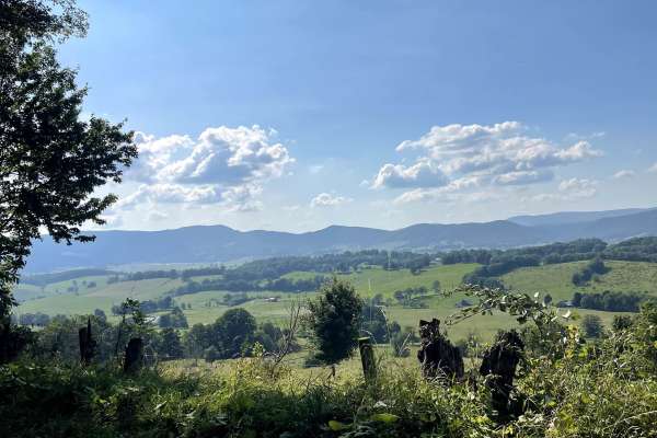
State Route 623
State Route 623 begins or ends in the Sharon Springs community and offers one of the most scenic drives in the area. This hard-packed gravel and dirt route is easy to traverse and provides breathtaking views throughout the journey. The trail winds through valleys, open meadows, and rural landscapes ...
Learn more about State Route 623
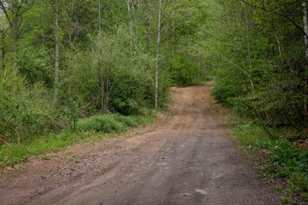
W17
Trail W17 is a wide, smooth route that winds between leafy trees with minimal embedded rock, offering an easy and scenic ride. The trail passes alongside striking rock walls and cliffs, adding visual interest. Visibility is excellent throughout, and the width allows for comfortable two-way travel al...
Learn more about W17
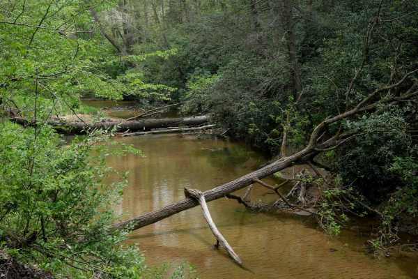
W22
Trail W22 is a 3.7-mile, wide and smooth route that runs alongside a ravine and stream, with scenic mossy rock walls adding visual interest. The trail features long, straight sections with excellent visibility and some gentle corners, making it an easy, fast-moving connector through the Warrior trai...
Learn more about W22
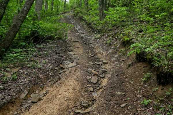
OP 36
OP 36 is a quarter-mile loop at the west end of OP 16 that reconnects back into it. The trail includes steeper sections with embedded and loose rock, shallow ruts, and a few tight switchbacks that require steady momentum to climb smoothly. While more textured and technical than many of the smoother ...
Learn more about OP 36
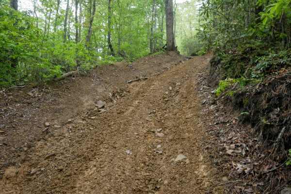
OP 92
OP 92 is a half-mile trail along the western edge of the system, rated moderate due to its steep grades and rocky hills. The narrow, one-lane path includes gradual corners and several downhill sections (when going southbound) with loose rock and pronounced ruts that will easily suck you into the tro...
Learn more about OP 92
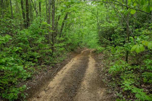
OP 34
OP 34 is a 0.6-mile trail connecting OP 67 to OP 15. It follows a narrow, one-lane shelf path cut into a hillside. The trail runs through lush Appalachian forest, with dense vegetation and thickets lining the route, creating a shaded, enclosed feel. The surface features shallow ruts, loose rock, and...
Learn more about OP 34
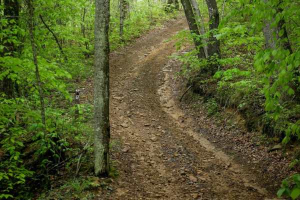
OP 67
OP 67 is a short, 500-yard connector between OP 16 and OP 34. It climbs south to north along a one-lane-wide shelf path through dense, lush Appalachian forest. The trail features muddy ruts, loose rock, and steeper sections that require steady, controlled momentum to maintain traction. It's slightly...
Learn more about OP 67
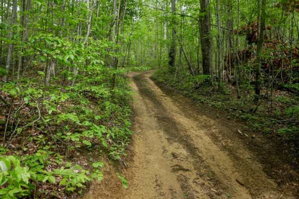
OP 40
Original Pocahontas 40 is a very short, easy connector trail linking OP 67 to OP 92. The trail follows a smooth, one-lane-wide path through dense Appalachian forest with hardly any rocks. Shaded by a thick canopy and surrounded by native undergrowth, it's just a quick stretch through classic Virgini...
Learn more about OP 40
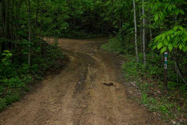
OP 15
OP 15 is a 0.6-mile loop branching off OP 16. It follows a wide, easy path through scenic forest with gradual grades and smooth terrain, crossing Tank Hill Road about halfway through. The trail has some muddy ruts but remains accessible and beginner-friendly. It also provides access to several other...
Learn more about OP 15
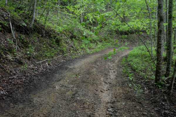
OP 51
OP 51 continues from the east end of OP 16, maintaining a similar feel with a one-lane shelf path alongside rhododendron thickets in a lush forest with a high canopy. The trail features a short, steep climbing section with minor loose rock and ruts. At less than a quarter mile, this moderately easy ...
Learn more about OP 51
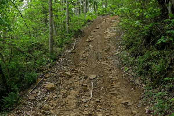
OP 32
OP 32 is a 0.6-mile easy trail that winds through scenic forest with tall ash and maple trees, offering a high canopy and consistent shade. The path is smooth with gradual curves and scattered mud puddles, making for a relaxed ride. A few short sections feature steeper grades and loose rock, but the...
Learn more about OP 32
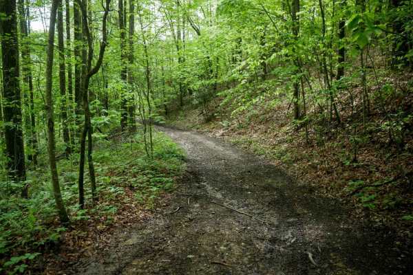
OP 16
OP 16 is a 1.7-mile trail in the western section of the system, offering a slightly more difficult ride due to occasional steeper grades, embedded rock layers, and loose rock. It sometimes parallels a ravine and winds through a lush forest floor lined with rhododendron thickets. Several well-marked ...
Learn more about OP 16
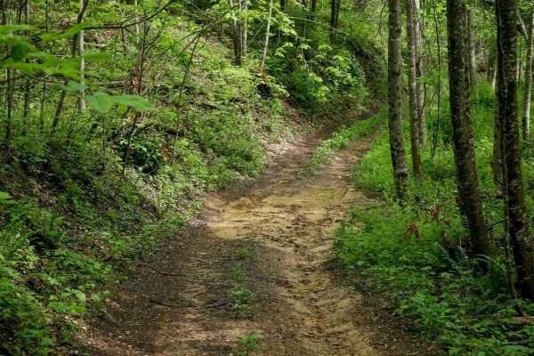
OP 11
The north end of OP 11 parallels a section of OP 12 and runs less than half a mile before ending at OP 46. This easy, one-lane-wide shelf path passes through dense forest with low-hanging branches and is lined with rhododendron and thick undergrowth. The trail shows lighter use, with grass growing i...
Learn more about OP 11
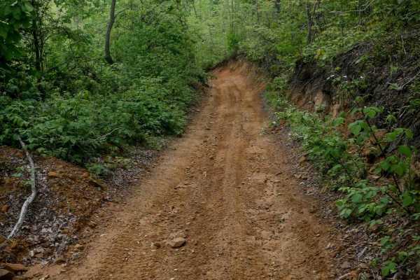
OP 26
OP 26 is a 0.6-mile easy trail that begins on a flat hilltop and gradually transitions into a steeper descent. The northern section travels over smooth, mildly uneven ground with ruts and dips before dropping down a shelf path cut into the hillside, along a dug-out slope lined with roots, moss, and ...
Learn more about OP 26
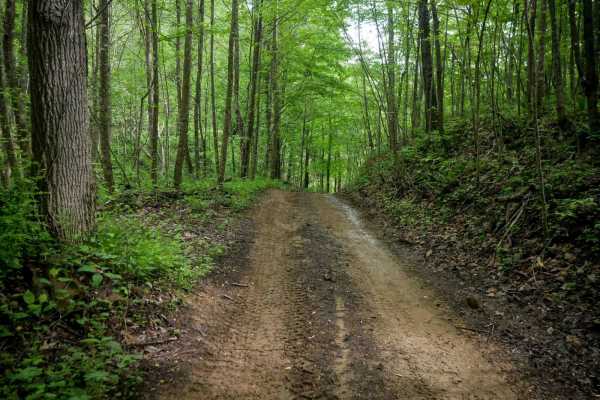
OP 46
OP 46 is a quarter-mile connector between OP 11 and OP 49. The trail is slightly bumpier with more embedded and loose rock, but remains easy overall. It features a steep descent from south to north and is lined in spots with rhododendron thickets, thick ash trees, and slender maple trees, offering a...
Learn more about OP 46
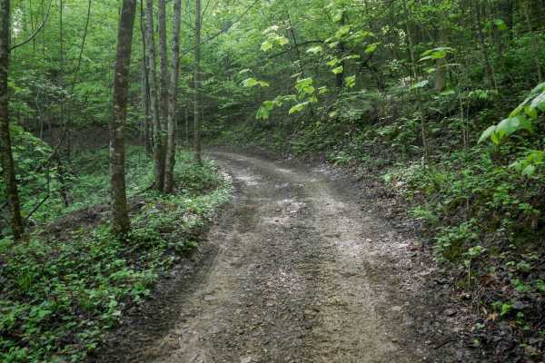
OP 12
The north end of OP 12 is a continuation from OP 43. It traverses a scenic forest with a dense leaf canopy along a shelf path cut into the hillside. The trail features small climbs and descents with numerous curvy sections. The surface includes muddy ruts and areas with loose rock, narrowing to a on...
Learn more about OP 12
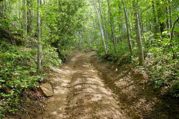
OP 43
OP 43 is an easy trail connecting OP 12 to OP 49, winding through dense forest with low-hanging branches and a lush, moss-covered hillside beside the shelf-cut path. It features gradual elevation changes, sweeping corners, and a fast, flowy feel. The surface is mostly clear, with minor muddy ruts an...
Learn more about OP 43
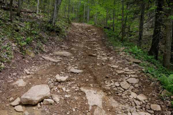
W77
Trail W77 is a 1.8-mile route that begins with a short climb from the north, followed by a flat section before transitioning into a long, steady descent toward its intersection with Trail 22. The trail features embedded rock layers across portions of the path, along with loose rocks and ruts as it w...
Learn more about W77
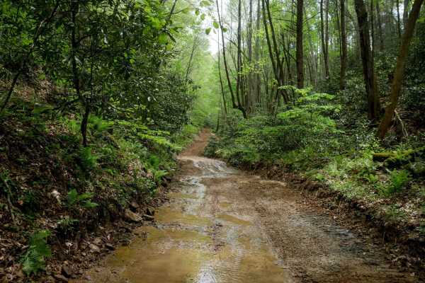
W21
Trail W21 is a long, scenic, and easy 5.2-mile route through lush forest in the Warrior Trail System. From the south, it begins as a wide shelf trail with flat embedded slickrock surfaces that do not increase difficulty. The trail winds alongside mossy rock walls and through gradual corners, includi...
Learn more about W21
ATV trails near Tazewell, Virginia
Explore ATV-friendly trails near you. These trails are accessible for vehicles up to 50 inches wide, perfect for ATVs and smaller off-road machines.
W17
Trail W17 is a wide, smooth route that winds between leafy trees with minimal embedded rock, offering an easy and scenic ride. The trail passes alongside striking rock walls and cliffs, adding visual interest. Visibility is excellent throughout, and the width allows for comfortable two-way travel al...
Learn more about W17
W22
Trail W22 is a 3.7-mile, wide and smooth route that runs alongside a ravine and stream, with scenic mossy rock walls adding visual interest. The trail features long, straight sections with excellent visibility and some gentle corners, making it an easy, fast-moving connector through the Warrior trai...
Learn more about W22
OP 36
OP 36 is a quarter-mile loop at the west end of OP 16 that reconnects back into it. The trail includes steeper sections with embedded and loose rock, shallow ruts, and a few tight switchbacks that require steady momentum to climb smoothly. While more textured and technical than many of the smoother ...
Learn more about OP 36
OP 92
OP 92 is a half-mile trail along the western edge of the system, rated moderate due to its steep grades and rocky hills. The narrow, one-lane path includes gradual corners and several downhill sections (when going southbound) with loose rock and pronounced ruts that will easily suck you into the tro...
Learn more about OP 92
UTV/side-by-side trails near Tazewell, Virginia
Find UTV and side-by-side trails near you. These trails accommodate vehicles up to 60 inches wide, ideal for UTVs, side-by-sides, and wider off-road rigs.
W17
Trail W17 is a wide, smooth route that winds between leafy trees with minimal embedded rock, offering an easy and scenic ride. The trail passes alongside striking rock walls and cliffs, adding visual interest. Visibility is excellent throughout, and the width allows for comfortable two-way travel al...
Learn more about W17
W22
Trail W22 is a 3.7-mile, wide and smooth route that runs alongside a ravine and stream, with scenic mossy rock walls adding visual interest. The trail features long, straight sections with excellent visibility and some gentle corners, making it an easy, fast-moving connector through the Warrior trai...
Learn more about W22
OP 36
OP 36 is a quarter-mile loop at the west end of OP 16 that reconnects back into it. The trail includes steeper sections with embedded and loose rock, shallow ruts, and a few tight switchbacks that require steady momentum to climb smoothly. While more textured and technical than many of the smoother ...
Learn more about OP 36
OP 92
OP 92 is a half-mile trail along the western edge of the system, rated moderate due to its steep grades and rocky hills. The narrow, one-lane path includes gradual corners and several downhill sections (when going southbound) with loose rock and pronounced ruts that will easily suck you into the tro...
Learn more about OP 92
The onX Offroad Difference
onX Offroad combines trail photos, descriptions, difficulty ratings, width restrictions, seasonality, and more in a user-friendly interface. Available on all devices, with offline access and full compatibility with CarPlay and Android Auto. Discover what you're missing today!
Open Trail Map