
Dirt Bike Trails
Near Rexford, Montana
Explore All Dirt Bike Trails Near Rexford, Montana
Dirt Bike Trails Near Rexford, Montana
Discover the best dirt bike trails near you. Browse trail maps, check difficulty ratings, and find your next adventure — whether you're looking for a quick ride or an all-day expedition.
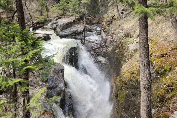
Pinkham Falls Route
Pinkham Falls is a favorite among locals of the Libby area and those visiting Lake Koocanusa. While it is a short route, the entrance is on private land with nearby residences. Be respectful and don't cross onto private land while hiking. This route is unmaintained, and you will need to pack out eve...
Learn more about Pinkham Falls Route
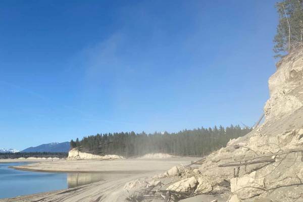
Tobacco Hills Sand Dunes
The area is open year-round, but access to the dunes is only available when the water level allows. Typically late spring. Please keep the water level in mind and do not attempt this trail if water levels are high. You will think you are at the Pacific Coast when you drop out of the trees onto the s...
Learn more about Tobacco Hills Sand Dunes
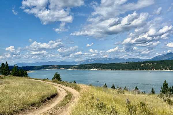
Sharptail North
This trail presents contrasting characteristics. The southern part of the loop is narrow and gives the trail its rating, with deeper ruts and some flex sections. However, the northern section of the loop is very easy. It’s easy enough to pull campers and a sprinter van. In the middle of the loop is ...
Learn more about Sharptail North
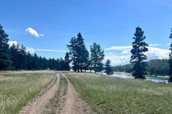
Sharptail South
This bumpy, remote out-and-back trail leads to the southernmost unimproved camping sites of Sharptail South on Lake Koocanusa. The first spur trail takes you to the officially marked Sharptail South area, with a few flat spots and fire rings to call your own for the night, offering elevated views of...
Learn more about Sharptail South
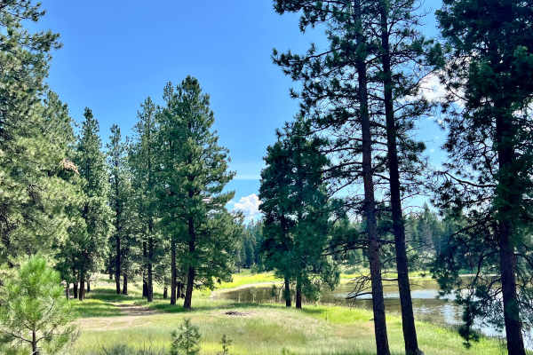
Mud Lake Loop
This is a nice, easy loop trail that goes past the peaceful Mud Lake. The lake is small and might be considered more of a pond. There is a single, lovely, larger campsite right on the pond's edge. Two swans were spotted lazily paddling around the clear waters. Other wildlife can be spotted in the ar...
Learn more about Mud Lake Loop
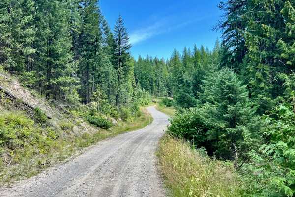
Meadow Creek Road
This easy route provides access from the south section of LinkLater Forest Service Road over to the lower lake area of Lake Koocanusa near Gold Creek Bay. This trail is a great way to connect from the network of trails off of LinkLater FSR to the Kikomun-Newgate paved road. The trail is well-maintai...
Learn more about Meadow Creek Road
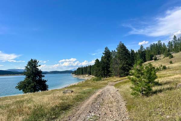
Dorr West Road
Dorr West Road begins as an enjoyable and relatively easy off-road experience, weaving in and out of densely treed sections and opening up into picturesque meadows. Expect a mix of classic trail conditions, including washboard surfaces, potholes, and the occasional mud puddle. As the main road heads...
Learn more about Dorr West Road
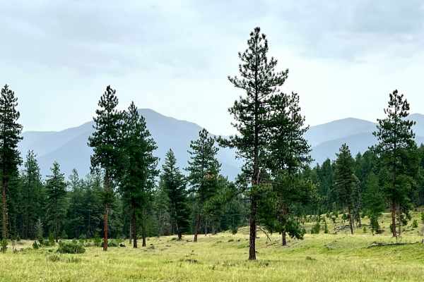
Grassy Meadows
Grassy Meadows offers an easy and scenic cruise, primarily along well-defined two-track trails that traverse vast meadows of former forest clearcuts. While the trail itself presents minimal technical difficulty, the panoramic mountain views that punctuate the treeline are truly stunning. Though not ...
Learn more about Grassy Meadows
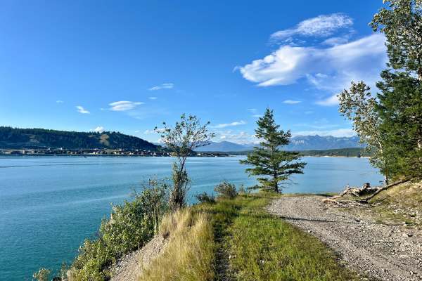
Grasmere Dorr Road
Grasmere Dorr Road begins as a well-maintained and wide graded road, offering an easy 1 rating start as it heads southwest. As you progress, the trail gradually tightens, increasing to a difficulty of 2 towards its end. The road meanders through picturesque meadows and forested sections before openi...
Learn more about Grasmere Dorr Road
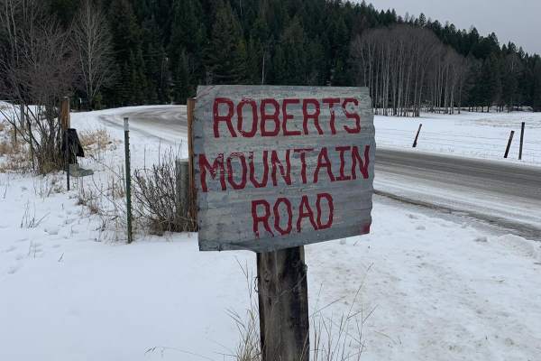
Robert's Mountain Trail
Robert's Mountain Trail is a scenic, 5.5-mile off-road route through the Kootenai National Forest in northwest Montana. Starting off Meadow Creek Road, the point-to-point dirt road climbs gradually from 3,039 feet to a peak of 3,331 feet, winding through dense pine and larch forests.
Rated 3 out of...
Learn more about Robert's Mountain Trail
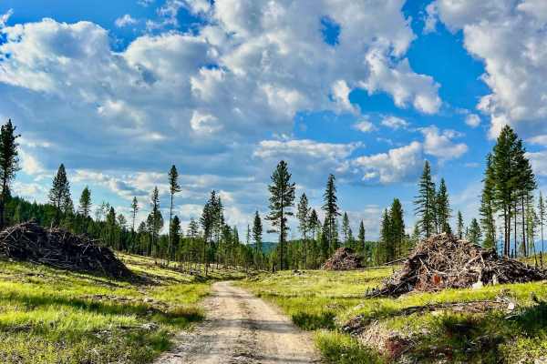
Middle Strauss
This route cuts through the middle section of the Strauss recreation area, serving primarily as a connecting trail rather than providing beach campsites. The northern end of the trail is generally in good shape, offering a relatively smooth passage. However, as you proceed south, the trail becomes i...
Learn more about Middle Strauss
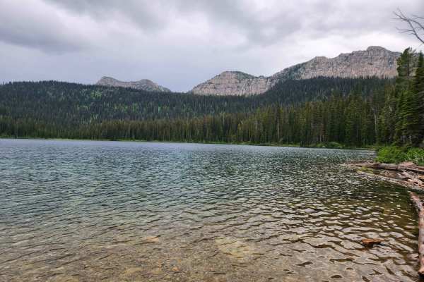
Bluebird Creek
Bluebird Creek is a well-used gravel FSR 7085 in the Kootenai National Forest. The route accesses Little Therriault Lake, the Clarence Ness trailhead, and a horse camp loop and trailhead. This route climbs into the Ten Lakes Wilderness Study Area and gives access to some of the most remote areas of ...
Learn more about Bluebird Creek
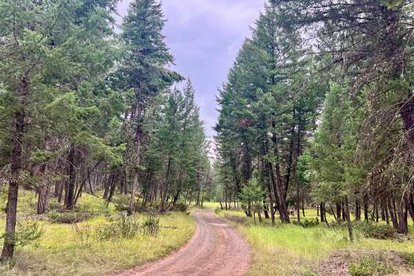
Loon Lake Cutover
Why get back on pavement when you can take dirt! This short and sweet trail provides a quick and easy connection between Loon Lake and Edward's Lake. This easy two-track trail may have one large mud hole to navigate. It could also make this cutover trail impassable early or late in the season. Enjoy...
Learn more about Loon Lake Cutover
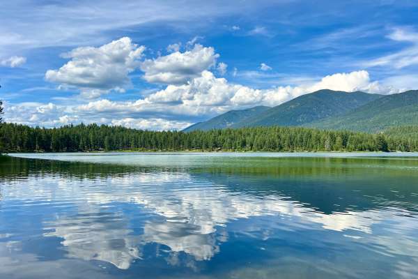
Loon Lake Recreation Area Trail
Embark on an off-road adventure to the serene Loon Lake, a picturesque gem nestled in the woods near Grasmere, British Columbia. Your journey begins just a short distance from the Grasmere General Store, the last opportunity to stock up on essential supplies before immersing yourself in the tranquil...
Learn more about Loon Lake Recreation Area Trail
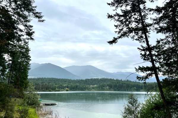
Edward's Lake
Edward's Lake offers a diverse off-road experience. To the east of the lake, the trail is generally easy with a 2 rating, mostly wide enough for two vehicles, with a few narrow sections. A basic campground with a single pit toilet provides a convenient base for exploring the area. As you head west o...
Learn more about Edward's Lake
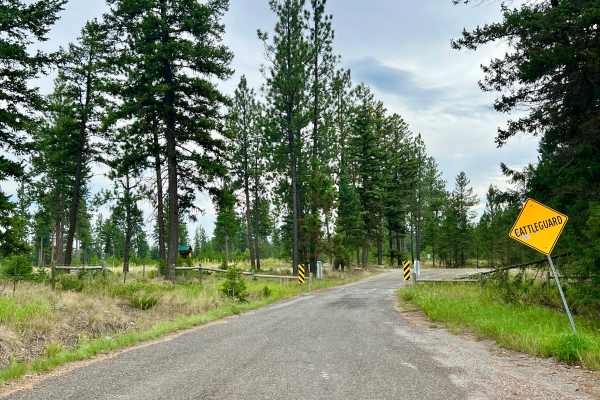
Dorr Cut-off Road
Dorr Cut-off Road is a well-graded and maintained main route providing access to the area from the northern side of Highway 93.
You'll find a staging area right off the highway, complete with informational kiosks featuring QR codes for online map downloads and area information.
While this is the pri...
Learn more about Dorr Cut-off Road
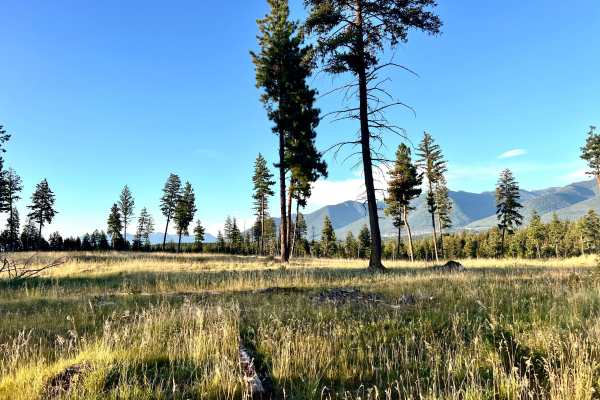
Grasmere Dorr Central 4WD Trail
This route offers a lightly traveled run through the heart of the Koocanusa Recreation Management Area (KRMA). Experience the beauty of grassy two-track trails and navigate through dense forest sections. This area teems with wildlife; keep an eye out for deer and the occasional cattle grazing along ...
Learn more about Grasmere Dorr Central 4WD Trail
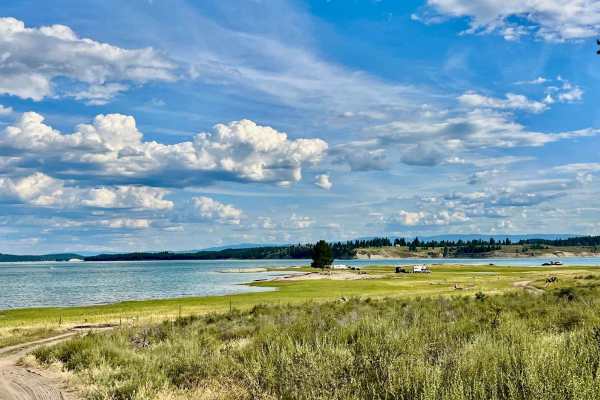
Strauss South
Strauss South picks up from the northern Strauss camping area and cuts through the trees to the southern Strauss dispersed camping area. This route is noticeably rougher than the trail leading to North Strauss and is generally not the best choice for trailers, although you will find a few out there ...
Learn more about Strauss South
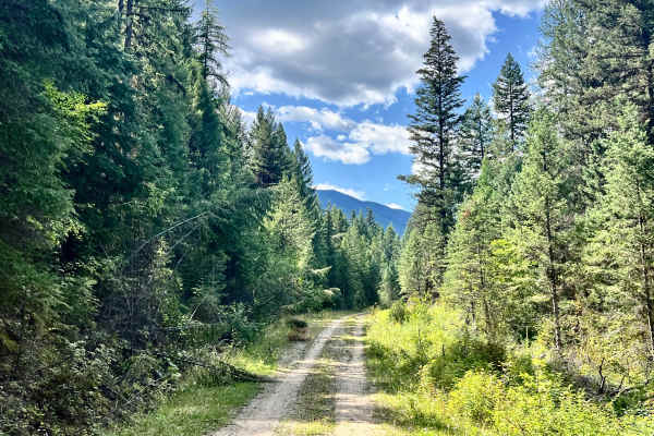
Gold Creek
This seldom-traveled trail begins from the paved road Kikomun-Newgate Road. Look for the Gold Creek Rec Site, which is a free camping area located on both sides of the creek. It is equipped with picnic tables and a pit toilet. It's a nice area to camp with plenty of spots to lay your claim in the sh...
Learn more about Gold Creek
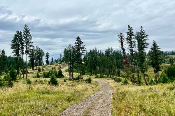
Loon Lake Meadows
This trail begins after passing through the pleasant Loon Lake Campground, heading north into the wilderness. Loon Lake Campground itself is a welcoming place, with open trees, children playing, and excellent lake access. You'll find pit toilets, fire rings, and picnic tables, and if you're fortunat...
Learn more about Loon Lake Meadows
ATV trails near Rexford, Montana
Explore ATV-friendly trails near you. These trails are accessible for vehicles up to 50 inches wide, perfect for ATVs and smaller off-road machines.
Pinkham Falls Route
Pinkham Falls is a favorite among locals of the Libby area and those visiting Lake Koocanusa. While it is a short route, the entrance is on private land with nearby residences. Be respectful and don't cross onto private land while hiking. This route is unmaintained, and you will need to pack out eve...
Learn more about Pinkham Falls Route
Tobacco Hills Sand Dunes
The area is open year-round, but access to the dunes is only available when the water level allows. Typically late spring. Please keep the water level in mind and do not attempt this trail if water levels are high. You will think you are at the Pacific Coast when you drop out of the trees onto the s...
Learn more about Tobacco Hills Sand Dunes
Sharptail North
This trail presents contrasting characteristics. The southern part of the loop is narrow and gives the trail its rating, with deeper ruts and some flex sections. However, the northern section of the loop is very easy. It’s easy enough to pull campers and a sprinter van. In the middle of the loop is ...
Learn more about Sharptail North
Sharptail South
This bumpy, remote out-and-back trail leads to the southernmost unimproved camping sites of Sharptail South on Lake Koocanusa. The first spur trail takes you to the officially marked Sharptail South area, with a few flat spots and fire rings to call your own for the night, offering elevated views of...
Learn more about Sharptail South
UTV/side-by-side trails near Rexford, Montana
Find UTV and side-by-side trails near you. These trails accommodate vehicles up to 60 inches wide, ideal for UTVs, side-by-sides, and wider off-road rigs.
Pinkham Falls Route
Pinkham Falls is a favorite among locals of the Libby area and those visiting Lake Koocanusa. While it is a short route, the entrance is on private land with nearby residences. Be respectful and don't cross onto private land while hiking. This route is unmaintained, and you will need to pack out eve...
Learn more about Pinkham Falls Route
Tobacco Hills Sand Dunes
The area is open year-round, but access to the dunes is only available when the water level allows. Typically late spring. Please keep the water level in mind and do not attempt this trail if water levels are high. You will think you are at the Pacific Coast when you drop out of the trees onto the s...
Learn more about Tobacco Hills Sand Dunes
Sharptail North
This trail presents contrasting characteristics. The southern part of the loop is narrow and gives the trail its rating, with deeper ruts and some flex sections. However, the northern section of the loop is very easy. It’s easy enough to pull campers and a sprinter van. In the middle of the loop is ...
Learn more about Sharptail North
Sharptail South
This bumpy, remote out-and-back trail leads to the southernmost unimproved camping sites of Sharptail South on Lake Koocanusa. The first spur trail takes you to the officially marked Sharptail South area, with a few flat spots and fire rings to call your own for the night, offering elevated views of...
Learn more about Sharptail South
The onX Offroad Difference
onX Offroad combines trail photos, descriptions, difficulty ratings, width restrictions, seasonality, and more in a user-friendly interface. Available on all devices, with offline access and full compatibility with CarPlay and Android Auto. Discover what you're missing today!
Open Trail Map