
Dirt Bike Trails
Near Rayle, Georgia
Explore All Dirt Bike Trails Near Rayle, Georgia
Dirt Bike Trails Near Rayle, Georgia
Discover the best dirt bike trails near you. Browse trail maps, check difficulty ratings, and find your next adventure — whether you're looking for a quick ride or an all-day expedition.
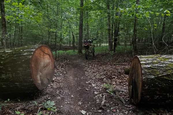
A Loop
Town Creek ORV is located in Onocee National Forest. This fun singletrack has plenty of twisties, ups and downs, both sweeping and tight turns, over rocks, pine needles, sand, hard pack dirt , roots and small tree limbs. The trail is ridden clockwise . There are few bridges on the this trail, wh...
Learn more about A Loop
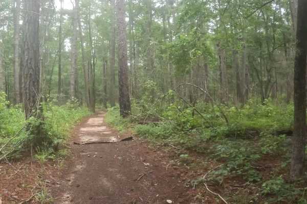
B Loop
Town Creek ORV is located in Onocee National Forest. The B Loop trail is fairly flat and made up of hard pack and red clay dirt with plenty of roots. The trail is ridden clockwise . The last two miles of the trail, are the most challenging due downhill trail erosion. There are many bridges on the t...
Learn more about B Loop
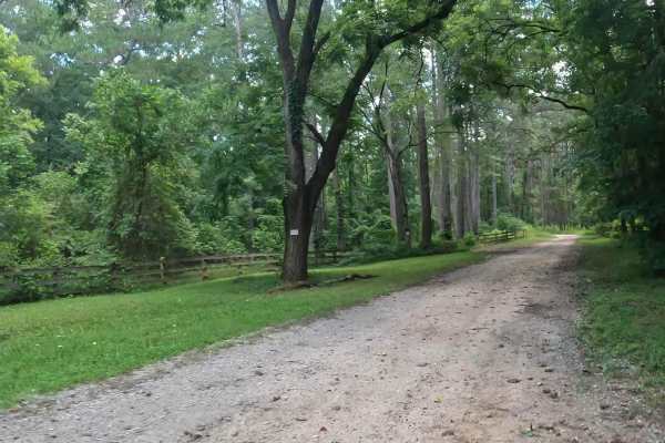
Penfield Hunt Camp Road
Penfield Hunt Camp Road is located in the Oconee National Forest. This road is mostly flat, with a few pothole exceptions. If you are traveling with a long trailer, drive slowly; the road is passable. At the end of the road, you'll find three fire rings, a large turnaround loop, a pit toilet, handic...
Learn more about Penfield Hunt Camp Road
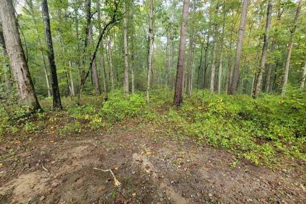
Turner Trail
Turner Trail offers offroaders an engaging, scenic trek through the dense pine and hardwood forests of the Oconee National Forest, making it an ideal option for drivers looking to escape into a remote woodland environment. Stretching just over two miles, this route begins just south of Springfield C...
Learn more about Turner Trail
Parsons Mtn OHV
Parsons Mountain OHV Trail is a well-maintained forest trail system suited for ATV riders, dirt bikes, and side-by-sides looking for a manageable ride with variable conditions that can quickly become more technical after rain. Located within Sumter National Forest near Abbeville and McCormick County...
Learn more about Parsons Mtn OHV
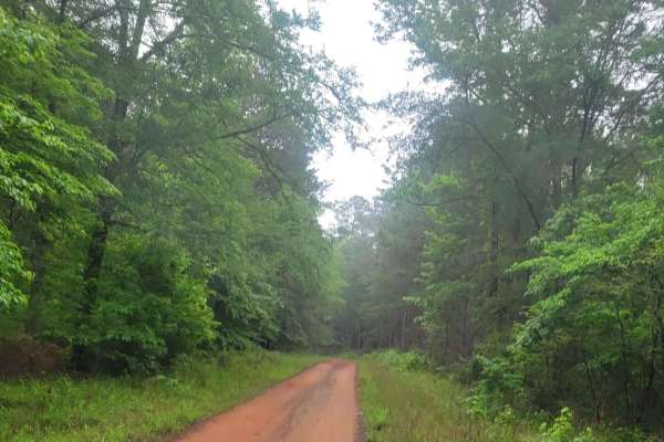
Oconee Southern Traverse (Segment 1)
This route begins at the northern end of Burgess Road (1120), a well-maintained gravel service road that leads to Martins Mill Road. At this split, travelers should turn right as taking a left will lead you to a dead end. Martins Mill Road is well maintained however some washed out road conditions m...
Learn more about Oconee Southern Traverse (Segment 1)
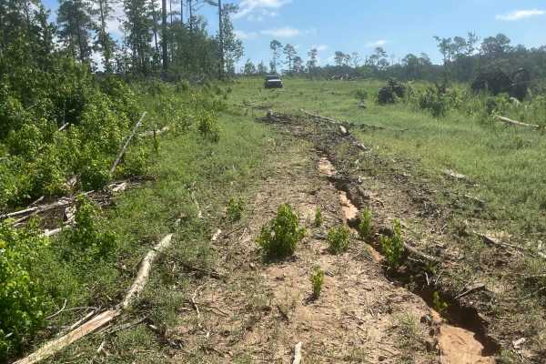
Mason Wildlife Trail North
Most of this trail is a single lane with several muddy patches and occasional ruts that require careful navigation. A four-wheel-drive vehicle is essential unless it hasn’t rained for weeks. Expect multiple mud holes, the deepest around eight inches, with some areas prone to sticky, deep mud—exercis...
Learn more about Mason Wildlife Trail North
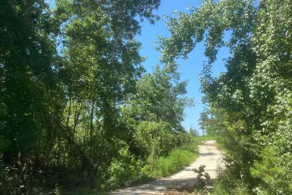
Mason Wildlife Trail South
The trail begins as gravel but quickly transitions to a dirt path with grass in the center. Located in a Wildlife Management Area used for hunting, it’s best to visit on Sundays when hunting is prohibited. Expect frequent small mud holes, as the trail can become very muddy. Taking the first right fo...
Learn more about Mason Wildlife Trail South
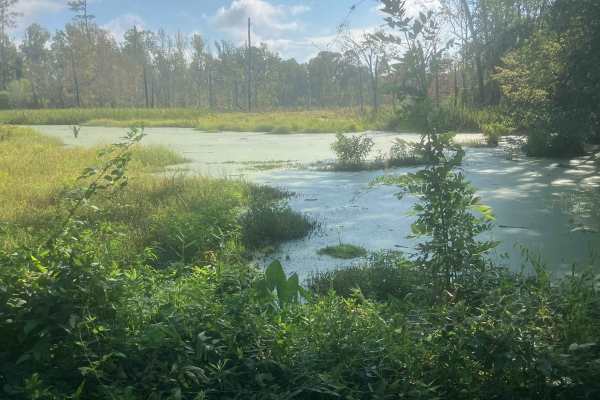
Fury's Ferry Boat Ramp
This short trail takes you down to the South Carolina Side of the Savannah River. You will pass some very swampy areas on both sides of the road. If you stop looking at the wildlife, make sure you watch for Alligators. This is a great trail to hit if you are out for a day of exploring and want a ni...
Learn more about Fury's Ferry Boat Ramp
Woodlawn D
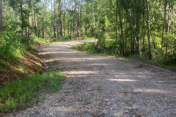
This beautiful, short trail offers scenic views along its path. It follows a well-maintained forest road, wide enough to allow two full-sized 4x4 vehicles to pass comfortably. Although it doesn't provide an off-road challenge, the trail gives visitors a captivating glimpse deep into the Sumter Natio...
Learn more about Woodlawn D
Murder Creek
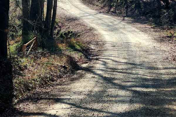
This 3.2-mile trail winds through the Charlie Elliott Wildlife Center, offering a relaxing yet engaging ride over mostly gravel with stretches of dirt. Expect scattered potholes and occasional soft shoulders shaped by runoff. This is a well-maintained and traveled road, so be prepared for frequent s...
Learn more about Murder Creek
Williamson Cemetery A - FS 1048A
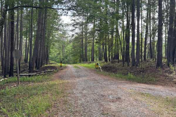
Williamson Cemetery A (FS 1048A) branches off of FS 1048 about three miles south of County Road 212. Most of the road is single-lane, improved gravel up to the closed gate where it enters private land. Turning left at the private gate to continue, the road loses some of its gravel base and picks up ...
Learn more about Williamson Cemetery A - FS 1048A
Red Root Road- FS 92
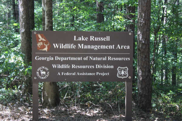
Red Root Road, also known as FSR 92, is a route that traverses the Lake Russel WMA from just outside Toccoa, GA to Mt. Airy, GA. This route can be used to access seasonal routes within the WMA area. Multiple areas can be found for camping, especially along the Middle Fork Broad River. If camping, p...
Learn more about Red Root Road- FS 92
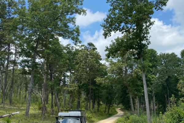
Guard Camp Road
Guard Camp Road is located in the Chattahoochee National Forest near Cornelia, GA. Nearby, you can visit Tallulah Gorge, view the waterfalls, explore downtown Clayton and fish in the numerous waterways. While camping is available throughout the region, this section of national forest seems less trav...
Learn more about Guard Camp Road
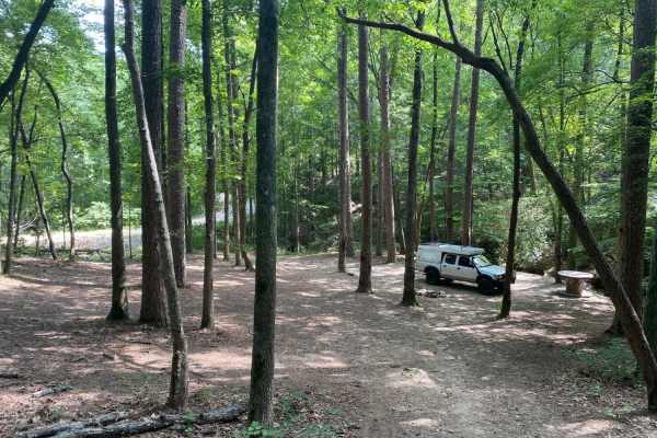
Brown Bottom Road
Brown Bottom Road is located in the center of a section of the Chattahoochee National Forest outside of Cornelia, GA. This road is wide, covered in large gravel and wide enough for two vehicles to pass in most sections. However, it's important to remember safe driving practices due to some steep cu...
Learn more about Brown Bottom Road
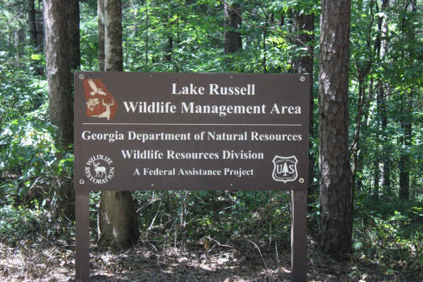
Georgia Mountain Orchard
Georgia Mountain Orchard Road is an easy route into the Lake Russel WMA. This route begins just outside of Cornelia, Georgia. This road can be driven in 2WD and is a relaxing trek overall. Driving south, you will encounter Austin Cemetery on the left. It is easy to pass if you are not looking for it...
Learn more about Georgia Mountain Orchard
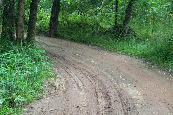
Campsite Road
Provides access to Campsites 2 through 6. This area is riddled with short twisties that can get you turned around easily. Keep track of the map so you don't get lost getting back to camp. Keep in mind that a few of the mudholes can be very deep- stay out, or you might need a rescue.
Learn more about Campsite Road

River Road
West side perimeter road following the river at the bottom of the hill. Portions may flood if the river is up. Easy 2-way trail, but can be VERY muddy. Stay out of the water- It's DEEP! River Road provides access to the lower entry or exit points of many of the park's trails. It also runs through t...
Learn more about River Road
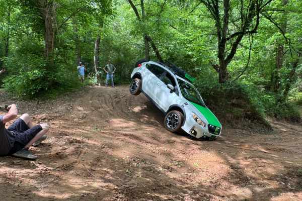
Water Cooler
Water Cooler trail may look like a straightforward loop, but in reality, it is a maze of tight twisties in the sand. Great place to practice wheeling in off-camber situations as well as testing your rig's flex and balance. Easy sand trails, but watch out for standing water, it changes with the tide ...
Learn more about Water Cooler
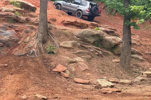
Hill 3
Up or down, it's a fun hill for everyone. Provides an easy way up or down to watch the wall-climbing action. Hill 3 connects The Barnyard at the bottom to Skip's Lookout at the top. There are a few smaller rock obstacles to play on along the north side.
Learn more about Hill 3
ATV trails near Rayle, Georgia
Explore ATV-friendly trails near you. These trails are accessible for vehicles up to 50 inches wide, perfect for ATVs and smaller off-road machines.
B Loop
Town Creek ORV is located in Onocee National Forest. The B Loop trail is fairly flat and made up of hard pack and red clay dirt with plenty of roots. The trail is ridden clockwise . The last two miles of the trail, are the most challenging due downhill trail erosion. There are many bridges on the t...
Learn more about B Loop
Penfield Hunt Camp Road
Penfield Hunt Camp Road is located in the Oconee National Forest. This road is mostly flat, with a few pothole exceptions. If you are traveling with a long trailer, drive slowly; the road is passable. At the end of the road, you'll find three fire rings, a large turnaround loop, a pit toilet, handic...
Learn more about Penfield Hunt Camp Road
Turner Trail
Turner Trail offers offroaders an engaging, scenic trek through the dense pine and hardwood forests of the Oconee National Forest, making it an ideal option for drivers looking to escape into a remote woodland environment. Stretching just over two miles, this route begins just south of Springfield C...
Learn more about Turner Trail
Parsons Mtn OHV
Parsons Mountain OHV Trail is a well-maintained forest trail system suited for ATV riders, dirt bikes, and side-by-sides looking for a manageable ride with variable conditions that can quickly become more technical after rain. Located within Sumter National Forest near Abbeville and McCormick County...
Learn more about Parsons Mtn OHV
UTV/side-by-side trails near Rayle, Georgia
Find UTV and side-by-side trails near you. These trails accommodate vehicles up to 60 inches wide, ideal for UTVs, side-by-sides, and wider off-road rigs.
Penfield Hunt Camp Road
Penfield Hunt Camp Road is located in the Oconee National Forest. This road is mostly flat, with a few pothole exceptions. If you are traveling with a long trailer, drive slowly; the road is passable. At the end of the road, you'll find three fire rings, a large turnaround loop, a pit toilet, handic...
Learn more about Penfield Hunt Camp Road
Mason Wildlife Trail North
Most of this trail is a single lane with several muddy patches and occasional ruts that require careful navigation. A four-wheel-drive vehicle is essential unless it hasn’t rained for weeks. Expect multiple mud holes, the deepest around eight inches, with some areas prone to sticky, deep mud—exercis...
Learn more about Mason Wildlife Trail North
Mason Wildlife Trail South
The trail begins as gravel but quickly transitions to a dirt path with grass in the center. Located in a Wildlife Management Area used for hunting, it’s best to visit on Sundays when hunting is prohibited. Expect frequent small mud holes, as the trail can become very muddy. Taking the first right fo...
Learn more about Mason Wildlife Trail South
Fury's Ferry Boat Ramp
This short trail takes you down to the South Carolina Side of the Savannah River. You will pass some very swampy areas on both sides of the road. If you stop looking at the wildlife, make sure you watch for Alligators. This is a great trail to hit if you are out for a day of exploring and want a ni...
Learn more about Fury's Ferry Boat Ramp
The onX Offroad Difference
onX Offroad combines trail photos, descriptions, difficulty ratings, width restrictions, seasonality, and more in a user-friendly interface. Available on all devices, with offline access and full compatibility with CarPlay and Android Auto. Discover what you're missing today!
Open Trail Map