
Dirt Bike Trails
Near Pine Valley, Utah
Explore All Dirt Bike Trails Near Pine Valley, Utah
Dirt Bike Trails Near Pine Valley, Utah
Discover the best dirt bike trails near you. Browse trail maps, check difficulty ratings, and find your next adventure — whether you're looking for a quick ride or an all-day expedition.
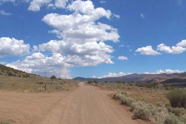
Grass Valley Rd-FR30011
Grass Valley Road is a 12.5-mile point-to-point dirt road rated 2 of 10. This road connects the communities of Pine Valley and Pinto. The road is predominately two-lane consisting of hard-pack dirt and gravel. This trail travels through the Pine Mountain section of the Dixie National Forest. If run ...
Learn more about Grass Valley Rd-FR30011
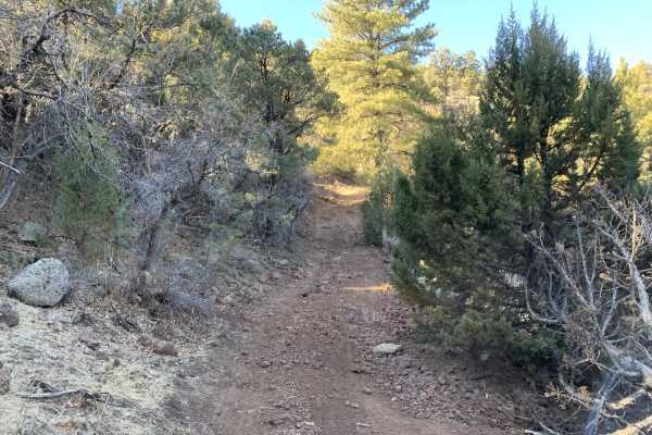
Pine Valley Mahogany Bench
The primary road is an easy trail, suitable for most vehicles unless it has recently rained or snowed. The road parallels the paved highway and the Santa Clara River between Route 18 and Pine Valley. The gorge and local views are not visible from the highway. There is one small spring runoff you wil...
Learn more about Pine Valley Mahogany Bench
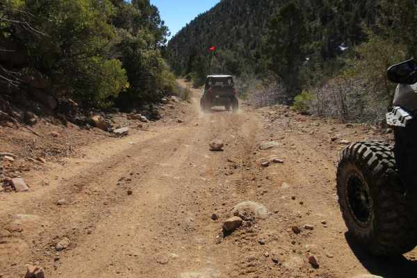
Cottonwood East
The first part of this trail is relatively easy, but it does narrow on the second half as you climb up the canyon. At the end you stop right next to a large pipe that is carrying significant water from a spring on up the valley. You can tell how much water flowed from the area by the size of the old...
Learn more about Cottonwood East
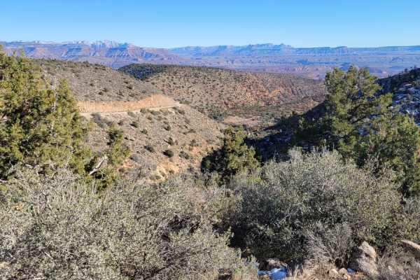
Cottonwood Creek
This easy scenic dirt road takes you around the Pine Valley Mountains and through the Cottonwood Forest Wilderness. There are a couple of hiking trailheads along this route as well as Yankee Doodle Canyon. Scattered primitive camp spots were noted. Great views of the towering mountain to the North.
Learn more about Cottonwood Creek
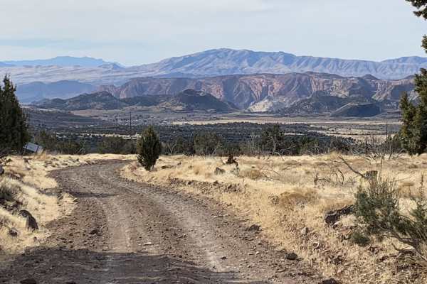
Diamond Valley-Lone Pine-Cottonwood Loop
This is a fun, easy trail with fantastic views of the surrounding area. On the Diamond Valley side you will have views of cinder cones, a dormant volcano with crater, hundreds of square miles to the west. Lone Pine Canyon has an oddity with a dead tall single pine with the backdrop of white mountain...
Learn more about Diamond Valley-Lone Pine-Cottonwood Loop
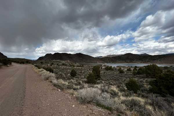
Old New Castle Road
This trail has scenic views and a couple of lookout points. It takes you to the edge of Newcastle Reservoir. It is two lanes wide most of the way and is fairly well maintained. There are a few small hills in the reservoir area. The worst you can expect is a little bit of mud.
Learn more about Old New Castle Road
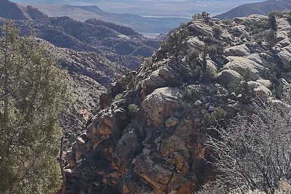
Leeds Creek - Cottonwood Vista Loop
Leeds Creek-Cottonwood Trail runs generally east and west in the Dixie National Forest in the shadow of Trail, Signal, and Burger Peaks. The Vista Loop spur off of this trail is Forest Service Trail #34058 and rises to an elevation of just over 4267 feet. It's a short loop, but it offers amazing vie...
Learn more about Leeds Creek - Cottonwood Vista Loop
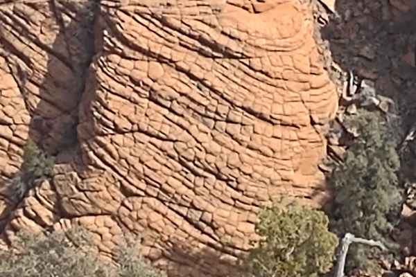
Leeds-Cottonwood Elephant Skin Canyon
This spur runs to the south off of Leeds Cr-Cottonwood Trail, and the Forest Service trail number is #34056 for the first part of this track. We rode beyond the Forest Service trail on a well-used two-track trail, and we found what one member of our group called "the gem" of the day! A canyon at the...
Learn more about Leeds-Cottonwood Elephant Skin Canyon
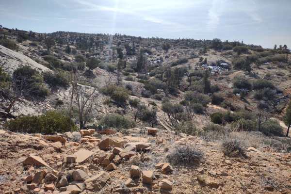
Leeds Creek-Cottonwood Spur #30905
Another "least traveled" route that goes south into the Dixie National Forest from the Leeds Creek-Cottonwood Trail. We rode this trail in early February, and it had just a bit of mud. This is a track that opens up hiking, exploring, and photography opportunities in this beautiful area of Utah. It's...
Learn more about Leeds Creek-Cottonwood Spur #30905
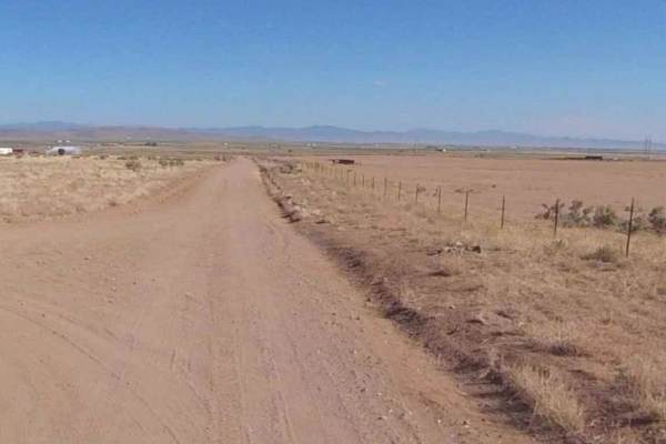
Meadow Canyon Road-FS30010
Meadow Canyon Road-FS30010 is a 6.5-mile point-to-point road that runs through Big Canyon and is rated 2 of 10. This two-track trail offers scenic views and stops at two historic sites: Hamblin Cemetery and the old townsite of Hamblin. The trail is mostly dirt and sand and crosses a single wash. The...
Learn more about Meadow Canyon Road-FS30010
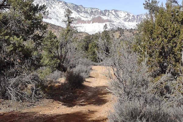
Leeds Cr-Cottonwood North Spur #30903
This trail takes you further north into the mountains, closer to Trail Peak. From the end of our track is a hiking trail to continue exploring this area of the Dixie National Forest. It rises to about 4700 feet. We rode the trail in early February, and in areas there was mud, but most of the trail w...
Learn more about Leeds Cr-Cottonwood North Spur #30903
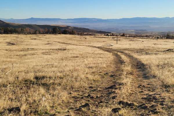
Cedar Bench Trail
This dirt trail starts off as a well-defined route but slowly turns into a meager two-track that ultimately fades away at a dead-end. Water erosion has rutted some spots. There are several sections with large, loose rocks to navigate. Scattered primitive camp spots were noted in the area. Please be ...
Learn more about Cedar Bench Trail
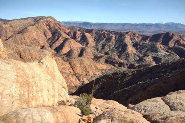
Leeds-Cottonwood Spur
This trail takes you to 4500 feet above sea level in the Dixie National Forest. The views include the Harmony Mountains to the north and some of the many canyons in the Cottonwood Canyon Wilderness to the south. To the east, you can see Zion National Park. It's a trail less traveled, so you're not l...
Learn more about Leeds-Cottonwood Spur
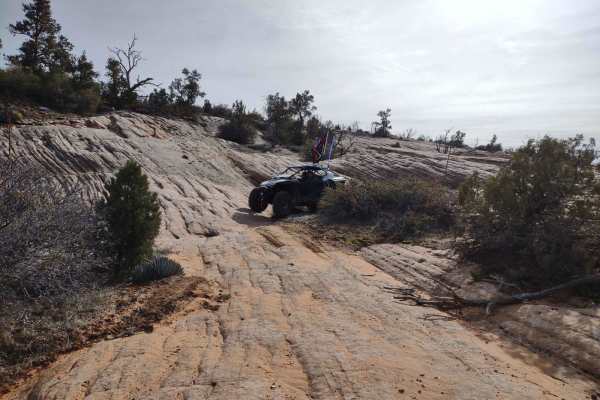
Leeds-Cottonwood Rock Crawling Playground
Just a little over a mile south of Leeds Creek-Cottonwood Trail, on Trail #30904, we found an area of slick and smooth rock to crawl around on with our SXSs. The scenery is amazing, but the best part was playing on the rocks. There aren't any difficult obstacles like in Sand Hollow State Park, but i...
Learn more about Leeds-Cottonwood Rock Crawling Playground
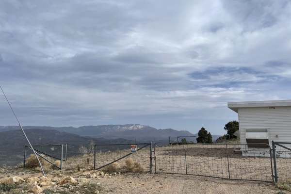
Big Mountain
If you're looking to get some elevation, look no further. Big mountain is over 7k feet and offers almost 360deg views from the top. You may have to explore the little fingers of trails up there to get a complete picture. But no matter which way you look, you won't be disappointed. The road itself is...
Learn more about Big Mountain
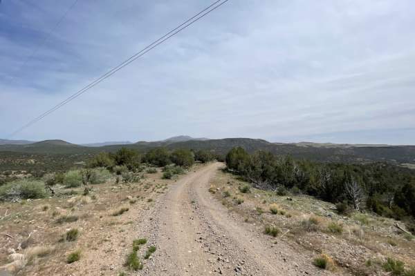
Cove Wash To Magotsu Creek
This mostly easy rip over the hill follows the utility lines as it twists, turns, rises, and falls along the mountains. There are long loose hill climbs, tight short turns, and some deeply rutted sections that may be impassable when wet. There are a few nice camping spots on the west side by Cove Wa...
Learn more about Cove Wash To Magotsu Creek
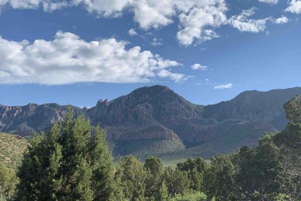
Turkey Road to Lone Pine
Turkey Road to Lone Pine is a scenic 23.4-mile off-road loop near St. George, Utah, perfect for drivers of high-clearance four-wheel-drive vehicles and SxSs looking to experience the transition from red rock desert to pine-covered highlands. Starting along West Old Turkey Road, the route winds throu...
Learn more about Turkey Road to Lone Pine
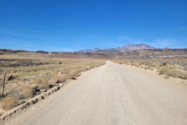
Cottonwood Road
What begins as a paved road soon turns into an easy, maintained dirt road, wide enough for vehicles to pass. There are several (hike, bike, horse) trailheads along this route. Beautiful desert scenery in every direction. Even though it's on BLM land, it's also the Red Cliffs National Conservation Ar...
Learn more about Cottonwood Road
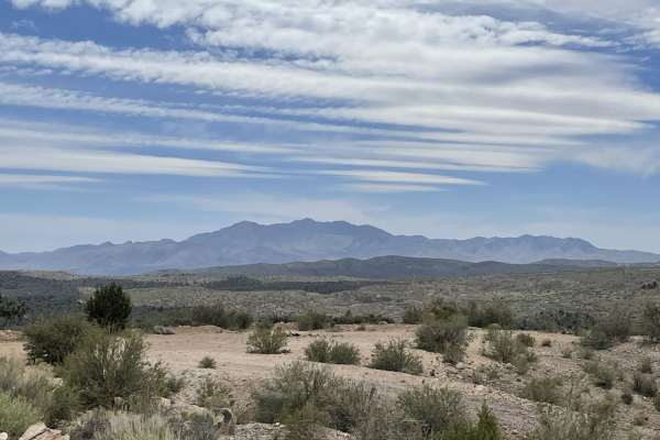
Lower Enterprise Lakes / Veyo Road
This easy two-lane washboard road heads up into the hills towards enterprise lakes and is almost all uphill. Once in the National Forest, the trail narrows to a single width with pullouts to pass oncoming traffic. There are many camping opportunities along the way down the many different pullouts. A...
Learn more about Lower Enterprise Lakes / Veyo Road
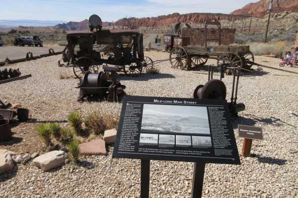
Silver Reef - Leeds Canyon
Silver Reef - Leeds Canyon is an easy, scenic 7.9-mile point-to-point drive perfect for families and beginners looking to explore historic ruins and climb from the desert floor into the cool pine forests of the Dixie National Forest. Starting near the historic town of Leeds, Utah, at an elevation of...
Learn more about Silver Reef - Leeds Canyon
ATV trails near Pine Valley, Utah
Explore ATV-friendly trails near you. These trails are accessible for vehicles up to 50 inches wide, perfect for ATVs and smaller off-road machines.
Grass Valley Rd-FR30011
Grass Valley Road is a 12.5-mile point-to-point dirt road rated 2 of 10. This road connects the communities of Pine Valley and Pinto. The road is predominately two-lane consisting of hard-pack dirt and gravel. This trail travels through the Pine Mountain section of the Dixie National Forest. If run ...
Learn more about Grass Valley Rd-FR30011
Pine Valley Mahogany Bench
The primary road is an easy trail, suitable for most vehicles unless it has recently rained or snowed. The road parallels the paved highway and the Santa Clara River between Route 18 and Pine Valley. The gorge and local views are not visible from the highway. There is one small spring runoff you wil...
Learn more about Pine Valley Mahogany Bench
Cottonwood East
The first part of this trail is relatively easy, but it does narrow on the second half as you climb up the canyon. At the end you stop right next to a large pipe that is carrying significant water from a spring on up the valley. You can tell how much water flowed from the area by the size of the old...
Learn more about Cottonwood East
Cottonwood Creek
This easy scenic dirt road takes you around the Pine Valley Mountains and through the Cottonwood Forest Wilderness. There are a couple of hiking trailheads along this route as well as Yankee Doodle Canyon. Scattered primitive camp spots were noted. Great views of the towering mountain to the North.
Learn more about Cottonwood Creek
UTV/side-by-side trails near Pine Valley, Utah
Find UTV and side-by-side trails near you. These trails accommodate vehicles up to 60 inches wide, ideal for UTVs, side-by-sides, and wider off-road rigs.
Grass Valley Rd-FR30011
Grass Valley Road is a 12.5-mile point-to-point dirt road rated 2 of 10. This road connects the communities of Pine Valley and Pinto. The road is predominately two-lane consisting of hard-pack dirt and gravel. This trail travels through the Pine Mountain section of the Dixie National Forest. If run ...
Learn more about Grass Valley Rd-FR30011
Cottonwood Creek
This easy scenic dirt road takes you around the Pine Valley Mountains and through the Cottonwood Forest Wilderness. There are a couple of hiking trailheads along this route as well as Yankee Doodle Canyon. Scattered primitive camp spots were noted. Great views of the towering mountain to the North.
Learn more about Cottonwood Creek
Old New Castle Road
This trail has scenic views and a couple of lookout points. It takes you to the edge of Newcastle Reservoir. It is two lanes wide most of the way and is fairly well maintained. There are a few small hills in the reservoir area. The worst you can expect is a little bit of mud.
Learn more about Old New Castle Road
Leeds Creek - Cottonwood Vista Loop
Leeds Creek-Cottonwood Trail runs generally east and west in the Dixie National Forest in the shadow of Trail, Signal, and Burger Peaks. The Vista Loop spur off of this trail is Forest Service Trail #34058 and rises to an elevation of just over 4267 feet. It's a short loop, but it offers amazing vie...
Learn more about Leeds Creek - Cottonwood Vista Loop
The onX Offroad Difference
onX Offroad combines trail photos, descriptions, difficulty ratings, width restrictions, seasonality, and more in a user-friendly interface. Available on all devices, with offline access and full compatibility with CarPlay and Android Auto. Discover what you're missing today!
Open Trail Map