
Dirt Bike Trails
Near Mio, Michigan
Explore All Dirt Bike Trails Near Mio, Michigan
Dirt Bike Trails Near Mio, Michigan
Discover the best dirt bike trails near you. Browse trail maps, check difficulty ratings, and find your next adventure — whether you're looking for a quick ride or an all-day expedition.
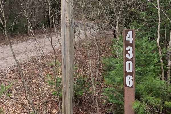
Wilcox Drive - FS 4093
Together, Federal Forest Service Road (FS) 4306 and FS 4093 are known as Wilcox Drive. A federally owned/ locally maintained, Level-2/ Level-3 forest road with a surface composition of dirt, sand, gravel, and native material. This route is currently open and in fair condition; it is not a DNR road (...
Learn more about Wilcox Drive - FS 4093
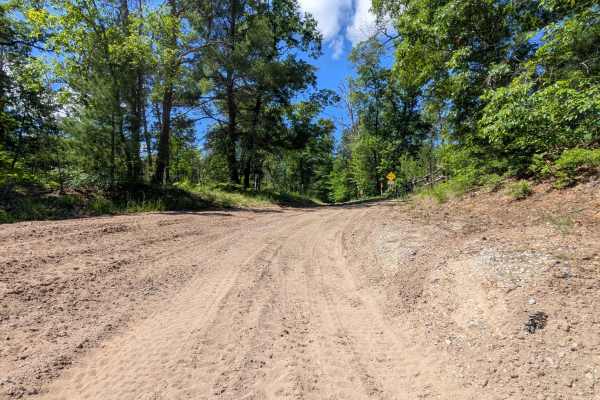
FS 4132/H576
This ORV Route runs north and south and connects you between a road that comes out of the town of Mio and south to the local trail system. Due to this being a "connector" trail, it is a heavily trafficked Trail. Use caution and slow speeds. The trail width maintains 1 to 2 cars the entire way. Th...
Learn more about FS 4132/H576
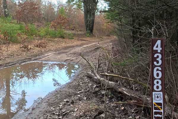
Au Sable Loop - FS 4368
Federal Forest Service Road (FS) 4368, also known as Fed Trail 4366 and "Au Sable Loop," is a federally owned/ locally maintained, Level-2/ Level-3 forest road with a surface composition of dirt, sand, and gravel. This route is currently open and in fair condition; it is not a DNR road (ORV use is s...
Learn more about Au Sable Loop - FS 4368
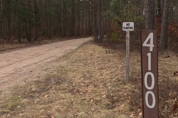
Perry Creek - FS 4100
Federal Forest Service Road (FS) 4100, also known as Perry Creek, is a federally owned/ locally maintained, Level-2/ Level-3 forest road with a surface composition of dirt, sand, gravel, and native material. This route is currently open and in fair condition; it is not a DNR road (ORV use is subject...
Learn more about Perry Creek - FS 4100
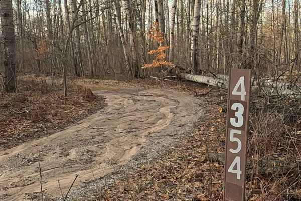
FS 4354
Federal Forest Service Road (FS) 4354 is a federally owned/ locally maintained, Level-2/ Level-3 forest road with a surface composition of dirt, sand, gravel, and native material. This route is currently open and in fair condition; it is not a DNR road (ORV use is subject to local government regulat...
Learn more about FS 4354
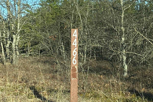
FS 4466
Forest Service Road 4466, also known as Weeks Road, is a versatile trail suitable for vehicles of all sizes, from large 4x4s to dirt bikes. The trail is predominantly composed of dirt and sand, and it's surrounded by dense forests and some clearings. Be cautious as there are multiple road crossings ...
Learn more about FS 4466
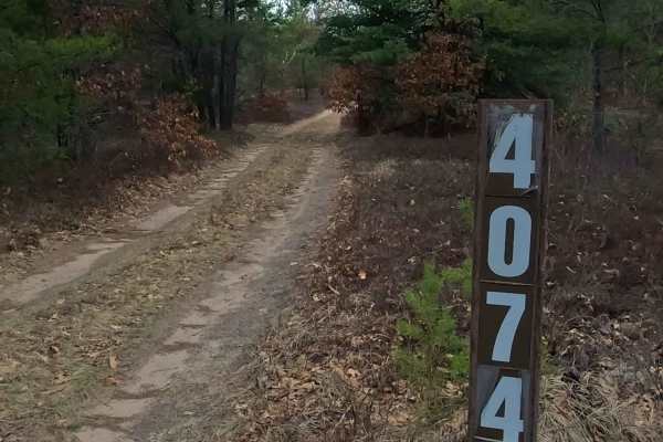
FS 4074
Federal Forest Service Road (FS) 4074 is a federally owned/ locally maintained, Level-2/ Level-3 forest road with a surface composition of dirt, sand, gravel, and native material. This route is currently open and in fair condition; it is not a DNR road (ORV use is subject to local government regulat...
Learn more about FS 4074

FS 4334
Forrest Service Road 4334 is a road that accommodates vehicles of all sizes, from large 4x4s to dirt bikes. Nestled amidst dense forests, it's relatively untraveled, resulting in its being composed of two-track grass. To truly appreciate this road, it's recommended to travel it in both directions.
Learn more about FS 4334
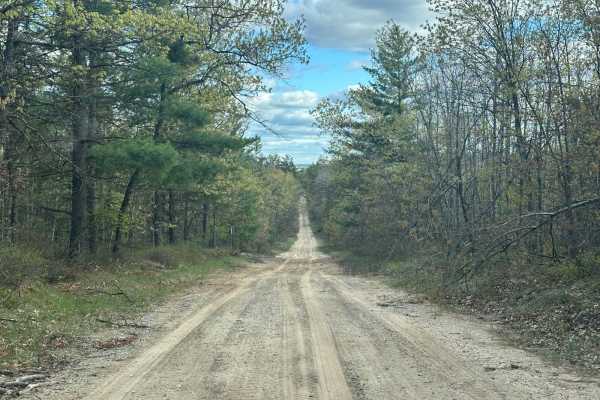
FS 4982
Forrest Service Road 4982 is a versatile road that accommodates vehicles of all sizes, from large 4x4s to dirt bikes. Nestled amidst dense forests, the road is predominantly composed of sand. At the summit of a hill, there's a breathtaking viewpoint that offers perfect photo opportunities.
Learn more about FS 4982

FS 4332 East Bull Gap Trailhead
Forrest Service road 4332 is a versatile road that accommodates various vehicle sizes, from large 4x4s to dirt bikes. Primarily composed of dirt, the road is flanked by dense forests and a few clearings. This road directly leads to the Bull Gap hill climb area, or it can serve as a gateway to explor...
Learn more about FS 4332 East Bull Gap Trailhead
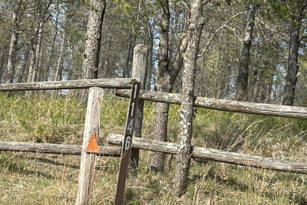
FS 1146
Forrest Service Road 1146 is a versatile road that accommodates various vehicle types, from large 4x4s to dirt bikes. The road is predominantly composed of sand and is flanked by expansive open spaces. As you travel from north to south along this road, the breathtaking view of the road and the surro...
Learn more about FS 1146
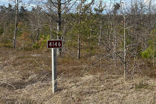
FS 4146
Forrest Service Road 4146 is a versatile road that accommodates vehicles of all sizes, from large 4x4s to dirt bikes. The road is flanked by expansive open spaces and interspersed with forests. It's primarily composed of sand and dirt, offering a variety of scenic features, including a few hills and...
Learn more about FS 4146
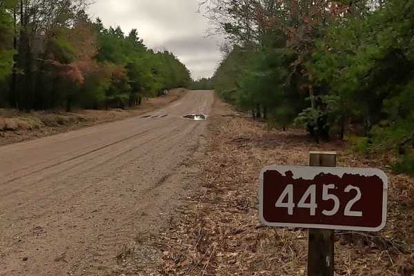
Keely Road - FS 4452
Federal Forest Service Road (FS) 4452, also known as Keely Road, is a federally owned/ locally maintained, Level-2/ Level-3 forest road with a surface composition of dirt, sand, gravel, and native material. This route is currently open and in fair condition; it is not a DNR road (ORV use is subject ...
Learn more about Keely Road - FS 4452
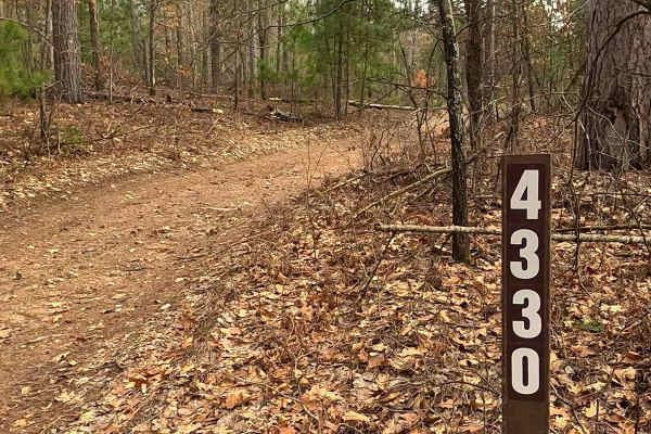
Woods - FS 4330
FS 4330, also known as Woods, is a federally owned/ locally maintained, Level-2/ Level-3 forest road with a surface composition of dirt, sand, gravel, and native material. This route is currently open and in fair condition; it is not a DNR road (ORV use is subject to local government regulations). I...
Learn more about Woods - FS 4330
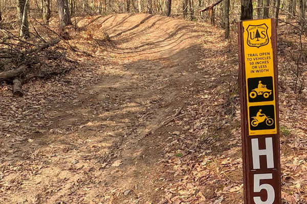
ORV H-57 7 : Mack- Bull Gap Trail
The Mack- Bull Gap Trail portion of the ORV Mack Lake Motorized Trail (MAT) is a designated 50-inch ATV/ off-road Motorcycle trail (max 50 inches wide) offering a mixture of sandy soil and hard-packed dirt, generally located in wooded terrain. The trail is known to be sandy and can become "whooped o...
Learn more about ORV H-57 7 : Mack- Bull Gap Trail
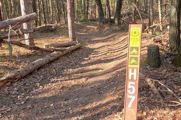
Mack Lake Loop Trail - ORV H-57
The Mack Lake Loop Trail, NW portion of the ORV Mack Lake Motorized Trail (MAT) is a designated 50-inch ATV/ off-road Motorcycle trail (max 50 inches wide) offering a mixture of sandy soil and hard-packed dirt, generally located in wooded terrain. The trail is known to be sandy and can become "whoop...
Learn more about Mack Lake Loop Trail - ORV H-57
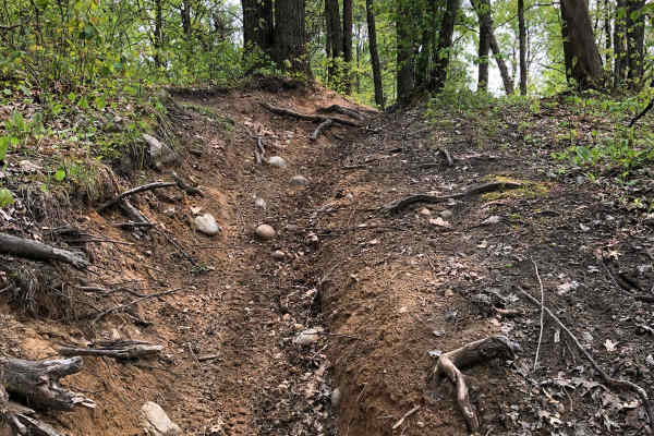
Mio
Mio Trail is a fifty-inch trail designed to be ridden by 50 Inch ATVs, dirt bikes, and quads. The general makeup of this trail is black dirt with sand. There is more sand in fresh timber-cut areas where the sun has had a chance to bake the ground. Among Michigan's 50-inch trails, this is a more tech...
Learn more about Mio
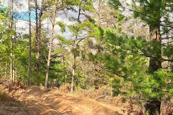
ORV H-57 : Bull Gap Hill Climb - Primary Return Loop <50"
The Bull Gap Primary return Loop Trail portion of the ORV Mack Lake Motorized Trail (MAT) is a designated 50-inch ATV/ off-road Motorcycle trail (max 50 inches wide) offering a mixture of sandy soil and hard-packed dirt, generally located in wooded terrain. The trail is known to be sandy and can bec...
Learn more about ORV H-57 : Bull Gap Hill Climb - Primary Return Loop <50"
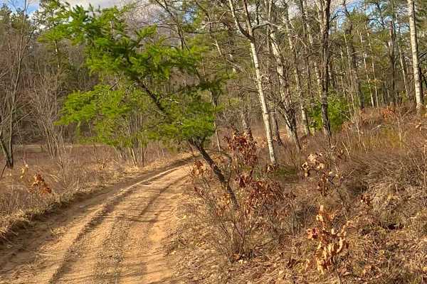
ORV H-57 : Bull Gap Hill Climb - Tertiary Return Loop <50"
The Bull Gap Hill Climb - Tertiary Return Loop Trail portion of the ORV Mack Lake Motorized Trail (MAT) is a designated 50-inch ATV/ off-road Motorcycle trail (max 50 inches wide) offering a mixture of sandy soil and hard-packed dirt, generally located in wooded terrain. The trail is known to be san...
Learn more about ORV H-57 : Bull Gap Hill Climb - Tertiary Return Loop <50"
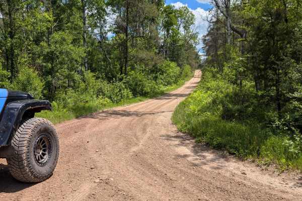
East Tower Road - FS 4169
This point-to-point trail connects South River Road and Trail 4132 of the Bull Gap trail system. The terrain is a mix of hard-packed sand and small stones. Expect to find some areas of washboarding and a few small muddy sections. This trail's width maintains 1-2 vehicles wide and could be driven ...
Learn more about East Tower Road - FS 4169
ATV trails near Mio, Michigan
Explore ATV-friendly trails near you. These trails are accessible for vehicles up to 50 inches wide, perfect for ATVs and smaller off-road machines.
Wilcox Drive - FS 4093
Together, Federal Forest Service Road (FS) 4306 and FS 4093 are known as Wilcox Drive. A federally owned/ locally maintained, Level-2/ Level-3 forest road with a surface composition of dirt, sand, gravel, and native material. This route is currently open and in fair condition; it is not a DNR road (...
Learn more about Wilcox Drive - FS 4093
FS 4132/H576
This ORV Route runs north and south and connects you between a road that comes out of the town of Mio and south to the local trail system. Due to this being a "connector" trail, it is a heavily trafficked Trail. Use caution and slow speeds. The trail width maintains 1 to 2 cars the entire way. Th...
Learn more about FS 4132/H576
Au Sable Loop - FS 4368
Federal Forest Service Road (FS) 4368, also known as Fed Trail 4366 and "Au Sable Loop," is a federally owned/ locally maintained, Level-2/ Level-3 forest road with a surface composition of dirt, sand, and gravel. This route is currently open and in fair condition; it is not a DNR road (ORV use is s...
Learn more about Au Sable Loop - FS 4368
Perry Creek - FS 4100
Federal Forest Service Road (FS) 4100, also known as Perry Creek, is a federally owned/ locally maintained, Level-2/ Level-3 forest road with a surface composition of dirt, sand, gravel, and native material. This route is currently open and in fair condition; it is not a DNR road (ORV use is subject...
Learn more about Perry Creek - FS 4100
UTV/side-by-side trails near Mio, Michigan
Find UTV and side-by-side trails near you. These trails accommodate vehicles up to 60 inches wide, ideal for UTVs, side-by-sides, and wider off-road rigs.
Wilcox Drive - FS 4093
Together, Federal Forest Service Road (FS) 4306 and FS 4093 are known as Wilcox Drive. A federally owned/ locally maintained, Level-2/ Level-3 forest road with a surface composition of dirt, sand, gravel, and native material. This route is currently open and in fair condition; it is not a DNR road (...
Learn more about Wilcox Drive - FS 4093
FS 4132/H576
This ORV Route runs north and south and connects you between a road that comes out of the town of Mio and south to the local trail system. Due to this being a "connector" trail, it is a heavily trafficked Trail. Use caution and slow speeds. The trail width maintains 1 to 2 cars the entire way. Th...
Learn more about FS 4132/H576
Au Sable Loop - FS 4368
Federal Forest Service Road (FS) 4368, also known as Fed Trail 4366 and "Au Sable Loop," is a federally owned/ locally maintained, Level-2/ Level-3 forest road with a surface composition of dirt, sand, and gravel. This route is currently open and in fair condition; it is not a DNR road (ORV use is s...
Learn more about Au Sable Loop - FS 4368
Perry Creek - FS 4100
Federal Forest Service Road (FS) 4100, also known as Perry Creek, is a federally owned/ locally maintained, Level-2/ Level-3 forest road with a surface composition of dirt, sand, gravel, and native material. This route is currently open and in fair condition; it is not a DNR road (ORV use is subject...
Learn more about Perry Creek - FS 4100
The onX Offroad Difference
onX Offroad combines trail photos, descriptions, difficulty ratings, width restrictions, seasonality, and more in a user-friendly interface. Available on all devices, with offline access and full compatibility with CarPlay and Android Auto. Discover what you're missing today!
Open Trail Map