
Dirt Bike Trails
Near Middlesboro, Kentucky
Explore All Dirt Bike Trails Near Middlesboro, Kentucky
Dirt Bike Trails Near Middlesboro, Kentucky
Discover the best dirt bike trails near you. Browse trail maps, check difficulty ratings, and find your next adventure — whether you're looking for a quick ride or an all-day expedition.
High Ridge Towers
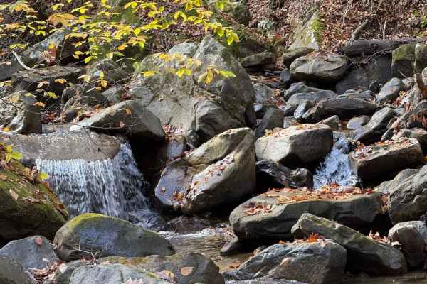
This trail intersects with 16 Creeks trail and runs out a long stretch of high ridges with some excellent views of the surrounding area. The east side of the trail goes to several cell/radio towers that allow you to look over the town of Middlesboro and even see the tunnels at Cumberland Gap into Te...
Learn more about High Ridge Towers
Sandlick Trail
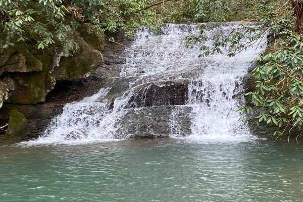
The Sandlick Trail is an easy trail ride that navigates through thick Tennessee mountain laurel, crosses several small streams along the way, and has a beautiful waterfall called No Business. This trail is one of the biggest feeder trails in the Tackett Creek area, with several trails branching off ...
Learn more about Sandlick Trail
Mary's Wild Horse Trail
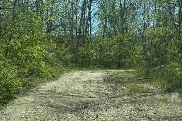
This is a gravel/dirt road uphill to a large open field with roads. The property includes open range horses and cattle, and there are lots of side trails to adventure onto. The trail can be reached off Highway 221 in Pineville, Kentucky. There's a railroad crossing as well as old gas wells on the pr...
Learn more about Mary's Wild Horse Trail
Mossy Springs
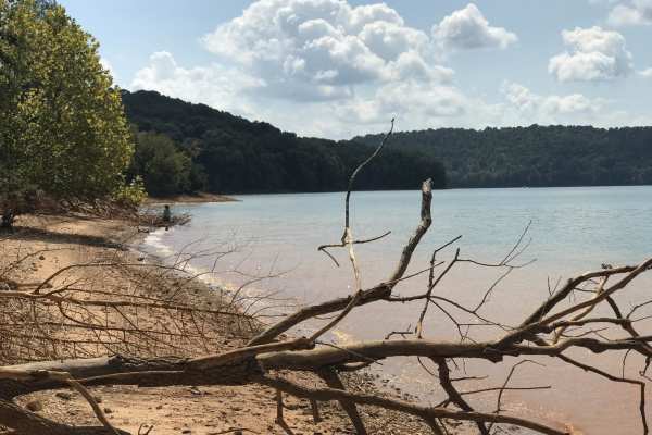
This route traverses from the southern portions of Chuck Swan WMA to one of the more remote areas on the northern border. Along this route you'll find some easy but fun roads, a natural freshwater spring, and if you time your visit right ample opportunities to pick fresh blackberries. In the summer ...
Learn more about Mossy Springs
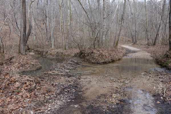
Lost Creek & Clear Creek
This route provides a bit more challenge and adrenaline than the majority of the roads in Chuck Swan WMA, but still keeps it well within the capabilities of most stock and slightly modified 4x4s. Along Clear Creek Rd. there are three water crossings that vary greatly depending on recent rains. All t...
Learn more about Lost Creek & Clear Creek
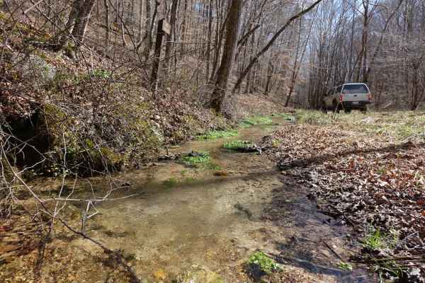
Big Loop & Big Springs
This loop gives you a bit of everything there is to see in Chuck Swan WMA. This route is slightly rougher than Main Forest Rd, but still passable by capable 2WD vehicles except during the wettest times of the year. You'll have opportunities to see natural springs just off of the road, visit some old...
Learn more about Big Loop & Big Springs
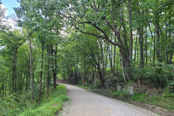
Elk Viewing Tower Road - Trail 25
This is a well-maintained gravel road that goes from Highway 25W to the elk viewing tower at Hatfield Knob. There are several viewing areas and lookouts on the way up as well, so keep an eye out for elk and deer. September is the best time to view elk, as they tend to gather into large herds during ...
Learn more about Elk Viewing Tower Road - Trail 25
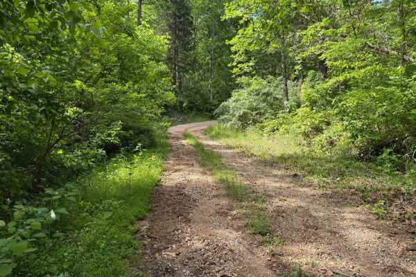
Crumely Loop
Crumely Loop is a mellow 2.6-mile forest road tucked into the heart of Chuck Swan State Forest. Like all the roads here, it's an active logging route, so keep an eye out for trucks and yield when needed. Several old roads branch off along the way, but most are closed to motorized vehicles; just foll...
Learn more about Crumely Loop
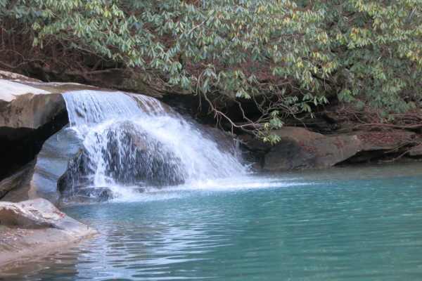
Trail 37 - Hickory Creek Trail
This trail is a wide rocky trail with small mud holes, transitioning to a single-track trail with longer mud holes, rocks, and water crossings near the end. At the end of the trail, you are rewarded with a waterfall and swimming hole. It draws a large crowd in the summer, so expect to get creative t...
Learn more about Trail 37 - Hickory Creek Trail
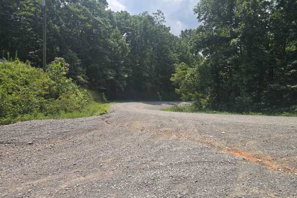
Ivydell Road
This is an easy two lane gravel road to the the trail system at the North Cumberland Wildlife Management Area. There is plenty of room to pass and has a 685 foot elevation gain in a short period. This road is just one of the ways to get to the Elk viewing tower. A North Cumberland Off-Highway Vehicl...
Learn more about Ivydell Road
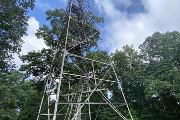
Main Forest Road
Main Forest Road runs from the entrance to Chuck Swan State Forest until it meets Forks of River Road, which will take you to the very end of this route. It's relatively smooth in comparison to the rest of the roads in CSSF, and outside of the occasional washout or exposed bedrock, it's easily trave...
Learn more about Main Forest Road
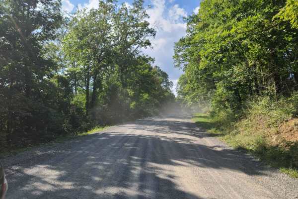
McCormick Cemetery Road - Trail 24
This trail is a maintained gravel road that connects several other popular trails. At one end it connects to Trail 19, and at the other end, it connects to Trail 25. Trail 37 is also accessible from this trail and is a popular waterfall destination. There is also a cemetery called McCormick Cemetery...
Learn more about McCormick Cemetery Road - Trail 24
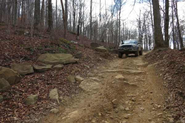
Trail 19 - Walnut Mountain Trail
This is a long mountain road that is almost all single track along the side of the mountains with beautiful views throughout the trail. There are lots of humps and dips that make it a challenge if you have low approach or departure angles, deep rutted mud holes, and a few technical rocky sections. T...
Learn more about Trail 19 - Walnut Mountain Trail
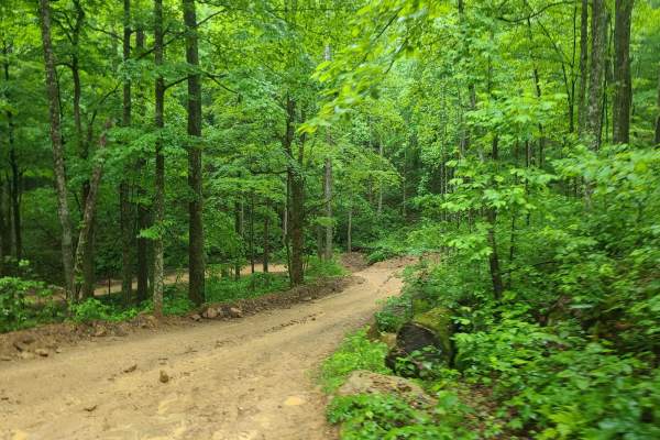
Ride Royal Blue Trail - Trail 27
This is a trail that connects the Ride Royal Blue Resort to the trails at Royal Blue. It starts off in the parking lot at Ride Royal Blue and goes up to Trail 19. The route is steep and winds its way up the ridges to the main trail system. It is slick and muddy with a few ledges and small obstacles.
Learn more about Ride Royal Blue Trail - Trail 27
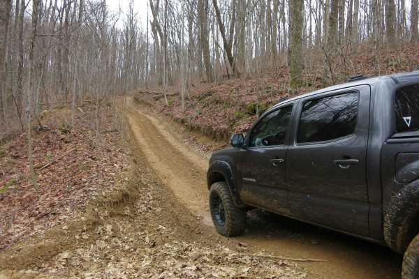
Trail 6 - Short Mountain Trail
This is a one-lane mountain road with steep climbs, ruts, and mud holes. There are places to pass and bypasses around most of the big mud holes. There is one mud pit with a steep entrance/exit that can't be bypassed and one hill climb with deep ruts that can't be bypassed. Have at least 33-inch tire...
Learn more about Trail 6 - Short Mountain Trail
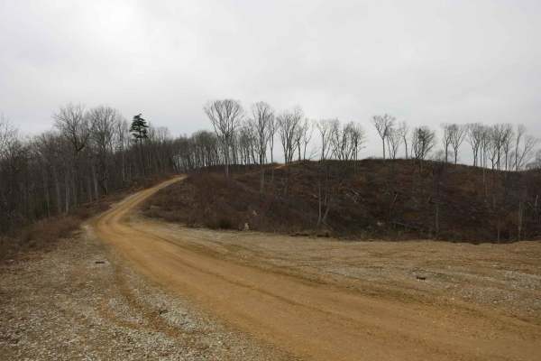
Trail 4 - Short Mountain Road
This is a road along the top of a ridge that has recently been cleared for logging. The road is wide and flat and easily accessible by most stock 4x4s. It gets a little bit rougher as it gets closer to Trail 6 with some humps and dips that may challenge low approach or departure angles. The use of t...
Learn more about Trail 4 - Short Mountain Road
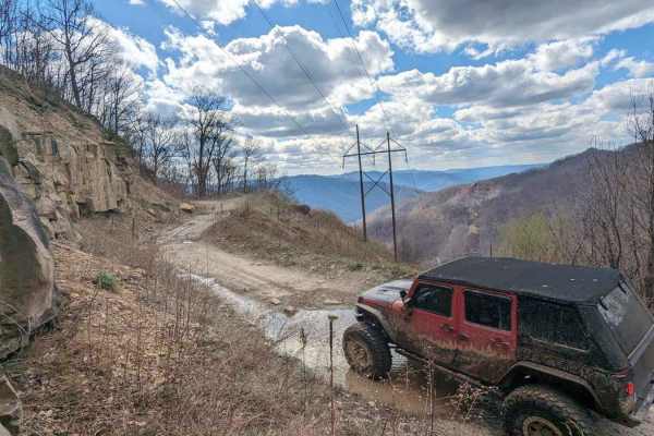
36
The majority of this trail is flat (the flattest in the park) with some shallow water/mud holes with solid bottoms. The terrain is small gravel-like rock mixed with softball-sized rocks. This drive is very picturesque, especially at the top, with a nice view from 2800 feet of elevation. You will fin...
Learn more about 36
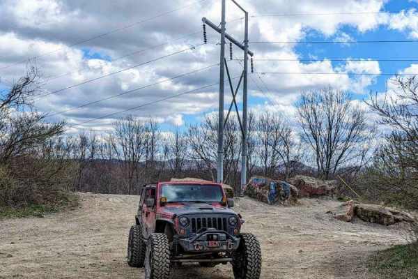
12b
Trail 12 splits into two parts in the OHV area. It is divided by private land. For mapping purposes, this trail has been labeled "12a" and "12b". 12b is an easy drive and is a great way to navigate through the park. It runs between a private property boundary and the 4 Poles Overlook. There are some...
Learn more about 12b
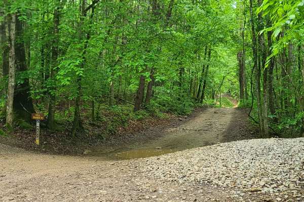
Stell Branch Trail - Trail 11
This trail connects Trail 13 and Trail 10 at the north end of the trail system. It is extremely rutted and run down--many of the trails have been blocked and replaced with bypasses. It can be difficult to figure out which branch to take, but it is a fun trail otherwise. The trail is open to ATVs and...
Learn more about Stell Branch Trail - Trail 11
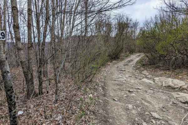
29
Trail 29 is a longer trail running from east and west near the far west side of the Black Mountain ORV Adventure Area. The trail ends on the west side at a private property which is gated and labeled "FOR EMERGENCY VEHICLES ONLY". Along the way, this trail travels through an area known as The Stadiu...
Learn more about 29
ATV trails near Middlesboro, Kentucky
Explore ATV-friendly trails near you. These trails are accessible for vehicles up to 50 inches wide, perfect for ATVs and smaller off-road machines.
High Ridge Towers
This trail intersects with 16 Creeks trail and runs out a long stretch of high ridges with some excellent views of the surrounding area. The east side of the trail goes to several cell/radio towers that allow you to look over the town of Middlesboro and even see the tunnels at Cumberland Gap into Te...
Learn more about High Ridge Towers
Sandlick Trail
The Sandlick Trail is an easy trail ride that navigates through thick Tennessee mountain laurel, crosses several small streams along the way, and has a beautiful waterfall called No Business. This trail is one of the biggest feeder trails in the Tackett Creek area, with several trails branching off ...
Learn more about Sandlick Trail
Mary's Wild Horse Trail
This is a gravel/dirt road uphill to a large open field with roads. The property includes open range horses and cattle, and there are lots of side trails to adventure onto. The trail can be reached off Highway 221 in Pineville, Kentucky. There's a railroad crossing as well as old gas wells on the pr...
Learn more about Mary's Wild Horse Trail
Mossy Springs
This route traverses from the southern portions of Chuck Swan WMA to one of the more remote areas on the northern border. Along this route you'll find some easy but fun roads, a natural freshwater spring, and if you time your visit right ample opportunities to pick fresh blackberries. In the summer ...
Learn more about Mossy Springs
UTV/side-by-side trails near Middlesboro, Kentucky
Find UTV and side-by-side trails near you. These trails accommodate vehicles up to 60 inches wide, ideal for UTVs, side-by-sides, and wider off-road rigs.
High Ridge Towers
This trail intersects with 16 Creeks trail and runs out a long stretch of high ridges with some excellent views of the surrounding area. The east side of the trail goes to several cell/radio towers that allow you to look over the town of Middlesboro and even see the tunnels at Cumberland Gap into Te...
Learn more about High Ridge Towers
Sandlick Trail
The Sandlick Trail is an easy trail ride that navigates through thick Tennessee mountain laurel, crosses several small streams along the way, and has a beautiful waterfall called No Business. This trail is one of the biggest feeder trails in the Tackett Creek area, with several trails branching off ...
Learn more about Sandlick Trail
Mary's Wild Horse Trail
This is a gravel/dirt road uphill to a large open field with roads. The property includes open range horses and cattle, and there are lots of side trails to adventure onto. The trail can be reached off Highway 221 in Pineville, Kentucky. There's a railroad crossing as well as old gas wells on the pr...
Learn more about Mary's Wild Horse Trail
Elk Viewing Tower Road - Trail 25
This is a well-maintained gravel road that goes from Highway 25W to the elk viewing tower at Hatfield Knob. There are several viewing areas and lookouts on the way up as well, so keep an eye out for elk and deer. September is the best time to view elk, as they tend to gather into large herds during ...
Learn more about Elk Viewing Tower Road - Trail 25
The onX Offroad Difference
onX Offroad combines trail photos, descriptions, difficulty ratings, width restrictions, seasonality, and more in a user-friendly interface. Available on all devices, with offline access and full compatibility with CarPlay and Android Auto. Discover what you're missing today!
Open Trail Map