
Dirt Bike Trails
Near Lima, Montana
Explore All Dirt Bike Trails Near Lima, Montana
Dirt Bike Trails Near Lima, Montana
Discover the best dirt bike trails near you. Browse trail maps, check difficulty ratings, and find your next adventure — whether you're looking for a quick ride or an all-day expedition.
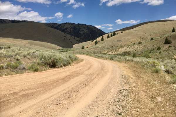
White Pine Ridge Route
This nearly 12-mile route accesses a ridgeline known as the White Pine Ridge. It is almost a continuous, but relatively gentle, climb from about 6,700 feet to just a little more than 9,000 feet. At the top, the road traverses a mixed pine forest of subalpine fir, lodgepole, and presumably white pin...
Learn more about White Pine Ridge Route

Big Sheep Creek Road
Over the eons, the Big Sheep Creek cut a canyon through the Tendoy mountains. The road faithfully follows the creek, so the traveler is treated to a ride through a very steep canyon and an awesome display of rock formations. There is a resident herd of Bighorn Sheep and a swallow cave that are fun t...
Learn more about Big Sheep Creek Road

West Fork Ridge Road
Montana is "Big Sky Country," and driving this road makes that phrase meaningful and personal. This road, labeled FS 8261, travels along a broad open ridge at an elevation of about 8,000 feet. The 360-degree panoramic views are magnificent and make one feel really small. A speck on a huge canvas of ...
Learn more about West Fork Ridge Road
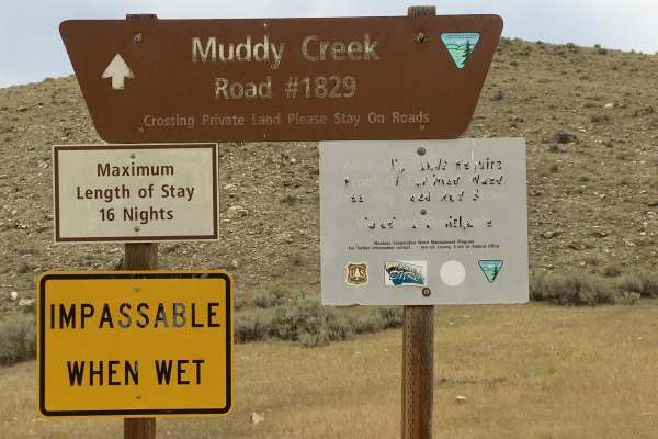
Muddy Creek Road
This is a one-lane dirt road that travels up a broad, shallow valley dominated by sagebrush on both sides. This road is signed as BLM 1829. When this road was evaluated, it had been recently maintained, so the tread was intact. It is unlikely to remain in that condition.
Learn more about Muddy Creek Road

BLM 1837 / FS 70107
This road is labeled as 1837 on BLM land and FS 70107 on Forest Service Land. It connects the Big Sheep Creek Road to the West Fork Ridge Road. In 2.7 miles, there is an elevation change of 1,435 feet. The lower 1.5 miles of this road is very steep, with one low-range 4WD pitch after another. The up...
Learn more about BLM 1837 / FS 70107

Little Water Creek Road
This is a 12-mile road that crosses the Tendoy Mountains and connects the Muddy Creek Valley to Interstate 15 at the Kidd, Montana interchange. This road is labeled as BLM 1857 on the west side of the Tendoys and FS 960 on the east side of the Tendoys. This is a very primitive road. It has not seen ...
Learn more about Little Water Creek Road
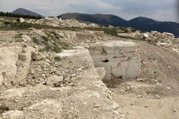
Round Top Road
This short road connects West Fork Ridge Road to Bannack Pass Road, also known as the Bannack Stage Road. Round Top Road also passes through a quarry for travertine, a starkly white rock used in the building industry. The road is a single lane, mostly rock road, but is easily navigated by any high-c...
Learn more about Round Top Road
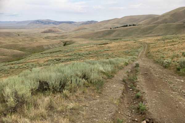
Bannack Pass Road
Bannack Pass Road (FS 951) has a variety of names because it is a portion of a historic route that supplied goods and services to the historic mining city of Bannack, Montana. It is often referred to as the South Medicine Lodge Road, the Corrine Freight Road, or the Bannack Stage Road. Whatever one ...
Learn more about Bannack Pass Road
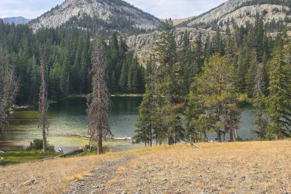
Webber Creek - Divide Creek
This is a great ride with good views of Italian Peak. The trail starts off crossing a few rock slides, then moves up into the trees. There are a few steep climbs and some steep side hills that you will need to be careful of, and you can go up to Webber Lakes. The trail is mostly rocks.
Learn more about Webber Creek - Divide Creek
Modoc Roads
This route is a series of Forest Service roads provided to assist visitors from the end of the West Modoc Creek Trail to the service road on Interstate 15. From that point, travelers can find their way on the access roads to the village of Monida to the north or to the Stoddard Creek campground to t...
Learn more about Modoc Roads
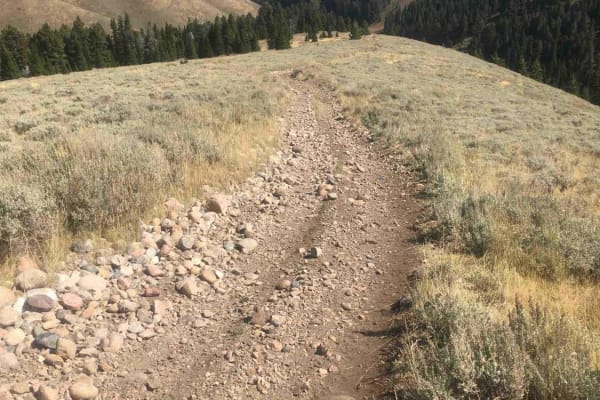
West Modoc Creek Trail
This trail is the seamless extension of Trail 1013. It follows a ridgeline that begins the descent into the Modoc Valley and eventually to the access road to Interstate 15. The trail starts out in an open grassland environment and gradually leads into a forested area. The tread is quite rocky and ro...
Learn more about West Modoc Creek Trail
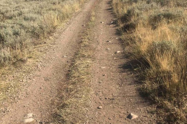
Modoc-Coral Creek Trail
This trail's elevation is above 8,000 feet for its entire length and tops out at 8,900 feet. The trail crawls along grassy alpine ridges with steep rocky ups and downs that seem to go on forever. This is a good place for the full alpine experience. There are whole new varieties and species of plants...
Learn more about Modoc-Coral Creek Trail
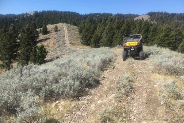
Picnic Ridge Trail
This is a ridgeline trail for its entire 2.8-mile length. The trail traverses a nice mixture of open grassy ridgeline terrain and tread that twists and turns through stands of mixed conifers. This trail tops out at about 7,500 feet of elevation, so there are abundant opportunities for panoramic view...
Learn more about Picnic Ridge Trail
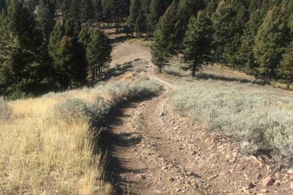
Stoddard Creek Ridge Trail
This trail is a ridgeline trail along its entire 3.5-mile length. Most of that ridgeline is free from timber, so there are abundant opportunities for sweeping panoramic views. The trail tops out at about 7,500 feet in elevation. The high point of the trail is substantially elevated above the surroun...
Learn more about Stoddard Creek Ridge Trail
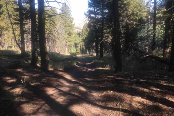
Van Noy-Stoddard Trail
From the end of the Van Noy-Stoddard Road, the trail climbs to a ridgeline for about 1.6 miles, topping out at about 7,800 feet. This section of the trail includes some challenging rocky ascents. The remainder of the trail winds through a beautiful forest of fir trees and some huge aspen groves. The...
Learn more about Van Noy-Stoddard Trail
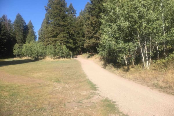
Stoddard Creek Loop Trail
This is a lovely little 3.6-mile loop trail that is convenient to the Stoddard Creek campground and the dispersed campsites along Stoddard Creek Road. It twists and turns through impressive stands of large fir trees with aspen occasionally intermixed with the conifers. It is a very scenic trip with ...
Learn more about Stoddard Creek Loop Trail
Van Noy-Stoddard Road
This is a short Forest Service Road that leads to a trailhead. There are a few dispersed campsites along this road. But the road itself is pretty rough and narrow, so those campsites are not suitable for bigger camp trailers or RVs. The road surface is rocky.
Learn more about Van Noy-Stoddard Road
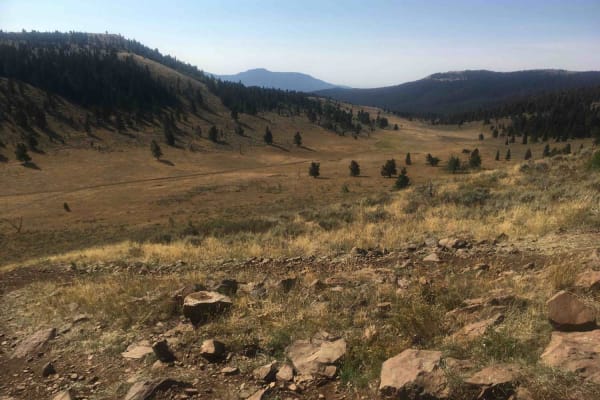
Camas Creek Trail
This trail takes off from the end of the Camas Creek Road and steadily climbs to the Continental Divide at an elevation of 8,167 feet. The lower portion of the road winds its way through dense forest; the middle portion of the road passes through thinner stands of trees alternating with subalpine me...
Learn more about Camas Creek Trail
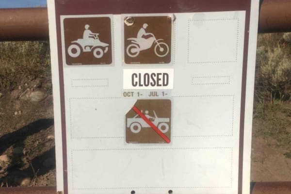
Camas Creek Road
This road travels up the Camas Creek drainage for about 4 miles. What is surprising is the visual impact of the foliage to be seen from the road. The mixture of conifers, aspen, and willow distributed over the landscape is truly remarkable. This road is open yearlong to 50" ATVs and motorcycles but ...
Learn more about Camas Creek Road
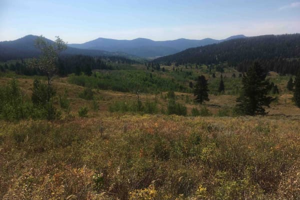
Pete Creek Trail
This short 1.3-mile trail leads from the end of the Pete Creek Road north to the Continental Divide. It goes through some dense timberland and occasionally breaks out into meadowlands at its upper end. The tread is primarily dirt and there are some washouts to be dealt with. The trail intersects wit...
Learn more about Pete Creek Trail
ATV trails near Lima, Montana
Explore ATV-friendly trails near you. These trails are accessible for vehicles up to 50 inches wide, perfect for ATVs and smaller off-road machines.
White Pine Ridge Route
This nearly 12-mile route accesses a ridgeline known as the White Pine Ridge. It is almost a continuous, but relatively gentle, climb from about 6,700 feet to just a little more than 9,000 feet. At the top, the road traverses a mixed pine forest of subalpine fir, lodgepole, and presumably white pin...
Learn more about White Pine Ridge Route
Big Sheep Creek Road
Over the eons, the Big Sheep Creek cut a canyon through the Tendoy mountains. The road faithfully follows the creek, so the traveler is treated to a ride through a very steep canyon and an awesome display of rock formations. There is a resident herd of Bighorn Sheep and a swallow cave that are fun t...
Learn more about Big Sheep Creek Road
West Fork Ridge Road
Montana is "Big Sky Country," and driving this road makes that phrase meaningful and personal. This road, labeled FS 8261, travels along a broad open ridge at an elevation of about 8,000 feet. The 360-degree panoramic views are magnificent and make one feel really small. A speck on a huge canvas of ...
Learn more about West Fork Ridge Road
Muddy Creek Road
This is a one-lane dirt road that travels up a broad, shallow valley dominated by sagebrush on both sides. This road is signed as BLM 1829. When this road was evaluated, it had been recently maintained, so the tread was intact. It is unlikely to remain in that condition.
Learn more about Muddy Creek Road
UTV/side-by-side trails near Lima, Montana
Find UTV and side-by-side trails near you. These trails accommodate vehicles up to 60 inches wide, ideal for UTVs, side-by-sides, and wider off-road rigs.
White Pine Ridge Route
This nearly 12-mile route accesses a ridgeline known as the White Pine Ridge. It is almost a continuous, but relatively gentle, climb from about 6,700 feet to just a little more than 9,000 feet. At the top, the road traverses a mixed pine forest of subalpine fir, lodgepole, and presumably white pin...
Learn more about White Pine Ridge Route
Big Sheep Creek Road
Over the eons, the Big Sheep Creek cut a canyon through the Tendoy mountains. The road faithfully follows the creek, so the traveler is treated to a ride through a very steep canyon and an awesome display of rock formations. There is a resident herd of Bighorn Sheep and a swallow cave that are fun t...
Learn more about Big Sheep Creek Road
West Fork Ridge Road
Montana is "Big Sky Country," and driving this road makes that phrase meaningful and personal. This road, labeled FS 8261, travels along a broad open ridge at an elevation of about 8,000 feet. The 360-degree panoramic views are magnificent and make one feel really small. A speck on a huge canvas of ...
Learn more about West Fork Ridge Road
Muddy Creek Road
This is a one-lane dirt road that travels up a broad, shallow valley dominated by sagebrush on both sides. This road is signed as BLM 1829. When this road was evaluated, it had been recently maintained, so the tread was intact. It is unlikely to remain in that condition.
Learn more about Muddy Creek Road
The onX Offroad Difference
onX Offroad combines trail photos, descriptions, difficulty ratings, width restrictions, seasonality, and more in a user-friendly interface. Available on all devices, with offline access and full compatibility with CarPlay and Android Auto. Discover what you're missing today!
Open Trail Map