
Dirt Bike Trails
Near Ider, Alabama
Explore All Dirt Bike Trails Near Ider, Alabama
Dirt Bike Trails Near Ider, Alabama
Discover the best dirt bike trails near you. Browse trail maps, check difficulty ratings, and find your next adventure — whether you're looking for a quick ride or an all-day expedition.
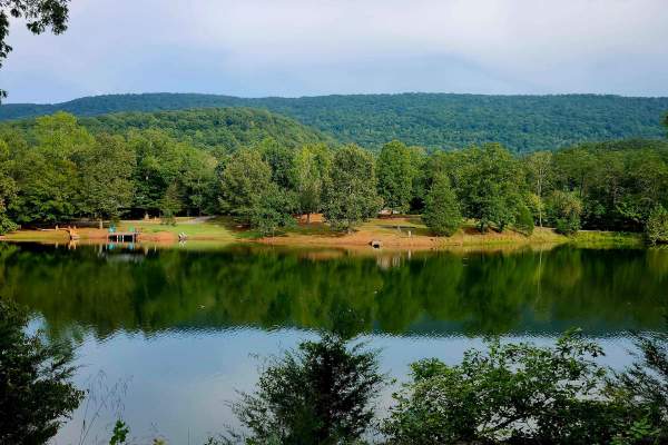
Newsome Gap
Newsome Gap Road (CR 197) is a 3.6-mile, primarily single-lane gravel-over-dirt route with occasional passing points. The scenic mountain descent winds through switchbacks and hairpin turns framed by massive rock formations and intermittent roadside water features. Minor rutting, switchback washouts...
Learn more about Newsome Gap
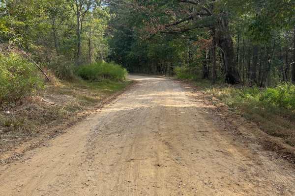
Atwood Trail
Tucked away amidst the majestic, undulating mountains of northwest Georgia lies a hidden gem—a dirt and gravel trail that beckons adventurers and nature enthusiasts alike. This enchanting out-and-back path meanders through the lush expanse of a Wildlife Management Area, promising a tranquil and pict...
Learn more about Atwood Trail
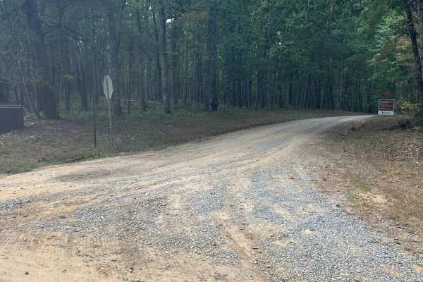
Rocktown Trail
Pigeon Mountain Road is a well-maintained dirt and gravel road winding through scenic forest within a Georgia Wildlife Management Area (WMA). The drive is suitable for most vehicles, leading to a designated parking area at the trailhead. From here, Rocktown Trail begins its journey toward the summit...
Learn more about Rocktown Trail
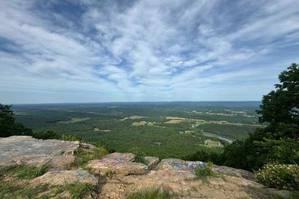
Pigeon Mountain
The trail transitions from pavement to mostly gravel and some dirt. There are no challenging obstacles and multiple possible routes within the trail system. There's an overlook at mile 3.4 (just past the paved section) and an offshoot at mile 5 that is a dead-end dirt trail. It's a bit rougher than ...
Learn more about Pigeon Mountain
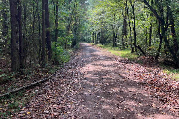
Shaw Branch Road
Starting just off Highway 193, this charming trail invites you on a delightful, surprisingly adventurous escape into the wilderness tucked inside the Crockford-Pigeon Mountain Wildlife Management Area, so don't forget your license/use permit. As you make your way in, the road begins as a smooth comb...
Learn more about Shaw Branch Road
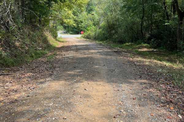
Estelle Mines Road
Tucked just off Highway 193, a hidden adventure awaits as a scenic track winds its way deep into the lush expanse of Crockford-Pigeon Mountain Wildlife Management Area. This inviting path feels like a secret passage into nature’s playground, with a smooth, well-kept road that invites exploration. Af...
Learn more about Estelle Mines Road
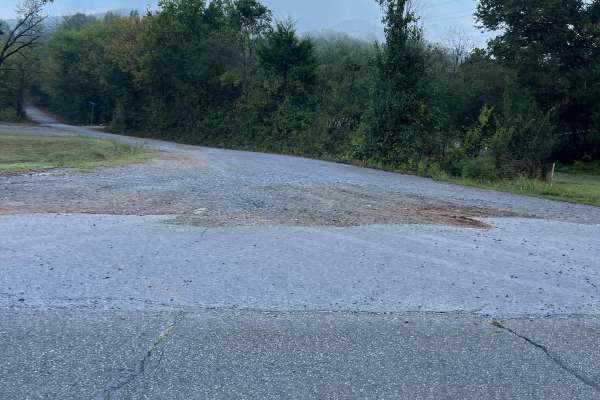
Blue Hole Road
Nestled just off the bustling Highway 193 lies a hidden gem waiting to be discovered! Picture this: a beautifully maintained gravel track, inviting you to embark on an adventure like no other. As you follow the path, the anticipation builds, leading you to a spacious parking area. Here, the entrance...
Learn more about Blue Hole Road
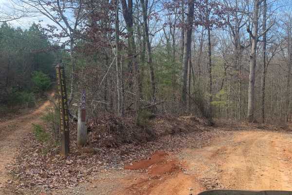
Ellis Pt/Bluff View Road
These two trails start at the end of Tower Road. The trail is mostly a narrow single track but traffic is two-way so be mindful of that. This trail, as with all the trails in Prentice Cooper, is a very nice drive in the woods. You need some clearance on this trail mostly due to the hills having larg...
Learn more about Ellis Pt/Bluff View Road

Brown Hollow Road
Brown Hollow Road is a wooded dirt trail on the south end of Prentice Cooper. It is smooth with little to no challenges. All trails at Prentice Cooper are subject to seasonal and weather-related closures. More information can be found at https://www.tn.gov/agriculture/forests/state-forests/prentice-...
Learn more about Brown Hollow Road
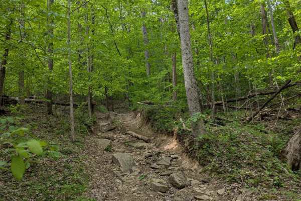
Trail 87
Trail 87 branches off towards the end of Trail 1 and heads straight up a rocky hill to Trail JW3. It is mostly rocks and dirt with tight trees along the way to watch out for. The park rating for this trail is Blue (Moderate). A Park Day-Use Trail Pass is required to access this system of trails. Cel...
Learn more about Trail 87
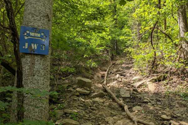
JW3
JW3 is yet another fun trail with some steep climbs and rock obstacles. The trail is named after Jeeps and Wrenches, a club based in Nashville that originally cleared this trail. The park rating for this trail is Blue (Moderate). A Park Day-Use Trail Pass is required to access this system of trails....
Learn more about JW3

Trail 27
Trail 27 is a U-shaped trail that begins and ends on Trail 1. It goes up a rocky hill to where JW3 and GWT meet and then comes back down. The trail can be run in either direction and consists of large rocks and some V-notches. It can also become very slippery when wet. In either direction, you will ...
Learn more about Trail 27

George Winters Trail (GWT)
GWT is a popular moderate trail at AOP. It can be challenging without being impossible. It is a winding, rocky trail with a few steep climbs at the top of the park between JW3 and JW4. The trail is named in honor of George Winters. The park rating for this trail is Blue (Moderate). A Park Day-Use Tr...
Learn more about George Winters Trail (GWT)
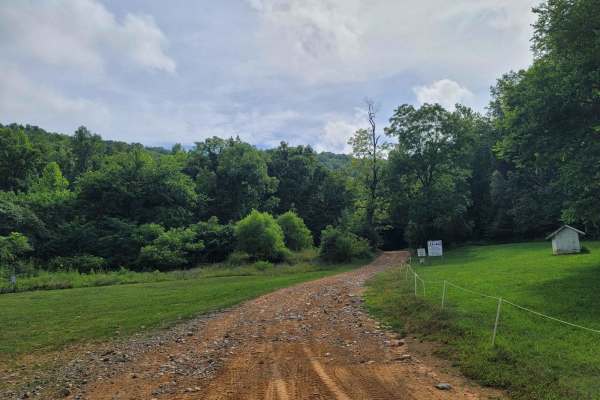
Trail 1
AOP 1 - Launchpad begins with a fine dirt-filled trail with a slight uphill climb. Once you make it to Area 51, there is lots of loose rock that makes you feel like you're driving on a cobblestone road. From this point on, the trail features hard-packed dirt, with scattered shallow mud holes. At the...
Learn more about Trail 1
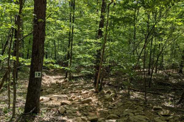
Trail 12
Trail 12 is a short wooded trail near Trails 1 and 15. It is gently rolling with a few deep mudholes to contend with; most of them have bypasses. The park rating for this trail is Green (Easy). A Park Day-Use Trail Pass is required to access this system of trails. Cell service is spotty in places, a...
Learn more about Trail 12
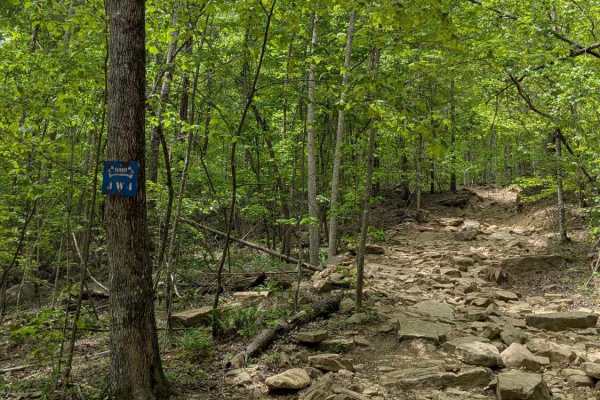
JW4
JW4 The trail is named after Jeeps and Wrenches, a club based in Nashville that originally cleared this trail. The park rating for this trail is Blue (Moderate). A Park Day-Use Trail Pass is required to access this system of trails. Cell service is spotty in places, and trail conditions can change q...
Learn more about JW4
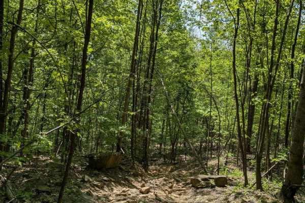
Trail 30
Trail 30 is a rocky trail with some steep climbs that runs roughly parallel to JW4. Many rocks are roughly 2 feet or taller. The park rating for this trail is Blue (Moderate). A Park Day-Use Trail Pass is required to access this system of trails. Cell service is spotty in places, and trail condition...
Learn more about Trail 30
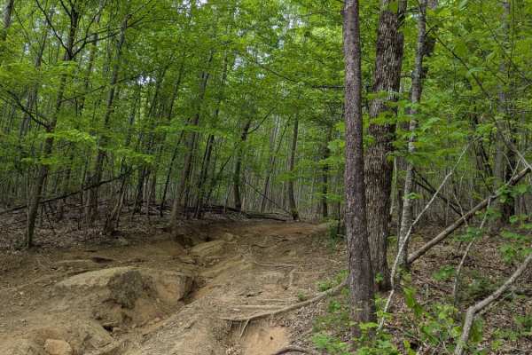
Trail 14
Trail 14 snakes through the top of the park, connecting Trails 1 and 3, and is a mix of rocky climbs and smooth dirt. The park rating for this trail is Green (Easy). A Park Day-Use Trail Pass is required to access this system of trails. Cell service is spotty in places, and trail conditions can chan...
Learn more about Trail 14

Trail 8
AOP Trail 8 - Megabit is a root-filled trail from topsoil that has washed down the mountain leaving the toes of the trees exposed throughout. Overall the trail is a very easy connector trail with the exception of one spot in the middle with an exposed rock, and the entrance to the trail that is mild...
Learn more about Trail 8

Smith Gap Branch A - FS 635A
Get ready to embark on an exhilarating off-road adventure starting right off FS 635, also known as Smith Gap! This trail promises a thrilling ride with its dynamic mix of rutted dirt and gravel paths, offering plenty of heart-pounding washouts and ruts to keep you on your toes. While it might be a s...
Learn more about Smith Gap Branch A - FS 635A
ATV trails near Ider, Alabama
Explore ATV-friendly trails near you. These trails are accessible for vehicles up to 50 inches wide, perfect for ATVs and smaller off-road machines.
Pigeon Mountain
The trail transitions from pavement to mostly gravel and some dirt. There are no challenging obstacles and multiple possible routes within the trail system. There's an overlook at mile 3.4 (just past the paved section) and an offshoot at mile 5 that is a dead-end dirt trail. It's a bit rougher than ...
Learn more about Pigeon Mountain
Ellis Pt/Bluff View Road
These two trails start at the end of Tower Road. The trail is mostly a narrow single track but traffic is two-way so be mindful of that. This trail, as with all the trails in Prentice Cooper, is a very nice drive in the woods. You need some clearance on this trail mostly due to the hills having larg...
Learn more about Ellis Pt/Bluff View Road
Brown Hollow Road
Brown Hollow Road is a wooded dirt trail on the south end of Prentice Cooper. It is smooth with little to no challenges. All trails at Prentice Cooper are subject to seasonal and weather-related closures. More information can be found at https://www.tn.gov/agriculture/forests/state-forests/prentice-...
Learn more about Brown Hollow Road
Trail 87
Trail 87 branches off towards the end of Trail 1 and heads straight up a rocky hill to Trail JW3. It is mostly rocks and dirt with tight trees along the way to watch out for. The park rating for this trail is Blue (Moderate). A Park Day-Use Trail Pass is required to access this system of trails. Cel...
Learn more about Trail 87
UTV/side-by-side trails near Ider, Alabama
Find UTV and side-by-side trails near you. These trails accommodate vehicles up to 60 inches wide, ideal for UTVs, side-by-sides, and wider off-road rigs.
Pigeon Mountain
The trail transitions from pavement to mostly gravel and some dirt. There are no challenging obstacles and multiple possible routes within the trail system. There's an overlook at mile 3.4 (just past the paved section) and an offshoot at mile 5 that is a dead-end dirt trail. It's a bit rougher than ...
Learn more about Pigeon Mountain
Ellis Pt/Bluff View Road
These two trails start at the end of Tower Road. The trail is mostly a narrow single track but traffic is two-way so be mindful of that. This trail, as with all the trails in Prentice Cooper, is a very nice drive in the woods. You need some clearance on this trail mostly due to the hills having larg...
Learn more about Ellis Pt/Bluff View Road
Brown Hollow Road
Brown Hollow Road is a wooded dirt trail on the south end of Prentice Cooper. It is smooth with little to no challenges. All trails at Prentice Cooper are subject to seasonal and weather-related closures. More information can be found at https://www.tn.gov/agriculture/forests/state-forests/prentice-...
Learn more about Brown Hollow Road
Trail 87
Trail 87 branches off towards the end of Trail 1 and heads straight up a rocky hill to Trail JW3. It is mostly rocks and dirt with tight trees along the way to watch out for. The park rating for this trail is Blue (Moderate). A Park Day-Use Trail Pass is required to access this system of trails. Cel...
Learn more about Trail 87
The onX Offroad Difference
onX Offroad combines trail photos, descriptions, difficulty ratings, width restrictions, seasonality, and more in a user-friendly interface. Available on all devices, with offline access and full compatibility with CarPlay and Android Auto. Discover what you're missing today!
Open Trail Map