
Dirt Bike Trails
Near Hillsboro, Alabama
Explore All Dirt Bike Trails Near Hillsboro, Alabama
Dirt Bike Trails Near Hillsboro, Alabama
Discover the best dirt bike trails near you. Browse trail maps, check difficulty ratings, and find your next adventure — whether you're looking for a quick ride or an all-day expedition.
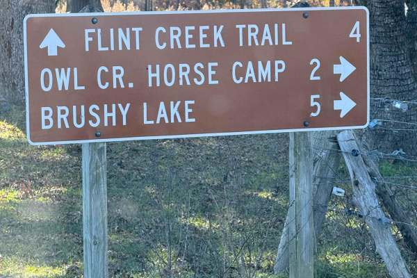
County Road 90 - FS 259
County Road 90 begins as a paved route meandering through picturesque farmland before transitioning into the lush expanse of the Bankhead National Forest. Along the way, travelers can enjoy abundant wildlife and admire charming, historic generational farmhouses lining the roadside. The route also pr...
Learn more about County Road 90 - FS 259
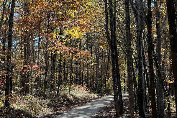
Indian Tomb Hollow Road
Indian Tomb Hollow County Road 86 is a scenic and heavily traveled forest route, known for its picturesque creek and charming bridge. This stretch of road is especially stunning during the fall when the foliage is in full color. Be mindful that the road can become slick after rain, so exercise cauti...
Learn more about Indian Tomb Hollow Road
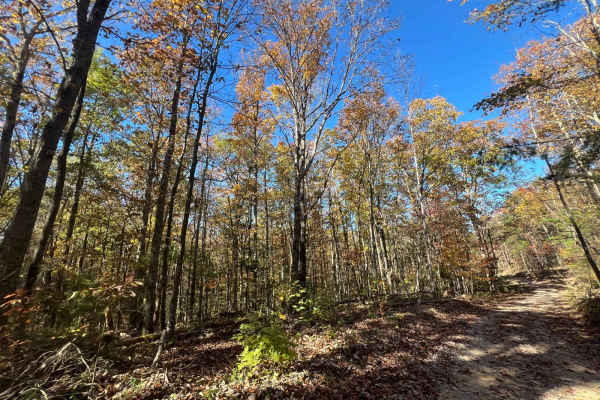
Flat Mountain Road - FS 270C
This is a tight, short out-and-back trail that winds through large stands of pine trees and passes old logging roads, along with a gate or two that are unlocked seasonally. Be sure to bring a saw, as fallen trees continue to block further access. The trail can be slick when muddy, so remember to tre...
Learn more about Flat Mountain Road - FS 270C
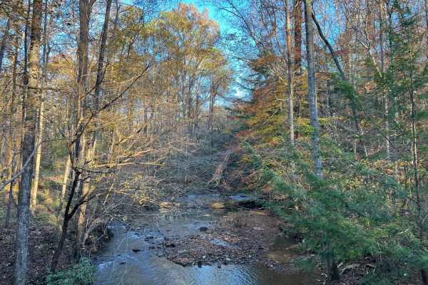
Brushy Creek Road - NF 254
This scenic road through the heart of the Bankhead National Forest offers not only a breathtaking drive but also access to fascinating historic sites waiting to be explored at its end. Along the way, you'll encounter numerous streams and picturesque bridges, each adding to the natural beauty of this...
Learn more about Brushy Creek Road - NF 254
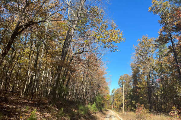
County Road 198 - FS272
This is a sparsely traveled trail that follows the telephone lines and weaves through private property, offering beautiful views of the local farmlands and surrounding landscape. The trail can be tricky during the muddy season, so be sure to check local conditions before heading out, and remember to...
Learn more about County Road 198 - FS272
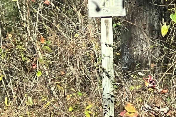
County Road 81 - FS 268
Forest Service Road 268 is a scenic, two-way country road that provides extensive access to other areas and trails. It offers ample opportunities for wildlife viewing and smooth, flowing travel. However, like many rural roads, it can be slick after rain or during muddy conditions. Be sure to leave n...
Learn more about County Road 81 - FS 268
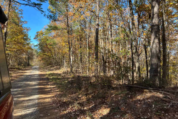
Braziel Creek Road - FS 223
FS223 is a gateway road leading into the wilderness areas of the Bankhead National Forest. This route culminates in a spacious parking lot, perfect for both camping and parking for those embarking on wilderness excursions. It's an excellent starting point for adventurers seeking to explore the fores...
Learn more about Braziel Creek Road - FS 223

Gum Pond Motorway - FS 229
FS229, also known as Gum Pond Motorway, is a single-lane, two-track road with freshly laid gravel and excellent maintenance. This scenic trail offers superb access to other parts of the Bankhead National Forest, making it a convenient route for further exploration. In the fall, this road is a stand...
Learn more about Gum Pond Motorway - FS 229
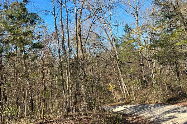
Northwest Road - FS 208 EA
This Forest Service road within the Bankhead National Forest is a well-traveled and well-maintained route, offering stunning scenery ideal for birdwatching and leaf-peeping enthusiasts. Its natural beauty makes it a perfect escape into the heart of nature. Always remember to tread lightly, leave no ...
Learn more about Northwest Road - FS 208 EA
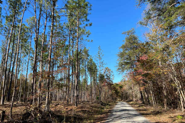
Mountain Springs Road - FS 236
This Forest Service road within the Bankhead National Forest is a well-traveled and well-maintained route, offering stunning scenery ideal for birdwatching and leaf-peeping enthusiasts. Its natural beauty makes it a perfect escape into the heart of nature. Always remember to tread lightly, leave no ...
Learn more about Mountain Springs Road - FS 236
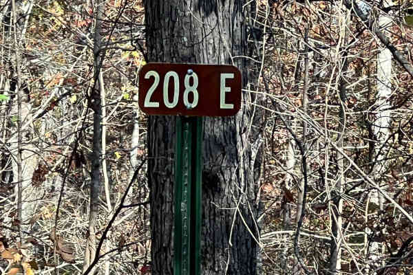
FS 208EA 2
National Forest Service Road 208EA is a single-lane, two-track route known for its sharp hairpin turns and banked corners, offering a challenging yet rewarding drive through the Bankhead National Forest. Travelers should be cautious of a prominent rock protruding from the road and prepare for varyin...
Learn more about FS 208EA 2
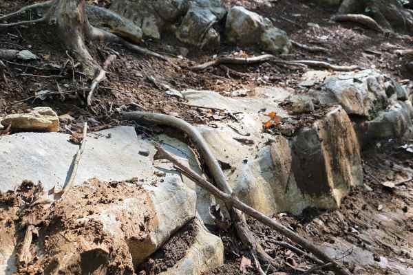
Homestead
This excellent offroad option features it all! Slick clay, exposed tree roots, ruts, slippery shale rock, ledges, and more! While this trail is difficult, it does not offer any dangerous off-camber positions. Riding this ravine uphill is sure to provide a challenge, with additional difficulties when...
Learn more about Homestead
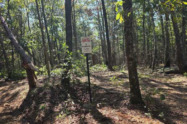
250 Acre Trail
250 Acre Trail is a cruiser's paradise. This trail contours to the mountainside with multiple trails of the same difficulty intersecting and splitting off. This is a perfect trail to let the younger riders take their time, as there are few to no obstacles that can pose a threat. The well-manicured t...
Learn more about 250 Acre Trail
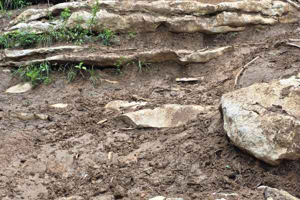
East View Ledges
East View Ledges is a great obstacle-type trail at NWALMP. This trail will test your line choices, driver skill, and machine durability. It features large exposed ridges with squishy clay filling each ledge as you climb this mountainside. Time for completion will vary greatly depending on how damp t...
Learn more about East View Ledges
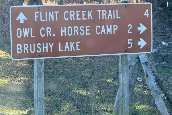
Owl Creek Road - FS 262
FS 262 is a one-lane gravel road, narrower than most others in the Bankhead National Forest. It provides access to the Al Creek Recreation Area, offering several large campsites along the route. The road also passes multiple closed roads and old roadbeds, providing ample opportunities for hiking and...
Learn more about Owl Creek Road - FS 262
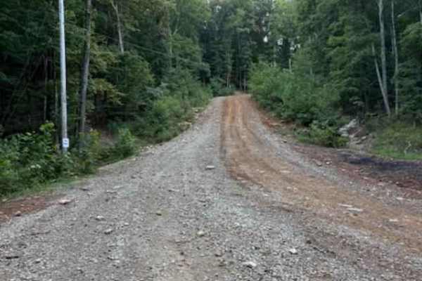
Main Road
The main road serves as the backbone of the trail system, with all routes connecting back to it. It is passable by stock four-wheel-drive vehicles in dry conditions and includes three creek crossings and one overlook with scenic views. The speed limit is 15 miles per hour, and wildlife such as deer ...
Learn more about Main Road
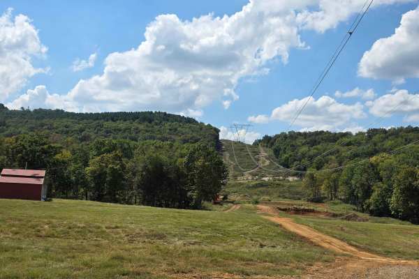
Power Line Trail
Power Line Trail can be a small spark or full-on electrifying! This trail offers a little bit of everything, with the main track being a cruising trail with many harder lines, should you try to take them. There are shorter, steep ledges on opposite sides of the trail for those who like to live on th...
Learn more about Power Line Trail
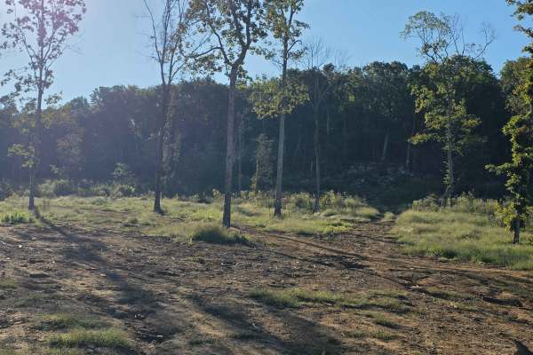
Can-am
Can-am is a trail close to camp that features a short flat ride to the nearest mountainside, where you will find an undercut ledge of slick rock and another line that is a bit more gradual. The easier of the two lines offers more of a stair-step climb, but puts the nose of your rig right into anothe...
Learn more about Can-am
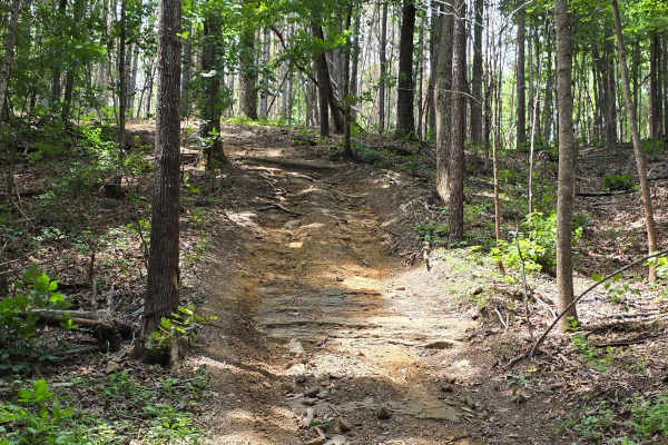
Titanic
All Aboard! Titanic is a great cruising trail that, when paired with the surrounding trails, can get you lost quickly. The Titanic section of the park is a small group of easy-riding trails on the opposite side of the ridge from Send It Hollow. Titanic primarily runs the long ridge line; however, th...
Learn more about Titanic
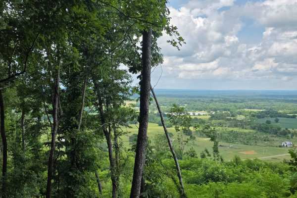
Sinking Ship
Sinking Ship is a dual drop trail - drop in to enter and drop in to exit. Once you are inside the middle portion of the trail, both exits are uphill. This means when the rain comes down, the exit off the trail will become increasingly difficult. Sinking ship offers beautiful mountainside views of th...
Learn more about Sinking Ship
ATV trails near Hillsboro, Alabama
Explore ATV-friendly trails near you. These trails are accessible for vehicles up to 50 inches wide, perfect for ATVs and smaller off-road machines.
County Road 90 - FS 259
County Road 90 begins as a paved route meandering through picturesque farmland before transitioning into the lush expanse of the Bankhead National Forest. Along the way, travelers can enjoy abundant wildlife and admire charming, historic generational farmhouses lining the roadside. The route also pr...
Learn more about County Road 90 - FS 259
Indian Tomb Hollow Road
Indian Tomb Hollow County Road 86 is a scenic and heavily traveled forest route, known for its picturesque creek and charming bridge. This stretch of road is especially stunning during the fall when the foliage is in full color. Be mindful that the road can become slick after rain, so exercise cauti...
Learn more about Indian Tomb Hollow Road
Flat Mountain Road - FS 270C
This is a tight, short out-and-back trail that winds through large stands of pine trees and passes old logging roads, along with a gate or two that are unlocked seasonally. Be sure to bring a saw, as fallen trees continue to block further access. The trail can be slick when muddy, so remember to tre...
Learn more about Flat Mountain Road - FS 270C
Brushy Creek Road - NF 254
This scenic road through the heart of the Bankhead National Forest offers not only a breathtaking drive but also access to fascinating historic sites waiting to be explored at its end. Along the way, you'll encounter numerous streams and picturesque bridges, each adding to the natural beauty of this...
Learn more about Brushy Creek Road - NF 254
UTV/side-by-side trails near Hillsboro, Alabama
Find UTV and side-by-side trails near you. These trails accommodate vehicles up to 60 inches wide, ideal for UTVs, side-by-sides, and wider off-road rigs.
County Road 90 - FS 259
County Road 90 begins as a paved route meandering through picturesque farmland before transitioning into the lush expanse of the Bankhead National Forest. Along the way, travelers can enjoy abundant wildlife and admire charming, historic generational farmhouses lining the roadside. The route also pr...
Learn more about County Road 90 - FS 259
Indian Tomb Hollow Road
Indian Tomb Hollow County Road 86 is a scenic and heavily traveled forest route, known for its picturesque creek and charming bridge. This stretch of road is especially stunning during the fall when the foliage is in full color. Be mindful that the road can become slick after rain, so exercise cauti...
Learn more about Indian Tomb Hollow Road
Flat Mountain Road - FS 270C
This is a tight, short out-and-back trail that winds through large stands of pine trees and passes old logging roads, along with a gate or two that are unlocked seasonally. Be sure to bring a saw, as fallen trees continue to block further access. The trail can be slick when muddy, so remember to tre...
Learn more about Flat Mountain Road - FS 270C
Brushy Creek Road - NF 254
This scenic road through the heart of the Bankhead National Forest offers not only a breathtaking drive but also access to fascinating historic sites waiting to be explored at its end. Along the way, you'll encounter numerous streams and picturesque bridges, each adding to the natural beauty of this...
Learn more about Brushy Creek Road - NF 254
The onX Offroad Difference
onX Offroad combines trail photos, descriptions, difficulty ratings, width restrictions, seasonality, and more in a user-friendly interface. Available on all devices, with offline access and full compatibility with CarPlay and Android Auto. Discover what you're missing today!
Open Trail Map