
Dirt Bike Trails
Near Glenbrook, Nevada
Explore All Dirt Bike Trails Near Glenbrook, Nevada
Dirt Bike Trails Near Glenbrook, Nevada
Discover the best dirt bike trails near you. Browse trail maps, check difficulty ratings, and find your next adventure — whether you're looking for a quick ride or an all-day expedition.
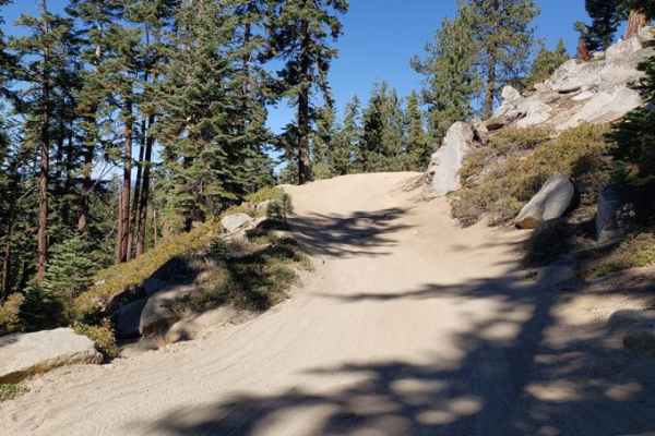
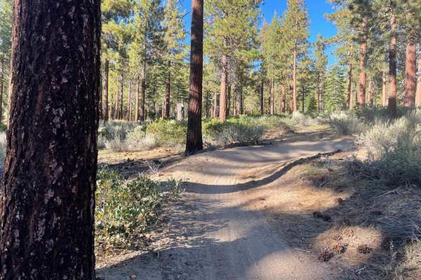
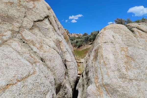
Genoa Peak Road - 41306
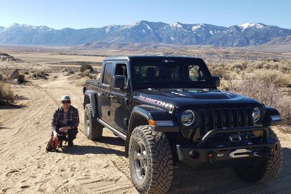
You'll get some great views of Lake Tahoe from this trail. It's a wide, single-lane gravel trail that's moderately to heavily used during the summer. The gates at both ends of the road are locked from November 15 to June 1st due to snowy conditions. It is recommended for 4x4s with high clearance, Je...
Learn more about Genoa Peak Road - 41306
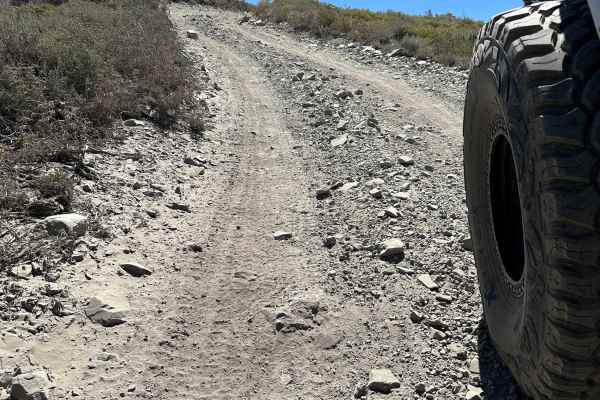
Genoa Peak Summit
This trail can be dusty. Head size sharp rocks on hard pack with occasional tree roots. Trail is roughly a 3 (any 4x4 should make it). Saw Jeeps, SxS, and ATVs on this day. There are a few small drop-offs on the South end of the trail that could be challenging if traveling North. The trail does not ...
Learn more about Genoa Peak Summit
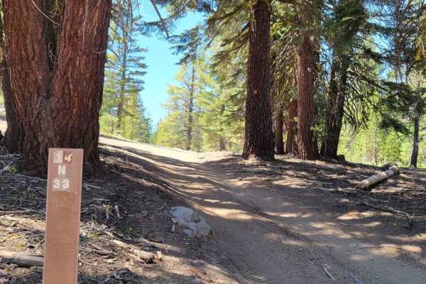
Logan House Loop 14n33
This trail has beautiful scenery that includes tree-filtered views of Lake Tahoe, Aspen groves, grassy meadows, a couple of small year-round streams, and the classic Sierra Nevada Mountain Forest. It is recommended for 4WD or AWD vehicles with higher clearance. Both ends of the trail offer paved sta...
Learn more about Logan House Loop 14n33
Kingsbury Stinger Trail
Kingsbury Stinger Trail is a fun all-arounder in the Tahoe Basin. It is one of the few legal trails for dirt bikes in the area. It can be ridden either direction and is strictly an out-and-back, as there is no way to loop it unless riding dual sport. Take note and be cautious, as this is frequently ...
Learn more about Kingsbury Stinger Trail
Lower Kingsbury Stinger Alternate - FS 18E46
This trail is commonly mapped as the Kingsbury Stinger Trail in apps, but according to the sign posted at the trail, it is not. It is Forest Service Trail 18E46, and we will refer to it as Lower Kingsbury Stinger Alternate. This trail allows you to out-and-back Kingsbury Stinger, but from a differen...
Learn more about Lower Kingsbury Stinger Alternate - FS 18E46
Indiana Bones Trail
The Indiana Bones Trail takes you from the OHV staging area up to Golden Eagle Rock and then down to Golden Eagle Lane. This trail is located in the Prison Hill OHV park and has views of Minden, Carson City, Sierra Nevada Mountains and the Pine Nut Mountains. The dirt trail is a double-track trail. ...
Learn more about Indiana Bones Trail

Cable Road
Named for the remnants of old cable wire scattered along its path and its original purpose, the Cable Road is a fun and fast-paced off-road trail within the Prison Hill OHV Area. Starting just off Golden Eagle Lane, it provides access to a network of trails in the area. The west end of the trail sta...
Learn more about Cable Road

Rubber Side Up
Rubber Side Up is a short, Fun trail perfect for the off-roader looking to step up from the medium-rated trails and looking for a manageable challenge. Rated as the easiest of the black-label trails on the Prison Hill map, this route offers a great introduction to more advanced terrain. After you ha...
Learn more about Rubber Side Up

D1
D1 has moved a bit due to erosion from the way it was originally shown on the Prison Hill map. The trail starts at the same trailhead as "Rubber Side Up" but heads off to the left to what looks like the easier path. Once you get up the trail a bit, what started off as a sandy dirt road quickly star...
Learn more about D1

Once Is Enough
Once is Enough may be the shortest black trail on the Prison Hill map, but don’t let its length deceive you—this trail is a compact powerhouse for off-road vehicles. It’s a short, intense shot with steep climbs that challenge both driver and machine. Off-camber turns add an extra layer of difficulty...
Learn more about Once Is Enough
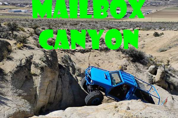
Mailbox Canyon
Mailbox Canyon is a short but brutal trail that will put your off-road skills to the test with two major obstacles that demand precision driving. The first obstacle throws a couple of big line choices your way, with a big ledge to climb on the left or a V-crack to climb on the right. The second obst...
Learn more about Mailbox Canyon

Gunslinger
Gunslinger is an exciting trail packed with challenges that will test your off-road skills and keep you engaged from start to finish. This trail is loaded with obstacles designed to slow you down and make you work for every inch. Expect to navigate over sizable boulders, perfect for crawling, as wel...
Learn more about Gunslinger
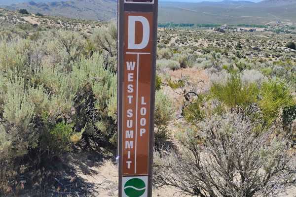
West Summit Loop
"West Summit Loop" starts off heading southeast from the main staging area. The trail takes you past "Headlight" and up to the "Cable Road," where it overlaps to the South for a bit, then turns up the hill. The trail traverses back and forth, getting steeper as you approach Golden Eagle Rock, a grea...
Learn more about West Summit Loop
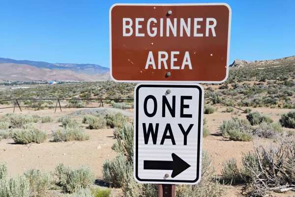
Beginner Track
This track is set up with the beginner in mind. The outside loop is the easier path with gentle turns and a smooth surface. The inside loop, however, makes things a bit trickier. There are optional small jumps and even a sand and rock obstacle to cross. The track is short but a great learning spot r...
Learn more about Beginner Track
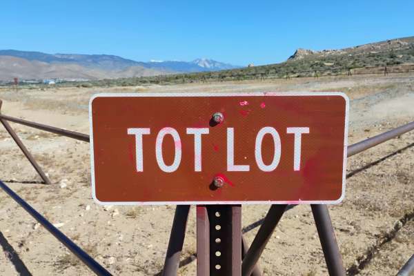
Tot Lot
The "Tot Lot" is a small dirt bike track for kids. There is a bench seat for the adult who wants a place to sit while they watch the kids. There are signs clearly posted that this is not a race track. There is no passing on the "Tot Lot." There is also a sign at the entrance that shows you what dir...
Learn more about Tot Lot
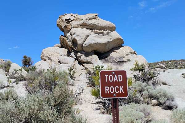
Toad Rock Loop
"Toad Rock Loop" is one of the most common trails to do when visiting Prison Hill. It starts by going north out of the staging area and cuts through "Off The Trailer." The trail had lots of markings, but it is hard to follow without using your GPS, since it travels back and forth close to itself, wh...
Learn more about Toad Rock Loop

Double Waterfall
Double Waterfall is a heart-pounding trail that lives up to its name with a dramatic double step-up waterfall feature at the top—a true test for any off-roader. This trail isn’t for the faint of heart, offering a mix of off-camber lines and big rocks to crawl over as you make your way to the main ob...
Learn more about Double Waterfall
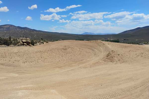
Sand Training Area
The "Sand Training Area" is an open riding zone where you can explore without the restrictions of a trail. The area changes from time to time, but there are some whoops to ride and some berms. This area is usually very busy with families and kids playing on dirt bikes and quads. If you are crossing ...
Learn more about Sand Training Area

Headlight
"Headlight" is a 6-acre open riding area where you are not required to stay on a designated trail. This is an open play area where you can practice your skills and push your rig into whatever challenge you're looking for. Expect to find cracks and climbs with a variety of challenges for most rigs. W...
Learn more about Headlight
Off The Trailer
"Off The Trailer" is a 22-acre open play area right next to the main staging area. This is a place to test your rig and skills in an open riding zone where you are not constrained to a single trail. The best part about this area is that you are right next to the staging area if anything goes wrong, ...
Learn more about Off The Trailer
ATV trails near Glenbrook, Nevada
Explore ATV-friendly trails near you. These trails are accessible for vehicles up to 50 inches wide, perfect for ATVs and smaller off-road machines.
Genoa Peak Road - 41306
You'll get some great views of Lake Tahoe from this trail. It's a wide, single-lane gravel trail that's moderately to heavily used during the summer. The gates at both ends of the road are locked from November 15 to June 1st due to snowy conditions. It is recommended for 4x4s with high clearance, Je...
Learn more about Genoa Peak Road - 41306
Genoa Peak Summit
This trail can be dusty. Head size sharp rocks on hard pack with occasional tree roots. Trail is roughly a 3 (any 4x4 should make it). Saw Jeeps, SxS, and ATVs on this day. There are a few small drop-offs on the South end of the trail that could be challenging if traveling North. The trail does not ...
Learn more about Genoa Peak Summit
Logan House Loop 14n33
This trail has beautiful scenery that includes tree-filtered views of Lake Tahoe, Aspen groves, grassy meadows, a couple of small year-round streams, and the classic Sierra Nevada Mountain Forest. It is recommended for 4WD or AWD vehicles with higher clearance. Both ends of the trail offer paved sta...
Learn more about Logan House Loop 14n33
Indiana Bones Trail
The Indiana Bones Trail takes you from the OHV staging area up to Golden Eagle Rock and then down to Golden Eagle Lane. This trail is located in the Prison Hill OHV park and has views of Minden, Carson City, Sierra Nevada Mountains and the Pine Nut Mountains. The dirt trail is a double-track trail. ...
Learn more about Indiana Bones Trail
UTV/side-by-side trails near Glenbrook, Nevada
Find UTV and side-by-side trails near you. These trails accommodate vehicles up to 60 inches wide, ideal for UTVs, side-by-sides, and wider off-road rigs.
Genoa Peak Summit
This trail can be dusty. Head size sharp rocks on hard pack with occasional tree roots. Trail is roughly a 3 (any 4x4 should make it). Saw Jeeps, SxS, and ATVs on this day. There are a few small drop-offs on the South end of the trail that could be challenging if traveling North. The trail does not ...
Learn more about Genoa Peak Summit
Logan House Loop 14n33
This trail has beautiful scenery that includes tree-filtered views of Lake Tahoe, Aspen groves, grassy meadows, a couple of small year-round streams, and the classic Sierra Nevada Mountain Forest. It is recommended for 4WD or AWD vehicles with higher clearance. Both ends of the trail offer paved sta...
Learn more about Logan House Loop 14n33
Cable Road
Named for the remnants of old cable wire scattered along its path and its original purpose, the Cable Road is a fun and fast-paced off-road trail within the Prison Hill OHV Area. Starting just off Golden Eagle Lane, it provides access to a network of trails in the area. The west end of the trail sta...
Learn more about Cable Road
Rubber Side Up
Rubber Side Up is a short, Fun trail perfect for the off-roader looking to step up from the medium-rated trails and looking for a manageable challenge. Rated as the easiest of the black-label trails on the Prison Hill map, this route offers a great introduction to more advanced terrain. After you ha...
Learn more about Rubber Side Up
The onX Offroad Difference
onX Offroad combines trail photos, descriptions, difficulty ratings, width restrictions, seasonality, and more in a user-friendly interface. Available on all devices, with offline access and full compatibility with CarPlay and Android Auto. Discover what you're missing today!
Open Trail Map