
Dirt Bike Trails
Near Fort Washakie, Wyoming
Explore All Dirt Bike Trails Near Fort Washakie, Wyoming
Dirt Bike Trails Near Fort Washakie, Wyoming
Discover the best dirt bike trails near you. Browse trail maps, check difficulty ratings, and find your next adventure — whether you're looking for a quick ride or an all-day expedition.
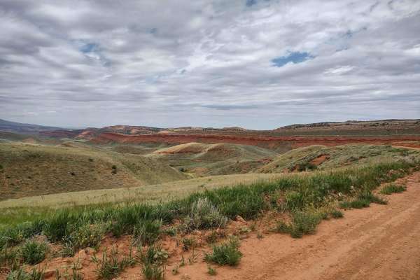
Red Canyon Road
Bypass the pavement and explore this beautiful canyon just west of Highway 28 south of Lander. High red rock cliffs run along the Little Popo Agie River. The canyon is filled with beautiful ranch property and a wildlife habitat management area. Even in mid-August, it is green and pretty. The north e...
Learn more about Red Canyon Road
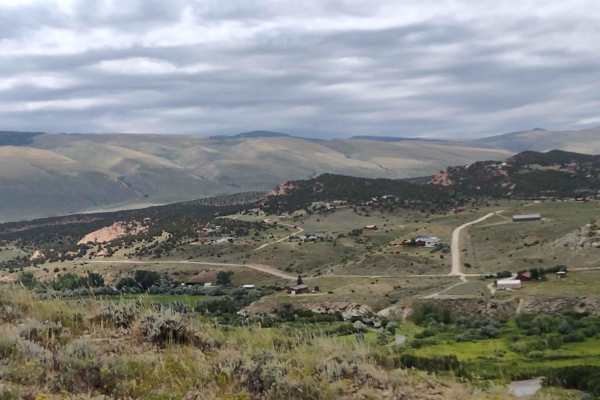
Ridge Runner Loop
Just south of the Red Canyon Rd exit on Hwy 28, there is a strip of BLM land between the highway and Red Canyon. This trail runs along the ridge, high above the highway, and then circles to the Red Canyon side. To complete the loop, you must go down through a wash (which was dry in August) and then ...
Learn more about Ridge Runner Loop
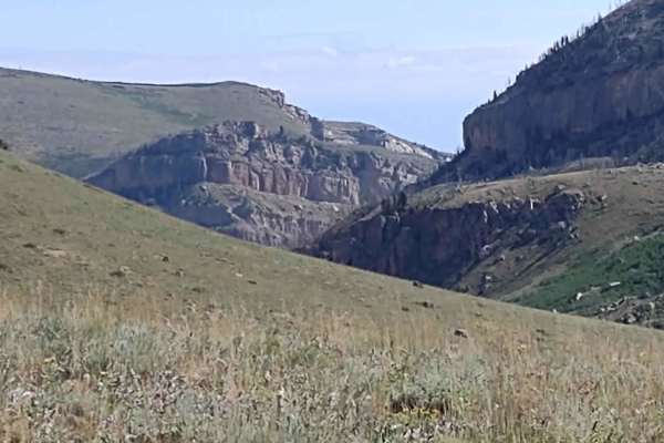
Indian 4WD Trail - FS 352
Indian 4WD Trail is a fantastic 11-mile trail that crosses two mountains, goes through the valleys and pines, goes across Pass Creek and the Little Popo Agie River, and ends at Frye Lake in the Shoshone National Forest. In some places, the trail has loose rocks, but they're navigable. The water cros...
Learn more about Indian 4WD Trail - FS 352
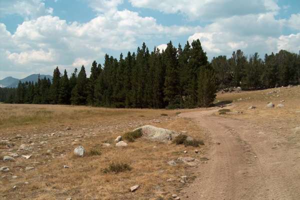
Christina Lake
This challenging route takes you to Gustave Lake and Christina Lake near the boundary of the Popo Agie Wilderness in the Wind River Range. The first few miles of this road follows a fairly smooth dirt path that can be handled by most 4WD vehicles, but usually only modified rigs and ATVs make it to t...
Learn more about Christina Lake
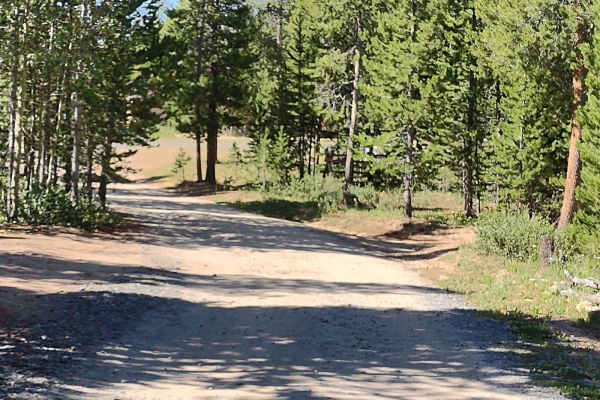
Beaver Creek 4WD (FS 366)
This trail connects Limestone Mountain Road at its east end with Little Rock Trail and Christina Lake Trail on its west end. There are amazing places to camp near the east end of this trail. You wind through the trees in places and cross sagebrush flats in others. The trail is rocky in several place...
Learn more about Beaver Creek 4WD (FS 366)
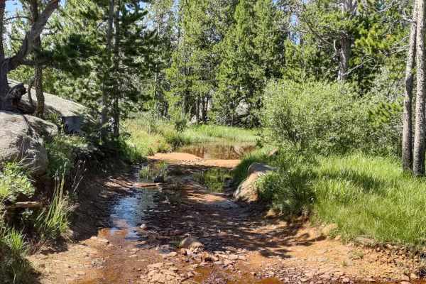
Little Rock (FS 368)
Little Rock is a two-track trail on the west end with the name "Little Rock" and number 368 on the Forest Service map. It begins at Louise Lake Road, and from there, the trail crosses the Shoshone National Forest in an easterly direction, and then it crosses some private property where access is gra...
Learn more about Little Rock (FS 368)
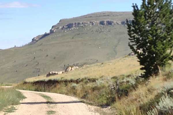
Limestone Mtn Rd (FS 326)
Limestone Mountain Road (a/k/a Ed Young Basin) runs from Hwy 28 near Atlantic City, Wyoming, up to the Indian Trail and beyond. Our track stops at the intersection with the Indian Trail. This is a well-maintained dirt road. I don't know if it's open year-round. You go up over the mountains at 8800 f...
Learn more about Limestone Mtn Rd (FS 326)
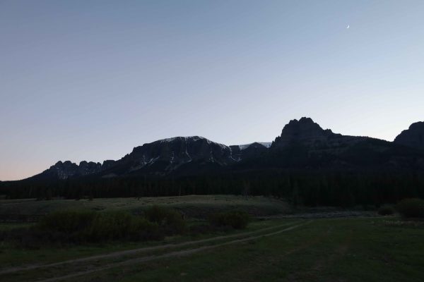
Wiggins Fork
When navigating this Forest Service road, you will find it mostly easy with views of rolling meadows to start. But the further you go, the terrain changes from a maintained dirt road to one that has small ruts, switchbacks, and rocks--nothing any 4WD or AWD vehicle can't get through. Along with the ...
Learn more about Wiggins Fork
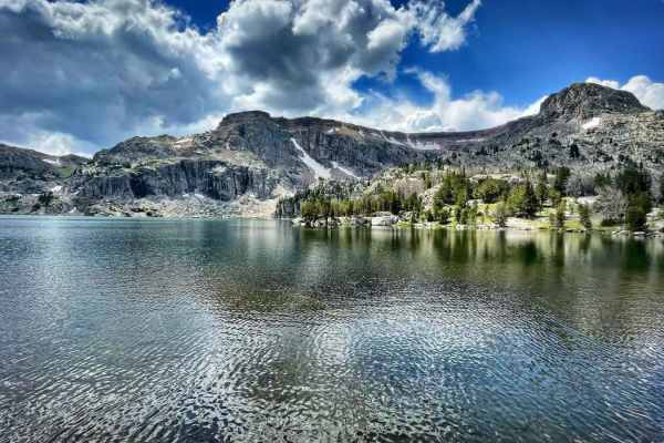
Granite Lake Trail
Granite Lake, In mid-summer, it's a very refreshing way to cool off. There is a hiking trail around the lake. If you plan to ride down the trail, tread lightly and leave no trace. This route is for 50 inches or less. Is fairly steep with loose sand, lots of roots, and rocks. Bring sunscreen, food, a...
Learn more about Granite Lake Trail
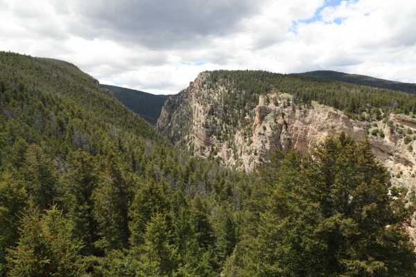
554 Wildcat and 528 Geyser Creek
Once you are on the 554 Trail you will need to go through a gate (just lock it when you go through). There are plenty of signs pointing you to the many trails so just keep an eye out at every junction point. 554 will go in a westerly direction until the junction point for 528. Follow 528 southerl...
Learn more about 554 Wildcat and 528 Geyser Creek

Buffalo Creek/ Hot Springs County 5
This scenic route takes the back roads from Thermopolis to Lysite, Wyoming. The county road travels through private property, so stay on the road. The road is a gravel road until you cross the county line, and then it can become rutted. The road will eventually reach gravel again. There is a section...
Learn more about Buffalo Creek/ Hot Springs County 5
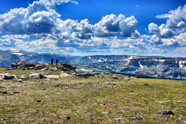
Seven Lakes Trails
This trail has the most amazing views of the Wind River Range. You will encounter a few water crossings, even in August. Be prepared to bring warmer gear, it becomes much colder and windier as you reach higher elevations, even in summer. Bring sunscreen, food, and extra H20, take your time, and enjo...
Learn more about Seven Lakes Trails
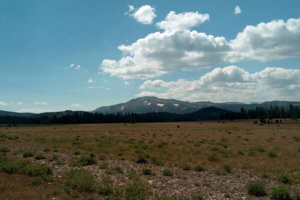
Moon Lake
This rough track leads to a remote lake on the northern side of the Wind River Range. The driving gets progressively more challenging the closer you get to the lake. The adventure begins by crossing the high meadows of the Continental Divide. Halfway in, Union Peak (11,491) and its small glaciers be...
Learn more about Moon Lake
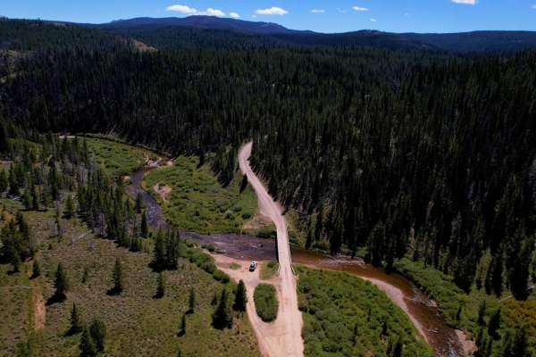
Union Pass
Union Pass is an easy, well-graded forest road that takes you from the pass all the way down to the Green River. At over 9,000 feet, you'll find yourself in a bowl surrounded by beautiful vistas, meadows, and lakes. The road is super easy and most vehicles can travel without issue. There are several...
Learn more about Union Pass
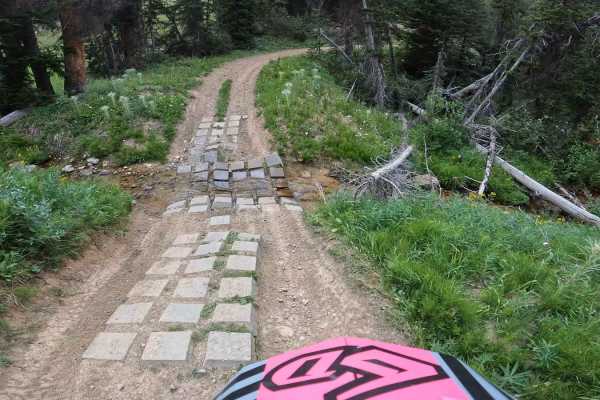
South Fork Ridge (MT13)
This is an easy-going ATV/dirt bike trail. There are a few water crossings, with man-made cinder blocks and potential large mudholes in spring. This trail has fun, small, little kickers and swooping turns, it almost feels like riding a mini dirt bike track. Small cc bikes and quad friendly. Since th...
Learn more about South Fork Ridge (MT13)
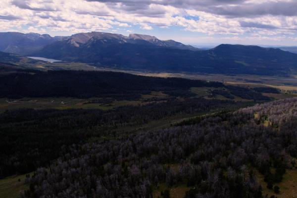
Grind up Pinon Pass
This is a fun, mid-level, technical trail that goes from the Green River all the way to the top of Gun Sight Pass, offering 360-degree views of the Wind River, Absarokas, and Grand Tetons Mountain ranges. Taking the trail from the Green River (south) you'll climb out of the river navigating deep mud...
Learn more about Grind up Pinon Pass

Outer Loop Boundary Trail
Mostly an easy winding trail that marks the west and north park boundaries. It's great for a more relaxing excursion to explore, or to limp your broken trail rig back to the parking area. Easy access to the upper reaches of the park without needing to take a boulder-filled trail.
Learn more about Outer Loop Boundary Trail
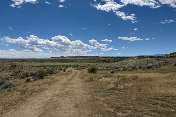
2 Track Escape
Relatively easy trail connecting visitors to the east side of the park, and providing an easy way out after running some of the harder areas of the park. It links up to the middle of the Side By Side Trail, providing quick and easy access to Hanging Bridge. It winds through vast sagebrush and has on...
Learn more about 2 Track Escape
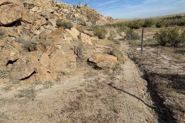
Matterhorn
This dead-end trail is an optional trek near the southern ends of Escalator and Charlie, and within easy reach of the parking area. It winds its way along the base of some steep cliffs, then shoots up a steep and rocky climb. Wider vehicles might find the fence a bit too close.
Learn more about Matterhorn

Charlie Trail
Charlie Trail cuts through the park in a north-south direction and offers some challenging sections with a large rock garden about the midpoint. A slight bypass can be found to the north of the main rock garden. The garden itself offers large drops and huge boulders to traverse, along with a very st...
Learn more about Charlie Trail
ATV trails near Fort Washakie, Wyoming
Explore ATV-friendly trails near you. These trails are accessible for vehicles up to 50 inches wide, perfect for ATVs and smaller off-road machines.
Red Canyon Road
Bypass the pavement and explore this beautiful canyon just west of Highway 28 south of Lander. High red rock cliffs run along the Little Popo Agie River. The canyon is filled with beautiful ranch property and a wildlife habitat management area. Even in mid-August, it is green and pretty. The north e...
Learn more about Red Canyon Road
Ridge Runner Loop
Just south of the Red Canyon Rd exit on Hwy 28, there is a strip of BLM land between the highway and Red Canyon. This trail runs along the ridge, high above the highway, and then circles to the Red Canyon side. To complete the loop, you must go down through a wash (which was dry in August) and then ...
Learn more about Ridge Runner Loop
Indian 4WD Trail - FS 352
Indian 4WD Trail is a fantastic 11-mile trail that crosses two mountains, goes through the valleys and pines, goes across Pass Creek and the Little Popo Agie River, and ends at Frye Lake in the Shoshone National Forest. In some places, the trail has loose rocks, but they're navigable. The water cros...
Learn more about Indian 4WD Trail - FS 352
Christina Lake
This challenging route takes you to Gustave Lake and Christina Lake near the boundary of the Popo Agie Wilderness in the Wind River Range. The first few miles of this road follows a fairly smooth dirt path that can be handled by most 4WD vehicles, but usually only modified rigs and ATVs make it to t...
Learn more about Christina Lake
UTV/side-by-side trails near Fort Washakie, Wyoming
Find UTV and side-by-side trails near you. These trails accommodate vehicles up to 60 inches wide, ideal for UTVs, side-by-sides, and wider off-road rigs.
Red Canyon Road
Bypass the pavement and explore this beautiful canyon just west of Highway 28 south of Lander. High red rock cliffs run along the Little Popo Agie River. The canyon is filled with beautiful ranch property and a wildlife habitat management area. Even in mid-August, it is green and pretty. The north e...
Learn more about Red Canyon Road
Ridge Runner Loop
Just south of the Red Canyon Rd exit on Hwy 28, there is a strip of BLM land between the highway and Red Canyon. This trail runs along the ridge, high above the highway, and then circles to the Red Canyon side. To complete the loop, you must go down through a wash (which was dry in August) and then ...
Learn more about Ridge Runner Loop
Indian 4WD Trail - FS 352
Indian 4WD Trail is a fantastic 11-mile trail that crosses two mountains, goes through the valleys and pines, goes across Pass Creek and the Little Popo Agie River, and ends at Frye Lake in the Shoshone National Forest. In some places, the trail has loose rocks, but they're navigable. The water cros...
Learn more about Indian 4WD Trail - FS 352
Christina Lake
This challenging route takes you to Gustave Lake and Christina Lake near the boundary of the Popo Agie Wilderness in the Wind River Range. The first few miles of this road follows a fairly smooth dirt path that can be handled by most 4WD vehicles, but usually only modified rigs and ATVs make it to t...
Learn more about Christina Lake
The onX Offroad Difference
onX Offroad combines trail photos, descriptions, difficulty ratings, width restrictions, seasonality, and more in a user-friendly interface. Available on all devices, with offline access and full compatibility with CarPlay and Android Auto. Discover what you're missing today!
Open Trail Map