
Dirt Bike Trails
Near Fish Springs, Nevada
Explore All Dirt Bike Trails Near Fish Springs, Nevada
Dirt Bike Trails Near Fish Springs, Nevada
Discover the best dirt bike trails near you. Browse trail maps, check difficulty ratings, and find your next adventure — whether you're looking for a quick ride or an all-day expedition.
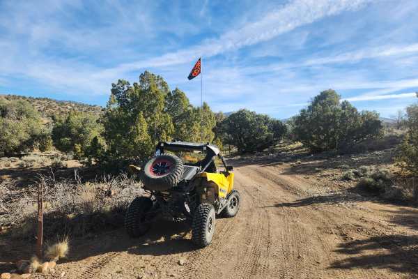
Pine Nuts P-16 Trail
Traveling East from the Carson Valley, P-16 Trail will take you into the heart of the Pine Nut Mountains. It is a one-lane winding mountain trail that gains altitude as you go East. The trail is lined with Juniper trees and Pinion Pines, with some open areas, and offers grand views of the Sierra Fro...
Learn more about Pine Nuts P-16 Trail
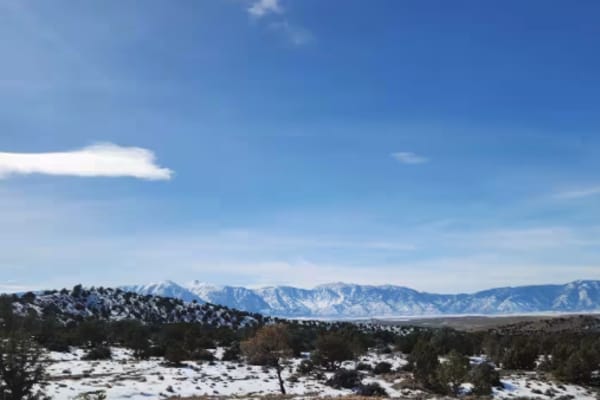
P-10 Trail
Named by the BLM, P-10 is a North/South trail passing along the East side of the Carson Valley. On the North it intersects Sunrise Pass (BLM R-09), and in the South intersecting with Pine Nut Road II (BLM P-11). P-10 is an easy trail, consisting of dirt, sand, and some rocky sections. There is a min...
Learn more about P-10 Trail
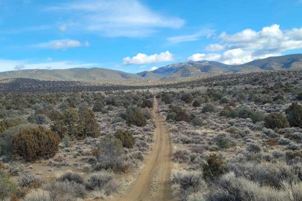
1947 Bunker Trail
This trail starts off on a wide graded dirt road. Then turning Northeast you proceed up a narrow double track trail. This portion of the trail ascends up a flat topped ridge which is lined with Juniper trees. There are several small arroyos to cross along the way. The arroyos are usually dry, but ca...
Learn more about 1947 Bunker Trail
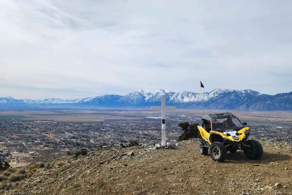
Hot Springs Mountains Senic Trail
This trail leads you to panoramic views of the Carson Valley and the Sierra Front. I prefer to start at the Johnson Lane Staging Area and travel North, but either direction is okay. The trail has a few challenges. You will encounter soft sand and loose rocks on some of the steep climbs, so have appr...
Learn more about Hot Springs Mountains Senic Trail
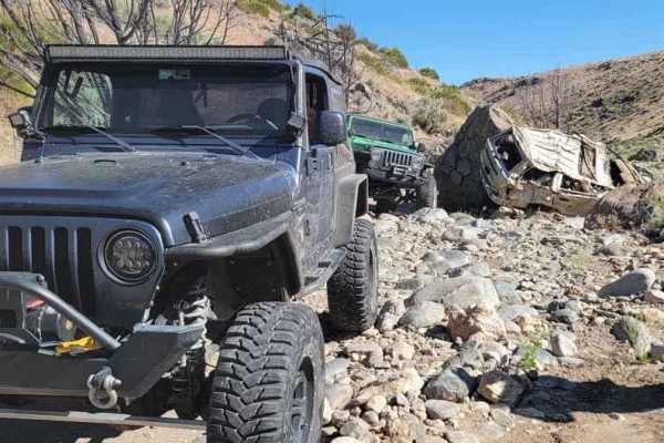
Secret Canyon
This trail offers a rugged adventure, tracing a dry riverbed through a rocky canyon. It's a demanding route, testing both driver skill and vehicle durability. The scenery may not be particularly picturesque, but the trail will thoroughly challenge every bolt, screw, and fastener on your 4x4. To tack...
Learn more about Secret Canyon
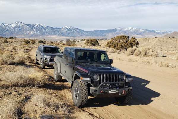
Sunrise Pass Road
This graded dirt county road begins at the Johnson Lane OHV Park located east of Minden, NV. As the road gradually ascends, it traverses alluvial plains covered in sage and low canyons with juniper trees. Rising to 7,000 feet at Sunrise Pass, the road takes you to the heart of the Pine Nut Mountains...
Learn more about Sunrise Pass Road
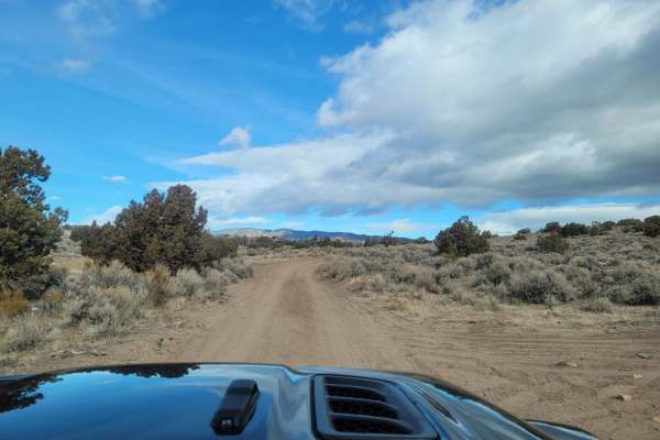
Pine Nut Mountains Vista Trail
The Pine Nut Mountains Vista Trail is a scenic double-track route in the Johnson Lane OHV Area, perfect for offroaders seeking panoramic views of the Sierra Nevada Mountains, Minden, and the surrounding Carson Valley. Starting near the end of Johnson Lane, just ten miles from Minden, this 2.56-mile ...
Learn more about Pine Nut Mountains Vista Trail
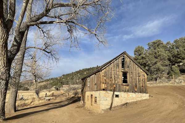
Carson River East Fork Hot Springs Trail
This trail along the East Fork of the Carson River with spectacular views of the River's canyon, the walls peaks of the High Sierra's to the west will not disappoint any mid-level experienced rider. Use caution and be courteous, this may be a high traffic area. The majority of this trail is only wid...
Learn more about Carson River East Fork Hot Springs Trail
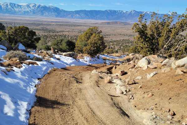
Power Line Trail RSM
The trail is typically one vehicle wide with a few places to pass on this double-track dirt and clay trail. The clay in this area is treacherous when wet. This first 1.7-mile portion of the trail gently descends from an elevation of 5,815 feet to 5,700 feet. The trail then ascends to the trail's hig...
Learn more about Power Line Trail RSM
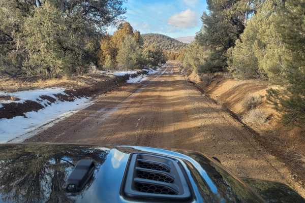
Utopian Mine Trail
This road takes you to the Utopian Mine located in the Pine Nut Mountains in Carson City County, Nevada. The graded dirt road is wide and flat for the first four miles. As you cross into Carson City County, the road is named Bruinswick Canyon Road. Turning on to a double-track side trail for the las...
Learn more about Utopian Mine Trail
Big Buck Meadows Trail
Big Buck Meadows Trail follows the power line service road for about 1.5 miles. This portion of the trail consists of a single vehicle-wide trail with a few easy hairpin switchbacks. Ascending about 800 feet to an elevation of 7,211 ft. the trail surface is mostly packed gravel. As the road quickly ...
Learn more about Big Buck Meadows Trail
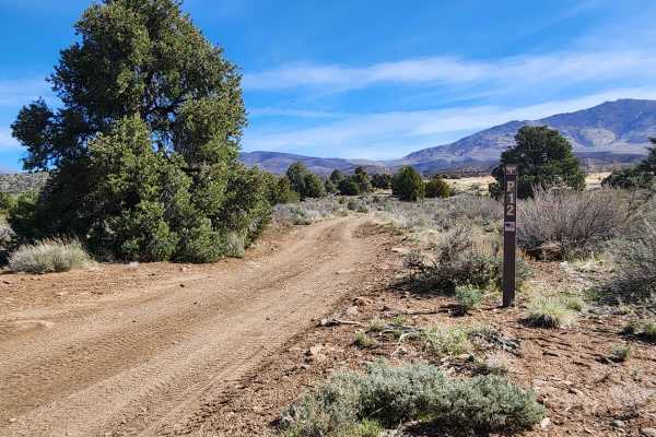
Lone Pine Canyon Road - BLM P-12
Traveling East from the Carson Valley, Lone Pine Canyon Road (BLM P-12) will take you into the Southern portion of the Pine Nut Mountains. It is a one-lane winding mountain trail with some moderate challenges. It gains altitude as you go East into the Pine Nuts. The trail once was lined with Junipe...
Learn more about Lone Pine Canyon Road - BLM P-12
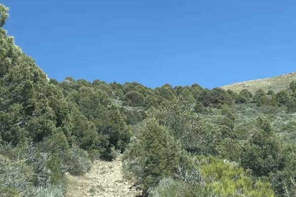
Mineral Valley Trail
This trail can connect you from Big Buck Meadows Trail to the Saddle of two over 8,000-foot peaks with spectacular views all around. The trail is VERY narrow with lots of Pinon trees and some boulders 2-3 feet at most. It can be very overgrown, so bringing a chainsaw and trimmers is recommended. Pin...
Learn more about Mineral Valley Trail
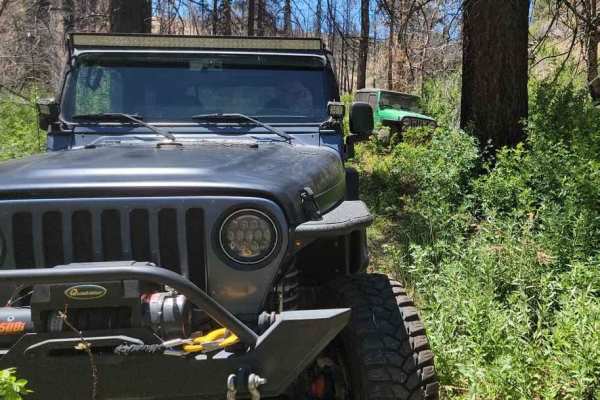
Poison Creek
The trail begins on a dirt road just off Highway 395 and quickly descends into a lush valley. In this valley, the path follows a creek, winding in and out of dense vegetation. At times, the vehicle feels like it's traveling through a tunnel formed by the overhanging trees and greenery. While the tra...
Learn more about Poison Creek
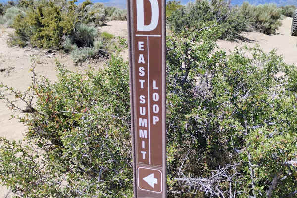
East Summit Loop
"East Summit Loop" starts from the main staging area and heads east, skirting the edge of "Off The Trailer." The trail heads up to the "Cable Road" and follows it through the whooped section to the east, where you will pass the first of a few great vista points. The trail continues up to a second vi...
Learn more about East Summit Loop
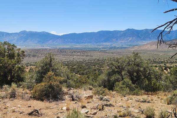
Fiddlers Green Trail
Fiddlers Green trail starts in a wooded area, then heads up and down steep, rocky stretches and trenches with noticeable off-camber sections. Some of the trail, especially the steep parts, is very narrow, so watch for oncoming traffic. Along the way, you climb in altitude and have views of Carson ...
Learn more about Fiddlers Green Trail
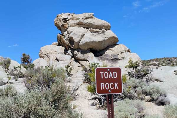
Toad Rock Loop
"Toad Rock Loop" is one of the most common trails to do when visiting Prison Hill. It starts by going north out of the staging area and cuts through "Off The Trailer." The trail had lots of markings, but it is hard to follow without using your GPS, since it travels back and forth close to itself, wh...
Learn more about Toad Rock Loop
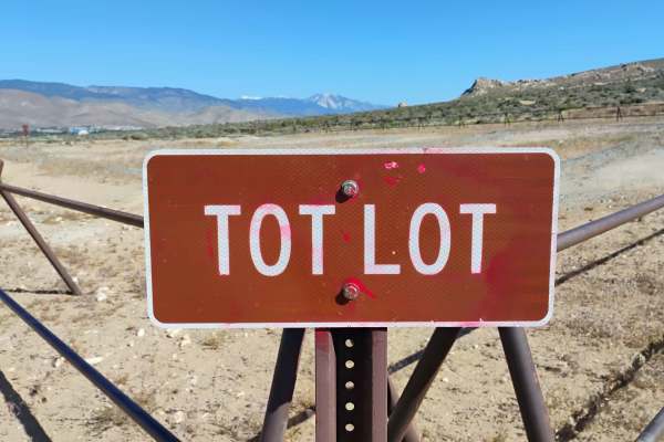
Tot Lot
The "Tot Lot" is a small dirt bike track for kids. There is a bench seat for the adult who wants a place to sit while they watch the kids. There are signs clearly posted that this is not a race track. There is no passing on the "Tot Lot." There is also a sign at the entrance that shows you what dir...
Learn more about Tot Lot
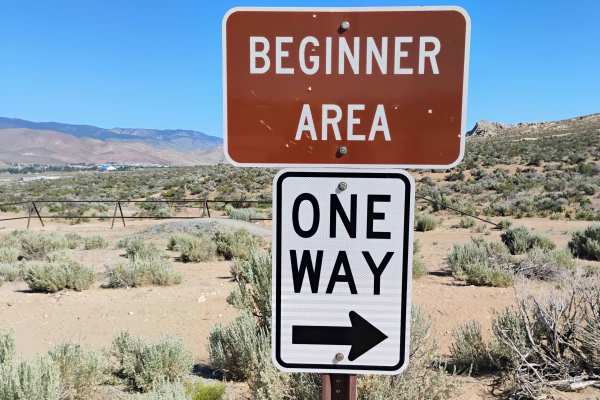
Beginner Track
This track is set up with the beginner in mind. The outside loop is the easier path with gentle turns and a smooth surface. The inside loop, however, makes things a bit trickier. There are optional small jumps and even a sand and rock obstacle to cross. The track is short but a great learning spot r...
Learn more about Beginner Track
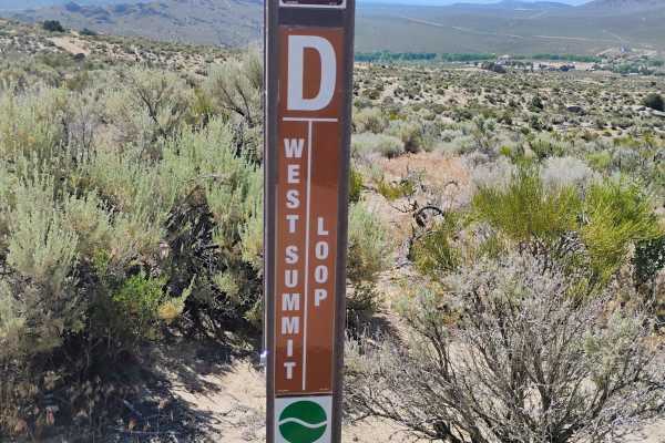
West Summit Loop
"West Summit Loop" starts off heading southeast from the main staging area. The trail takes you past "Headlight" and up to the "Cable Road," where it overlaps to the South for a bit, then turns up the hill. The trail traverses back and forth, getting steeper as you approach Golden Eagle Rock, a grea...
Learn more about West Summit Loop
ATV trails near Fish Springs, Nevada
Explore ATV-friendly trails near you. These trails are accessible for vehicles up to 50 inches wide, perfect for ATVs and smaller off-road machines.
Pine Nuts P-16 Trail
Traveling East from the Carson Valley, P-16 Trail will take you into the heart of the Pine Nut Mountains. It is a one-lane winding mountain trail that gains altitude as you go East. The trail is lined with Juniper trees and Pinion Pines, with some open areas, and offers grand views of the Sierra Fro...
Learn more about Pine Nuts P-16 Trail
P-10 Trail
Named by the BLM, P-10 is a North/South trail passing along the East side of the Carson Valley. On the North it intersects Sunrise Pass (BLM R-09), and in the South intersecting with Pine Nut Road II (BLM P-11). P-10 is an easy trail, consisting of dirt, sand, and some rocky sections. There is a min...
Learn more about P-10 Trail
1947 Bunker Trail
This trail starts off on a wide graded dirt road. Then turning Northeast you proceed up a narrow double track trail. This portion of the trail ascends up a flat topped ridge which is lined with Juniper trees. There are several small arroyos to cross along the way. The arroyos are usually dry, but ca...
Learn more about 1947 Bunker Trail
Hot Springs Mountains Senic Trail
This trail leads you to panoramic views of the Carson Valley and the Sierra Front. I prefer to start at the Johnson Lane Staging Area and travel North, but either direction is okay. The trail has a few challenges. You will encounter soft sand and loose rocks on some of the steep climbs, so have appr...
Learn more about Hot Springs Mountains Senic Trail
UTV/side-by-side trails near Fish Springs, Nevada
Find UTV and side-by-side trails near you. These trails accommodate vehicles up to 60 inches wide, ideal for UTVs, side-by-sides, and wider off-road rigs.
Pine Nuts P-16 Trail
Traveling East from the Carson Valley, P-16 Trail will take you into the heart of the Pine Nut Mountains. It is a one-lane winding mountain trail that gains altitude as you go East. The trail is lined with Juniper trees and Pinion Pines, with some open areas, and offers grand views of the Sierra Fro...
Learn more about Pine Nuts P-16 Trail
P-10 Trail
Named by the BLM, P-10 is a North/South trail passing along the East side of the Carson Valley. On the North it intersects Sunrise Pass (BLM R-09), and in the South intersecting with Pine Nut Road II (BLM P-11). P-10 is an easy trail, consisting of dirt, sand, and some rocky sections. There is a min...
Learn more about P-10 Trail
1947 Bunker Trail
This trail starts off on a wide graded dirt road. Then turning Northeast you proceed up a narrow double track trail. This portion of the trail ascends up a flat topped ridge which is lined with Juniper trees. There are several small arroyos to cross along the way. The arroyos are usually dry, but ca...
Learn more about 1947 Bunker Trail
Hot Springs Mountains Senic Trail
This trail leads you to panoramic views of the Carson Valley and the Sierra Front. I prefer to start at the Johnson Lane Staging Area and travel North, but either direction is okay. The trail has a few challenges. You will encounter soft sand and loose rocks on some of the steep climbs, so have appr...
Learn more about Hot Springs Mountains Senic Trail
The onX Offroad Difference
onX Offroad combines trail photos, descriptions, difficulty ratings, width restrictions, seasonality, and more in a user-friendly interface. Available on all devices, with offline access and full compatibility with CarPlay and Android Auto. Discover what you're missing today!
Open Trail Map