
Dirt Bike Trails
Near Fair Haven, New York
Explore All Dirt Bike Trails Near Fair Haven, New York
Dirt Bike Trails Near Fair Haven, New York
Discover the best dirt bike trails near you. Browse trail maps, check difficulty ratings, and find your next adventure — whether you're looking for a quick ride or an all-day expedition.
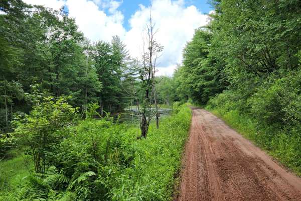
Happy Valley Road
Stony loamy trail connecting Route 26 and Stone Hill Road. The road goes through Happy Valley Wildlife Management Area. There is a pull-off access to Whitney Pond for fishing, hiking, or viewing wildlife. This road is part of the Oswego County ATV club so use caution for oncoming ATV traffic.
Learn more about Happy Valley Road
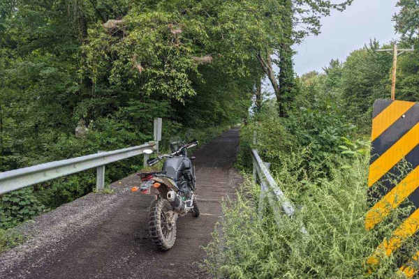
Oswego Recreational Trail
The Oswego Recreational Trail is an old railroad bed with various surface types and old road millings. Very flat with some whoops and potholes in places. It's a nice easy ride through wooded, shaded areas and runs through the three-mile bay wildlife area. There are a couple of restaurants, bars, and...
Learn more about Oswego Recreational Trail
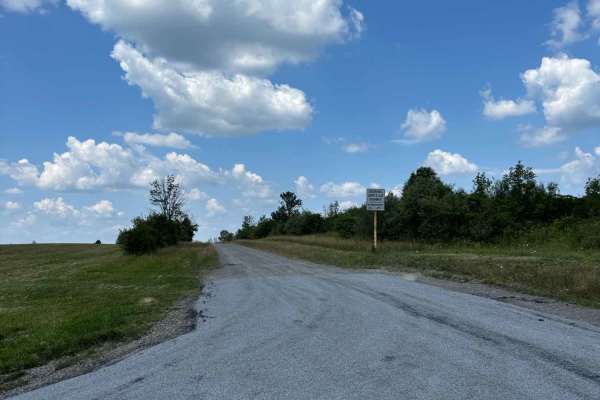
View Board Road
This seasonal road is atop South Hill and offers a picturesque trip along a wooded path. It is a short distance from High Tor Wildlife Management Area and runs adjacent to a private hunting preserve. The woods offer a beautiful trip during the Fall for colorful foliage and views of the nearby hills....
Learn more about View Board Road
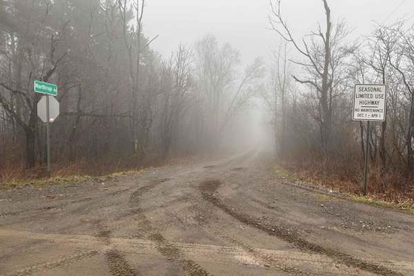
Northrup Hill Road
This seasonal road runs along and through sections of flooded woodland. At the south end, it intersects with West Lightning Road, which has access to Italy Hill State Forest. The road is not well-maintained and has several potholes and mud puddles. All of the land along the road is private property ...
Learn more about Northrup Hill Road
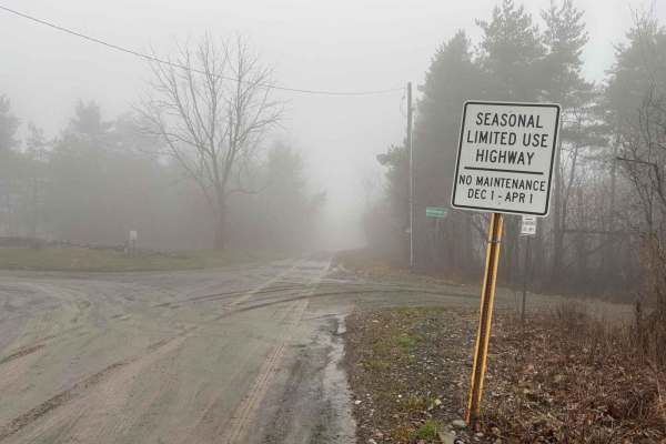
West Lightening Road
This seasonal road terminates at a large parking lot in Italy Hill State Forest. This area is open to camping and hunting. A gated-off gas well road, Old Pulver Road, transects the forest and terminates at the Pulver Road parking lot. The Finger Lakes Trail runs through the forest as well, and a lea...
Learn more about West Lightening Road
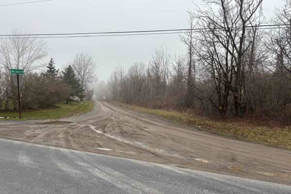
Little Church Road
This is short seasonal road that can be be added to a route for a winter run. The road travels through a wooded area. Towards the west end an old house foundation can be seen just of the side of the road. During the fall season the road would offer an opportunity to travel through a tunnel of changi...
Learn more about Little Church Road
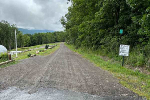
Warren Road
This road descends from the top of East Hill to Italy Valley. The road travels through a large patch of woods that makes for a nice shaded trip in warmer weather. A section of the woods is being managed with deer habitat improvement projects. The road is steeper the closer you get to the valley bott...
Learn more about Warren Road
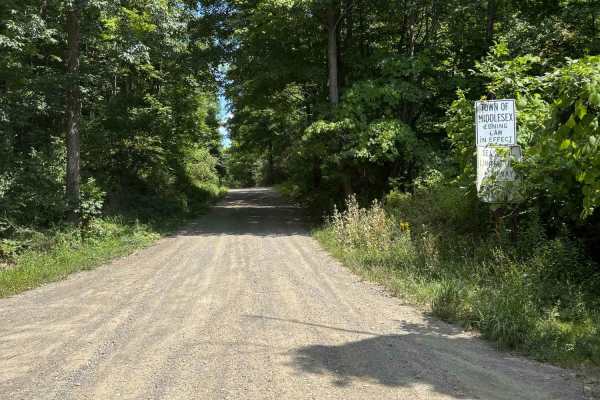
South Hill Road
This road travels through High Tor Wildlife Management Area. There are several areas to stop and access the WMA. There is a parking area to access more of the area. There is now a gate blocking the access road to an overlook, which is not far from the parking lot.
Learn more about South Hill Road
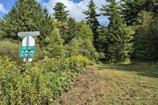
Culpepper Spur
Expect to see varying terrain as you creep through a mix of rocky trail and mud/dirt that traverses a mostly pine forest on the edge of O'Leary's pond. Lots of ruts and the potential for shallow water holes exist, especially after rain events. A Lewis County trail permit is required to use this trai...
Learn more about Culpepper Spur
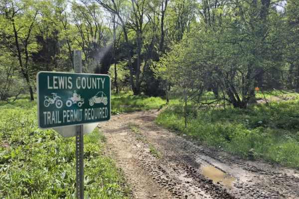
Worth Road Spur
Worth Road is a short, easy to moderate OHV connector in the Tug Hill Plateau designed for registered ATVs and compliant side-by-sides linking Worth Road and Culpepper Road within the Lewis County OHV Trail System. While not a destination trail on its own, it plays an important role in connecting la...
Learn more about Worth Road Spur
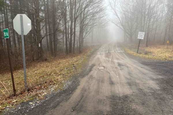
Potts Road
This seasonal road makes for a wonderful trip in the fall when the leaves are changing colors. During the winter, accessing the road could be difficult due to snow being piled at either end. It makes for a great connector road when building a route of the nearby trails and roads.
Learn more about Potts Road
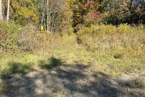
Three Hills Road
This road is one of the most challenging in the area. This road is no longer maintained but it is still open to the public. It is overgrown and definitely not a road for a factory vehicle. The south end has several brushy sections that will pin-stripe your vehicle and several washouts. The north end...
Learn more about Three Hills Road
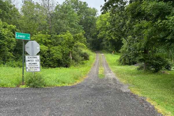
Lower Road
This road runs along West Italy Hill and has several gullies that intersect the road. There are some great views to glimpse through the trees, but the most impressive thing is the gullies. Several are large and have washed out the road in a few sections. The town has repaired them, but in this secti...
Learn more about Lower Road
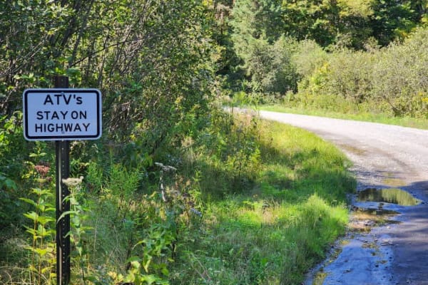
Worth Road Connector
Avoid the pavement! This route connects the Lewis County ATV/SXS trail system to the Jefferson County system and is all gravel/dirt. The trail offers many places to stop and take in the sights of the Tughill plateau. This trail is a public road and does not require a permit to ride.
Learn more about Worth Road Connector
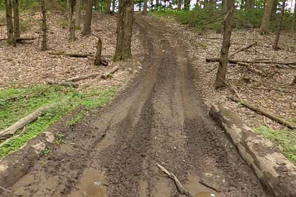
Lewis County Area A - Blue Trail
This is a county parcel with several connecting trails, making for a good day of riding. You can expect narrow, muddy, hilly trails designed for ATVs and 60-inch SxSs. Bridges and tight turns make for some fun riding. Deer are a common sighting. There are open areas for picnics, etc.
Learn more about Lewis County Area A - Blue Trail
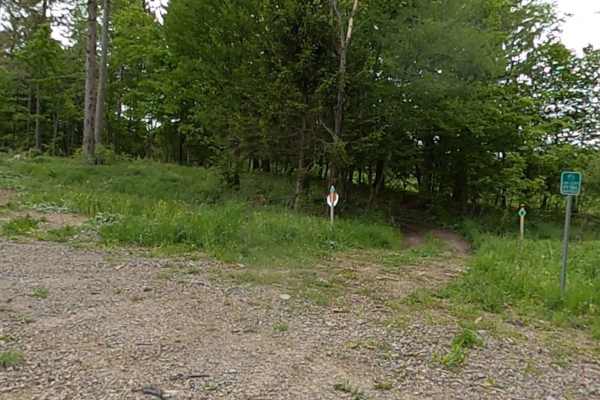
Lewis County Area A - Green Trail
This is a county parcel with several connecting trails, making for a good day of riding. You can expect narrow, muddy, hilly trails designed for ATVs and 60-inch SxSs. Bridges and tight turns make for some fun riding. Deer are a common sighting. There are open areas for picnics, etc. Lewis County T...
Learn more about Lewis County Area A - Green Trail
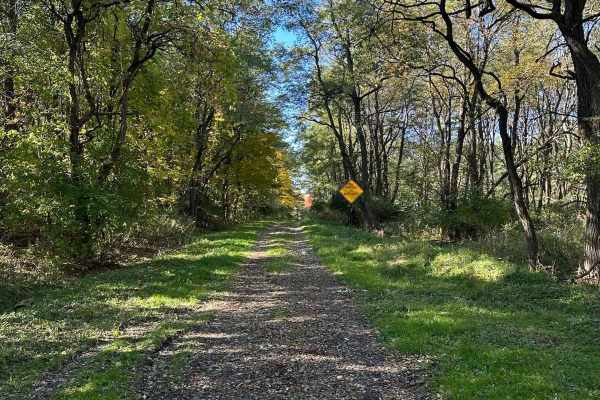
Wood Hill Road
Wood Hill may have a "Road Closed "sign but still open to the public. It is just not maintained and continues to deteriorate over time. It is overgrown and could cause some minor pin-striping. It has several washes that make it difficult for standard vehicles to get through without some scraping of ...
Learn more about Wood Hill Road
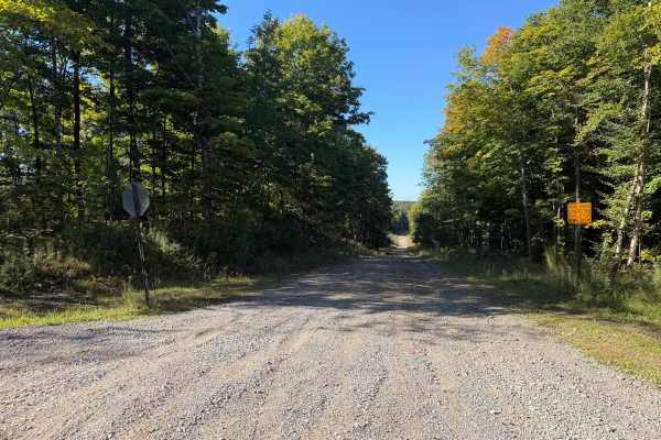
Olin Road
This seasonal road travels along a wide, wooded trail with a mix of maintained gravel, hard-packed dirt, loose stone, and several noticeably rocky sections. Travelers will encounter rolling hills and grades where exposed and embedded rocks create a rough, uneven surface and, at times, off-camber sec...
Learn more about Olin Road
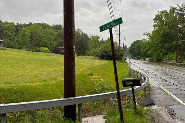
Parker Hill Road
This seasonal road climbs up the hill from 54a and the picturesque Keuka Lake. The road offers a beautiful ascent from the lake to the vineyards at the top of the hill. Its wooded sections will offer a colorful jaunt during the Fall. The road is maintained during the warmer months and could be hazar...
Learn more about Parker Hill Road
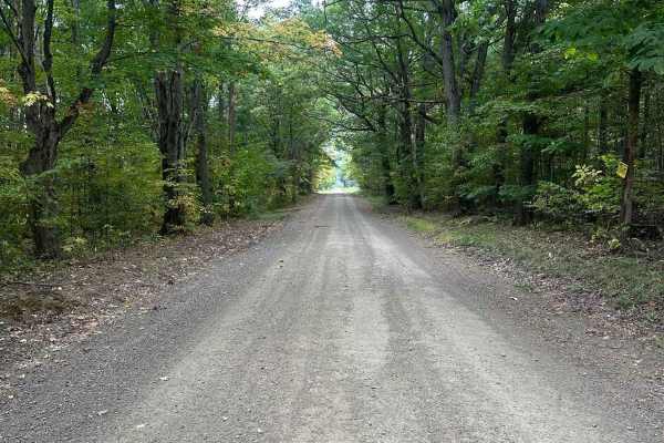
Bauchman Road
This is a seasonal road that is maintained in the warmer months and easily driven. The road is fairly level and graded. It offers a good view of Italy Hill and views of the fall foliage. During the winter months the road is not plowed and is difficult to travel in heavy snow or icy conditions. This ...
Learn more about Bauchman Road
ATV trails near Fair Haven, New York
Explore ATV-friendly trails near you. These trails are accessible for vehicles up to 50 inches wide, perfect for ATVs and smaller off-road machines.
Happy Valley Road
Stony loamy trail connecting Route 26 and Stone Hill Road. The road goes through Happy Valley Wildlife Management Area. There is a pull-off access to Whitney Pond for fishing, hiking, or viewing wildlife. This road is part of the Oswego County ATV club so use caution for oncoming ATV traffic.
Learn more about Happy Valley Road
Oswego Recreational Trail
The Oswego Recreational Trail is an old railroad bed with various surface types and old road millings. Very flat with some whoops and potholes in places. It's a nice easy ride through wooded, shaded areas and runs through the three-mile bay wildlife area. There are a couple of restaurants, bars, and...
Learn more about Oswego Recreational Trail
Culpepper Spur
Expect to see varying terrain as you creep through a mix of rocky trail and mud/dirt that traverses a mostly pine forest on the edge of O'Leary's pond. Lots of ruts and the potential for shallow water holes exist, especially after rain events. A Lewis County trail permit is required to use this trai...
Learn more about Culpepper Spur
Worth Road Spur
Worth Road is a short, easy to moderate OHV connector in the Tug Hill Plateau designed for registered ATVs and compliant side-by-sides linking Worth Road and Culpepper Road within the Lewis County OHV Trail System. While not a destination trail on its own, it plays an important role in connecting la...
Learn more about Worth Road Spur
UTV/side-by-side trails near Fair Haven, New York
Find UTV and side-by-side trails near you. These trails accommodate vehicles up to 60 inches wide, ideal for UTVs, side-by-sides, and wider off-road rigs.
Happy Valley Road
Stony loamy trail connecting Route 26 and Stone Hill Road. The road goes through Happy Valley Wildlife Management Area. There is a pull-off access to Whitney Pond for fishing, hiking, or viewing wildlife. This road is part of the Oswego County ATV club so use caution for oncoming ATV traffic.
Learn more about Happy Valley Road
Oswego Recreational Trail
The Oswego Recreational Trail is an old railroad bed with various surface types and old road millings. Very flat with some whoops and potholes in places. It's a nice easy ride through wooded, shaded areas and runs through the three-mile bay wildlife area. There are a couple of restaurants, bars, and...
Learn more about Oswego Recreational Trail
Culpepper Spur
Expect to see varying terrain as you creep through a mix of rocky trail and mud/dirt that traverses a mostly pine forest on the edge of O'Leary's pond. Lots of ruts and the potential for shallow water holes exist, especially after rain events. A Lewis County trail permit is required to use this trai...
Learn more about Culpepper Spur
Worth Road Spur
Worth Road is a short, easy to moderate OHV connector in the Tug Hill Plateau designed for registered ATVs and compliant side-by-sides linking Worth Road and Culpepper Road within the Lewis County OHV Trail System. While not a destination trail on its own, it plays an important role in connecting la...
Learn more about Worth Road Spur
The onX Offroad Difference
onX Offroad combines trail photos, descriptions, difficulty ratings, width restrictions, seasonality, and more in a user-friendly interface. Available on all devices, with offline access and full compatibility with CarPlay and Android Auto. Discover what you're missing today!
Open Trail Map