
Dirt Bike Trails
Near Dexter, New Mexico
Explore All Dirt Bike Trails Near Dexter, New Mexico
Dirt Bike Trails Near Dexter, New Mexico
Discover the best dirt bike trails near you. Browse trail maps, check difficulty ratings, and find your next adventure — whether you're looking for a quick ride or an all-day expedition.
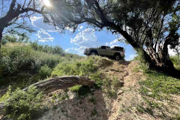
Pecos River Cruise
Pecos River Cruise is an easy-to-moderate 3.7-mile off-road trail located near Brantley Dam in New Mexico, perfect for drivers seeking a scenic riverside drive with access to excellent fishing spots. Running along the banks of the Pecos River, this route features a sandy surface and minimal elevatio...
Learn more about Pecos River Cruise
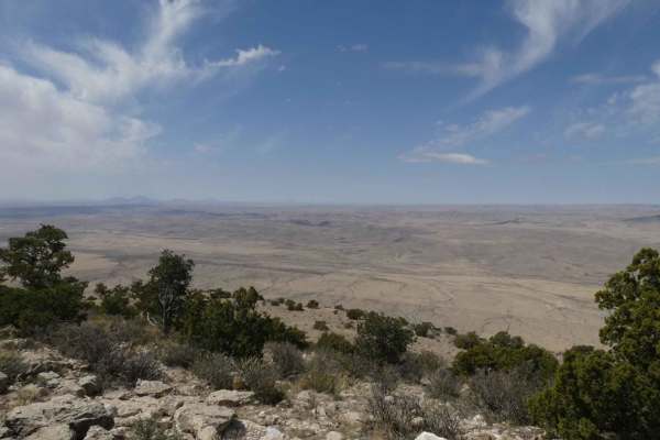
Guadalupe Rim Road
Guadalupe Rim Road runs almost the entire length of the Guadalupe Mountain Range of Lincoln National Forest. Located in the southeast portion of New Mexico, it lies just north of the Texas border and offers substantial views, variations in terrain, and dispersed camping opportunities. The road is ju...
Learn more about Guadalupe Rim Road
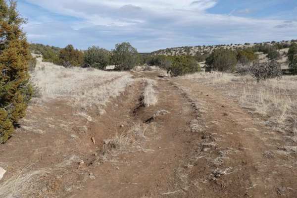
Calf Crossing
Calf Crossing starts and ends at gated private property lines, and intersects off Baca Traverse. This trail has the potential to be very muddy, with signs of rutting and washes, as well as multiple small water crossings after rain or snow melt. The trail surface is primarily dirt and rocks with some...
Learn more about Calf Crossing
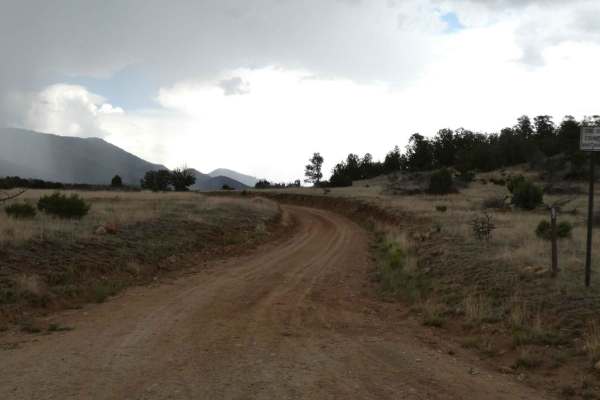
Salazar Canyon East
Salazar Canyon East begins just east of Baca campground inside a private land boundary before returning to USFS. The surface is a combination of rock and dirt with some small rock gardens, low-lying areas that have the potential to be shallow water crossings, and some spots being primarily rocks. Th...
Learn more about Salazar Canyon East
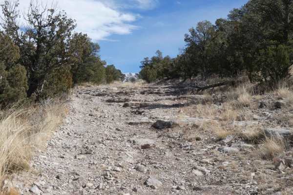
Baca Traverse
Baca Traverse sits in the foothills of the Capitan Mountains and starts out with some minor off-camber rutted areas that are a combination of rocks and dirt. The initial ascent opens up to a more rocky surface and provides a rock garden with some steps and the option of several different lines to ch...
Learn more about Baca Traverse

It's a Road
It's A Road is one of several spurs that runs east off of Sargent Tank. The trail starts with a steep grade ascent on a loose rocky surface and remains rocky throughout with only a couple of small sections being primarily dirt. There are multiple rock gardens along the trail with some having obstacl...
Learn more about It's a Road
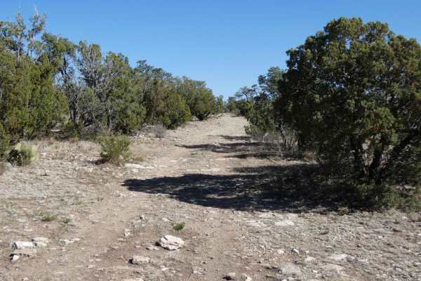
Corkscrew
Corkscrew is a trail that runs off FS322 and runs south into numerous canyons. There is a large area of private land in the middle section of the trail, stay on the main road and close any gates that are encountered. The trail is single vehicle wide with room to pass and is mostly loose rocks with s...
Learn more about Corkscrew
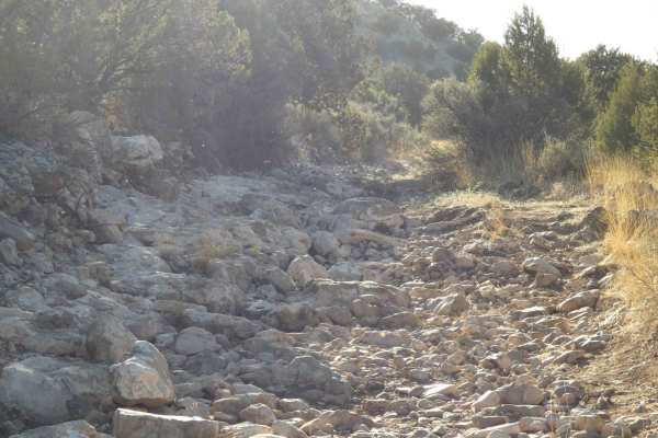
Redwater
Redwater is one of the more challenging trails in the northern portion of the Guadalupe Mountain range. The trail can be accessed via Anderson/Panama (FS518/FS5514) from its north, or from the south off Corkscrew/FS322B. The trail is primarily rock with some obstacles in excess of 18" in a dry canyo...
Learn more about Redwater
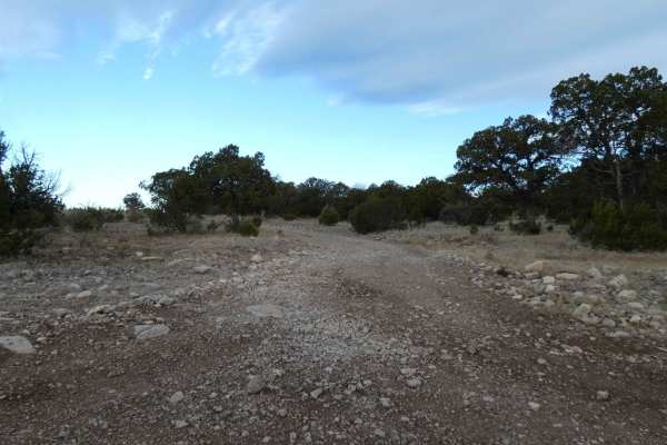
Sargent Tank
Sargent Tank is a connecting trail that can be run from the north or south. At the north end it connects from FS321 and runs south to FS518/FS5514 Panama/Anderson. There are a few motorized and hiking spurs off the trail as well as several areas open for dispersed camping. The trail switches between...
Learn more about Sargent Tank
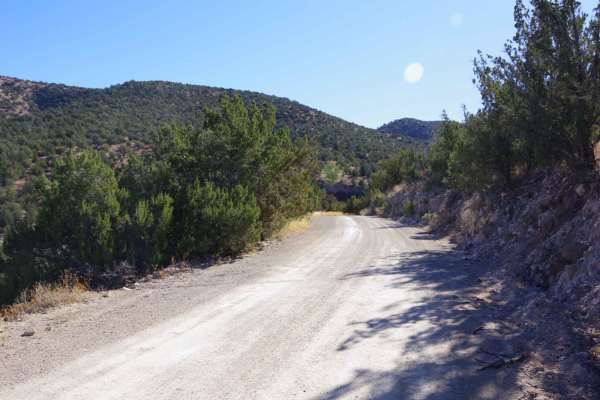
Hale Lake Trail
The trail is well maintained and easily accessible by most vehicles, however, 2WD passenger vehicles may find some of the rocky areas difficult. The road is primarily dirt and gravel mixed with some rock gardens and minor rutting. While dry, the road provides a very easy and scenic drive with views ...
Learn more about Hale Lake Trail
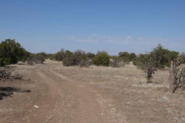
Indian Creek Overlook
Indian Creek Overlook is a spur off Rawhide/FS522 that runs east and is an out and back. Trail is primarily single vehicle wide with some areas to pass where foliage is not too heavy or overgrown. The trail is a combination of dirt and rocks with some small rock gardens along the route, but no obsta...
Learn more about Indian Creek Overlook
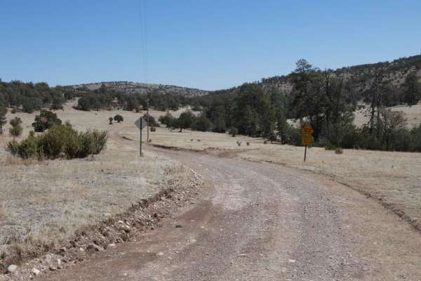
Dog Canyon
Dog Canyon is a well-maintained road that is a combination of rock and dirt surfaces. Wide open meadows throughout with rolling hills surrounding the area and canyon walls towards the east end before intersecting with Chimney Lake. Some small rock gardens and loose gravel make the drive slightly rou...
Learn more about Dog Canyon
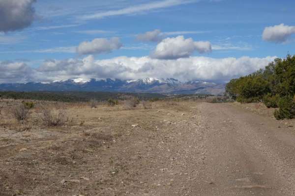
Eagle Lakes
Eagle Lakes is a canyon-to-ridge trail that can be accessed and completed from its east or west entrance. From the east entrance, the trail starts lower in a valley and ascends to its ridge line before dropping back down on the west end. The surface starts differently on each end, with a primarily r...
Learn more about Eagle Lakes
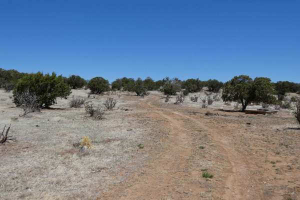
Acrey Allot
Acrey Allot is a spur off Storage/FS313 and is very similar in terrain and features. The trail begins with a primarily dirt surface, later becoming more rocky. There are multiple dispersed camping areas at the lower elevation of the trail where the foliage and brush is less dense. This is an out and...
Learn more about Acrey Allot
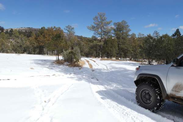
Burnt Can
Burnt Can is an out-and-back trail and starts out as a very easy trail, but does progress to more difficult areas with the potential for several deep water crossings after rains or snow melt. Primarily a rock and dirt surface, with some rutting and slippery muddy areas, the trail is not overly techn...
Learn more about Burnt Can
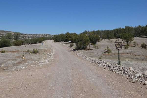
Chimney Lake to Angel Canyon (FS176)
FS176 includes both Chimney Lake and turns into Angel Canyon. The route is two vehicles wide, comprised of a combination of rock and dirt with some small rock gardens, and is overall well maintained and should be easily completed by most AWD or 4x4 vehicles. There are no obstacles larger than 8", ho...
Learn more about Chimney Lake to Angel Canyon (FS176)
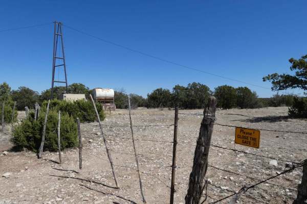
Crooked Canyon
Crooked Canyon is a trail that can be approached from the north or south and overall is an easily completed trail by 4x4 and some AWD with appropriate ground clearance. Being primarily a single vehicle wide dirt trail, there are sections through low-lying washes that are primarily made up of rock ga...
Learn more about Crooked Canyon
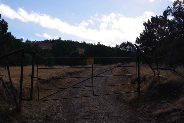
Five Mile Pass
Five Mile Pass is an unmaintained trail that tracks one of several valleys in the area with some changes in elevation and great views. The road is primarily dirt and rock, with some rock gardens towards the eastern portion. Signs of light maintenance at the middle of the trail, possibly by local ran...
Learn more about Five Mile Pass
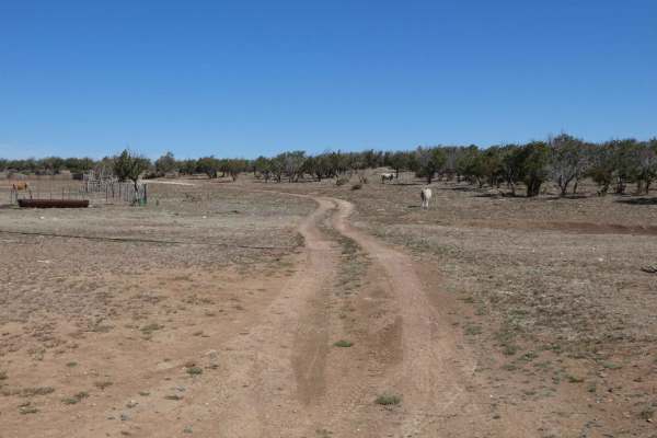
Storage
Storage begins as a dirt road and then frequently changes to a rocky surface before eventually becoming primarily rock. This out and back trail is a spur off Rocky/FS521 and will be easily completed by most 4x4s. Rutting is present in a few of the areas that are primarily dirt some of which is mildl...
Learn more about Storage
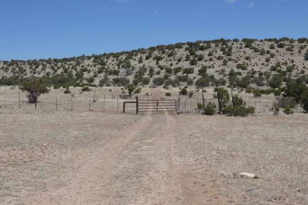
Powers Ridge
Powers Ridge is located in the central portion of the Guadalupe Mountain Range in Lincoln National Forest. The trail is a combination of rocks and dirt, with some obstacles in excess of 12". The trail is primarily single vehicle wide, with room to pass in a few areas and is an out and back. Trail do...
Learn more about Powers Ridge
ATV trails near Dexter, New Mexico
Explore ATV-friendly trails near you. These trails are accessible for vehicles up to 50 inches wide, perfect for ATVs and smaller off-road machines.
Pecos River Cruise
Pecos River Cruise is an easy-to-moderate 3.7-mile off-road trail located near Brantley Dam in New Mexico, perfect for drivers seeking a scenic riverside drive with access to excellent fishing spots. Running along the banks of the Pecos River, this route features a sandy surface and minimal elevatio...
Learn more about Pecos River Cruise
Guadalupe Rim Road
Guadalupe Rim Road runs almost the entire length of the Guadalupe Mountain Range of Lincoln National Forest. Located in the southeast portion of New Mexico, it lies just north of the Texas border and offers substantial views, variations in terrain, and dispersed camping opportunities. The road is ju...
Learn more about Guadalupe Rim Road
Calf Crossing
Calf Crossing starts and ends at gated private property lines, and intersects off Baca Traverse. This trail has the potential to be very muddy, with signs of rutting and washes, as well as multiple small water crossings after rain or snow melt. The trail surface is primarily dirt and rocks with some...
Learn more about Calf Crossing
Salazar Canyon East
Salazar Canyon East begins just east of Baca campground inside a private land boundary before returning to USFS. The surface is a combination of rock and dirt with some small rock gardens, low-lying areas that have the potential to be shallow water crossings, and some spots being primarily rocks. Th...
Learn more about Salazar Canyon East
UTV/side-by-side trails near Dexter, New Mexico
Find UTV and side-by-side trails near you. These trails accommodate vehicles up to 60 inches wide, ideal for UTVs, side-by-sides, and wider off-road rigs.
Pecos River Cruise
Pecos River Cruise is an easy-to-moderate 3.7-mile off-road trail located near Brantley Dam in New Mexico, perfect for drivers seeking a scenic riverside drive with access to excellent fishing spots. Running along the banks of the Pecos River, this route features a sandy surface and minimal elevatio...
Learn more about Pecos River Cruise
Guadalupe Rim Road
Guadalupe Rim Road runs almost the entire length of the Guadalupe Mountain Range of Lincoln National Forest. Located in the southeast portion of New Mexico, it lies just north of the Texas border and offers substantial views, variations in terrain, and dispersed camping opportunities. The road is ju...
Learn more about Guadalupe Rim Road
Calf Crossing
Calf Crossing starts and ends at gated private property lines, and intersects off Baca Traverse. This trail has the potential to be very muddy, with signs of rutting and washes, as well as multiple small water crossings after rain or snow melt. The trail surface is primarily dirt and rocks with some...
Learn more about Calf Crossing
Salazar Canyon East
Salazar Canyon East begins just east of Baca campground inside a private land boundary before returning to USFS. The surface is a combination of rock and dirt with some small rock gardens, low-lying areas that have the potential to be shallow water crossings, and some spots being primarily rocks. Th...
Learn more about Salazar Canyon East
The onX Offroad Difference
onX Offroad combines trail photos, descriptions, difficulty ratings, width restrictions, seasonality, and more in a user-friendly interface. Available on all devices, with offline access and full compatibility with CarPlay and Android Auto. Discover what you're missing today!
Open Trail Map